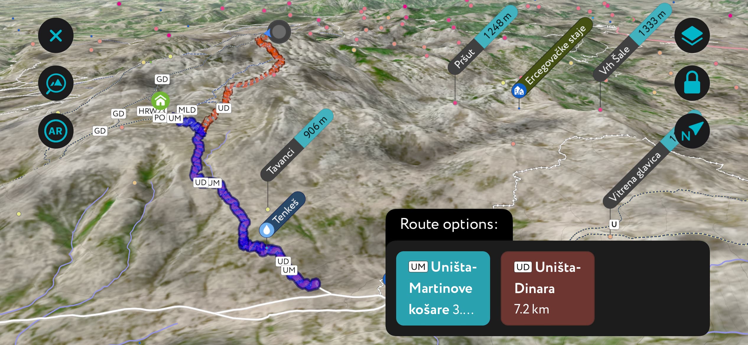
Scan the QR code and open PeakVisor on your phone
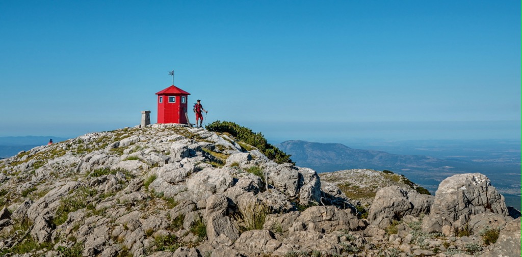
The Dinara Range, and its namesake Dinara Nature Park, lies on the border between Croatia and Bosnia and Herzegovina, with numerous karst formations, hiking routes, and mountain views. Dinara (1,831 m / 6,007 ft) is the park’s highest and most prominent peak.
The Dinara is a mountain range in the Dinaric Alps, spanning 100 km (60 mi). It boasts three major peaks:
Sinjal, often labeled as Dinara on maps, stands as Croatia's highest mountain with an impressive, towering cliff on its southwestern side. This striking feature is visible from the Dalmatian plain below. The name served as the origin for the Dinaric Alps or Dinarides, a significant European mountain region.
The Dinara Nature Park encompasses a part of the Dinara massif, including Sinjal, Troglav, and Kamešnica, as well as the headwaters and upper course of the Cetina River, along with the karst fields adjacent to the river. The landscape is characterized by a contrast between high mountain karst terrain, which is often arid and features steep, inaccessible cliffs, and expansive mountain pastures.
The Cetina River valley is fertile and teeming with life. The park lies in the Zagora region and stretches from northwest to southeast. The northern part of the area borders the region of Lika and the Krka River plateau.
Dinara Nature Park is located administratively within two counties, Šibensko-kninska and Splitsko-dalmatinska, near the border with Bosnia and Herzegovina, and it spans eight municipalities or towns. Within its boundaries, it includes 11 areas within the Natura 2000 ecological network, comprising two areas important for bird conservation and nine areas significant for species and habitat types.
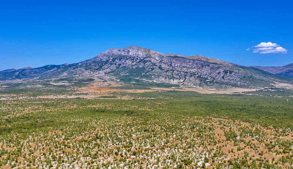
The Dinara Nature Park features high mountainous karst terrains with limited water and often steep, inaccessible cliffs, as well as expansive mountain pastures and the Cetina River, which has shaped valleys (karst fields) that are fertile and teeming with life. Dinaric karst is a distinct landscape characterized by soluble and porous carbonate rocks.
The present-day Dinaric karst landscape formed in the Tertiary and Quaternary periods. The vertical relief, perpendicular to the so-called Dinaric direction along which mountains and interstitial spaces extend, results from 250 million years of geological development, driven by compressive forces between the Adriatic carbonate platform and the Eurasian plate. Dinara primarily comprises Cretaceous and Jurassic limestone, typical for karst landscapes.
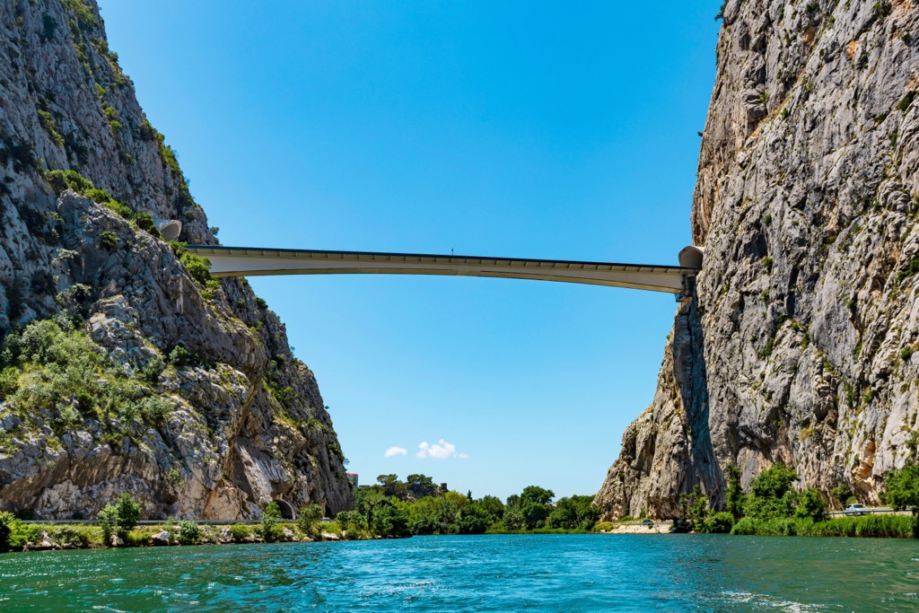
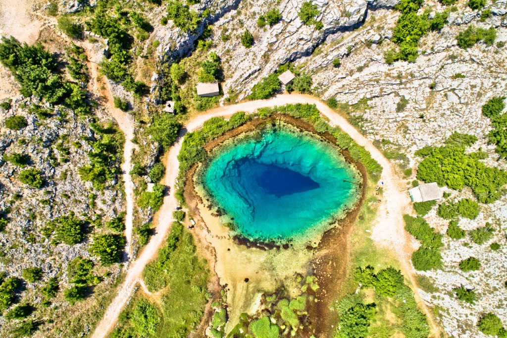
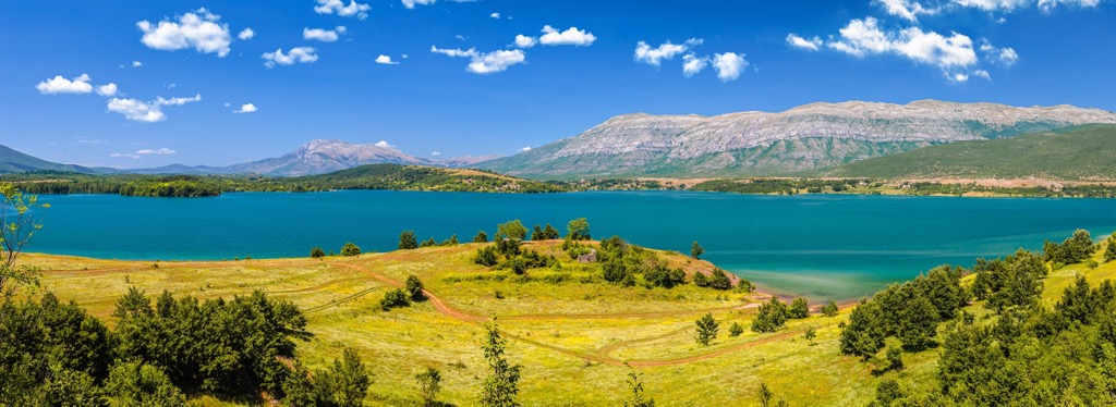
The region features karst landforms, including fields, sinkholes, plateaus, and caves; surface streams are virtually absent within Dinara. Meanwhile, an extensive underground network of water flows collects water primarily in the Cetina River basin and, to a lesser extent, in the Krka River basin.
Dinara is just a short distance from the Adriatic Sea, forming part of the Dalmatian Hinterland. However, it has a significantly colder mountain climate, making it one of the coldest regions in Croatia, with average temperatures ranging from 2 to 4°C at its peaks. Precipitation is abundant, and the area enjoys between 1,700 and 1,900 hours of sunshine each year.
The first records of the flora in the Dinaric mountains date back to the late nineteenth century when Günther Beck explored Dinara and Troglav, and Đorđe Protić studied the flora of Troglav and Kamešnica.
With over 5,000 plant species, subspecies, and hybrids found in Croatia, the discovery of more than 1,100 plant taxa in the Dinara region, representing over one-fifth of Croatia's flora, highlights its ecological significance.
Among these 1,164 plant taxa, 75 are recognized as Croatian endemics. Most endemic plant taxa within the proposed Dinara Nature Park have distributions covering less than 40,000 sq. km (15.444 sq. mi), mainly within Croatia's borders or extending slightly into neighboring countries.
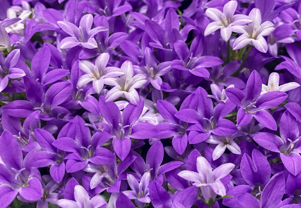
In total, seven steno-endemic species (those that are particularly restricted and at risk of extinction) have been recorded, such as Dalmatian bellflower, Adriatic iris, Dalmatian black pine, tomentose milk-parsley, and Adriatic violet.
The Dinara region is home to various bird species, including common pheasants, common quails, shore larks, redshanks, stone curlews, mustached warblers, golden eagles, and short-toed snake eagles. There have also been sightings of Eurasian griffon vultures, likely on their migratory route to Cres.
The mammal species found in the Dinara region include brown bears, grey wolves, Eurasian lynxes, wildcats, red foxes, wild boars, Eurasian badgers, brown hares, and Balkan snow voles, which are endemic and endangered.
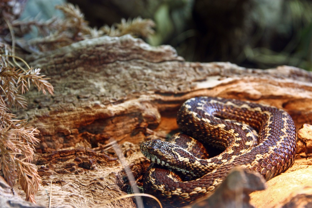
The herpetofauna of the Dinara region consists of approximately 15 species of lizards, snakes, and amphibians, with some facing endangerment due to habitat reduction or degradation. Species include smooth snakes, Balkan whip snakes, nose-horned vipers, fire salamanders, slow worms, karst meadow vipers, and alpine newts.
The ancient Illyrians regarded Dinara as a sacred mountain, calling it Troura or Triget. The modern name likely originates from the Illyrian tribe Dindari, who lived on its eastern side and used it as a tribal mountain for livestock.
The protection of Dinara's slopes gave rise to the first Croatian state. The core area of the early Croatian state, from the first rulers in the ninth century to the death of the last king of the native dynasty in 1093, was bounded by the Cetina and Zrmanja Rivers.
Under Dinara, you can find Knin, Biskupija, and Cetina, which have provided Croatian archaeology with invaluable archaeological treasures and stone memorials indispensable for understanding Croatian medieval history. Knin was the capital of Croatian rulers, and Biskupija served as the seat of the Croatian bishop with the right to use the Glagolitic script from 1040 until its abolition in 1493, along with early Romanesque old Croatian churches.
Beneath Dinara lies the settlement of Cetina, with the church of St. Spas. This entire region, from Zrmanja to Cetina and all these sites, forms the foundation of Croatia's national identity and Roman Catholic Western orientation.
The rugged environmental conditions and inaccessible terrain, on the one hand, and the favorable summer climate for high-quality pasture development, on the other, have contributed to preserving Dinara from intensive human impact. Nevertheless, it has been significantly shaped by the longstanding tradition of livestock farming in this region.
The Dinaric Alps feature a unique form of seasonal livestock farming, where herders take their livestock to various parts of the mountains during the summer and stay there until autumn and the first snowfall. Valuable anthropogenically conditioned natural habitats, primarily subalpine and alpine grasslands, have evolved here.
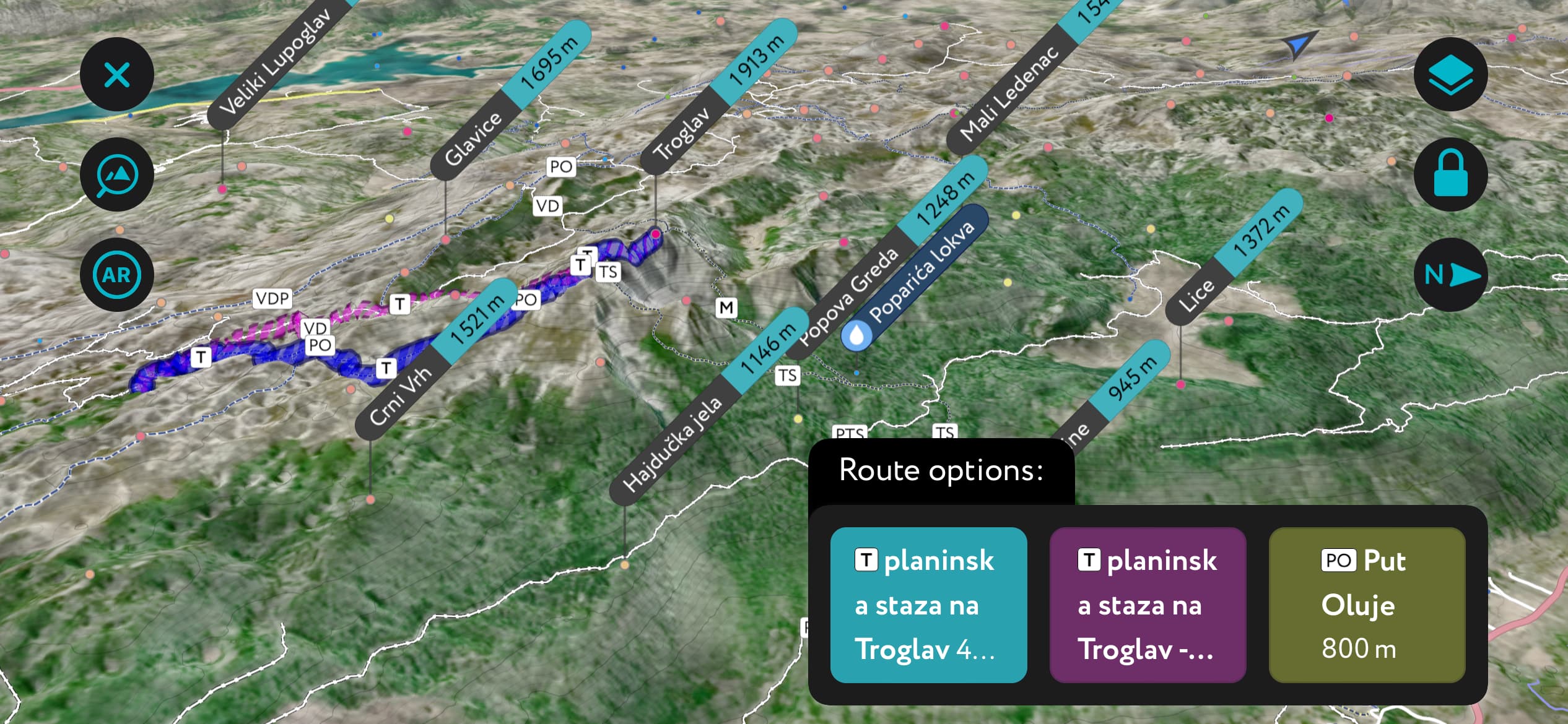
The highest peak of Dinara is also the highest point on the Vi Dinarica "White Trail," a route that follows the natural course of the Dinaric Alps. The trail connects the highest peaks of the Dinarides from Slovenia through Croatia, Bosnia and Herzegovina, Montenegro, and Albania.
Despite not reaching remarkable heights, Dinara's configuration and length combine to create one of the most impressive mountains in Croatia. Its massif serves as a natural boundary between Dalmatia and Bosnia, effectively separating two distinct worlds: the Mediterranean and the continental.
The region's abundant flowery meadows and forests contribute to its natural beauty. Climbing to the summit of Dinara requires good physical condition, as all routes are long, steep, and challenging.
The Troglav group spans approximately 30 km (18.6 mi) in length and 15 km (9.3 mi) in width. On the northeastern side (Bosnian side), there is the vast Livanjsko Polje karst field, measuring 65 km (40.4 mi) in length. On the southwestern side lies Perucko Jezero Lake.
There are only three marked trails within the Troglav group. Two of them lead to Troglav, and the third one ascends to Bat (1,851m / 6,070 ft), the second-highest peak in the group. This area is a pristine wilderness, and it's doubtful that you'll encounter anyone during your journey.
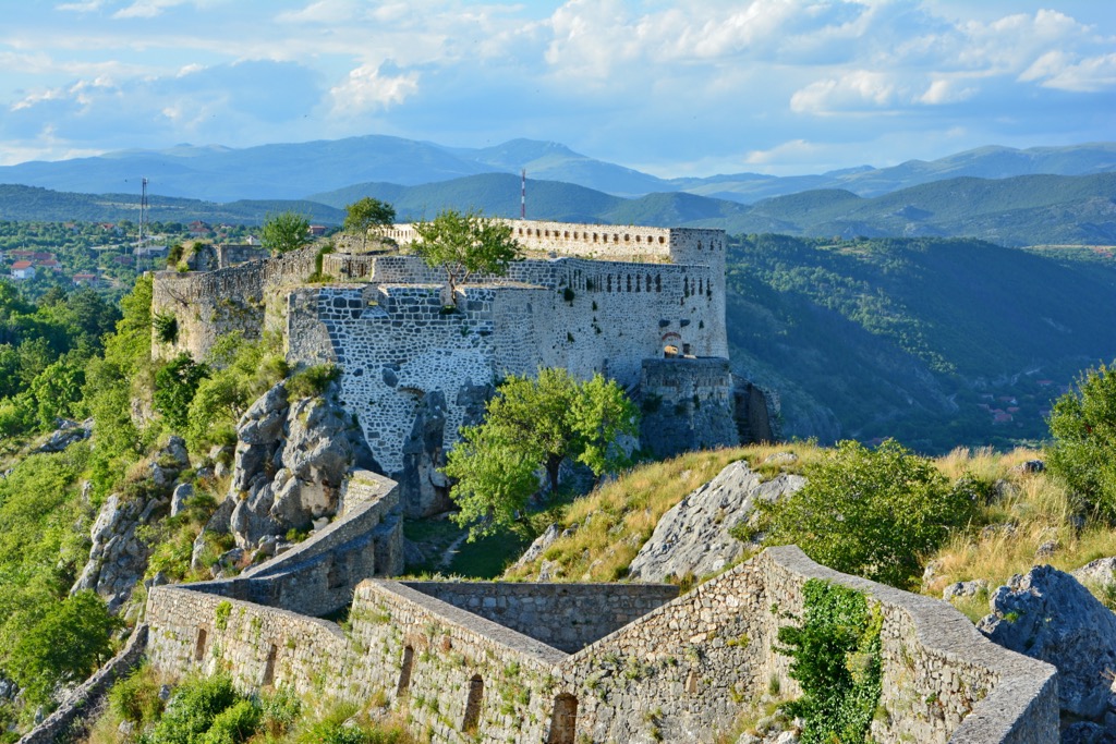
Knin is a historic town in Croatia with a population of approximately 10,000. It is renowned for its rich cultural heritage and strategic significance. The town has a deep historical connection with the medieval Kingdom of Croatia and serves as the royal capital.
Knin boasts a mix of architectural styles, reflecting its complex past, from medieval fortresses and Ottoman influences to more contemporary elements. The town is also a gateway to stunning natural landscapes, including the Krka National Park, making it a fascinating blend of history and natural beauty.
Livno is a charming town in Bosnia and Herzegovina, with a population of around 37,000. It's nestled in a picturesque valley surrounded by mountains, providing a scenic backdrop for its visitors.
The town's architecture blends Ottoman and Austro-Hungarian influences, creating a unique visual appeal. Livno is known for its vibrant cultural scene, with traditional music, dance, and cuisine playing a significant role. The stunning natural surroundings, including nearby mountains and lakes, offer ample opportunities for outdoor activities and exploration.
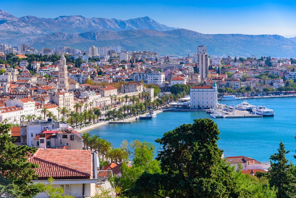
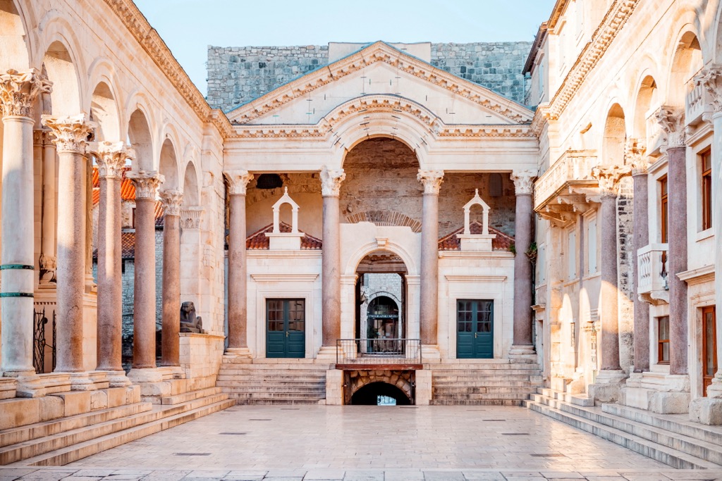
Split is a vibrant coastal city in Croatia with a population of approximately 150,000. It is the largest city in the Dalmatian region and holds historical significance as the home of the ancient Roman Diocletian's Palace, a UNESCO World Heritage site.
The city's architecture beautifully merges Roman and medieval elements with a Mediterranean flair. Split is known for its lively atmosphere, with numerous cafes, restaurants, and cultural events. Its stunning waterfront, known as the Riva, is a favorite gathering spot for locals and tourists alike, offering breathtaking views of the Adriatic Sea.