Scan the QR code and open PeakVisor on your phone
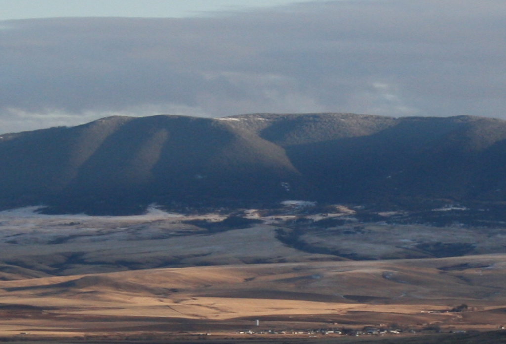
The Custer National Forest is located in southeastern Montana, and spreads eastward to South Dakota. In total, the forest covers a region of 1.18 million acres of land. There are 55 named mountains in Custer National Forest. Iron Mountain is the highest point at 10,095 feet. The most prominent mountain is Big Pryor Mountain. The western section of the forest is part of the Greater Yellowstone Ecosystem and is distinctly different from the eastern region which is characterized by small groups of trees and rolling fields. In 2014, the Custer and Gallatin National Forests began being managed together with their headquarters located in Bozeman, Montana.
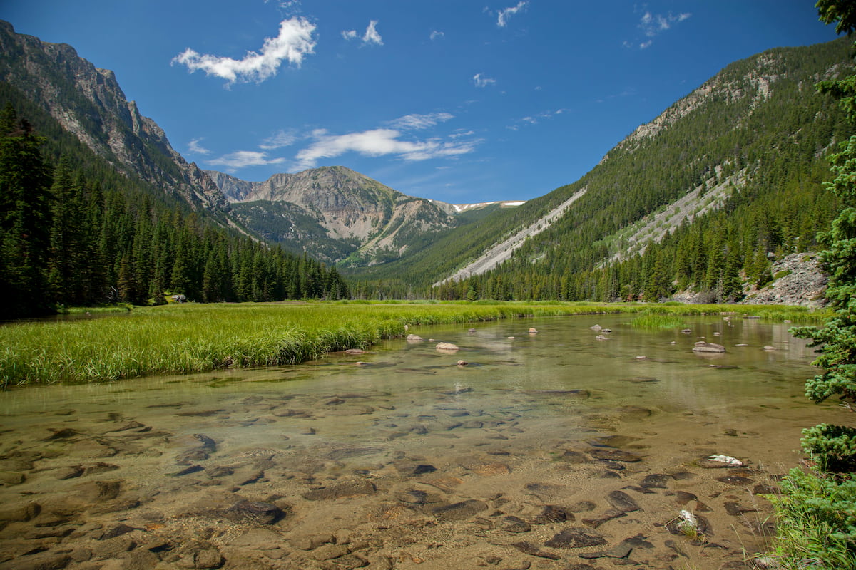
The western region of the Custer National Forest is shared with the Gallatin National Forest. Here, hikers will find the tallest peaks within the state of Montana, alpine lakes, rugged cliffs, and even the famous Grasshopper Glacier. The western side of the forest receives more rainfall than the eastern plains of the region. Within the forest there are four National Grasslands; Grand River, Cedar River, Little Missouri, and the Sheyenne National Grasslands. The Absaroka-Beartooth Wilderness is also partially located within the Custer National Forest.
The forest boasts over 1,500 miles of hiking trails, with a large majority of them being in the western region. Similar to many parts of Montana, the forest is home to grizzly bear, black bear, cougar, big horned sheep, elk, coyotes, sheep, mountain goats, moose, bison, and a rare falcon known as a merlin. Only approximately 6% of the forest is located in North Dakota, and the scenery varies greatly from its western counterparts.
Beaten Path Trail: This multi-day backpacking trip totals 29 miles with 3,431 feet of elevation gain. The point to point trail, travels through the Absaroka-Beartooth Wilderness located within the Custer National Forest. The trail travels through numerous ecosystems, with an abundance of rivers, streams, valleys, and peaks throughout. Though it can be completed in a day, it is recommended hikers take at least three days to fully appreciate this seemingly untouched wilderness.
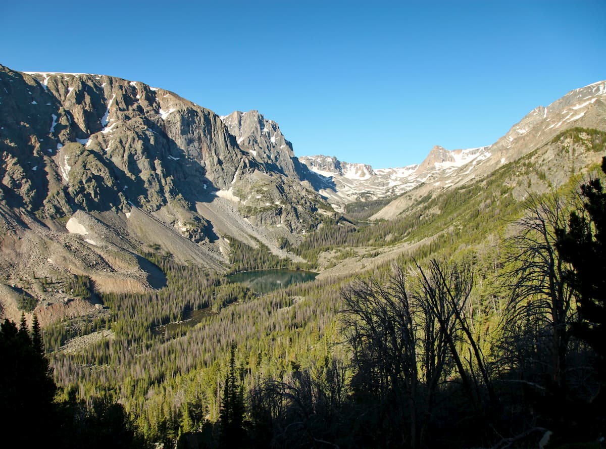
East Rosebud: This section of the wilderness comprises one of the most scenic valleys in the region. There are multiple hikes leading to lakes, waterfalls, and viewpoints of varying levels of difficulty. The valley is surrounded by the rugged mountains and full of lakes and waterfalls. In fact, there are so many lakes and waterfalls that some are still yet to be named. East Rosebud valley is home to Slough Lake, and the Phantom Creek Trail that leads to the summit of Granite Peak
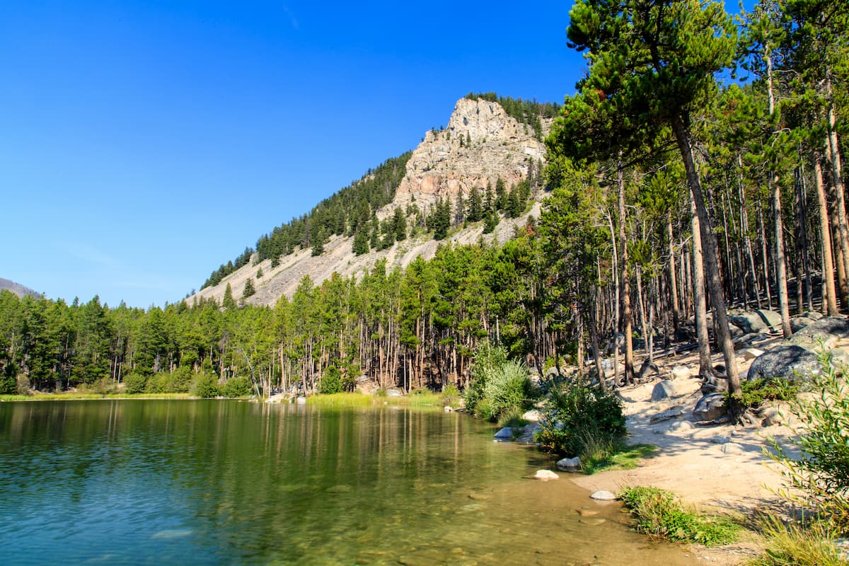
Mystic Lake: This scenic lake is the deepest within all of the Beartooth Mountains. The route is a 5.5 miles round trip with 1,345 feet of elevation gain. The lake is also home to the largest stretch of sandy beach on a lake within the wilderness, making it the perfect spot to stop and take a break. The lake also features a dam and is located within the Custer National Forest.
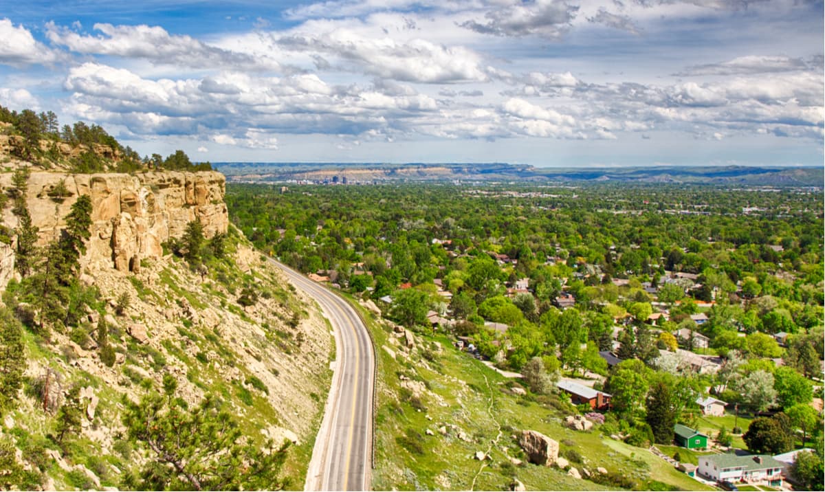
Billings is the largest city in the state of Montana. The population is approximately 110,000. The city is nicknamed the “Magic City” due to the rapid growth it received as a railroad after being established in 1882. Billings is often a popular place to stay as it has more hotels than within a five-state region. The city has an extensive trail network within the metro area while the surrounding lands are great for hiking, rock climbing, skiing, mountaineering, and biking. The city was named one of the 50 most bike friendly cities in America.
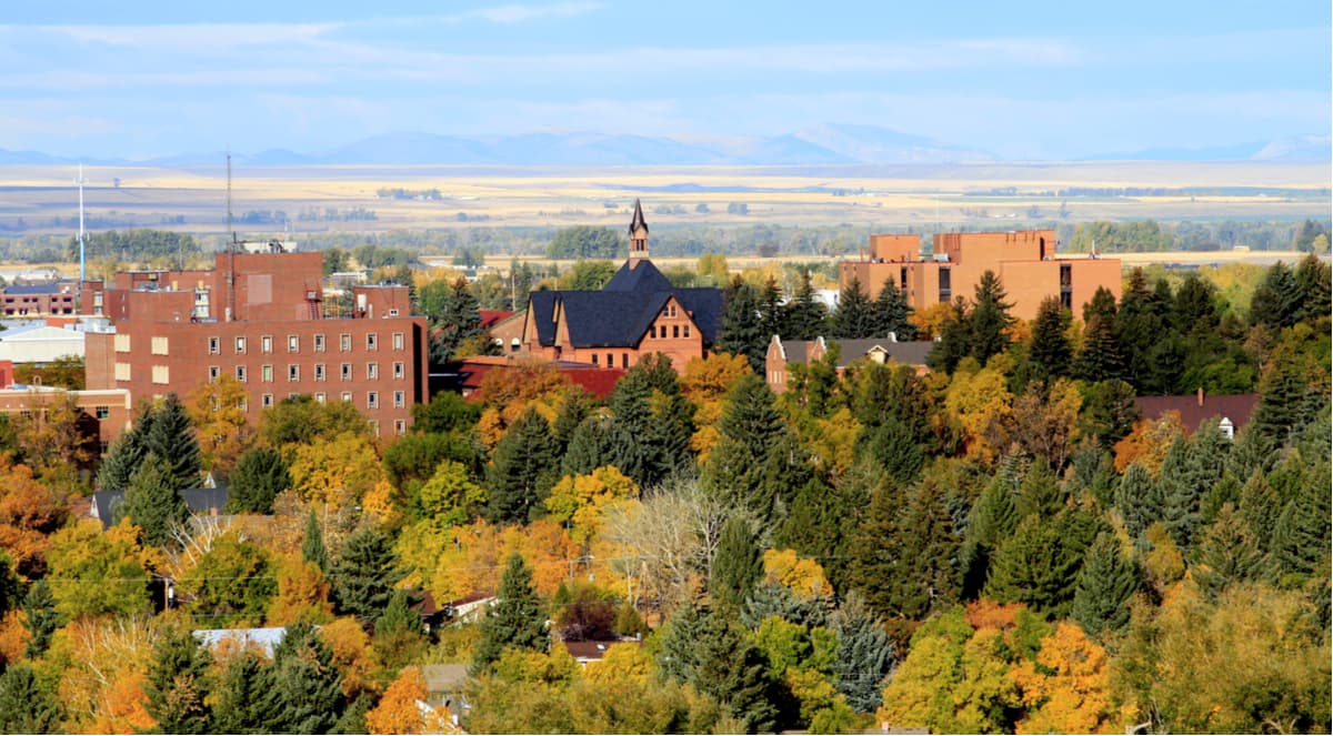
The city of Bozeman is one of the largest in the state of Montana and the headquarters for the Custer National Forest. The population is estimated to be about 50,000 as the city saw a lot of growth over the past decade. The city is home to Montana State University and was named after John M. Bozeman who in 1864 established both the town and the Bozeman Trail. At an elevation of 4,820 feet the city experiences warm summers and snowy cold winters. Weather can change drastically from day to day. Bozeman is surrounded by mountains, making it a popular destination for outdoor adventure.