
Scan the QR code and open PeakVisor on your phone
The Charles M. Russell National Wildlife Refuge (shortened to CMR NWR) is a federally managed area of public land located along the MIssouri River in the US state of Montana. The protected region marks the second largest National Wildlife Refuge in the lower 28 states of the US. The tallest peak in the wildlife refuge is Iron Skate Ridge at 3,123 ft (952 m) tall while the most prominent is Brandon Butte with 574 ft (175 m) of prominence.
The Charles M. Russel National Wildlife Refuge encompasses land on either side of the Missouri River in the northeastern section of the US state of Montana. By air, the refuge spans 125 miles (201 km) from east to west from the Fort Peck Dam to the Fred Robinson Bridge.
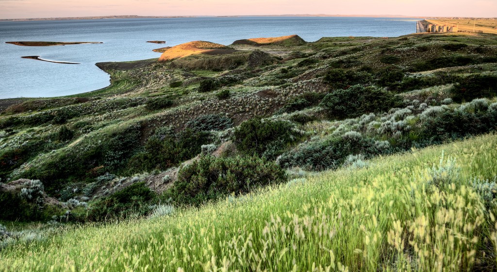
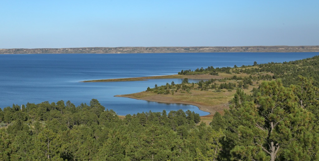
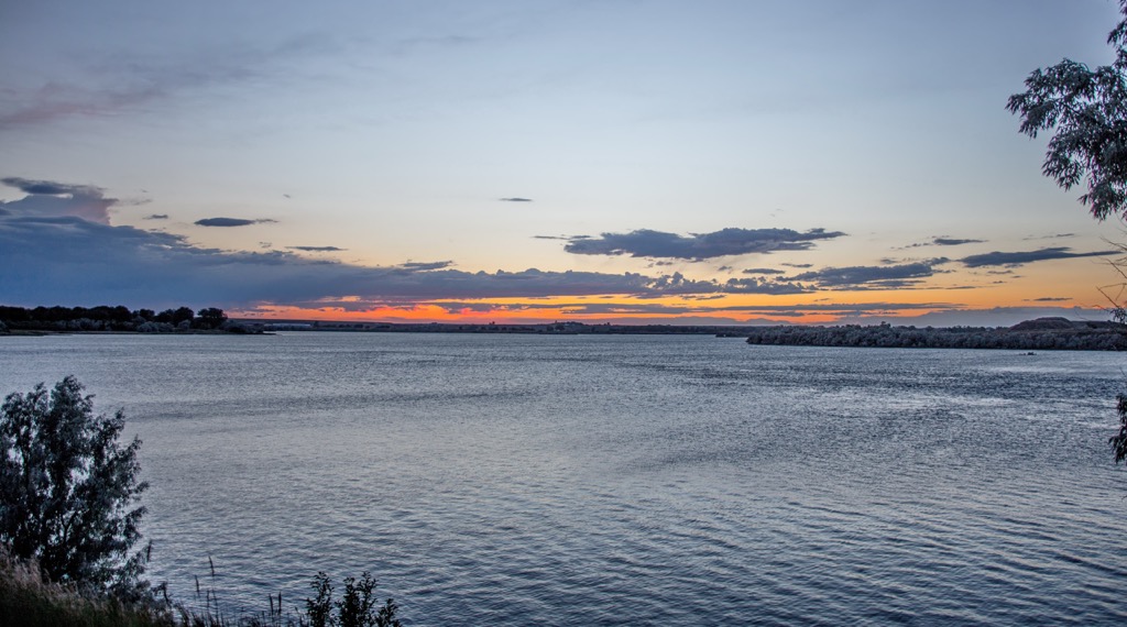
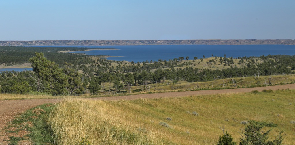
The wildlife refuge encompasses approximately 1.1 million acres (445,154 ha) including Fort Peck Lake which spans 250,000 acres (101,171 ha) and has 1,600 miles (2,575 km) of shoreline. The lake is not technically part of the refuge but is often included when referring to the region.
From west to east the refuge lies within Fergus, Phillips, Petroleum, Garfield, Valley, and McCone counties. While the river and lake are the main features of the refuge, the geography consists of a mixture of landforms.
Sweeping grasslands are found throughout the region, often along the shores of the waterways. These relatively flat land formations are met with rocky buttes, badlands, and canyons up to 1,000 feet (305 m) deep.
Elevations range from around 2,200 feet (670 m) when the lake is full, up to the summit of Iron Skate Ridge. These changes in elevations are minimal compared to the Rocky Mountains that define western Montana.
The expansive region, coupled with surrounding federal lands, allow for a variety of flora and fauna to thrive. Just north of the refuge lies the Milk River while the Musselshell River flows southward out of the refuge.
Additionally, Charles M. Russel National Wildlife Refuge is surrounded by other popular outdoor recreation areas. To the west lies the Upper Missouri River Breaks National Monument and the Woodhawk Wilderness Study Area. The War Horse National Wildlife Refuge lies to the south while sections of BLM land surround a majority of the refuge.
Topography in the Charles M. Russel National Wildlife Refuge is highly varied, despite the relatively low changes in elevation. Around 100 million years ago, the entire region was covered in the Western Interior Seaway. This inland sea is thought to have covered much of the central US and Canada.
The sea led to extensive prehistoric fossils throughout the region. Up until 1.5 million years ago the major waterways of the region, including the Missouri, Yellowstone, and Musselshell Rivers, flowed northwards into a lake.
The last glacial maximum shifted the flow of these rivers as the Laurentide and Cordilleran ice sheets forced the rivers southwards. Today the refuge encompasses the once glaciated plains of the region. Mineral deposits slowly filled in some of the valleys, creating relatively low changes in elevation.
Glacial retreating led to the alternating valleys and buttes visible today. Researchers have been able to discover a wide range of historical fossilized flora and fauna throughout the surrounding region.
Major peaks within the refuge include Iron Skate Ridge, Brandon Butte, Schuyler Butte, Mickey Butte, and Signal Butte.
The wildlife refuge features four major ecological regions; river bottom, wetlands and riparian zones, shoreline, and uplands. A majority of the larger mammals can be found in the shoreline and upland zones.
The wildlife refuge is home to the largest population of Rocky Mountain bighorn sheep outside of the Rocky Mountains. Other large species in the region include cougars, Rocky Mountain elk, pronghorn, white-tailed deer, and coyotes. Bird species such as sharp-tailed grouse are also common.
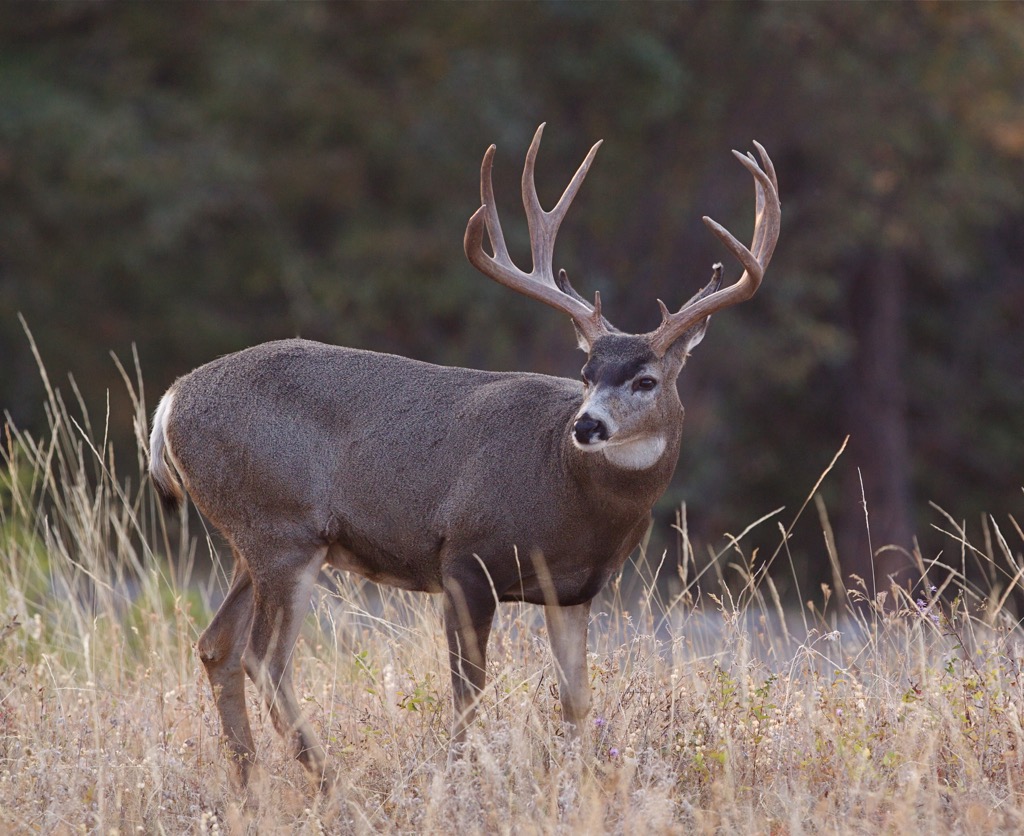
Other common animals include beavers, prairie dogs, and porcupines. The refuge is also an important region for many endangered species in the area including grizzly bear, northern leopard frown, black-footed ferret, burrowing owl, and various others.
A majority of the flora consists of low growing shrubs and grasses. The wetlands feature plants that are common in bogs while the prairies have some small forested sections amidst the rocky buttes and grasslands.
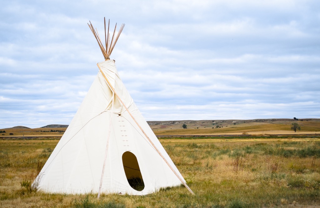
Humans have lived on the land in and around what is now the Charles M. Russell National Wildlife Refuge for thousands of years. The region marks the ancestral homelands of numerous Indigenous peoples, including the Apsáalooke (Crow) and Notameohmésêhese (Northern Cheyenne).
Traditionally the Apsáalooke (Crow) lived in the Midwest of the US before migrating to present-day Wyoming and Montana. After arriving in the region, the tribe split into four bands known as the River Crow, Mountain Crow, Beaver Dries its Fur, and Kicked in the Bellies.
The Notameohmésêhese (Northern Cheyenne) also lived in the region and were known for their impeccable hunting skills. They originally lived in the Midwest US and were slowly forced out west by the Lakota Tribe.
Both the Apsáalooke (Crow) and Notameohmésêhese (Northern Cheyenne) hunted large game that lived near the river, including bison which once roamed freely.
The first recorded contact between European colonizers and the Indigenous peoples occurred in 1805 during the Lewis and Clark Expedition. During this time the members of the expedition gave many of the sites in the wildlife refuge English names, disregarding the Indigneous names for the region.
In the decades that followed the Lewis and Clark Expedition, the lure of the “wild west” attracted many settlers who traveled to the region for expansive lands, fur trapping, and the promise of gold.As the population of settlers continued to grow, the US government backed groups that would attack, murder, and displace the Indigneous Tribes. Many of the Indigneous people fought to protect their native homelands but were ultimately driven out.
Today, the Crow Tribe of Montana is a federally recognized tribe that maintains a reservation near Billings, Montana. The Crow Tribe has around 14,000 enrolled tribal members. The Northern Cheyenne Tribe are also a federally recognized tribe whose reservation is situated in southeastern Montana.
Following the onset of the Great Depression, in hopes of generating more jobs and electricity, then President Franklin D. Roosevelt turned over land surrounding the Missouri river to the US Army Corps of Engineers. Dams were built along the river, ultimately forming the lake visible today.
In an effort to protect the wildlife of the region, the Migratory Bird Conservation Act was signed into law in 1929, followed by the Fort Peck Game Range in 1936. In 1976 the “range” was renamed the Charles M. Russel National Wildlife Refuge after the famous American painter.
Hiking is allowed anywhere in the Charles M. Russell National Wildlife Refuge though there are no established trails. The east side of the refuge features a few paved paths near the Fort Peck Dam Interpretive Center and Museum. Hikers can explore the nearby Hell Creek State Park that features a few trails. Here a few trails near the refuge:
This loop trail lies in the northeastern corner of the refuge near the Fort Peck Dam. The paved path offers views of the river heading downstream after passing through the dam. This shorter hike is accessible for many people as it is 1 mile (1.6 km) long and features just 19 feet (6 m) of elevation gain.
The Antelope Creek Nature Trail lies just west of the wildlife refuge. The loop trail winds through the stunning landscape and is a popular place to spot a variety of wildlife. Information signs lie along the route, describing the terrain and history of the region. The loop is 1.9 miles (3 km) long and features 127 feet (39 m) of elevation gain.
Looking for a place to stay near Charles M. Russell National Wildlife Refuge? Here are some of the best cities and villages to check out in the region:
Situated just north of Fort Peck Lake lies the city of Glasgow, Montana. Home to around 3,200 residents, Glasgow acts as an economic hub for the surrounding region. Originally established as a railroad town, today the city is popular amongst those visiting the nearby wildlife refuge and lake.
In the downtown area, visitors will find local shops, restaurants, and the Busted Knuckle Brewery. The Valley County Pioneer Museum also showcases some of the history of the city. Visitors can take in the quaint atmosphere by exploring the stunning scenery that surrounds the small city.
A three hours drive south of the refuge lies the city of Billings, Montana. Home to around 110,000 residents, Billings is the largest city in the state. After its establishment in 1882, the city experienced rapid growth, coining it the nickname “Magic City.
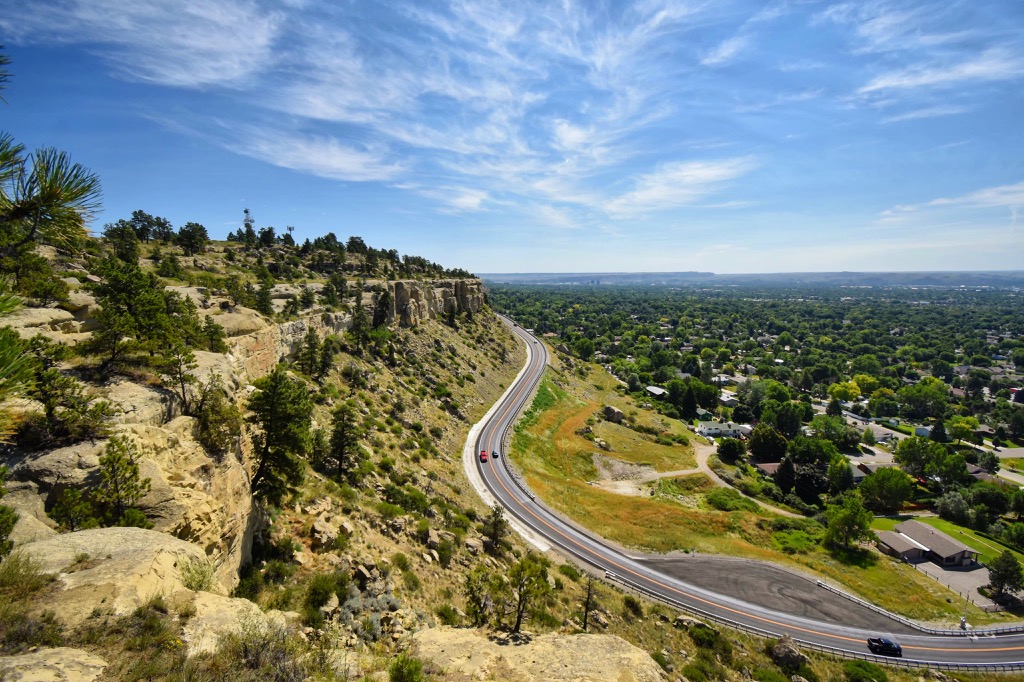
Billings is surrounded by a vast network of trails making a popular spot for hiking, biking, trail running, skiing, and rock climbing. Besides exceptional trails and scenery, the city is also known for its thriving food scene. Other nearby attractions include Pictograph Caves State Park, Four Dances Recreation Area, and the Beartooth Highway.


