Scan the QR code and open PeakVisor on your phone
Boulder is both a city and a county in the state of Colorado. We have already written about Boulder County, which encompasses much more territory than the City of Boulder. The city, of course, lies entirely within the county limits, approximately 25 miles to the northwest of Denver, the largest city and capital of the state. Open Space and Mountain Parks (OSMP) is a department under the city government and has jurisdiction over many of the recreational venues of the city, even though some of them lie outside of city limits. The department preserves and protects more than 45,000 acres and maintains about 155 miles of trails. There are 18 named mountains in OSMP, the highest and most prominent of which is South Boulder Peak.
The OSMP system was created to form a buffer around the city that is meant to establish its own, separate identity from neighboring communities. Thus, the mountain backdrop on the west and the riparian greenways on the east provide a scenic framework within which development occurs in the Boulder Valley. This framework provides some of the finest recreational opportunities in Colorado and especially in the greater Denver metropolitan area. Every time I drove north on State Highway 93 (SH-93) to go hiking in the Boulder area, I always got excited when the dramatic outline of the mountains came into view. The urge to “hit the trail” was overwhelming, and in over forty years living just a short distance to the south in adjacent Jefferson County, I took real advantage of the hiking options that were available. Here, I will share much of what I have experienced.
I mentioned an article above about Boulder County hiking. That one covers a much broader area but also includes some information about the trails in Boulder OSMP. Here we will get into much more detail. Being at the edge of a big metropolitan area, you can be assured that you will not be alone hiking here. With elevations ranging from less than 5,500 feet to as high as 8,524 feet, hiking here is a year-round activity - the only limitations are some mid-summer days when it can get really hot, and right after a major snowstorm, when the trails can be hard to follow. But even these extremes will not deter die-hard adventurers. And this place is home to many of the latter. In addition, many famous mountaineers have called Boulder home or have lived here at some time in their climbing careers. The mountains right at the edge of the city offer not only miles of hiking but also some world-class climbing, such as on the Flatirons.
This entity, Boulder OSMP, is not a mountain range, it is not an officially named park, nor is it a county or state, or a designated wilderness area. It is merely an administrative department under a city government. So what makes it different from all others that we have written about in our PeakVisor library? It is simply nothing more than a collection of parks set aside for the enjoyment of nature and recreation. At least in my understanding. Here at PeakVisor, we focus our attentions on mountains – hiking, climbing, skiing. Our focus here will also be on those same activities, but we also want to call attention to other recreation opportunities within this entity, since they play prominently in what makes Boulder so different. To clarify – what I call “Boulder” herein is not the city, nor the county. Instead, it is a feeling, a way of life, a sense of belonging. A place like few others. As an avid hiker, having spent much time in this place, I have always felt that I belong in a place like this.
For first-time visitors to Boulder, I advise driving there one of two ways – U.S. Highway 36 (US-36) from Denver or SH-93 from Golden. You will experience what is so typical of the entire Front Range of Colorado. The western Great Plains of the central United States, mostly flat and monotonous, with only slight modulations of terrain, bumping head-first into that great barrier known as the Rocky Mountains. Nowhere in the country is that abrupt transition more obvious than in Boulder (although Colorado Springs might want to challenge that claim). Both of these highways will present you with eye-popping views as you crest over their high points and start to drop, ever so gently, into the Boulder Valley. Ahead of you, you will see open fields and meadows that suddenly end at a wall of rock rising almost 3,000 feet. OK, maybe just a slight exaggeration, but the effect is such.
Among the many miles of easy trails in the “flatlands” you will find some that connect with the more difficult and more strenuous trails in and to the tops of the mountains. Yes, even in the “flatlands” are some named “mountains” but they are really nothing more than somewhat prominent high points on the otherwise flat or rolling terrain. Here, they are mostly called “hills” or “mesas” and mostly less than 6,000 feet in elevation. Some of the easier trails can turn into rather long hikes and can catch inexperienced hikers unprepared. With the many options for making interesting loops, one can easily find themselves beyond their expectations and suddenly find that they are not nearly as close to their cars as they thought. For these people I can only say: bring a map (and know how to read it), bring or wear clothing appropriate to time of year and weather conditions (sudden storms can happen here, especially on summer afternoons) and bring lots of water (there is none to be found on most trails around here).
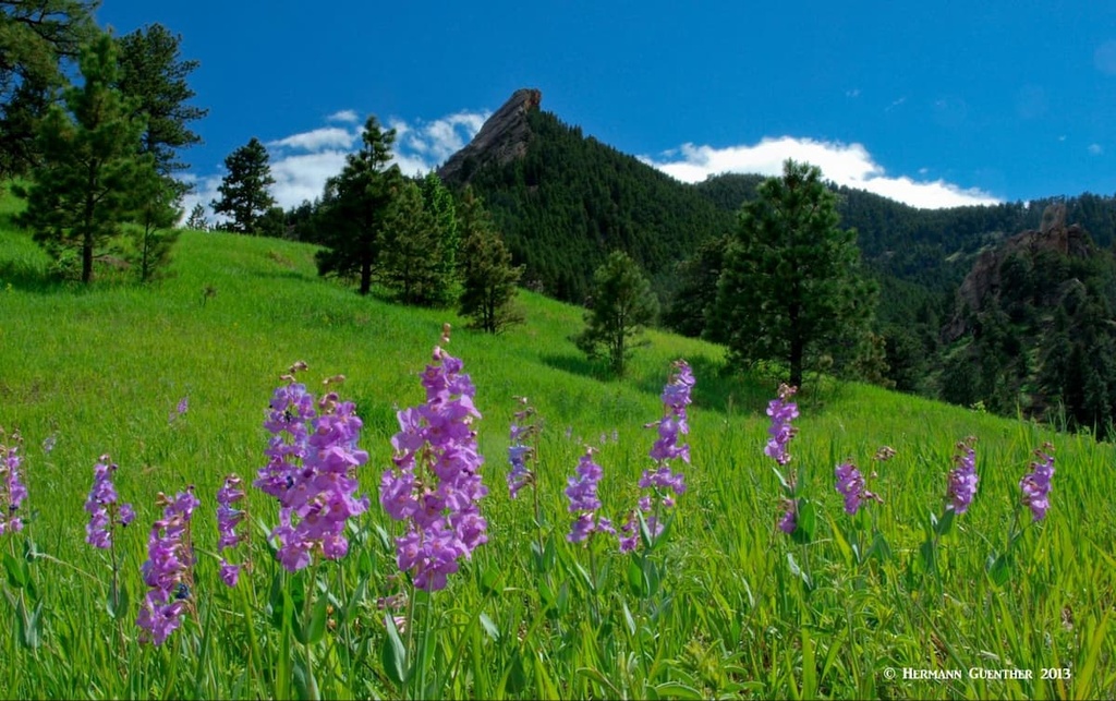
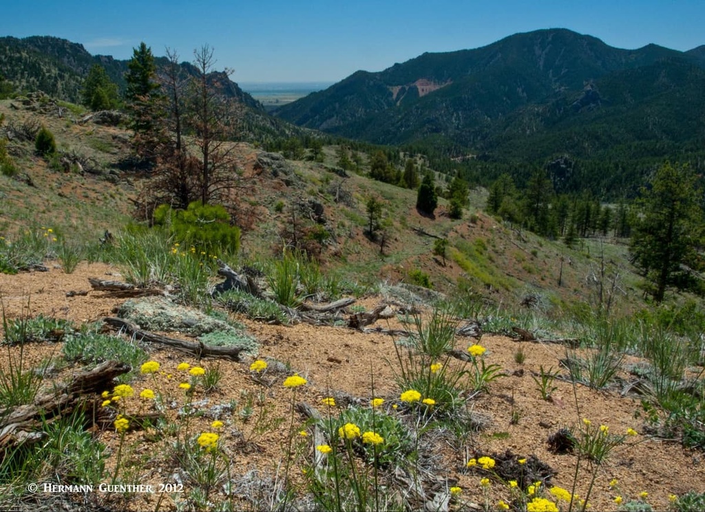
Among the many pleasures of hiking (or running or biking) here is the great variation in the landscape from season to season. Winter, especially right after a snowstorm, will delight the eye with a white mantle. In summer, most of the grasslands below the mountains will be brown. In autumn most vegetation, with the exception of evergreen trees mainly on the steep slopes of the mountains, will change to vibrant hues of gold and orange, and often even bright red. Spring, the time of new awakening, will bring lush, green meadows studded with colorful wildflowers. Seeing these variations while hiking in the lower elevations, yet always rewarded with a glimpse of the higher mountains, you can only wonder at the stunning surroundings and views that are constantly changing as you round every bend in the trail or top out on a small knoll or hill.
Experiencing the trails of Boulder is a dream-come-true for outdoors aficionados. Hiking, walking, running, climbing, biking, jogging, horseback riding, cross-country skiing (limited only to times immediately following major snowstorms) – this is what you do on the 155 miles of trails you will find here. There are more trailheads than we can mention here, many of them located right in residential areas; even trails into the high mountains can be hiked right from your house – if you are lucky enough to live near one. But there are plenty of places to park at most trailheads. Some of them charge a fee for all but residents of Boulder County, others are free for everyone. Free or not, you will want to arrive early, especially during peak seasons, holidays and weekends. Remember, this place is popular.
One thing that I have always loved about hiking here (well, not just one thing) is the fact that most hikes can be turned into loops so that you don’t have to retrace your tracks going back, at least not more than short segments. And that applies as much to climbing the major peaks as well as to “flatland” loops. The major peaks have maintained trails to their summits, but since large segments of these trails pass through Habitat Conservation Areas, off-trail use is prohibited or at best is limited to special or seasonal permit holders. Based on my years of experience in these mountains, the terrain is rugged enough without trying to fight your way through almost impossible vegetation and cliffs. Please stay on the trails for your own good – and for the good of the environment.

For defining what is east of the mountains, I use the Mesa Trail as the demarcation line. This 6.6-mile (one way) trail running from south to north through the greatest proportion of OSMP has more trail junctions than any trail I have ever hiked. A majority of the easier “flatland” trails emanate from this trail with their eastern termini in residential areas and even along SH-93. Some of these trails continue even further east to connect with other OSMP properties. The Mesa Trail itself, a point-to-point trek, though not difficult, can be a significantly strenuous hike if you don’t have a car shuttle and need to turn it into a round trip hike. That will encompass over 13 miles and an accumulated elevation gain over 2,500 feet due to its many ups and downs. It is a formidable hike by itself; many people will do parts of it in combination with other trails intersecting it from the east, thus affording imaginative and charming loops. Several of the following trailheads will also be discussed in connection with mountain hikes later. But for now, let’s look at a few ideas for easier hikes east of the Mesa Trail. Keep in mind that, even if you are only hiking at the lower elevations, you will be constantly rewarded with stunning views.
South Mesa Trailhead – This is likely the most popular trailhead at the southern end of the OSMP area. About three miles along SH-170 (also known as Eldorado Springs Drive) from its intersection with SH-93, it has a large parking area and serves as the starting point for many serious hikes into the mountains as well as easier hikes in the more gentle terrain east of the Mesa Trail. Those who want to start or end their hike of the entire Mesa Trail will use this spot. A number of moderate loop hikes of between three and seven miles can be started here, such as the South Boulder Creek West/Big Bluestem/Mesa Loop. This one can also be started at the South Boulder Creek Trailhead adjacent to SH-93. There are so many connector trails that offer ways to make any loop longer or shorter, that the combinations you can find here will ensure that you will never get bored.
Shanahan Ridge Trailhead – A pleasantly moderate 4-mile loop encompassing the Shanahan Ridge Trail (both north and south forks) and a part of the Mesa Trail begins at Shanahan Hill right at the edge of a housing development. Of course you add as few or as many miles to your hike thus creating your own personalized excursion. This trail, typical of many in this area, will meander over grasslands and through stands of Ponderosa Pines. As with any hikes starting east of the mountains, you can always add the option of including strenuous ascents of the high peaks and ridges to the west. Always keep in mind that, although many of these eastern hikes are classified as easy or moderate, as soon as you add miles to extend your hike, you will also be adding elevation gains since the terrain varies significantly, especially as you get closer to the mountains.
Marshall Mesa Trailhead – This trailhead is well-positioned right at the intersection of SH-93 and SH-170. Here you can begin easy hikes of three miles as well as moderate hikes of as long as 28 miles (it beats me how this one can be classified as moderate when it involves over 5,000 feet of accumulated elevation gain in addition to the miles!). One interesting option here is to follow the Community Ditch Trail, first to Marshall Mesa and Marshall Lake east of SH-93, then head west to include the Spring Brook Loop Trail. Although 11.4 miles long, the total elevation gain is only 846 feet. While I have not hiked this one, I can tell you that the views along this trail will be stimulating. There is a fine lookout beside SH-93 that features this trail as it meanders across the prairie towards the high peaks of Boulder.
Dowdy Draw Trailhead – Located across the road from the South Mesa Trailhead, this busy trailhead has plenty of parking but requires payment of a fee for those who are not residents of Boulder County. The Goshawk to Doudy Draw loop trail is 8.6 miles long and affords lots of reward for a relatively moderate hike involving about 1,200 feet of overall elevation gain. It provides spectacular views into Eldorado Canyon as well as more distant views of the Flatirons. In addition to hiking, this trail is well-suited for trail running. The Community Ditch Trail mentioned above can also be accessed from this trailhead. There are also some shorter combinations available here for those just wanting a stroll in the grasslands (watch out for rattlesnakes in tall grass).
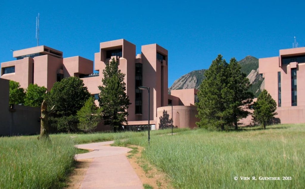
NCAR Trailhead – This trailhead serves as a major access point for the Mesa Trail and numerous shorter connecting trails such that moderate combination hikes can be started here. NCAR stands for National Center for Atmospheric Research, which sits atop Table Mesa (a redundant name since “Mesa” is the Spanish word for “Table”). This scientific facility conducts research into weather, climate and worldwide atmospheric studies, too complex to discuss here. It was tastefully designed for this pristine spot by the famous architect I.M. Pei. There is a huge parking lot here, free to everyone (hikers, visitors, scientists and employees), and the center is even open to the public, containing a fascinating museum relating to the atmosphere and weather phenomena. It is well worth visiting. But back to hiking, the trailhead here is used mainly for starting the more difficult hikes into the high peaks. More on that later.
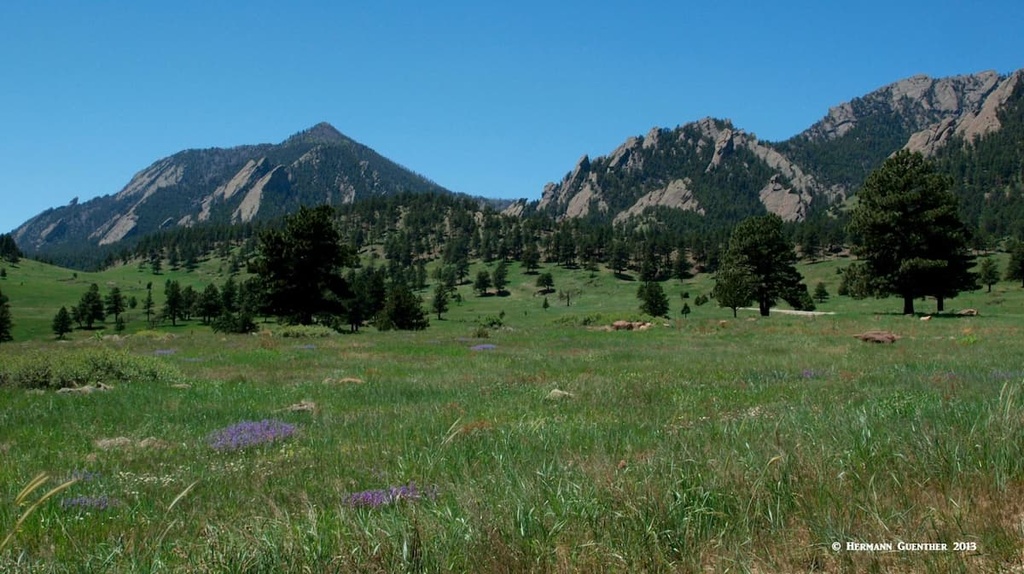
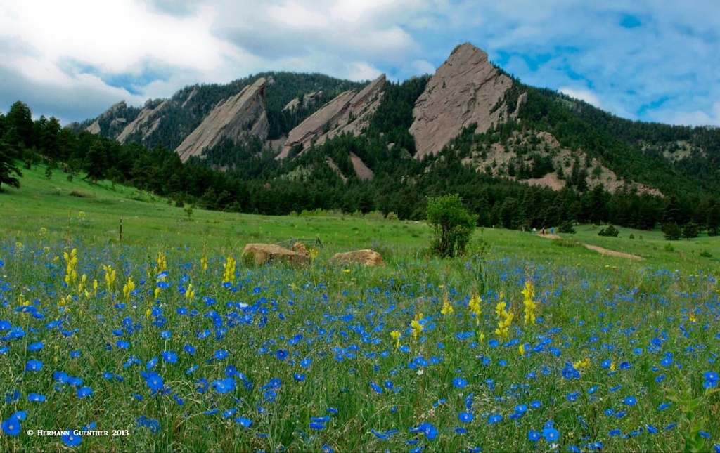
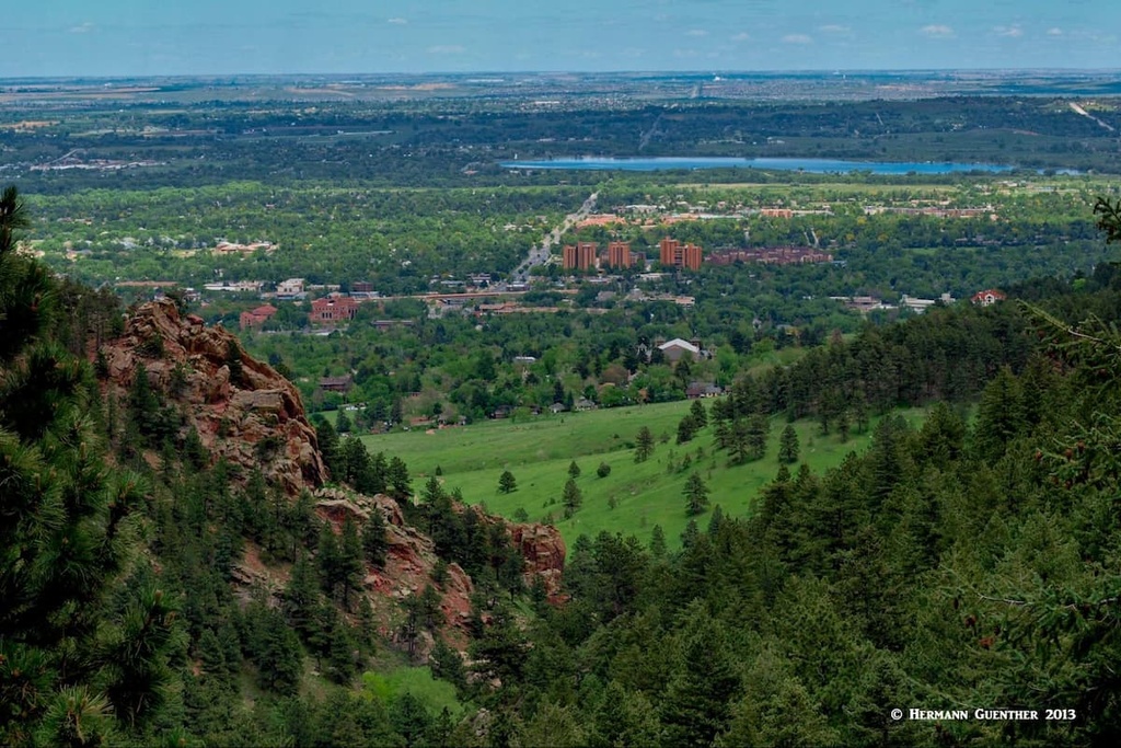
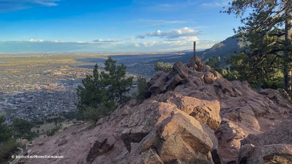
Chautauqua Park and Gregory Canyon Trailheads – I combined these two trailheads since they are close together and serve more or less the same network of trails. While they obviously provide prime access into higher terrain for more experienced hikers, here you will find nice combinations of easy trails suitable for all family members. That’s part of the reason this area is so popular. Parking is free at Chautauqua but not at Gregory Canyon (except for Boulder County residents). It really doesn’t matter where you park – the distance into the mountainous areas is not much longer from Chautauqua, so I have always parked here. No matter which place you choose to park, get there early! The view of the impressive Flatirons is truly epic, and one of the best-known views in Boulder. The north end of the Mesa Trail is just a half mile south of here. The Chautauqua Trail Overlook is just 500 feet from the parking lot – it’s a good walk for visitors in street shoes (or flip-flops) who don’t want to hike but still want to get an impressive view for very little effort.
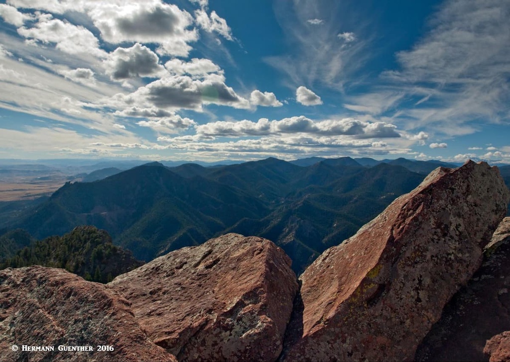
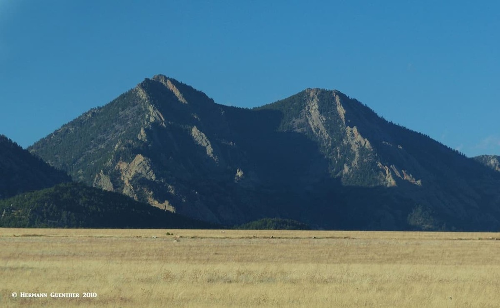
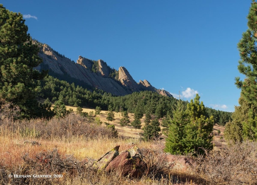
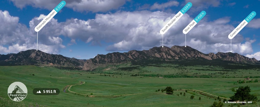
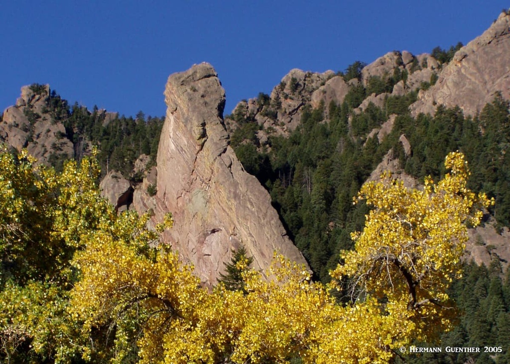
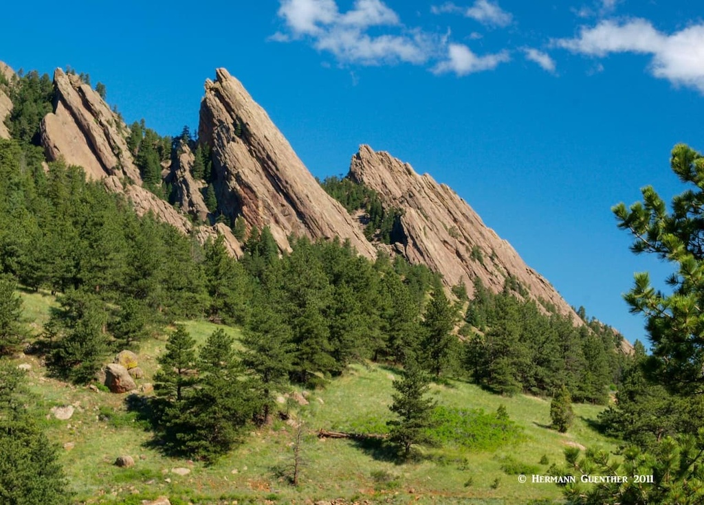
While we say that Boulder OSMP has 14 named mountains, we need to differentiate the PeakVisor definitions from those of people who do the hiking and climbing. This would eliminate such “mountains” as Two Tree Hill, Saddle Rock or Davidson Mesa for example, though they are officially listed in the PeakVisor database. For purposes of our discussion here, there are really only about six or seven mountains that have trails to their summits and that are regularly climbed for the purpose of getting to those summits. The mountains that we want to discuss follow a segment of a ridgeline or geological uplift from Eldorado Mountain in the south to Mount Sanitas in the north, a straight-line distance of only 8.5 miles. It is theoretically possible to hike from one summit to the other, mostly on maintained trails - but I doubt that anyone has ever calculated the trail distance, much less ever having done that. The hiking experiences you can find between these summits will give you endless pleasure. Trust me on this. The kind of terrain that this geological uplift has created is best exemplified in the photo below.
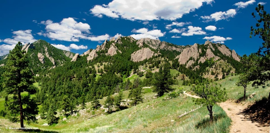
The peaks, and the hiking variations they present, that I want to tell you about are: Eldorado Mountain, South Boulder Peak, Bear Peak, Green Mountain, Flagstaff Mountain and Mount Sanitas. With the exception of Eldorado Mountain, this is where the greater proportion of mountain hiking in OSMP takes place. All the mountains here fall into the Foothills zone since they occur mostly between the elevations of 5,500 and 8,500 feet (the Foothills zone actually extends up to 10,000 feet). So here are descriptions for some of the finest hikes in the foothills of the Rocky Mountains.
Eldorado Mountain - Let me be clear on this - this mountain is not very frequently climbed, since it has no pristine qualities. The Denver and Rio Grande Railroad cuts across its northern and eastern slopes and the summit is occupied by an antenna farm, which is reached by a road. I include it here simply because it is the third-highest and second-most prominent mountain in OSMP. Its redeeming feature is that the views from the summit are spectacular and climbing it can be a pleasant diversion from the trails on the more popular peaks up north. It is usually climbed via its north and northeast ridges, which can be reached by the Rattlesnake Gulch Trail which starts within the Eldorado Canyon State Park; a State Parks Pass is required to park here.
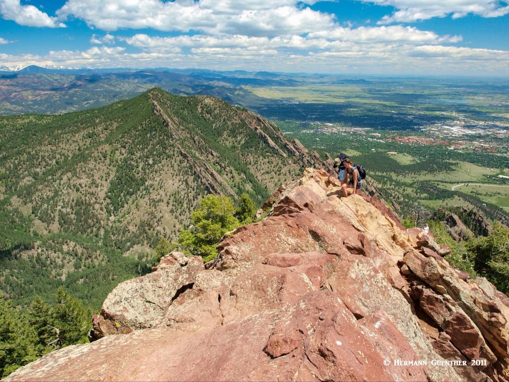
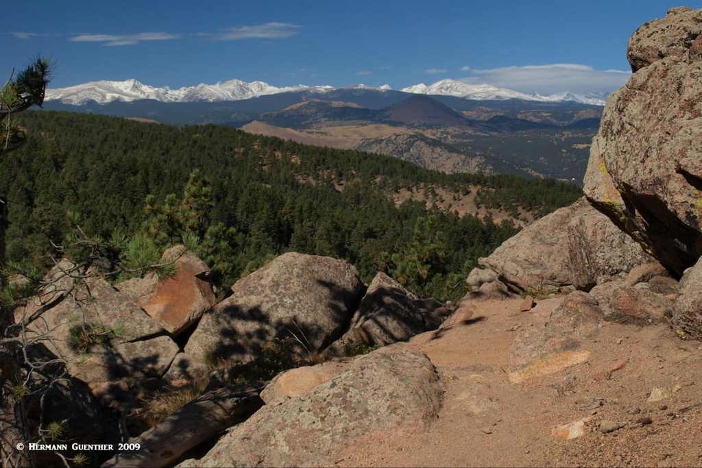
South Boulder Peak - This is the highest and most prominent of all the Boulder peaks. It is fun to climb and will provide any hiker with a good workout. For those who want to climb this one just by itself, the most likely approach will be from the South Mesa Trailhead. For the first couple of miles there are several possible routes involving part of the Mesa Trail in combination with the Homestead Trail and the Shadow Canyon South Trail. Eventually, to gain the summit, you will have to follow the main part of the Shadow Canyon Trail. This steep trail in the aptly named canyon is frequently in the shadow of trees and features rough terrain; although well constructed and maintained, it is best to wear good boots here. As you get higher up the trail you will pass below and then emerge above a favorite climbing feature - the Devils Thumb.
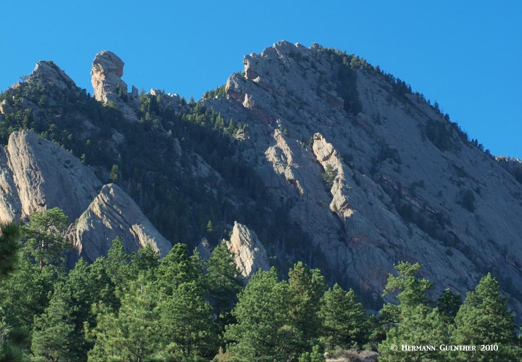
The trail emerges from the trees on a saddle between South Boulder Peak and Bear Peak. Here is your first view toward the west and the Continental Divide. A short spur of less than a half mile takes you to the summit, which involves a good scramble over big boulders. The summit is small and very rocky, so find yourself a rock to sit on and enjoy the great views in all directions (see first photo in this article). To the north you will see the craggy summit of Bear Peak less than a mile away. If you decide to call it a day, you will have to go back down the way you came. Of course you have the option of taking the short and relatively easy side trip to Bear Peak - just go back to the saddle and then follow the trail to the top.
Bear Peak - From South Mesa Trailhead - You can climb this pleasant peak following the Shadow Canyon route as above and then just go right at the saddle. You can then return the way you came. I have more often than not combined the two peaks using this approach. It is the easiest way to climb both of them in one hike without exerting too much additional effort. The summit of Bear Peak is far more interesting (imho) than that of South Boulder Peak. In fact, it can be quite intimidating since it has a tiny summit at the upper end of a very sharp ridge almost approaching a “knife edge” but not quite. For those who are a bit queasy about the exposure or are not comfortable on their feet, you can help yourself by using your hands for more security. I’ve seen many people doing that, including me until I found a way around that part.
This wonderful mountain is spectacular and the views down into Boulder or west to the Continental Divide are epic. Whenever I have been up here, and that has been many times, I often felt like just staying there forever. But one has to think about which way to go back down. The easiest is going the way you came. But there are more interesting options - and they are considerably more strenuous. I will give you two good alternatives. You can continue over the top and head north to the Fern Canyon Trail, which will take you down and eventually connect you to the Mesa Trail via the Sahanahan-Mesa connector.You then take this back to your starting point. This nine-mile loop will give you a workout for sure since you will have completed over 3,500 feet of total elevation gain; remember that the Mesa Trail has many significant ups and downs. You will feel good after this hike. At least I hope so. One important note I want to pass on - the Fern Canyon Trail is probably the steepest trail anywhere in the Boulder mountains. It’s a real knee-burner going down. But the view over toward Green Mountain makes it all worthwhile.
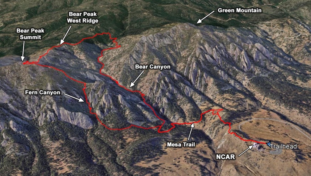
Bear Peak - From NCAR Trailhead - If you just want to climb Bear Peak without bagging any other summit, this would be about the shortest way to do it. Starting at NCAR, you take the spur trail to the Mesa Trail which you then follow south until it intersects the Fern Canyon Trail, which you take to the summit. Then you return the same way - only six miles round-trip but still 2,800 feet of elevation gain. Don’t forget that steep Fern Canyon Trail - you have to do it going up and then back down. But once on top, you have an easier option for returning, but it is 2.5 miles longer. You leave the top via the Bear Peak West Ridge Trail, which after about two miles meets the Bear Canyon Trail. You then take this back to the Mesa Trail and to your starting point. These two trails are a lot less punishing on your knees. You will also see a lot less hikers on this return. The illustration below is one of my recorded GPS tracks of this route overlain on a Google Earth view.
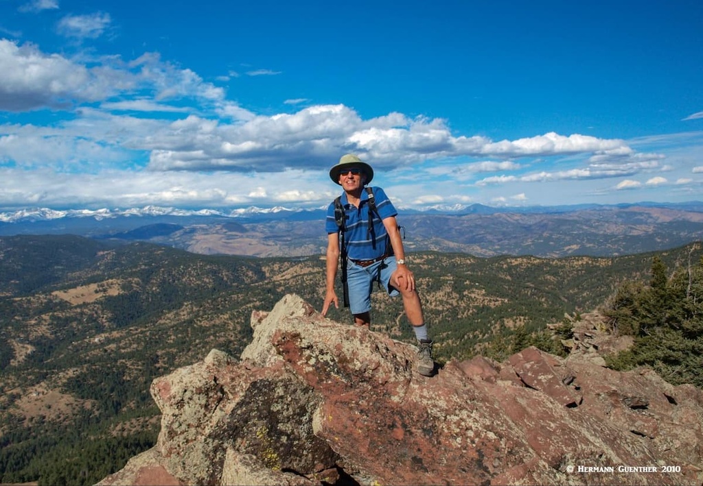
Green Mountain - This delightful chunk of rock is a lot more forgiving than either South Boulder Peak or Bear Peak, even though any summit attempts are generally considered “hard,” mainly due to the fact that you will have to overcome 2,600 feet of elevation gain. My wife and I have always done this as a loop hike from the Chautauqua Park Trailhead. We like to do this loop in the clockwise direction because of the fine view we get hiking back down through Gregory Canyon to the city of Boulder. As you begin your hike at Chautauqua Trailhead, you have a choice of trails to take. Your goal is to get to the Saddle Rock Trail (nice viewpoint at Saddle Rock) which you then follow until you meet the H.M. Greenman Trail. Stay left at this junction or you will start going down again. Follow Greenman to the top. When you have finished your snack or lunch while enjoying the great views in all directions, take the Green Mountain West Ridge Trail until it meets the Ranger Trail. You then take this to the Gregory Canyon Trail which you then follow all the way down, where you can then connect to one of the short trails that take you back to Chautauqua Park.
If any of the aforementioned hikes still don’t satisfy your craving to punish yourself, you must try this one. I’ve done this one twice - the second time when I was just short of 60 years old. That’s when I decided not to do it again! To do this, here is the route I took. Start at the South Mesa Trailhead and go up Shadow Canyon. Nip over to South Boulder Peak and then take the easy traverse to Bear Peak. From here take the Bear Peak West Ridge Trail to its intersection with the Green-Bear Trail. Take this one to the Green Mountain West Ridge Trail which will take you to the top. At this point you have reached your last summit, but this is not the end of your uphill battles - there is lots more elevation gain to come on your way home. In fact you haven’t even reached the halfway point of your hike - you still have more than ten miles to go. But while you are on Green Mountain’s summit, do take a break and enjoy this one. It is much more “friendly” than the other ones.
After enjoying the view, retrace your steps on the Green Mountain West Ridge Trail to the Ranger Trail, which you follow until it joins the Gregory Canyon Trail; you then take this all the way down to the Gregory Canyon Trailhead. If you have a car shuttle in place, this would be the end of your hike. I didn’t, so I just had to go another seven miles and an additional elevation gain of 1,250 feet via the Mesa Trail back to where I started. The total hike was 17.5 miles and 5,400 feet of elevation gain. However, if you start the hike at the Gregory Canyon Trailhead, it can be done in 14 miles and only 4,600 feet of elevation gain, provided you don’t go down Shadow Canyon. This hike is epic and so worth doing if you are in condition. I’ve done many longer and tougher hikes, but none since then.
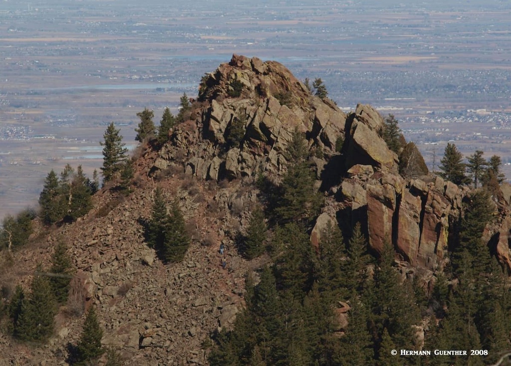
Mount Sanitas - This seemingly small mountain near the north end of Boulder may appear to be nothing much to crow about - at only 6,821 feet elevation, it is easily overlooked when the higher peaks to the south beckon. It has been overlooked by me in all the years that I have hiked in Boulder. But believe it, this can be a rough hike, even though it can be done in a round-trip of under three miles and only about 1,200 feet of elevation gain. I am basing my knowledge only on research, but all that I have read seems to indicate that one must take this one seriously. There are various options to consider here so that you don’t have to go up and back down on the main trail. My choice would be a five-mile clockwise loop going up the Sunshine Canyon Trail which follows a road for a little over a mile. This then connects to the Lion’s Lair Trail which follows an indirect route to the top, through areas of shade and some switchbacks, finally approaching the summit from the north. Here you will have a few options as to how to return to your car, some very steep and rocky. Good footwear is recommended here. The view from the top is outstanding, as are all the views in the Boulder Mountains. Many locals do this one regularly - early in the morning or late after work.
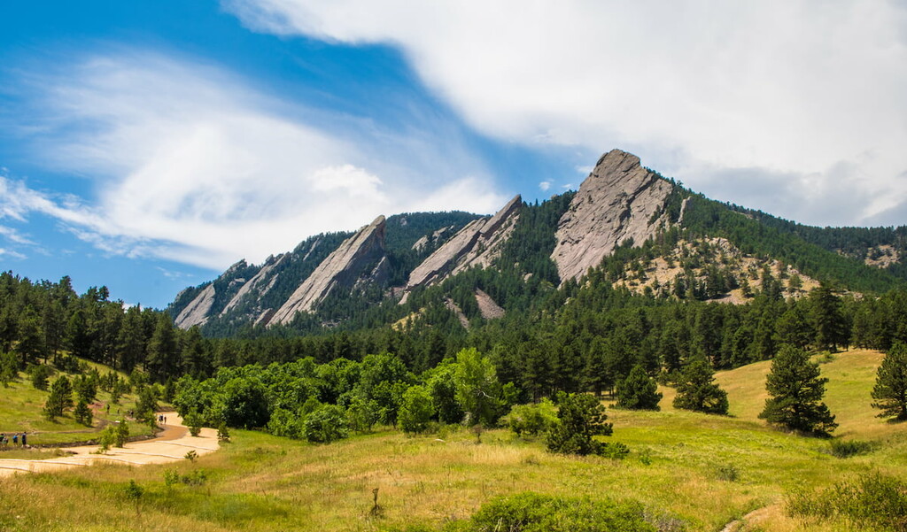
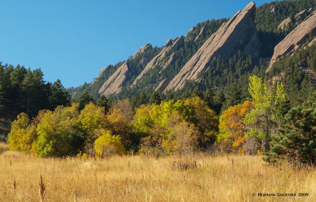
The Flatirons - When we talk about the Flatirons, we are mostly referring to the five numbered ones (i.e. First through Fifth Flatiron) starting with the northernmost and ending with the Fifth at the south end of the group. These are the ones that are located on the lower eastern slopes of Green Mountain and are best viewed from the Chautauqua Park Trailhead. In fact, this is the most iconic view of anywhere in Boulder. They can be seen on countless photos, paintings and even sculptures. Just go to any tourist shop in Boulder and you will see them. But there are in fact several other flatirons further south, all the way to the southern slopes of South Boulder Peak. All of these can be seen in various poses as one hikes the length of the Mesa Trail. The one thing they all have in common is that they are part of the same sandstone formation and uplift which occurred between 35 and 80 million years ago. Their inclination from vertical is almost identical. Most of them are climbed. But not hiked. These all involve technical climbing skills. The southernmost of these is the Matron, seen very prominently from the south end of the Mesa Trail and the Shadow Canyon trail.
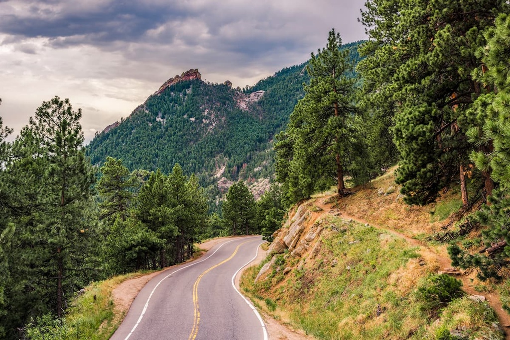
Flagstaff Mountain - This mountain is not really a hiking mountain - after all, you can drive to the top on a very fine paved road. The awesome views from the road tempt you to look each time you come around a bend as you climb steeply. But pay attention - this road has more curves than a pretzel, and any driver distraction can spoil your day. This road is also one of the best bike-climbs in the area, which adds to the need to be focused when driving here. But rest assured, there are places to pull over to look and take photos. While there are several trailheads along the road, parking is not free. There is one trail, the Flagstaff Trail, that starts at the bottom switchback and climbs steeply to the summit in a little over two miles. Elevation gain is 1,500 feet. It is not a wilderness experience since it crosses the road many times.
It goes without saying that Boulder Open Space and Mountain Parks sits at the western edge of a large metropolitan area of 2 million inhabitants. So access to the fine recreation opportunities OSMP offers is easy from all over the greater Denver area. Visitors from out-of-state will find anything they need in terms of tourist infrastructure in this sprawling metropolis. But let’s think about smaller, more quaint places to stay and eat, places that are more in character with the mountain environment of the Boulder area. We will look at two such places.
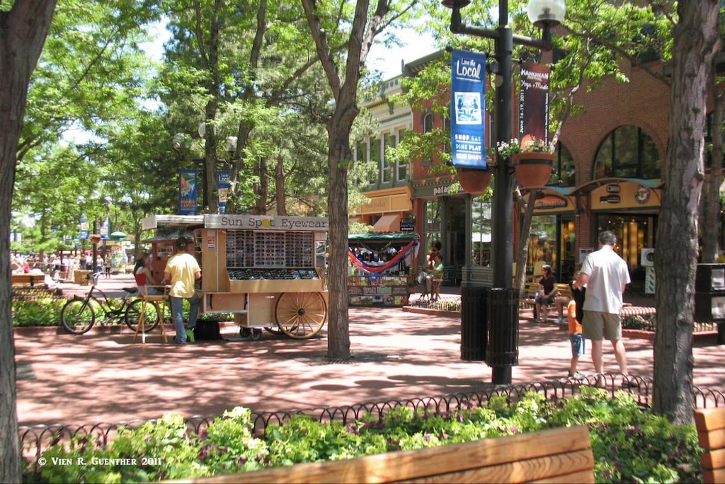
The City of Boulder is located 25 miles northwest of Denver and has a population of 108,250 as of the 2020 census, making it the 12th most populous city in Colorado. In addition to its spectacular setting right at the foot of the Rocky Mountain foothills, Boulder might be best known as the home to the main campus of the University of Colorado. It alone contributes 46,000 students and faculty to the overall population of the city. The elevation of 5,430 means that the mountains in its backyard rise more than 3,000 feet, thus making any climbs to their summits fascinating and demanding outings. Boulder has gathered many top rankings in recent years for health, well-being, quality of life, education and art. The city is notable for many science and high-tech institutions. It is an expensive place to live - in 2016, the median price of a home exceeded $1 million. Boulder is a delightful place to simply hang out and do some people-watching while eating in one of many fine restaurants or shopping in the many boutiques along the famous Pearl Street Mall, a pedestrian-only street.
But from a hiker’s perspective, the one thing Boulder offers above all else is its mountains. Unlike the higher peaks on the Continental Divide only 20 miles to the west, these peaks can be hiked any time of the year by anyone in good condition - special winter equipment is not required, though spikes are helpful in icy conditions and appropriate clothing is mandatory as it can get really hot in summer and really cold in winter. Even right after a snowstorm, the trails will get beaten down by snowshoes and hiking boots so that anyone can “hit the trail.” And they surely do - the many students in town make sure of that. And rock climbers surely must get their adrenaline flowing when they have a look at the magnificent Flatirons which practically drop right into town.
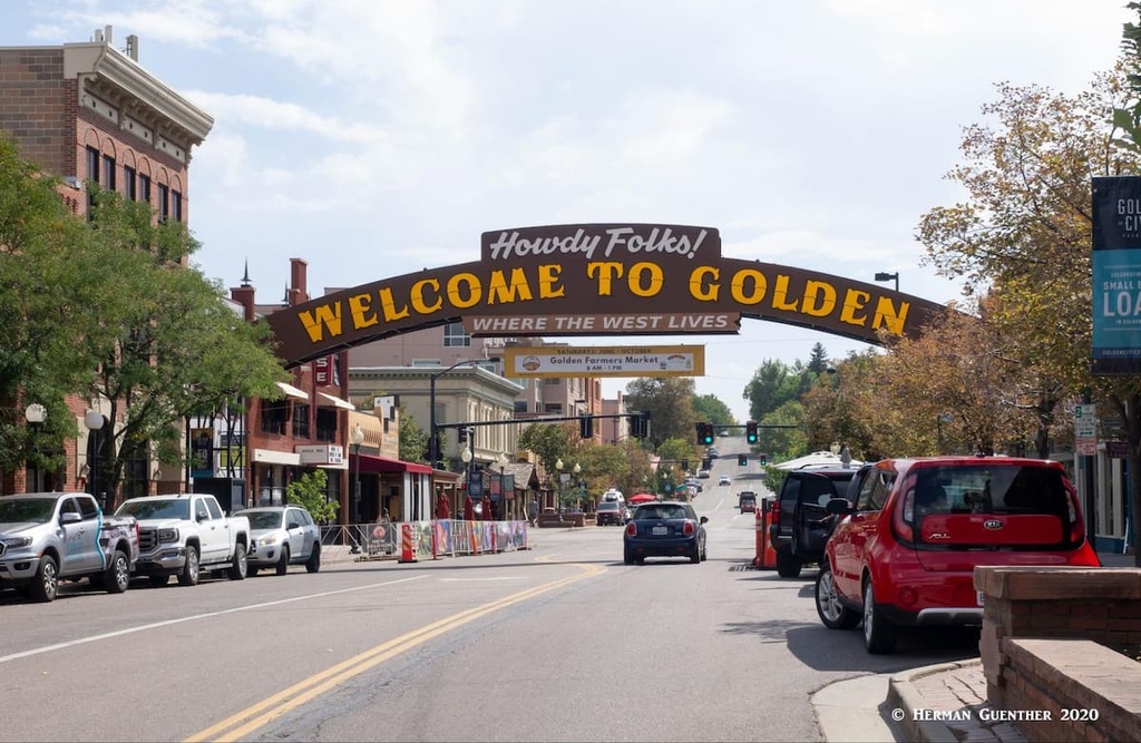
This historic town is a scenic 20-mile drive south of Boulder along SH-93. Golden is the seat of Jefferson County and has an interesting and colorful history. Situated on Clear Creek at the foot of the Front Range, Golden was founded during the Pike’s Peak Gold Rush on June 16, 1859. The town is home to the excellent Colorado School of Mines which offers programs in engineering and science. If one wants to become a mining engineer, this would not be a bad place to undertake your studies. The famous western showman, William F. Cody (better known as Buffalo Bill) is buried on nearby Lookout Mountain. The Coors Brewery, located in the Clear Creek Valley between North Table Mountain and South Table Mountain, is the largest single-site brewery in the world. Visitors must take a tour – and sample some of the goods as well.
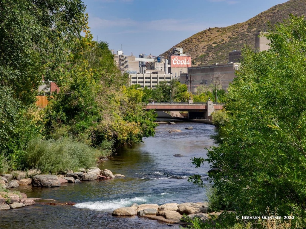
The historic center of Golden is a charming place to spend a couple of hours. Its setting at the foot of South Table Mountain, with Lookout Mountain on the opposite side of downtown, is one of the finest in the entire Front Range, just minutes from downtown Denver. Walk along the waterfront park developed around the sparkling Clear Creek and you will be transported to another world that seems far from the bustling metropolis of which it is a part. And appropriately, the American Mountaineering Center is located here. Its museum is the first and only one in the nation dedicated to mountaineering history. The town has no shortage of places to eat and drink, but accommodations are somewhat limited here, although readily available elsewhere in the Denver urban area.