AllTrails is a popular platform where people from all over the world publish trails with their own description of hiking itineraries. While it might be a good source of inspiration for a next hike, blindly following the steps of someone you don’t know seems a bit reckless. That hiker’s skill level, knowledge of the locality, personal preferences, and the such are most likely to be totally different from yours.

What would appear to be an easy hike with a couple of exposed sections along the route for Reinhold Messner might be out of reach for ordinary humans. The past achievements might have skewed the contributor’s perception. Reinhold Messner made the first solo ascent of Mount Everest and later topped it up with the first ascent of Everest without supplemental oxygen. Also, he was the first climber to ascend all fourteen peaks over 8,000 metres above sea level.
On the other hand, someone new to hiking, or someone who recently moved from a flat area might see even an ordinary hiking trail as a challenge, let alone mountain or alpine trails. Therefore, knowing other people’s skills is essential if you want to compare your options.
Also, there have been numerous attempts to grade hiking trails and climbing routes but they still lack precision and people will argue whether a particular trail is Class 2 or Class 3. Mind you, the difference can either make you or break you.
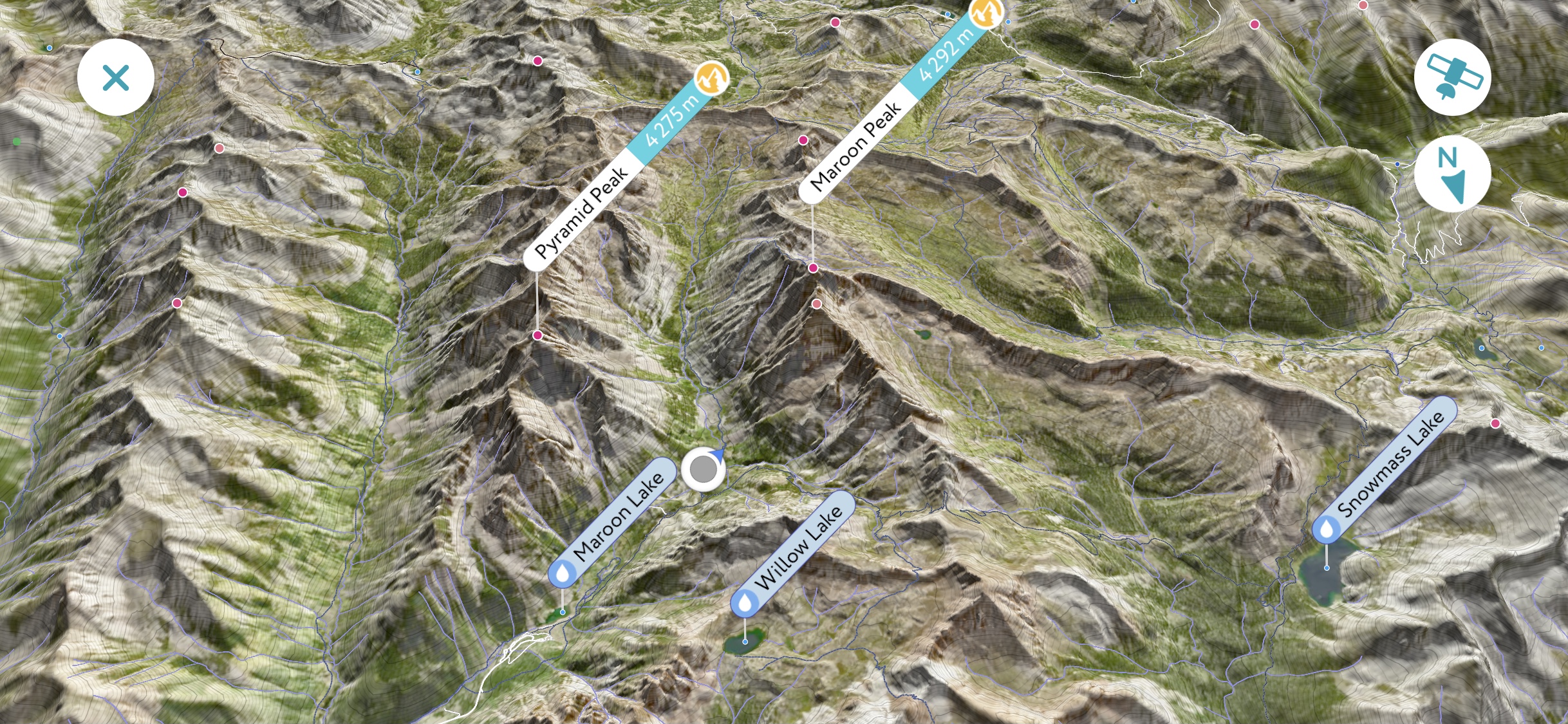
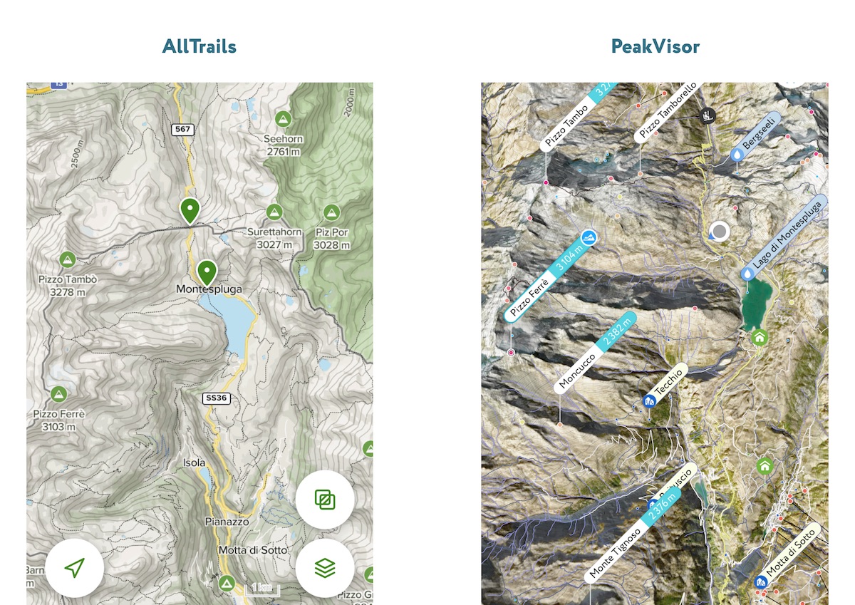
AllTrails makes it easy to share your personal outdoor experience with others but personal differences make the benefits questionable. PeakVisor 3D Maps is a great alternative to AllTrails. It provides a detailed 3D model of any hiking area with all the hiking opportunities and points of interest.

Here is the one-million-dollar question. Would you rather risk and follow the path of undoubtedly great adventure laid by the guides whose skills and experiences are not known to you or would you rather learn how to read a map and apply this skill everywhere you go without being dependent on anybody? And taking into account that PeakViso’s maps are visually rich and intuitive, the latter option looks like a piece of cake. Also, a better understanding of the area allows you to switch from turn-by-turn instructions to actual exploring. Be an explorer, not a tourist. Use PeakVisor!
There are two major approaches to outdoor hiking apps:
- Curated (or not so much) itineraries (e.g. AllTrails)
- Topographic maps (PeakVisor is here)
Contrary to AllTrails, PeakVisor doesn’t provide personal trip reports published by other users. Instead, PeakVisor presents all the relevant information to organize a hike wherever you would like. It doesn’t matter whether someone published interesting trails in the area, you’ll see all the trails and points of interest anyway.

One of the benefits of using a detailed map instead of precooked hiking itineraries is that explorers distribute more evenly over recreational areas. It is much better for outdoor enthusiasts to find new trailheads and follow less crowded trails. And that is better for nature as it helps to avoid spiking crowds of visitors in the most photographed places. You might have seen “Tag Responsibly. Keep {a place} wild” on Instagram. That’s for the same reason.
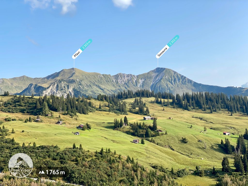
Additionally, PeakVisor provides an extremely helpful tool for peak identification. In the end, what that mountain is and how to get there are two most popular questions on any trail.

PeakVisor supercharges your skills to the superhero level. You immediately understand the terrain, what you see in the distance, how the trail looks like in real life. You don’t rely on subjective evaluation by another person.
Try PeakVisor as your backup option with a free 7-day trial and see for yourself all the benefits of spectacular 3D maps and peak identification technology. You won’t want to use anything else after that.
Have we mentioned that PeakVisor is way cheaper to use as well?!
We believe that modern hiking must be about personal exploring and going places. Not to follow someone’s turn-by-turn instructions, especially someone you barely know. Instead, you will unite with Nature, see all the hiking opportunities, and avoid the teeming crowds. If that’s something you are interested in, PeakVisor will be an ideal alternative to AllTrails for you.
However, AllTrails can be very beneficial if you want to get some deep aesthetic pleasure from looking at the stunning pictures uploaded there. What’s more, AllTrails is quite a treasure chest of ideas for hiking, combining it with PeakVisor’s precision and sophistication will surely make your trips safer and more exciting.
Be an explorer, not a tourist.

