Scan the QR code and open PeakVisor on your phone
Malta, officially the Republic of Malta, is a small island country located in the Mediterranean Sea. Located in between the continents of Europe and Africa, Malta has long since played a vital role throughout history. There are 32 named peaks in Malta with the tallest and most prominent being Ta’Dmejrek (253 m/ 830 ft).
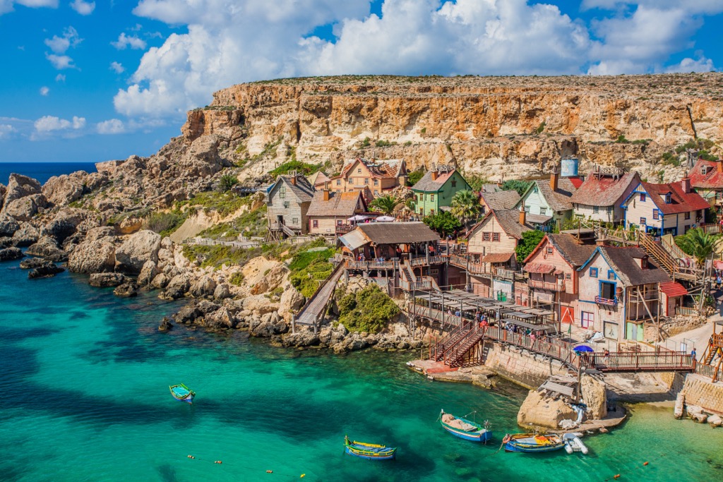
Malta consists of an archipelago containing five major islands. Of the five largest islands, only three are inhabited; Malta, Gozo, and Comino. The islets of Kemmunett and Filfla are uninhabited.
Spanning just 316 sq. km (122 sq. miles), Malta marks the tenth smallest country by area in the world. Home to 516,000 residents, Malta is the fourth most densely populated sovereign country.
There are over a dozen minor islands that are also part of the archipelago. The archipelago lies on the Malta plateau, with the islands marking the high points of a land bridge that connects Sicily to northern Africa.
Malta lies in the Mediterranean Sea 80 km (50 miles) south of Italy, separated by the Malta Channel. Libya is situated roughly 290 km (180 miles) south of Malta while Tunisia is located 290 km (180 miles) to the west.
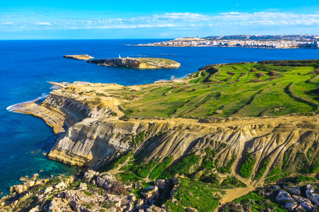
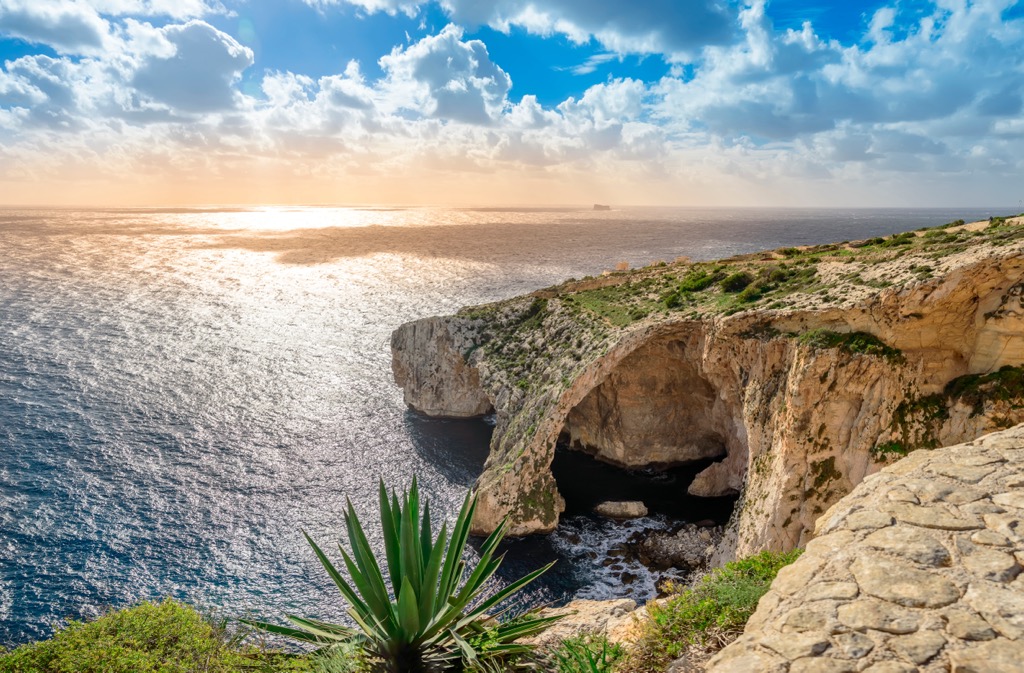
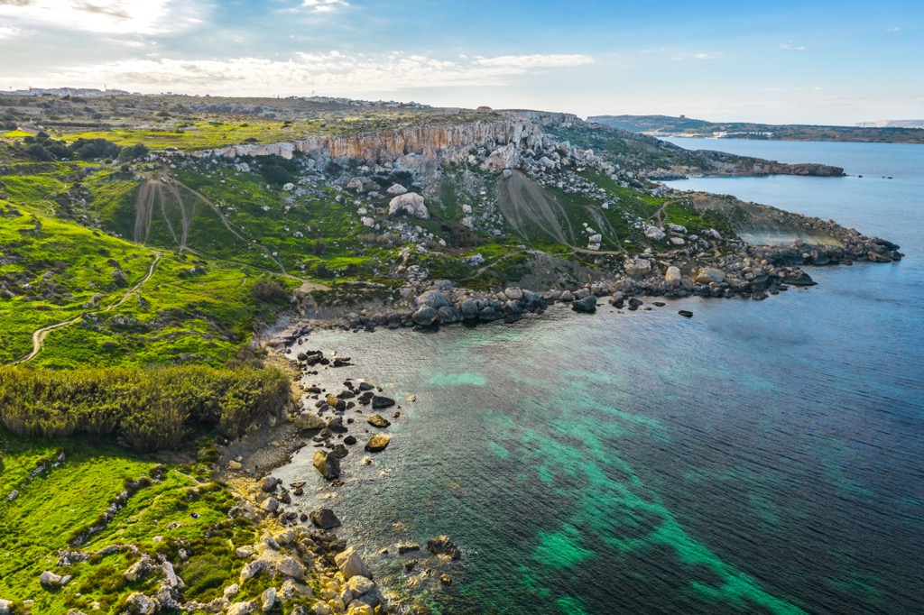
There are multiple bays situated along the coastline of Malta, many of which are used as harbors. A majority of the bays are found along the eastern side of the islands while dramatic cliffs define Malta’s west coast.
Ta’Dmerjrek is the tallest peak in the country, standing at just 253 m (830 ft) tall. A majority of the landscape on the islands is marked by low sloping hills and terrace fields.
After heavy rainfall visitors may spot small creeks and streams though there are no permanent rivers or lakes in the country. There are a few protected areas in Malta that feature designated hiking trails. Some prominent protected areas include the Il-Majjistral Nature and History Park, Filfla Nature Reserve, and Xrobb l–Ghagin Nature Park.
Malta has a relatively brief geological history, dating back roughly 30 million years ago. The archipelago is part of a land bridge that connects the island of Sicily to northern Africa. At various points in history this land bridge has been exposed due to the changing depth of the Mediterranean Sea.
Situated roughly 200 km (124 miles) south of the subduction boundary between the African Plate and Eurasian Plate, Malta was formed by tectonic shifting. From the late Miocene to the Pliocene, present-day Malta was formed through the uplift of sedimentary rocks.
Malta consists solely of sedimentary rock dating back to the Oligocene. The Malta archipelago forms the crest of a tilted block situated along the edge of the Malta Graben.
Due to millions of years of erosion, Malta is dominated by steep cliffs and limestone rock formations. The tallest peaks consist primarily of Coralline limestone while blue clay and other types of limestone are present throughout the rest of the islands.
Flora and fauna found in Malta is similar to that found in other lowland Mediterranean regions. The vast majority of Malta’s woodlands have been destroyed due to logging, agriculture, and industrialization.
The small stands of forest that remain are populated by holm oak and aleppo pine. Valleys in the country support populations of olive, bay laurel, carob, and maquis. Garigue is found throughout the main limestone plateau of Malta.
Steppe sections of the terrain feature various grasses, thistles, and leguminous. Many of Malta’s native species, including Maltese rock-centaury and Maltese cliff-orache, can be found near the cliffs of the country.
Native mammals in Malta include several species of bats along with a subspecies of the Sicilian shrew. Animals that have been introduced to Malta include the rabbit, weasel, Mediterranean chameleon, and Algerian hedgehog. Reptiles including the leopard snake, Turkish gecko, Maltese wall lizard, and ocellated skink are native to the region.
Migratory birds are extremely common in Malta with some of the most plentiful bird species including the storm petrel, Mediterranean shearwater, Cory’s shearwater, Spanish sparrow, and blue rock thrush.
Humans are thought to have inhabited Malta since 5900 BCE. Remnants of Neolithic culture have been marked by various temples and Megalithic structures. Around 800 BCE the Phoenicians colonized the region.
The Carthaginiians ruled the region after Phoenicians. ARound 216 BCE the Romans conquered present-day Malta. In 60 CE, St. Paul was shipwrecked on Malta. During his three month stay in Malta, he preached the Christian faith to its inhabitants. The Byzantine seized control of both Sicily and Malta following the fall of the Roman Empire.
During the eighth century CE the Arabs conquered the islands. Invaders pillaged and destroyed many important buildings and left Malta practically uninhabited. Arabs from Sicily recolonized the islands around 1050 CE.
Over the following centuries the Normans, Kingdom of Sicily, Angevin Empire, and the Spanish governed Malta. In 1530, Charles V of Spain gave Malta to the Order of Knights of the Hospital of St. John of Jerusalem.
In 1798, Napoleon of France took control of the Maltese Islands. The people of Malta requested English aid and the French presence ended shortly after in 1800. The Treaty of Paris in 1814 established Malta as a British colony.
During World War II, the Allies used Malta as a strategic spot due to its proximity to Italy. During WWII, the Axis heavily bombed the islands. Britain awarded Malta the George Cross to recognize the bravery of the Maltese people.
Malta achieved independence from Britain in 1964, becoming a republic with the Commonwealth in 1974. In 2004 Malta joined the European Union.
There are numerous protected areas and parks throughout the islands of Malta. Below are a few popular hiking trails to check out on your next visit to the region:
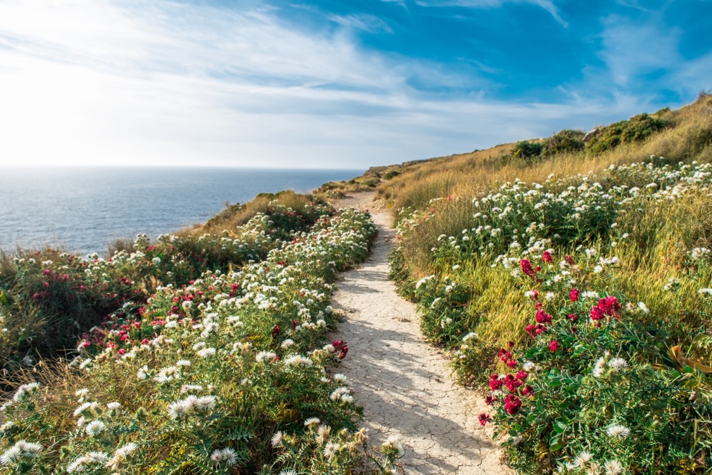
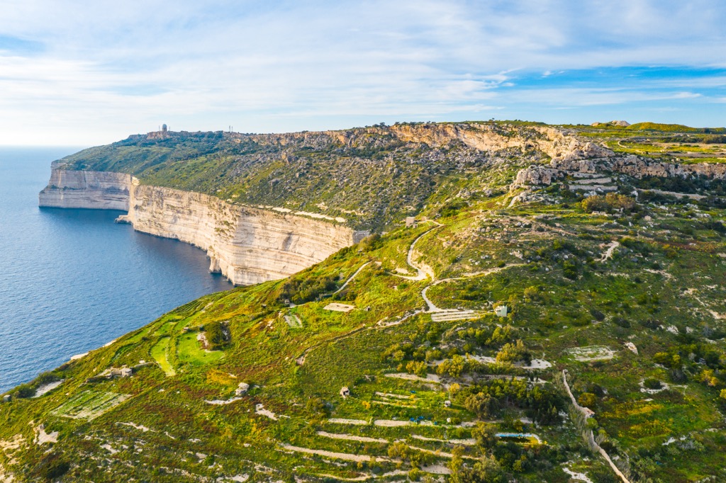
The Dingli Cliffs are situated along the western edge of the island of Malta. The section of land is home to Ta’Dmejrek, which marks the tallest point in the country. Much of the coastline stands above 240 m (787 feet) in height.
This loop trail follows along the edge of the cliffs which span over 3.2 km (2 miles) in length from Bahrija to Munga. Hikers have unobstructed views of the Mediterranean and the islet of Filfa. This loop is 9.3 km (5.8 miles) long and features 186 m (613 feet) of elevation gain.
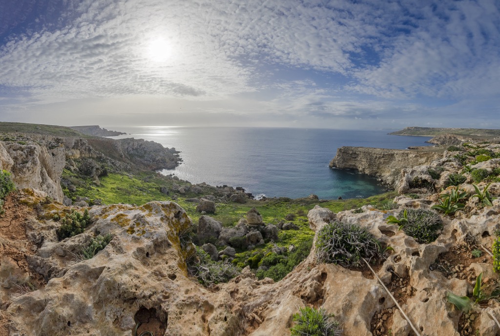
This loop trail is located in Il-Majjistral Nature and History Park along Malta’s northwestern coast. Throughout the route hikers have views of the Mediterranean landscape, Malta’s rocky shores, and numerous historical sites. The loop is 6 km (3.7 miles) in length and features 126 m (413 feet) of elevation gain.
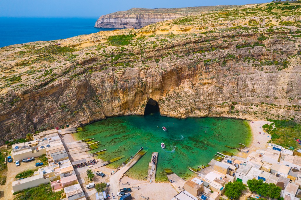
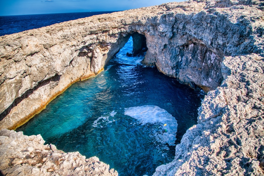
The Coral Lagoon loop is located along Malta’s northern tip. The trail follows along the edge of the peninsula offering continual views of the Mediterranean Sea and Malta’s limestone cliffs.
About halfway through the loop the trail leads to the Carol Lagoon. This large coral sea cave has a collapsed roof offering visitors a beautiful view from up above. The loop route is 10.4 km (6.5 miles) long and features 131 m (429 feet) of elevation gain.
Looking for a place to stay on your next trip to Malta? Below are a few options of villages and cities on the island:
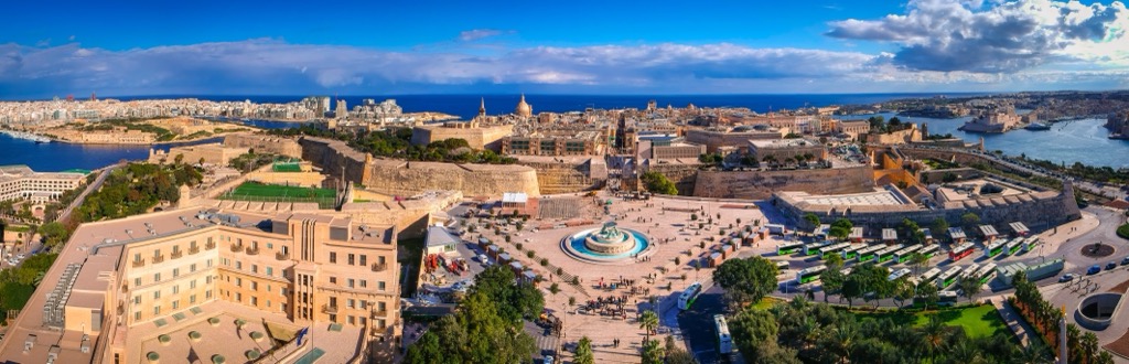
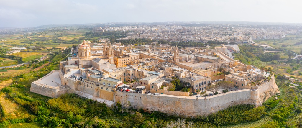
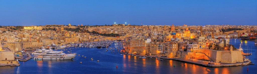
Valletta is the capital city of the country of Malta and is situated on the east coast of the island of Malta. Spanning just 0.61 sq km (0.24 sq miles), Valletta marks the smallest capital by area in the European Union.
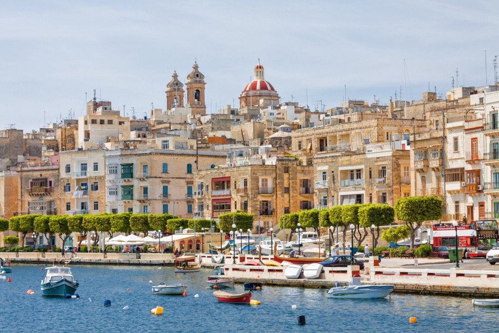
Established during the sixteenth century, today Valletta is home to around 6,000 residents. The stunning architecture of the city is met with the beautiful water of the Mediterranean Sea. Popular sites in the city include St. John’s Co-Cathedral, Grand Master’s Palace, Barrakka Gardens, National War Museum, and Triton Fountain.
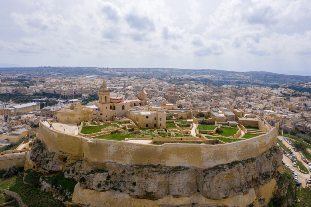
The town of Victoria, also known as Rabat, is situated near the center of the island of Gozo, the second largest island in the archipelago. Victoria is home to fortified walls surrounding its medieval Citadel.
Other popular attractions in Victoria include the Gran Castello Historic House, Gozo Museum of Archaeology, and the Gozo Cathedral. The town is home to around 7,400 residents and features a quieter experience compared to popular areas on the island of Malta. Numerous beaches and communities are within a fifteen minute drive of downtown Victoria.