
Scan the QR code and open PeakVisor on your phone
Harney County is home to 206 named mountains. The highest is Steens Mountain at 2,968 m.
Harney County is a county located in southwestern Oregon. The county spans 10,266 square miles across the state and has an estimated population of 7,422 people. The county is surrounded by other counties in the state as well as the state of Nevada that lies to the south. There are 172 named mountains in Harney County. The highest and the most prominent mountain is Steens Mountain at 9,747 feet.
Despite being the largest county by land, in the state, and one of the largest in the entire country, 75% percent of Harney County is designated federal land. Parts of both the Ochoco National Forest and the Malheur National Forest lie within Harney County. In the southern region of the county lies the Steens Mountain Wilderness. The Burns Paiute Indian Reservation is also located within Harney County.
Much of the county is characterized as high desert. This geography has led to small amounts of rainfall. Because of this, the main industries are ranching and farming. Harney County, combined with the neighboring Grant County, is home to the largest Ponderosa pine forest in all of America.
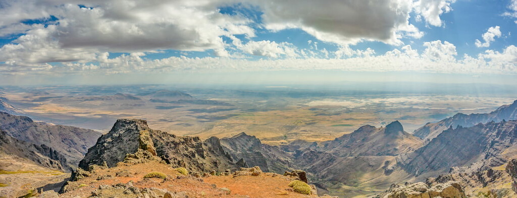
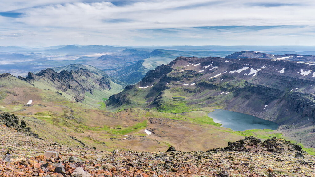
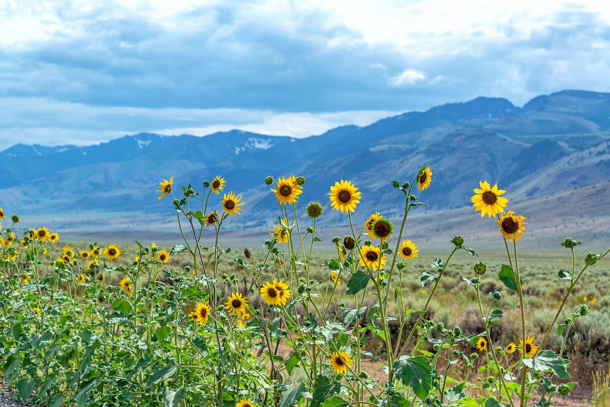
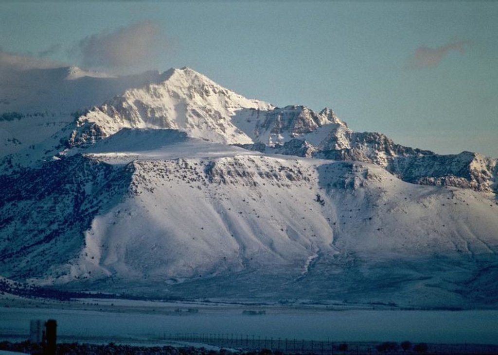
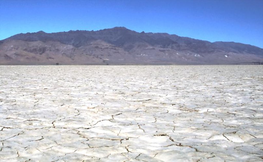
One of the most iconic features of the county is Steens Mountain which is also the highest point in all of Harney County. Steens Mountain lies within the Steens Mountain Wilderness. The area surrounded this mountain is quite flat, making for its dramatic appearance across the landscape. In the southeast region of the county lies Alvord Desert. This high desert is known to be the driest place in the entire state, receiving about seven inches of rainfall per year. The Trout Creek Mountains also lie within the county. They are classified as a Great Basin Mountain Range and extend southward into neighboring Nevada. Another remote mountain range within the county is the Pueblo Mountains. These remote mountains are similar to the Trout Creek Mountains in that they extend south into northwestern Nevada.
Another landmark of the county is Harney Basin. This endorheic basin marks the northwestern region of the Great Basin. Harney Basin is home to both Malheur Lake and Harney Lake. The basin is also known for being one of the least populated regions in all of the United States, excluding the state of Alaska.
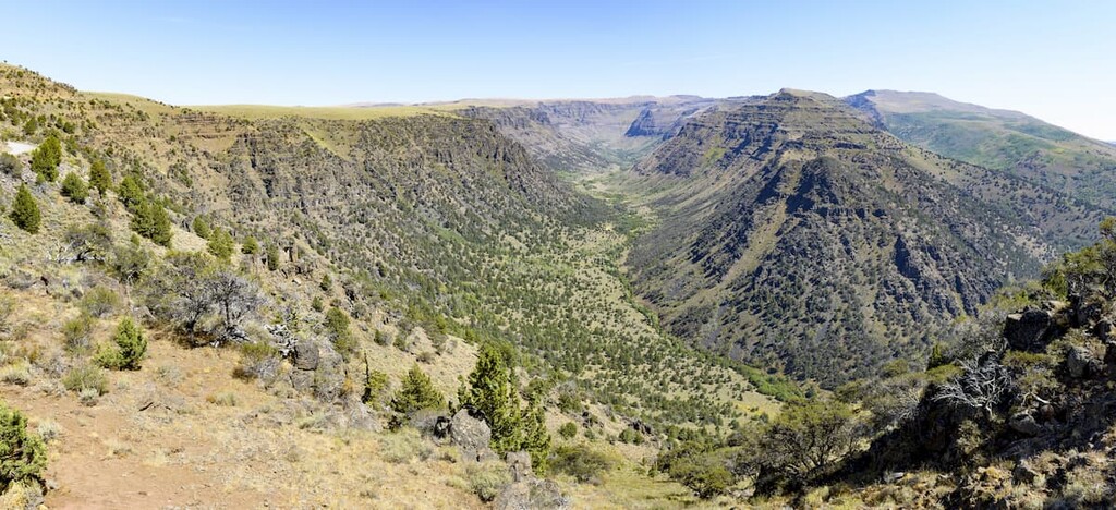
Steens Mountain Wilderness: The most iconic region in the county is Steens Mountain Wilderness. The wilderness area covers 170,166 acres and is home to the tallest peak in the entire county. Nearly half of the land is open to cattle grazing while the higher elevations offer hiking trails. Steens Mountain is the largest fault-block in the entire country. The eastern side is met with rugged peaks while the western side is characterized by more rolling slopes. Well-known hikes within the wilderness include Wildhorse Lake Trail, Big Indian Gorge Trail, Pike Creek Canyon, and Steens Mountain Summit.
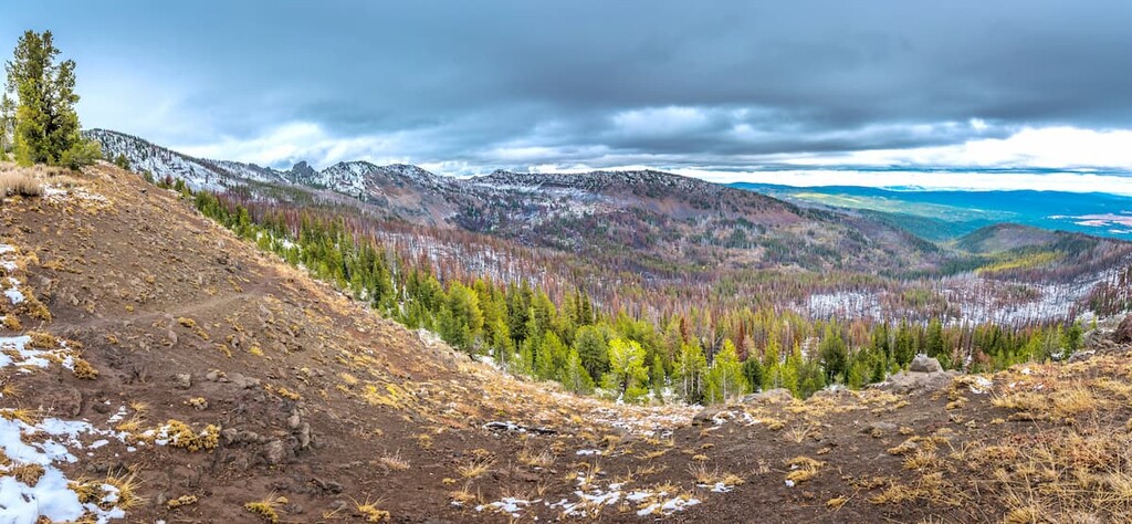
Malheur National Forest: The southern section of Malheur National Forest lies within Harney County. The forest covers 1.4 million acres across the state and is known for its rugged peaks, old growth forest, and high desert grasslands throughout. Within the forest also lie two wilderness areas; Strawberry Mountain Wilderness and Monument Rock Wilderness. Popular hikes within the forest include Strawberry Peak, Monument Rock, and Slide Lake Trail.
Malheur National Wildlife Refuge: This national wildlife refuge is located in the central region of Harney county. The region spans 293 square miles and is now a popular destination for bird watching, hiking, hunting, and fishing. Popular hikes include Diamond Craters, Frenchglen Warm Springs, and exploring the land around Malheur Lake.
Located just an hour north of Steens Mountain Wilderness, lies the small town of Burns, Oregon, which happens to be the largest city in the entire county. The city has an estimated population of 2,800 residents. Archeologists believe that the region has been inhabited by humans for over 10,000 years. The small town is also located near the Malheur National Wildlife Refuge. Much of the region is used for ranching and other forms of land use. The Burns-Hines region is characterized as a high-desert climate, similar to many parts of eastern Oregon.
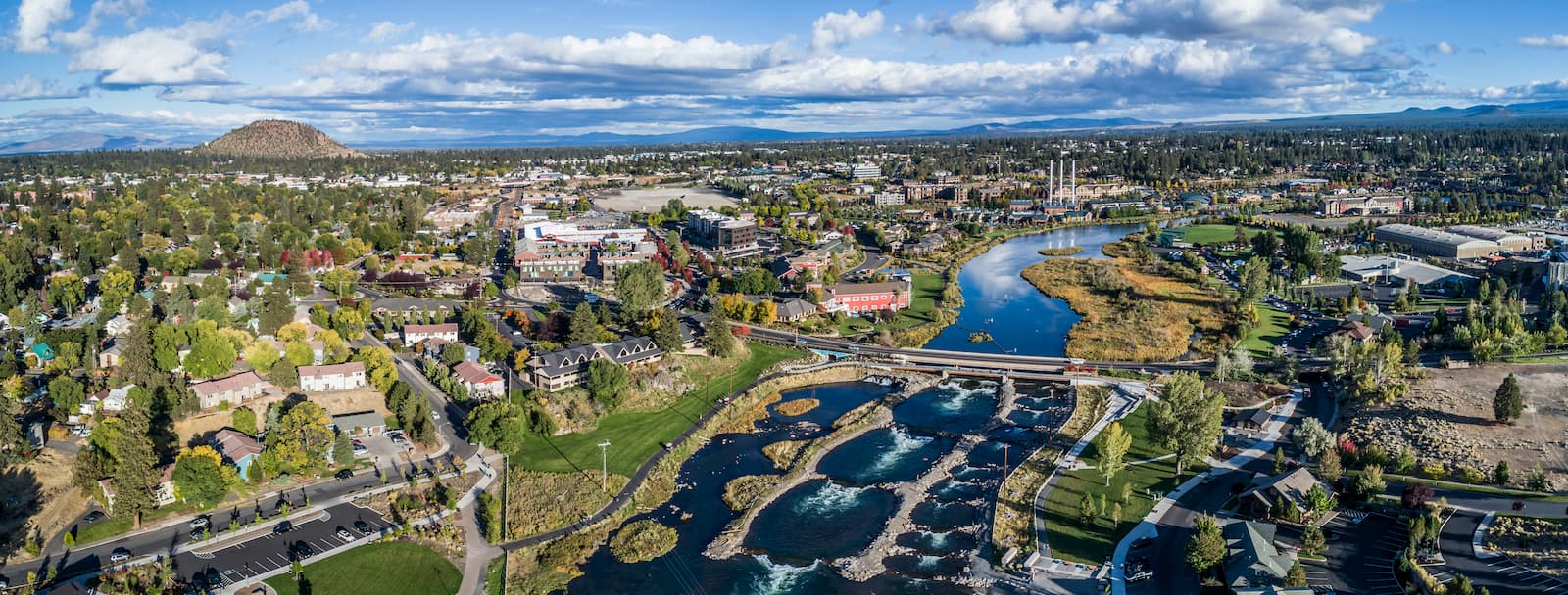
To the northwest of Harney County, lies the city of Bend, Oregon. Bend is the largest city located in eastern Oregon with a population of nearly 100,000. The city is located on the Deschutes River and is known for being an outdoor paradise. To the west lies the lake and peaks of the Cascade Mountains, along with Mount Bachelor Ski Resort, while a trail in the city leads to the top of Pilot Butte. To the south lies the High Desert Museum and Newberry National Volcanic Monument. Just north of town is one of the state’s most iconic rock-climbing locations, Smith Rock State Park. As a whole, the city is a mecca for trail running, skiing, mountain biking, hiking, rock climbing, and even surfing in the river. Besides the abundance of outdoor activities, Bend is known for its numerous breweries and restaurants.


Yes. Harney County has 206 named mountains. The highest is Steens Mountain at 2,968 m.
The highest mountain in Harney County is Steens Mountain, at 2,968 m.
Harney County has 206 named mountains.


