
Scan the QR code and open PeakVisor on your phone
Eritrea is home to 1,769 named mountains. The highest is Emba Soira at 3,018 m.
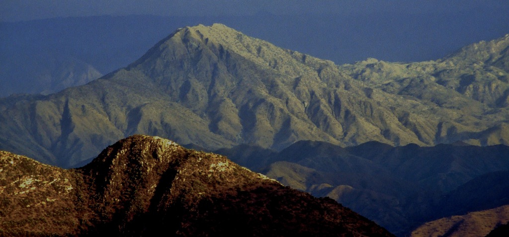
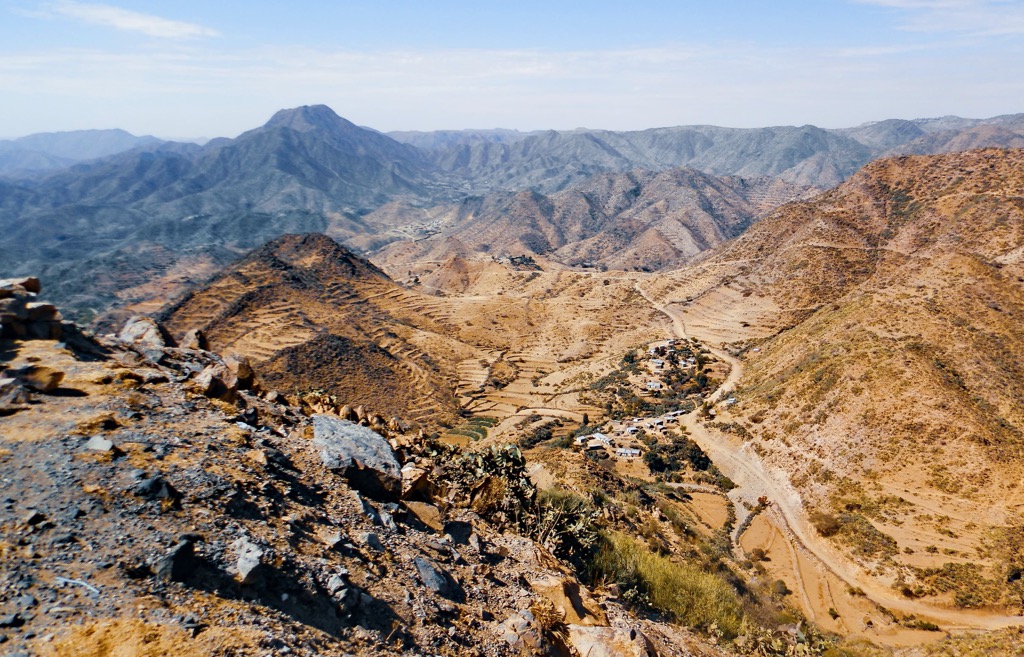
Eritrea is a small country in eastern North Africa, located on the shores of the Red Sea. The central feature of Eritrea mountains is its main range, the Eritrean Highlands, which covers the central part of the country. Emba Soira (3,018 m / 9,902 ft) is the highest point of this range, and the country. The most prominent mountain is Ramlo (2,189 m / 7,182 ft), in the southeast, which boasts nearly 2,000 meters (6,600 ft) of topographic prominence. In total, there are 1769 named mountains in Eritrea.
Eritrea is one of the smaller nations in mainland Africa, with a total area of 117,600 square kilometers (45,410 sq mi) and a population of approximately 3.5 million. The country lies across the Red Sea from Saudi Arabia and Yemen. By land, it borders three nations: Sudan, Ethiopia, and Djibouti, clockwise from west to southeast, respectively.
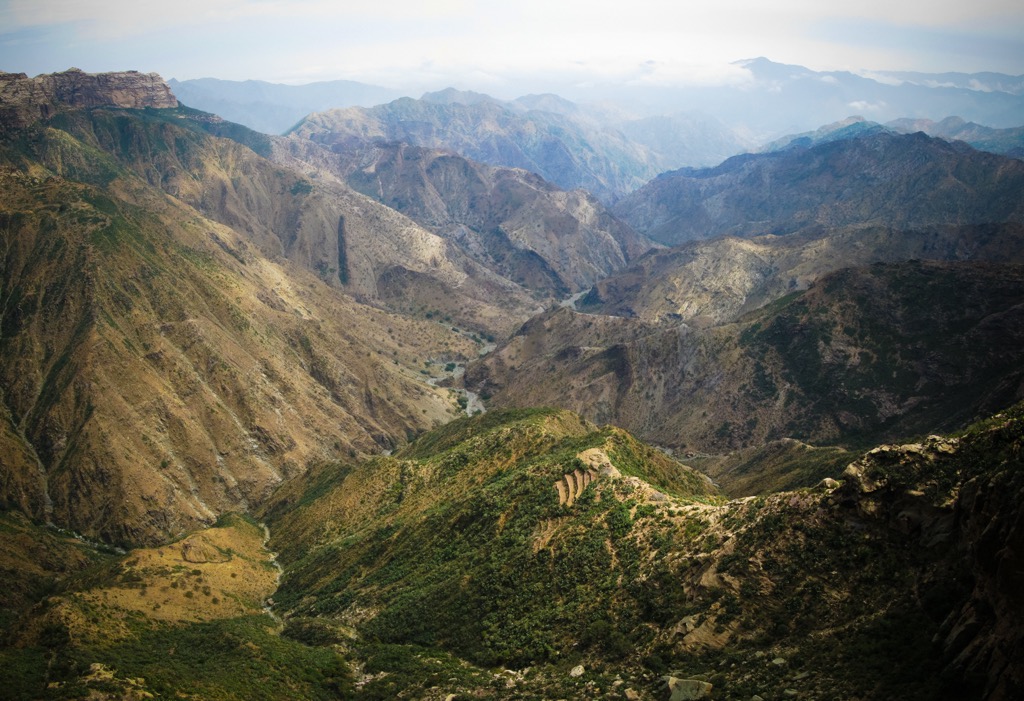
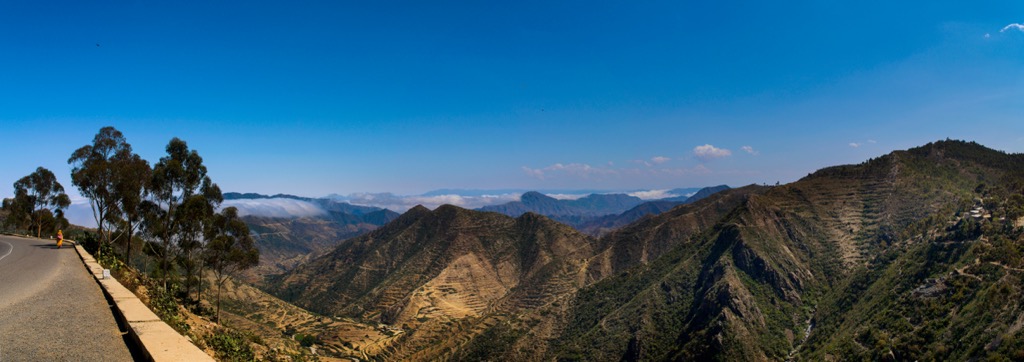
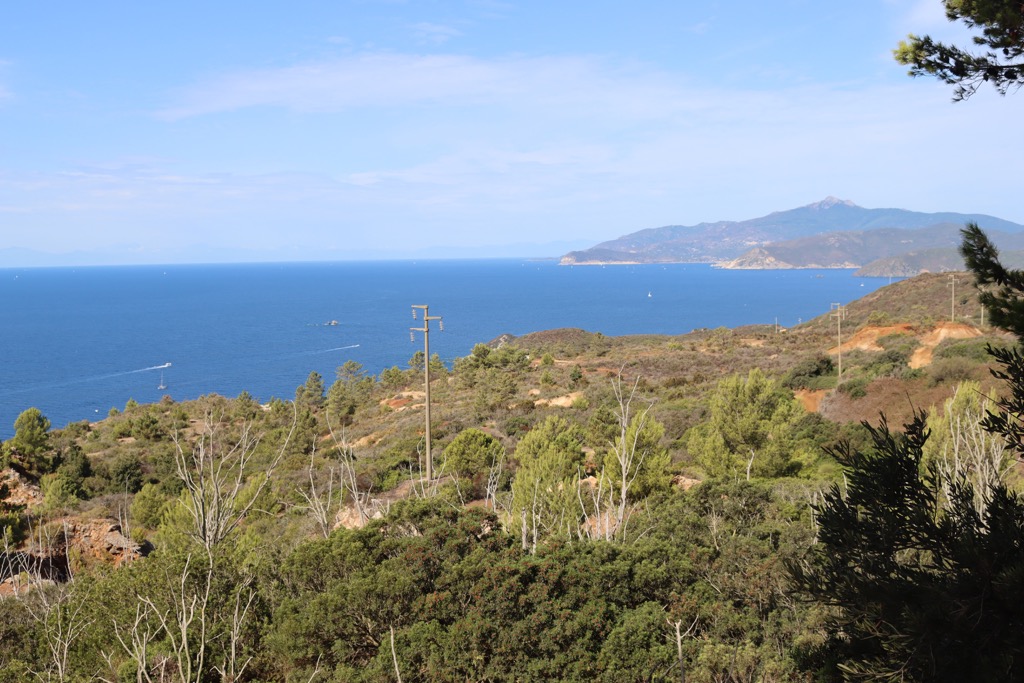
A significant coastline and central highlands characterize Eritrea’s geography. This coastline stretches approximately 1,000 kilometers (610 mi) along the Red Sea, from Cape Kasar in the north to the Strait of Mandeb in the south. The central highlands— the country’s main geographic feature—run north-south through the country, forming part of the Ethiopian Plateau. Average elevations are around 2,000 meters (6,600 ft), reaching 3,000 meters (9,900 ft) on Emba Soira, the country’s highest peak.
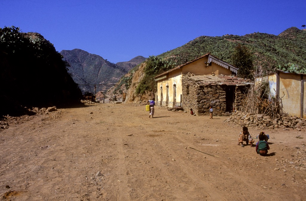
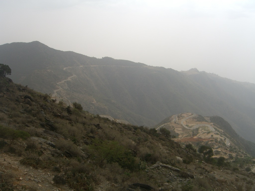
These highlands are dissected by deep gorges and river channels, creating unique geological formations known as ambas. Historically, the highlands have been a center of sedentary agriculture, supporting a significant portion of the Eritrean population. The rugged terrain has also been a natural barrier, influencing historical trade routes and military strategies.
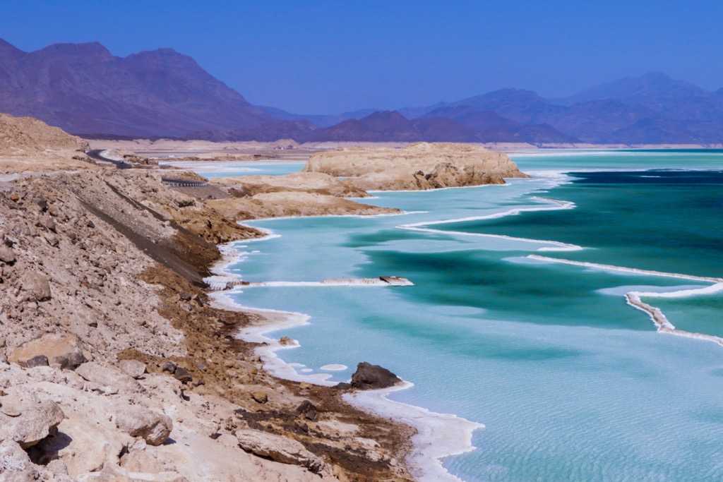
To the east, the plateau descends sharply into a coastal plain, part of the East African Rift System. This includes the Danakil Plain, a barren region with a depression known as the Kobar Sink that descends more than 90 meters (295 ft) below sea level. The western flank of the highlands slopes gradually toward Sudan, featuring a savanna landscape with scattered trees and grasses.
In the far southeast, the triple border between Eritrea, Ethiopia, and Djibouti is marked by another high summit, the stratovolcano Mousa Ali (2,021 m / 6,631 ft), which is the highest point in Djibouti, and the second most prominent peak in Eritrea.
Eritrea is drained by four major rivers: the Gash, Tekezē, Baraka, and Anseba. The Gash and Tekezē rivers flow westward into Sudan. The Tekezē River, also known as the Satit, is a significant tributary of the Atbara River, which eventually joins the Nile. The Gash River reaches the Atbara only during the flood season. The Tekezē forms part of Eritrea's border with Ethiopia, while the upper course of the Gash, known as the Mereb River, forms the border on the plateau. The Baraka and Anseba rivers flow northward into a marshy area on the eastern reaches of the Red Sea.
Eritrea also lays claim to a few islands off its coastline, most notably the Dahlak Archipelago, a group of more than 100 small coral and reef-fringed islands around 58 kilometers (36 mi) east of the port city Massawa.
Eritrea’s climate varies significantly due to its diverse geography and elevation differences. The coastal region, including cities like Massawa, experiences some of the highest average temperatures globally, around 30 °C (mid-80s °F). In contrast, Asmara, the nation’s capital, is situated on a plateau approximately 2,300 meters (7,500 ft) above sea level and has much cooler average temperatures, around 17 °C (low 60s °F).
Rainfall patterns also differ across the country. The plateau receives about 400 to 500 millimeters (16 to 20 in) of annual rainfall, primarily during the summer from a southwesterly airstream. The western plains receive less than 400 mm annually. In contrast, the northeastern plateau and coastal areas get minimal rain from a northeasterly airstream in winter and spring, while the Danakil Plain is nearly rainless.
Eritrea’s highlands are the northernmost aspect of the Ethiopian Plateau, a sprawling geological feature that covers most of Ethiopia and central Eritrea. The formation of the Ethiopian Plateau was primarily due to the thermal expansion of the lithosphere, a process that occurs when the lithosphere is rapidly heated by an upwelling of hot material from the asthenosphere. This causes the surface to uplift and form a plateau.
In Eritrea, these highlands comprise a foundation of crystalline rocks such as granite, gneiss, and mica schist, which are overlain by sedimentary rocks like limestone and sandstone. The top layer is capped by basalt, indicating past volcanic activity. The highlands narrow in the north and transition into a system of hills where erosion has exposed the basement rock.
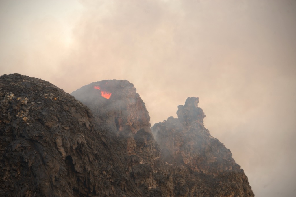
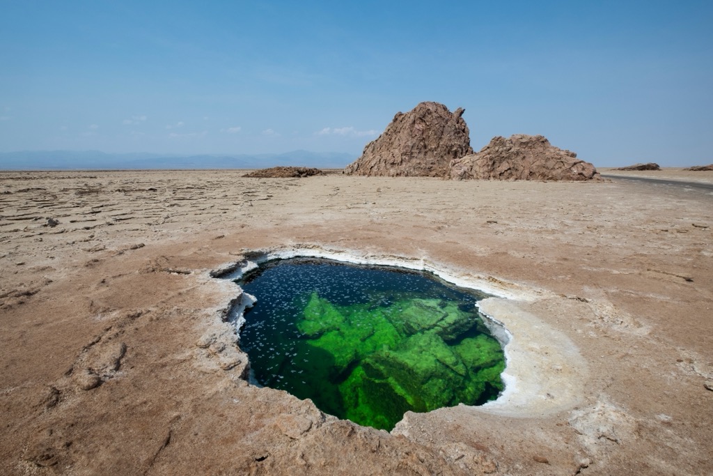
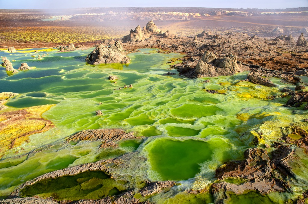
In eastern Eritrea, the plateau descends sharply into the coastal plain, part of the East African Rift System. This region is home to what is perhaps Eritrea’s most famous geologic feature, the Afar Triangle (or Danakil Depression), a depression along a diverging triple-tectonic plate junction between the Nubian, Somali, and Arabian plates, which are moving apart at a rate of 1-2 centimeters (0.4-0.8 in) per year.
The Afar Triangle is one of Earth's hottest and most geologically active regions. It is also where the earliest specimens of hominins have been found, and many paleontologists believe it to be the cradle of human evolution. The Triangle also contains the lowest point in Africa, Djibouti’s Lake Assal, which lies 155 meters (509 ft) below sea level.
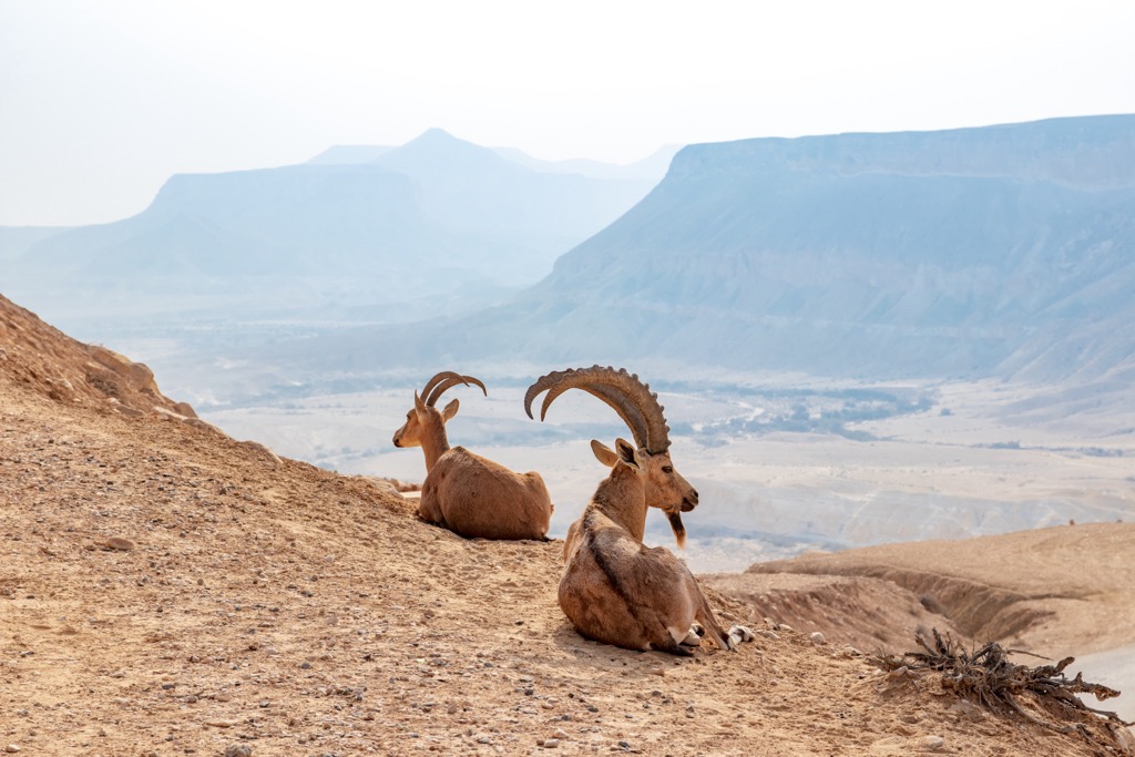
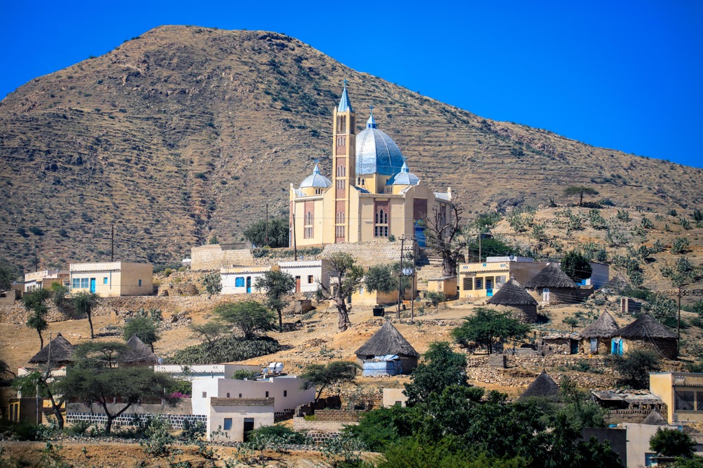
Though Eritrea is quite arid, the country still has a diversity of flora and fauna. The Eritrean highlands are characterized by juniper forests, dominated by the majestic African Juniper (Juniperus procera). These forests are interspersed with olive trees (Olea europaea), acacia trees (Acacia spp.), and a variety of shrubs and herbs.
The western lowlands, meanwhile, are characterized by savanna grasslands, with acacia trees, baobabs (Adansonia digitata), and doum palms (Hyphaene thebaica) being prominent. Along the coastal plains, mangrove forests and salt-tolerant vegetation dominate. These ecosystems are vital for coastal protection and provide habitats for numerous marine species. Meanwhile, the eastern and far southeastern regions near Afar support drought-resistant plants like succulents and thorny shrubs.
Eritrea is home to several iconic African mammals, including the African bush elephant (Loxodonta africana), African wild ass (Equus africanus), and the endangered African leopard (Panthera pardus pardus). Gazelles, such as the Dorcas gazelle (Gazella dorcas), Soemmering's gazelle (Nanger soemmerringii), and Eritrean gazelle (Eudorcas tilonura), are also found in the grasslands.
Eritrea is also a birdwatcher's paradise, with over 566 recorded bird species. The country lies on a major migratory route; notable species include the African fish eagle (Haliaeetus vocifer) and the striking secretary bird (Sagittarius serpentarius), as well as the common ostrich (Struthio camelus).
The country's arid regions are also home to various reptiles, including snakes, lizards, and the Nile crocodile (Crocodylus niloticus), found in the Gash-Barka region. The Red Sea coast, meanwhile, boasts vibrant coral reefs supporting species of fish, turtles, dolphins, and dugongs.
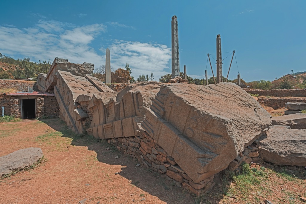
Evidence suggests a human presence in Eritrea dating back to ancient prehistoric times. As mentioned above, Eritrea’s Afar Triangle is one of the birthplaces of humanity. The first key player in Eritrea’s modern history is the Aksumite Empire, which emerged at the turn of the millennium, laying claim to a territory that includes most of present-day Eritrea and northern Ethiopia.
Adulis, a port near modern-day Zula, flourished as a major trading hub connecting the Aksumite Empire to the Roman Empire, India, and beyond. The Aksumites introduced Christianity in the 4th century, leaving a lasting religious legacy that continues today.
Following the decline of the Aksumite Empire approaching 900 AD, various kingdoms rose to prominence in Eritrea, including the Beja and the Medri Bahri. In the 16th century, the Ottoman Empire extended its influence over the coastal areas, establishing Massawa as a key port. This period saw the intertwining of Islamic and Christian traditions in Eritrean society.
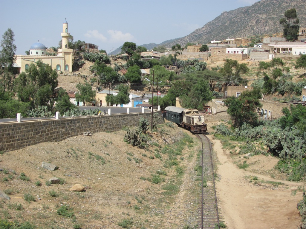
In the late 19th century, Italy colonized Eritrea, establishing its first colony in Africa. Asmara, strategically located in the highlands, was developed as the capital, and Massawa was expanded as a modern port. Italian colonization brought significant infrastructure development, including railways and roads, but also imposed a system of political and economic control.
After World War II, Eritrea was federated with Ethiopia under a UN resolution. However, Ethiopia annexed Eritrea in 1962, triggering a thirty-year war for independence. The Eritrean People's Liberation Front (EPLF) led a determined struggle against Ethiopian rule, culminating in Eritrea's independence in 1991 and admission to the United Nations two years later.
In the years since, the country has faced significant challenges, including a border war with Ethiopia (1998-2000), political repression, and economic hardship. The government, led by President Isaias Afwerki since independence, has been criticized for its authoritarian practices and human rights record. Afwerki has been in power for over thirty years and is chairman of Eritrea's sole legal political party, the People's Front for Democracy and Justice. In the 2024 Press Freedom Index, Reporters Without Borders ranked Eritrea last out of 180 countries.
For trekkers, the 12-kilometer (7.5 mi) trail to the summit of Emba Soira (3,018 m / 9,902 ft) in the Erta Ale Range is an excellent goal. Starting near the town of Senafe, the journey begins on a paved road before transitioning to a difficult dirt track. The rugged path winds through the landscape, offering stunning views of the surrounding valleys and hills. In total, parties can usually make the climb in three hours. The trek entails around 1,200 meters (4,000 ft) of vertical gain. Keep an eye out for the pale yellow-white Rosa abyssinica, the only rose native to Africa, as well as rock art and cave dwellings along the route.
The archipelago of Dahlak is likely the most famous national park in the country. This stunning collection of over 200 islands and islets in the heart of the Red Sea is a haven for biodiversity, boasting coral reefs, diverse marine life, and important seabird nesting sites. The islands are primarily barren, so hiking is limited, but Dahlak is a scuba diving and snorkeling destination. Occasionally, divers will be joined in the water by dolphin pods.
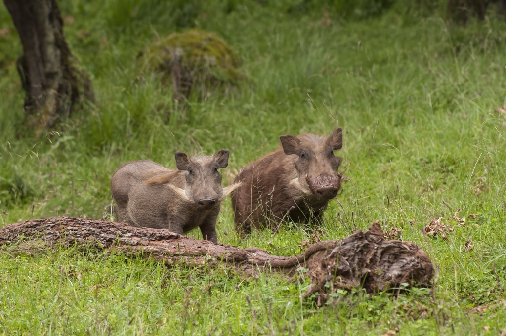
Around 140 kilometers (90 mi) east of Asmara by Massawa, the mountainous Semenawi Bahri National Park is little-visited by foreign tourists but contains some of the most beautiful highlands of Eritrea. The park is home to exotic birds like the colorful blue-breasted bee-eater (Merops variegatus), many antelope species, such as klipspringer and duiker, warthogs, and even a small population of leopards. A single, winding paved road snakes through the park as a jumping-off point to various bush adventures.
Located along Eritrea's western border with Sudan, along the banks of the River Gash, Gash-Setit is a relatively small park. Still, it contains a wealth of wildlife, including the African elephant, gazelle, and kudu. The elephant populations here are among the northernmost in all of Africa. Be sure to visit from June to September, during the rainy season when the river is flowing, for the best chance at wildlife sightings.
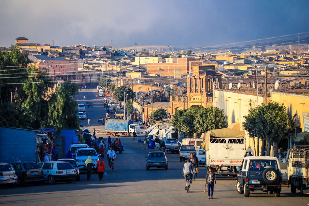
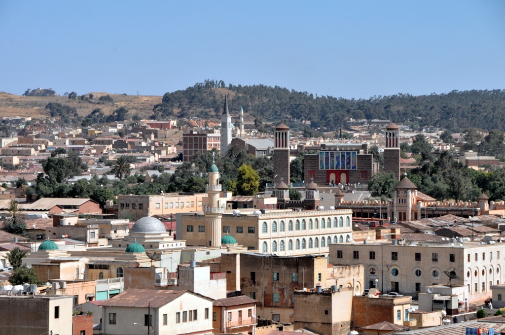
Asmara (pop. 963,000) is the capital and largest city of Eritrea. Located in the central highlands, its elevation gives it a pleasant climate year-round. The city is known for its well-preserved Italian colonial architecture, a legacy of its time as the capital of the Italian colonial state. Asmara is sometimes called “Piccola Roma” (Little Rome) because of this. The city is also a UNESCO World Heritage Site, recognized as “an exceptionally well-preserved example of a colonial planned city,” and its unique blend of Modernist and Art Deco architecture.
Eritrean cuisine, similar to Ethiopian food, is a highlight for visitors. Dishes like injera, zigni, and shiro are staples, often served with the spicy berbere seasoning. The influence of Italian cuisine is also evident, with dishes like pasta and frittata commonly found on menus. Coffee plays a central role in social life, prepared through a traditional process emphasizing patience and skill.
Wander the streets and admire the architecture, or relax in one of Asmara's many cafes, enjoying a cup of Eritrean coffee and soaking up the atmosphere. Be sure to take a stroll down Harnet Avenue, the main street, and admire the Fiat Tagliero Building, the Cinema Impero, and the Asmara Opera House. Don’t miss the National Museum of Eritrea to learn about the country's history and culture, and take an afternoon to explore the traditional Medeber market, where scrap material is repurposed into a staggering array of goods.
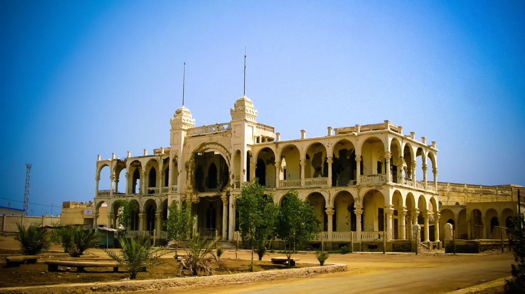
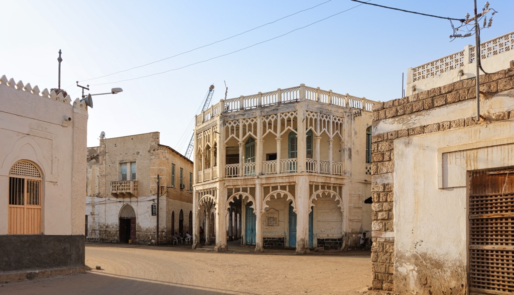
Though not as large as Asmara, the port city of Massawa (pop. 50,000) on the Red Sea is perhaps Eritrea’s most important hub, a font for Eritrean exports like nuts, hides, coffee, oilseeds, salt, fish, and pearls. The city is divided into three distinct parts: the old town—a fascinating blend of Ottoman and Egyptian architecture—the mainland, and the islands.
Massawa has a tropical climate and is known for its beautiful beaches and coral reefs. Massawa's climate is one of the hottest globally, with an average annual temperature over 30°C (86°F). The city is also a hub for outdoor activities, including fishing, diving, and snorkeling, as it’s the jumping-off point for the Dahlak Islands.
Don’t forget to stop at the Sahaba Shrine, an important pilgrimage site for Muslims. Dating to the early 7th century, some believe this is the oldest mosque in all of Africa. Also, check out the Imperial Palace, which dates to 1872. Once the winter residence of Emperor Haile Selassie, the palace is now a museum.
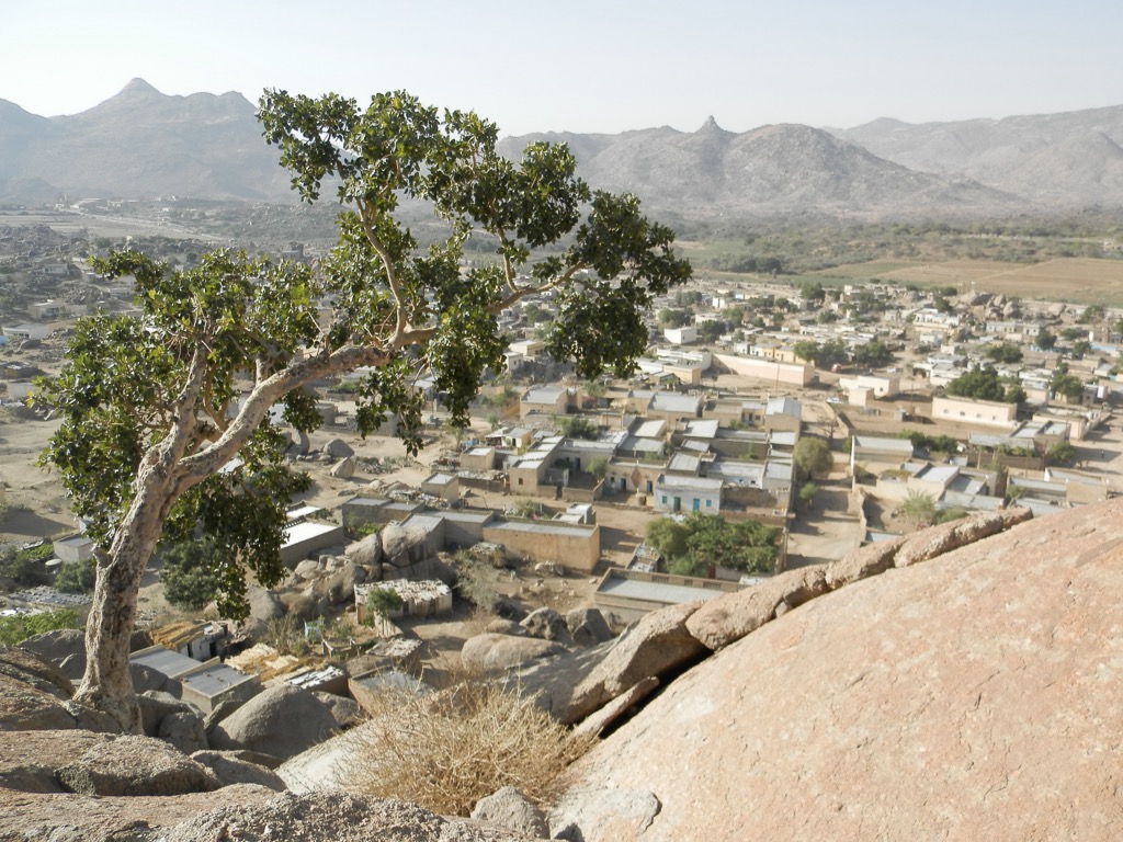
Keren (pop. 150,000) is the second-largest city in Eritrea and is nestled in a valley surrounded by granite hills. It’s known for its cultural and religious diversity and is home to the Tigrinya, Tigre, Bilen, and Nara ethnic groups. The vibrant Mariam Dearit Festival, held in Keren every May, exhibits the traditions and customs of the Eritrean Orthodox Church, including a procession of the Virgin Mary's statue around a massive baobab tree that is over 500 years old.
One of Keren's most prominent landmarks is the imposing Tigu Fort, an Egyptian fortress dating back to the 19th century. Another architectural gem is St. Michael's Catholic Church, which has a distinctive Romanesque design. The Keren War Cemetery, a poignant reminder of World War II, is the resting place for Commonwealth and Italian soldiers who lost their lives in the Battle of Keren.
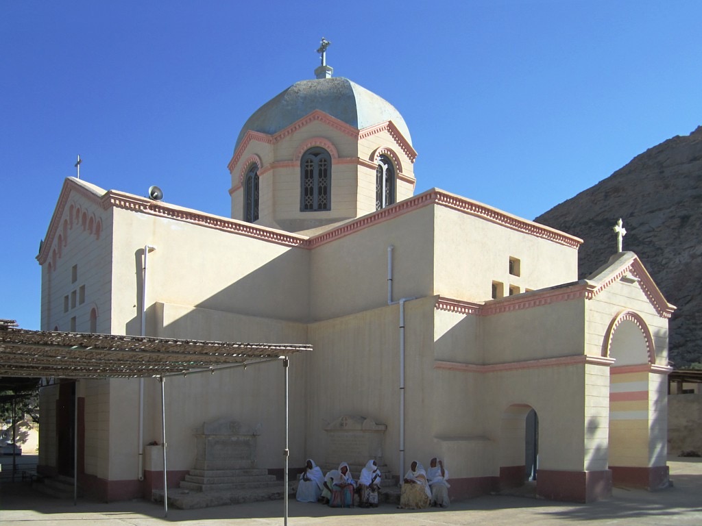
Nefasit (pop. 25,000) is about 30 kilometers (19 miles) southwest of Asmara. It is known for its cool climate and agricultural production, particularly fruits and vegetables. Like Dekemhare, it is a popular destination for those looking to escape Asmara's heat and enjoy the Eritrean highlands' fresh air and scenic beauty. Be sure to visit the 650-year-old mountaintop Debre Bizen Orthodox monastery, which offers stunning views, and explore the surrounding hiking trails.


Yes. Eritrea has 1,769 named mountains. The highest is Emba Soira at 3,018 m.
The highest mountain in Eritrea is Emba Soira, at 3,018 m.
Eritrea has 1,769 named mountains.


.jpg)