Get PeakVisor App
Sign In
Search by GPS coordinates
- Latitude
- ° ' ''
- Longitude
- ° ' ''
- Units of Length

Yes
Cancel
❤ Wishlist ×
Choose
Delete
The Garden Route District Municipality, formerly the Eden District Municipality, is in South Africa’s Western Cape province. There are 568 named mountains in Garden Route District Municipality. The highest and the most prominent mountain is Seweweekspoortpiek, measuring 2,325 meters (7,628 ft).
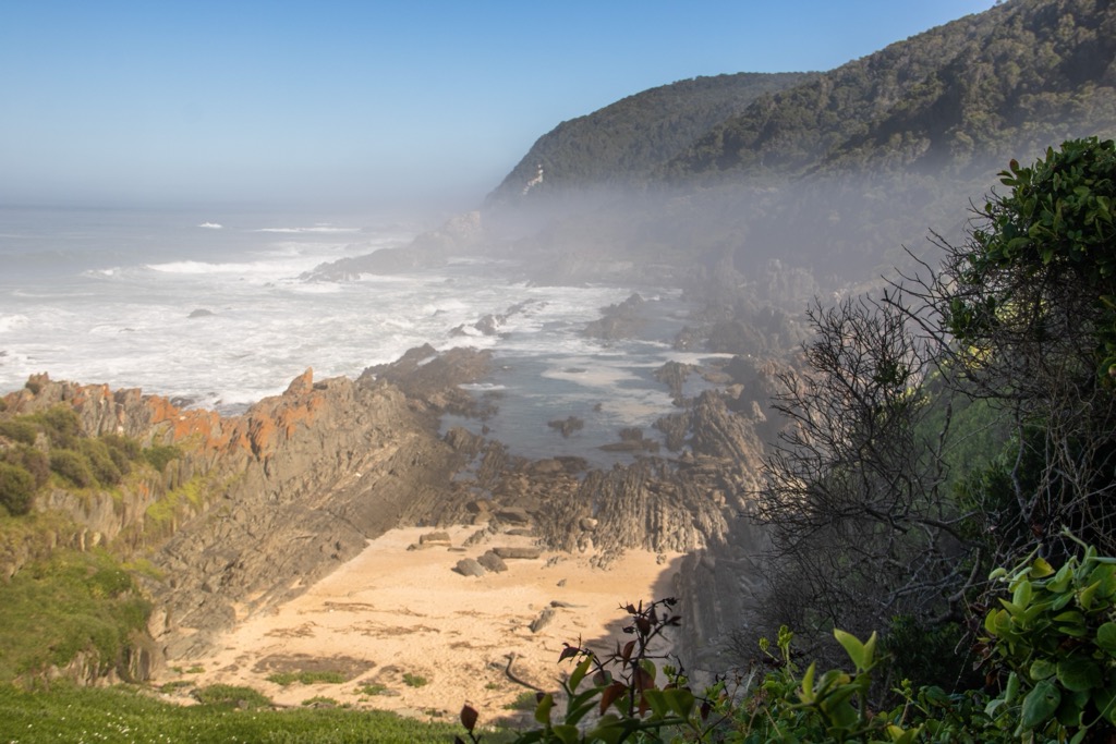
The Garden Route District Municipality spans 2,333,100 ha (5,765,215 ac) along South Africa’s southern coast and stretches from the Indian Ocean into the inland Little Karoo. This region’s geography includes coastal areas, mountains, forests, and semi-arid plains.
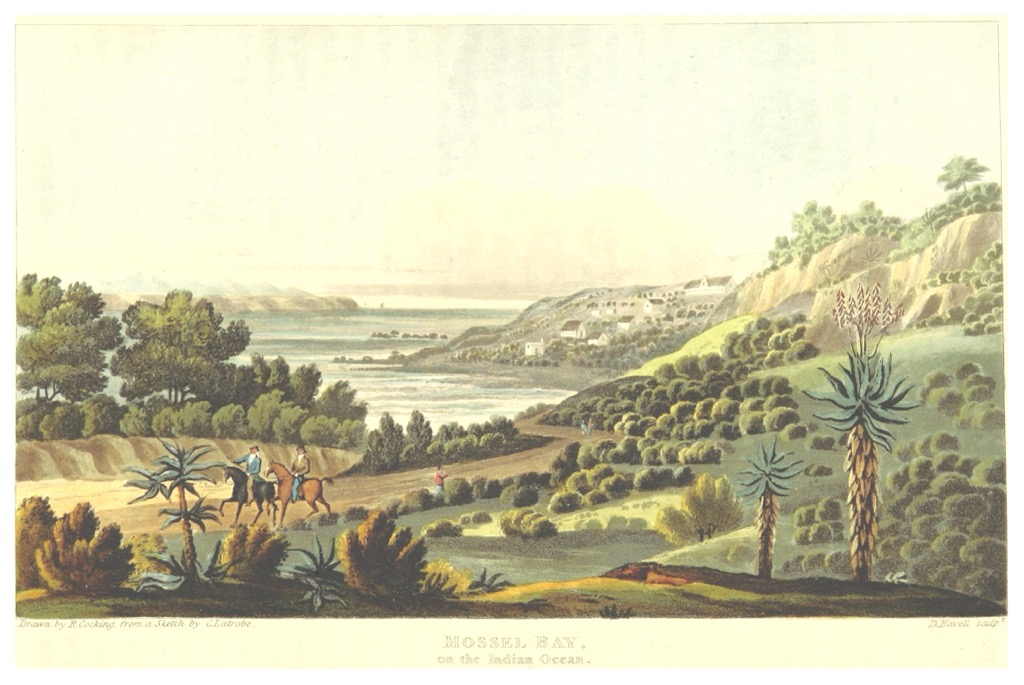
The coastline along the Indian Ocean features beaches, cliffs, and bays, with prominent beach towns like Mossel Bay, Knysna, and Plettenberg Bay. Meanwhile, the Outeniqua and Tsitsikamma Mountains divide the coast from the semi-arid Little Karoo.
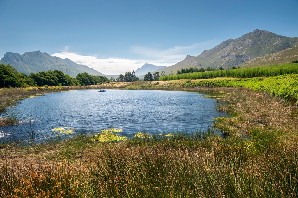
The district also includes substantial Afromontane forests, particularly around Knysna and Tsitsikamma, which contain ancient yellowwood trees and other endemic species. Much of this forested area is protected within the Garden Route National Park.
Inland, the Little Karoo presents a semi-arid landscape with open plains and rugged hills. Towns like Oudtshoorn have a dry climate suited to hardy vegetation and are known for ostrich farming and unique arid-region tourism.
The climate varies across the district, with coastal areas experiencing a mild Mediterranean climate and the inland Little Karoo having semi-arid conditions with more extreme temperatures. These diverse climates have resulted in unique ecosystems and contribute to the district’s agriculture and tourism.
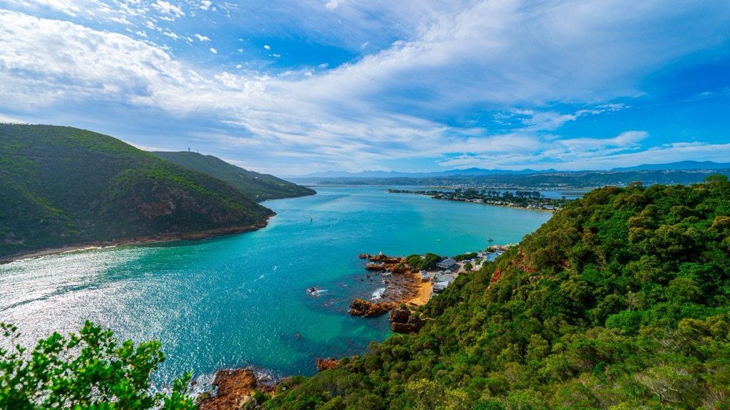
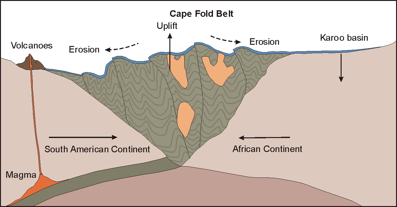
The Garden Route District Municipality is located within the Cape Fold Belt, formed by tectonic processes over the past 250 million years, resulting in the folding and uplift of mountain ranges like the Outeniqua and Langeberg Mountains.
The region features a variety of rock types, predominantly metamorphic rocks such as schists and gneisses, formed from sedimentary rocks under high heat and pressure. Sedimentary rocks, including sandstone, shale, and limestone from ancient marine environments, are also present, particularly in the Cape Supergroup. Minor igneous rocks, such as basalt, relate to historical volcanic activity.
The Garden Route District Municipality is a biodiversity hotspot. The Garden Route’s status is primarily due to its location within the Cape Floral Kingdom, recognized as one of the most biodiverse plant regions globally. The district's vegetation features a broad range of endemic plants, particularly within the fynbos biome, characterized by unique species such as proteas, ericas, and restios.
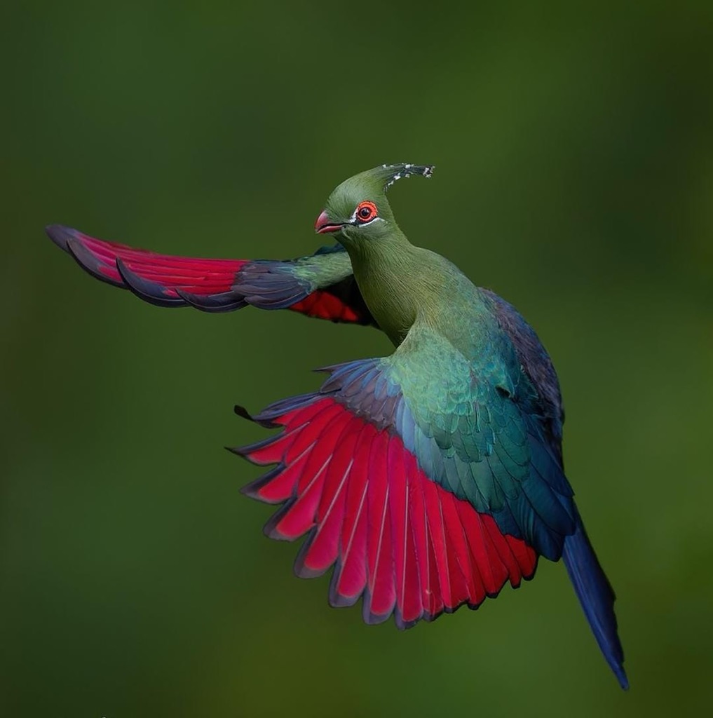
The district’s wildlife includes various mammals, such as antelope species, and historically, it was one of the last known habitats for Knysna elephants. A lone female survives as of 2019 and is expected to live until 2039, or around her 65th birthday. Otherwise, bird species like the endangered Knysna turaco and several raptors contribute to the district’s rich biodiversity.
The Khoikhoi and San people were the first inhabitants of the Garden Route District Municipality, as shown by archaeological sites, including rock art and ancient tools.
The arrival of European settlers in the 17th century marked a significant change. The Dutch East India Company established a refreshment station at the Cape of Good Hope, increasing interaction and conflict with indigenous populations. Under British colonial rule in the 19th century, towns and infrastructure developed, laying the foundation for modern growth. This period introduced new agricultural practices and expanded trade routes.
The 19th century saw significant economic development in the Garden Route District Municipality, driven by the discovery of gold and diamonds in northern South Africa. However, this economic prosperity wasn't uniform, especially during the apartheid. During this era, from 1948 to 1994, the county imposed systemic racial segregation, resulting in social and economic disparities and forced relocations.
The district was officially named Eden District Municipality in 2000. In 2018, it was renamed the Garden Route District Municipality to better represent its geographical and cultural identity.
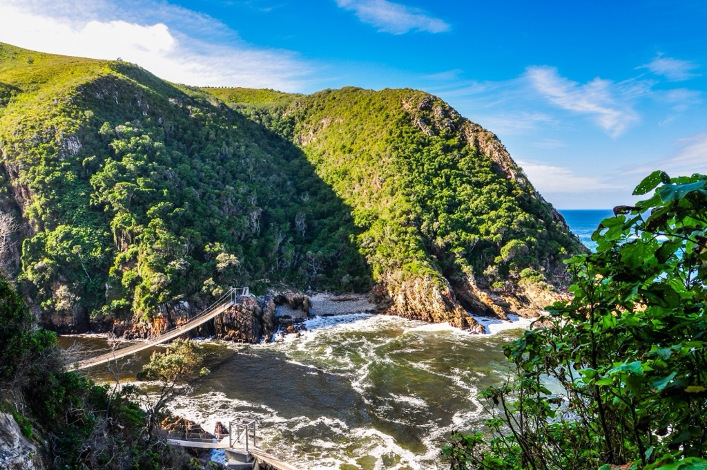
Tsitsikamma National Park offers a range of hiking trails along the Garden Route. The Otter Trail covers 43 km (27 mi) over five days and features rugged beaches, indigenous forests, and wildlife sightings of the Cape clawless otter. The Tsitsikamma Trail is a longer option at 62 km (38.5 mi) over six days, passing through forests, mountain streams, and gorges.
The Dolphin Trail covers 17 km (10.5 mi) over two days with guided hikes and showcases ocean views and potential dolphin sightings. For shorter hikes, the Waterfall Trail is a 6 km (4 mi) day hike leading to a waterfall, while the Loerie Trail is a 1 km (0.6 mi) path through coastal forest. The 2 km (1.2 mi) Storms River Mouth Trail starts at Sandy Bay and leads to a suspension bridge over the Storms River Mouth, offering views and insight into the area’s Khoisan heritage.
The Outeniqua Hiking Trail is a multi-day trek that spans 108 km (67 mi) through the Outeniqua Mountains. Over the course of seven days, hikers traverse Afromontane forests, fynbos, and rugged, steep sections of trail. Hikers are treated to views of the surrounding peaks of Jonkersberg, Platboshoogte, and Keurkop.
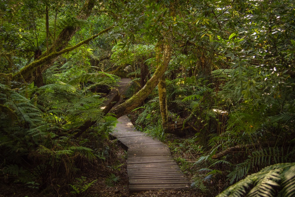
Knysna Forest features a range of hiking trails through lush Afromontane woodlands. The Sparrebosch Fisherman’s Walk is a challenging 4 km (2.5 mi) trail with beach views, while the Red Elephant Trail provides a moderate 6 km (4 mi) journey through an indigenous rainforest featuring a 600-year-old yellowwood tree.
Additionally, the Diepwalle Elephant Trails, starting at the Diepwalle Forestry Station, offer routes of varying difficulty. These include the easy 9 km (5.5 mi) Black Route, the moderate 8 km (5 mi) White Route, and the moderate to strenuous 7 km (4 mi) Red Route. These trails showcase the natural beauty of the Knysna Forest, from dense forests and ancient trees to waterfalls and coastal views.
Robberg Nature Reserve, located near Plettenberg Bay, offers some of the most scenic hiking trails along the Garden Route. The reserve features dramatic cliffs, ocean views, and diverse wildlife, from the rare blue duiker to dolphin and whale sightings. The reserve has three main trails.
The Gap Circuit is a 2 km (1.2 mi) easy trail with lookout points of the ocean and Plettenberg Bay. One of the highlights includes passing a historical mudstone cleft, a remnant from the breakup of the supercontinent Gondwanaland. The Witsand Circuit is a moderately challenging 5.5 km (3 mi) hike that passes a Cape fur seal colony and the Witsand sand dune. The Point Circuit is the most challenging trail at 9 km (5.5 mi), but it rewards hikers with panoramic views and the chance to spot whales.

Plettenberg Bay is a coastal town in the easternmost region of the Western Cape. It is located along South Africa’s Garden Route and is known for its long stretch of coastline, outdoor activities, and wildlife.
One of the highlights of Plettenberg Bay is its beaches. Plettenberg Bay Beach and Robberg Beach are popular for surfing, swimming, and watersports. Robberg Nature Reserve is another top attraction in the area, offering various coastal hiking trails. Hikers can spot seals, dolphins, and diverse bird species along the trails.
Plettenberg Bay is also excellent for whale and dolphin watching. Visitors can watch Southern Right Whales migrating along the coast from June to November. Dolphin tours are available year-round, offering chances to see these marine mammals up close.
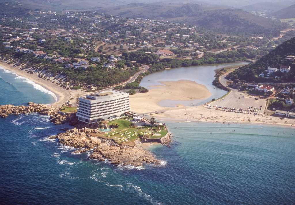
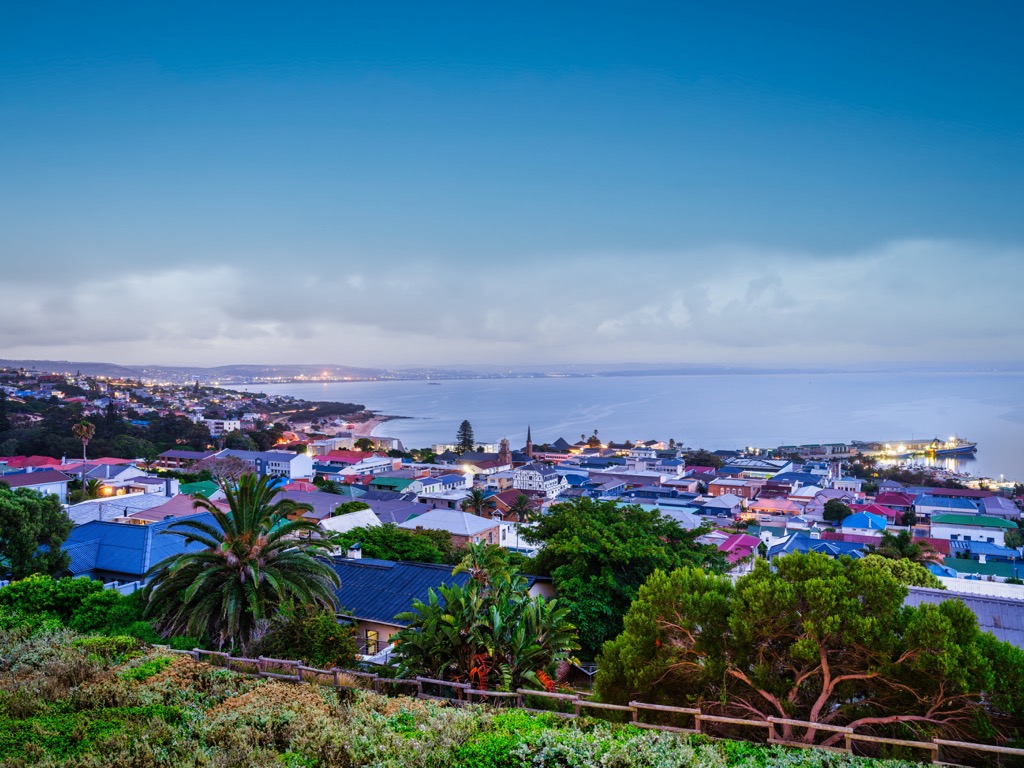
Mossel Bay is a town in the Western Cape and is the westernmost district of the Garden Route District Municipality. The town is located between the Outeniqua Mountains and the Indian Ocean and is known for its beaches and whale-watching opportunities.
Seal Island lies a short boat trip from Mossel Bay harbor. Visitors come here to observe a large colony of Cape fur seals. The boat tours often include opportunities for dolphin watching and enjoying the scenic coastline. Meanwhile, the Cape St. Blaize Lighthouse is a historic lighthouse built in 1864 on a sea cliff. Visitors can climb to the top for views of the ocean and coastline.
Finally, the Bartolomeu Dias Museum Complex features a life-size replica of Dias’s ship and the famous Post Office Tree, which has been used as a mail collection point since the 1500s.
Explore Eden District Municipality with the PeakVisor 3D Map and identify its summits.


