
Scan the QR code and open PeakVisor on your phone
Dumfries and Galloway is one of the finest areas of the Scottish Southern Uplands, featuring rolling hills, secluded glens, glistening lochs (lakes), and a wild coastline. There are 2617 named summits in Dumfries and Galloway. Merrick (843 m / 2,766 ft) is the highest and most prominent summit.
One of 32 council areas of Scotland, Dumfries and Galloway covers an area of roughly 2,481 sq mi (6,426 sq km). It's in Scotland's southwestern corner, bordering England to the south, East Ayrshire, South Ayrshire, South Lanarkshire to the north, and the Scottish Borders to the northeast. Dumfries and Galloway has a population of around 148,000 people.
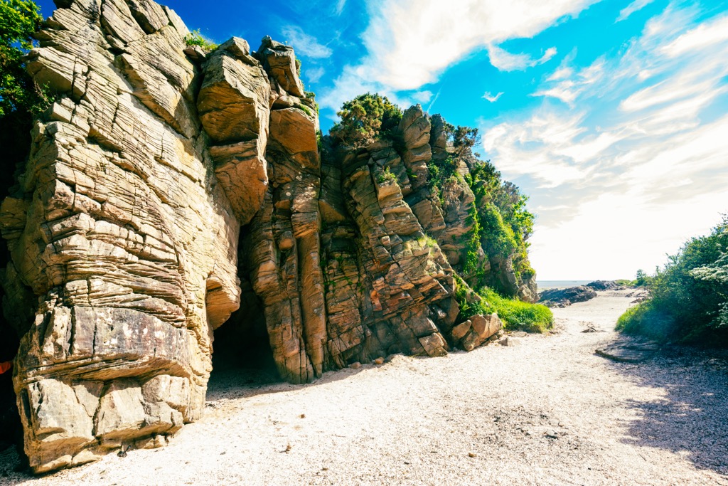
Dumfries and Galloway is coastal, bound by the Irish Sea and the North Channel. To the south is Solway Firth, the UK's third largest estuary, which separates the area from Dumfries and Galloway from Cumbria. Dumfries and Galloway's meandering coastline is over 200 miles long and features several rugged bays, with Loch Ryan at its western end banded by the Rhins of Galloway peninsula.
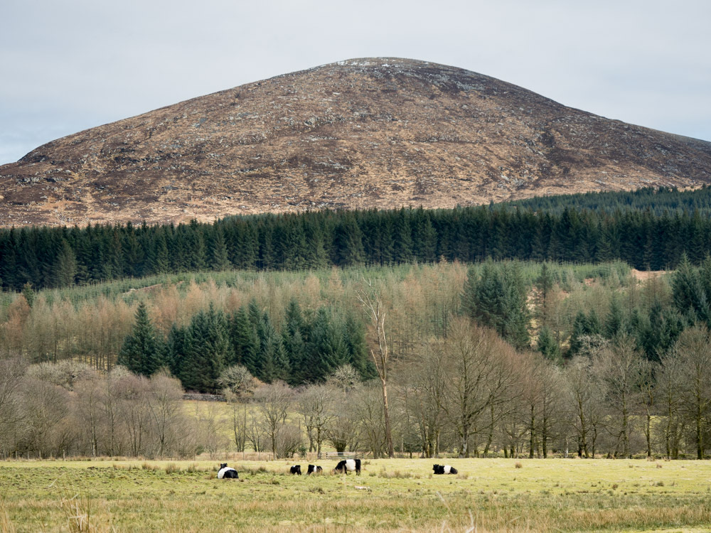
Dumfries and Galloway is mostly rural — over 70% of the area is agricultural, and another 25% is forested. It's home to the first Dark Sky Park in the UK, Galloway Forest Park, covering approximately 300 sq mi (777 sq km) in northwestern Dumfries and Galloway.
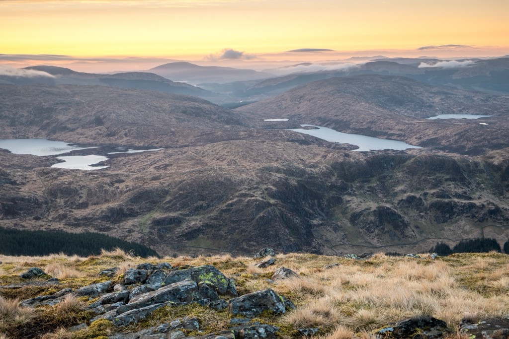
Despite lacking any Munros (mountains over 3,000 ft), Dumfries and Galloway is home to ten Grahams (2,000 - 2,500 ft) and five Corbetts (2,500 - 3,000 ft), spread across numerous hill ranges, including the Galloway Hills, Lowther Hills, and Moffat Hills.
Located within the Galloway Forest Park are the Galloway Hills, the highest hill range in the region. The Galloway Hills have three main ridges: the Awful Hand, the Rhinns of Kells, and the Dungeon Hills. The highest is the Awful Hand, which includes the Merrick, Kirriereoch Hill (787 m / 2,582 ft), and Shalloch on Minnoch (774 m / 2,543 ft). The Merrick is the highest mountain in the Southern Uplands.
The second-highest hill range in Dumfries and Galloway is the Moffat Hills. Located on Dumfries and Galloway's northeastern boundary with the Scottish Borders, the Moffat Hills are an isolated triangular range just north of the town of Moffat.
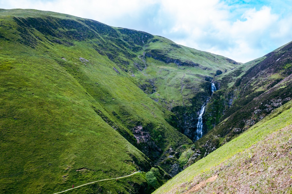
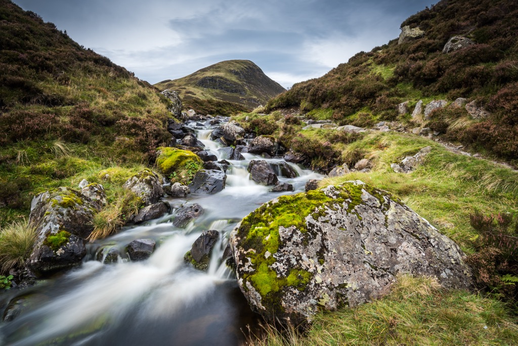
The northern extent of the Moffat Hills falls within the Grey Mare's Tail Nature Reserve, named for the 60-m (200 ft) high Grey Mare's Tail Waterfall, the fifth highest in the UK. The Moffat Hills are home to the second-highest summit in Dumfries and Galloway, White Coomb (821 m / 2,694 ft), and Hart Fell (808 m / 2,654 ft).
The Lowther Hills, also known as the Lowthers, lie west of Moffat and are a large diamond-shaped range, home to Green Lowther (732 m / 2,402 ft) and Lowther Hill (725 m / 2,379 ft). Part of the range is within South Lanarkshire. Between the Lowthers and the Galloway Hills are the Carsphairn and Scaur Hills, a smaller hill range that boasts some of the highest and most prominent summits in Dumfries and Galloway, such as Cairnsmore of Carsphairn (797 m / 2,614 ft).
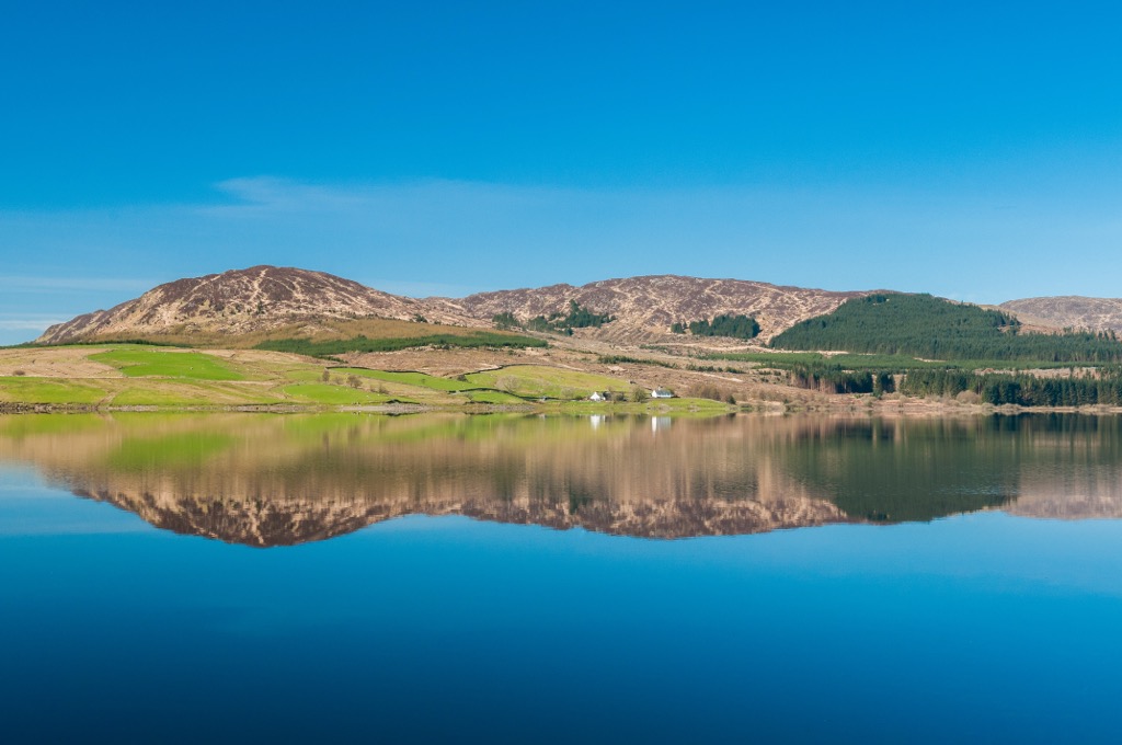
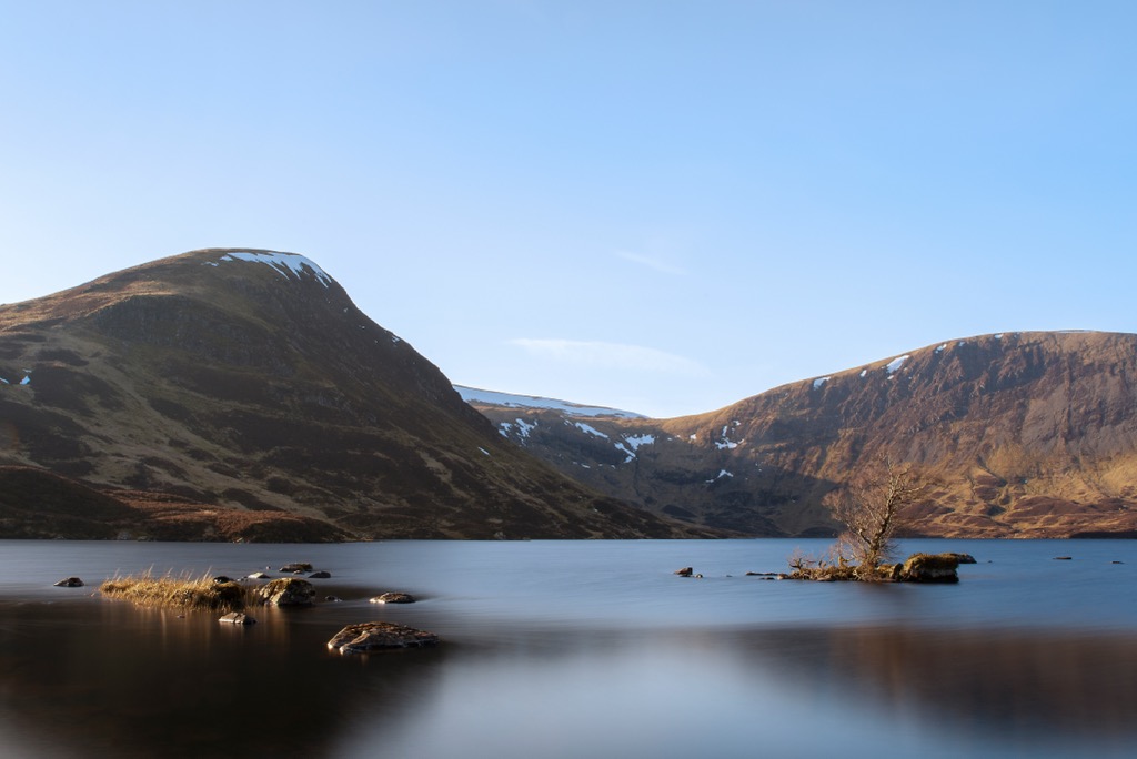
The largest freshwater lake in Dumfries and Galloway is Loch Ken, roughly 9 mi (14 km) long. Notable rivers in the Dumfries and Galloway include the River Dee, River Cree, and Urr Water.
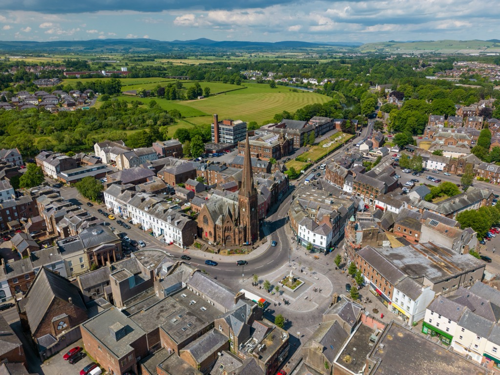
Dumfries is the largest town in Dumfries and Galloway by a significant margin, with a population of over 31,000 people — 20,000 more than the next largest settlement. Other notable towns in Dumfries and Galloway include Stranraer, Annan, and Locharbriggs.
As with the whole of the British and Irish Isles, Dumfries and Galloway has a long and complex geological history. It began forming around 500 million years ago when the closing of the ancient Iapetus Ocean caused continental collisions as part of a mountain-building event called the Caledonian Orogeny.
Most of the rocks that comprise Dumfries and Galloway are sedimentary greywackes and shales dating around 450 million years to the Ordovician-Silurian Period.
However, newer red sandstone is also present, and large granite intrusions make up the likes of Criffel (570 m / 1,870 ft), Cairnsmore of Fleet (711 m / 2,333 ft), and Screel Hill (344 m / 1,129 ft). Its coastline is composed partly of sedimentary sandstones, mudstones, and limestones. There are even bands of coal, known as coal measures, in Dumfries and Galloway around Sanquhar and Canonbie.
Dumfries and Galloway's Ordovician-Silurian sedimentary rocks are harder than its younger sandstones, which have been heavily eroded, leaving behind rounded hills and gently sloping dales throughout most of the area. The prominent granite masses of Dumfries and Galloway, like those of the Cairnsmore of Carsphairn, are mostly domed, but the exposed white granite on their flanks means they're craggy and have defined rims.
Isolated and sparsely populated, Dumfries and Galloway is an outstanding area in which to appreciate Scotland's varied flora and fauna.
Around 45 mammal species roam Dumfries and Galloway, the largest of which is red deer, which can weigh over 200 kg (440 lbs). Some common mammal species include rabbits, badgers, and wood mice.
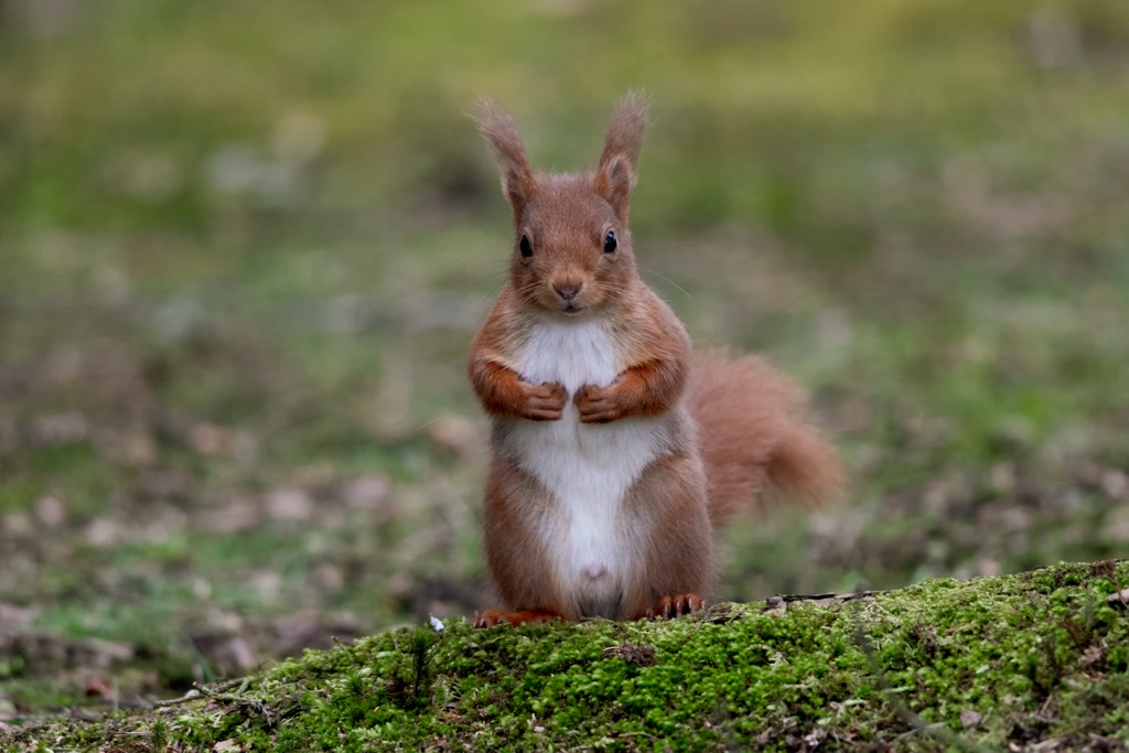
Feral goats are one unique common mammal found throughout Dumfries and Galloway, with large herds in the Galloway Hills. Around 20% of Scotland's red squirrel population live within Dumfries and Galloway. Several semi-aquatic species also call Dumfries and Galloway home, including American mink, otters, and water voles. There are no wolves or bears in Scotland.
Dumfries and Galloway's forests, lochs, rivers, and coastlines are habitats for an array of bird species. There are numerous common bird species in Dumfries and Galloway — visitors can easily spot over 20 species with little effort, including robins, swallows, house sparrows, blue tits, and starlings.
With its extensive salt and mud flats, the Solway Firth welcomes 40,000 barnacle geese from Svalbard in Norway annually. Other rarer bird species include goshawks, merlins, black grouses, arctic terns, redshanks, and spotted flycatchers.
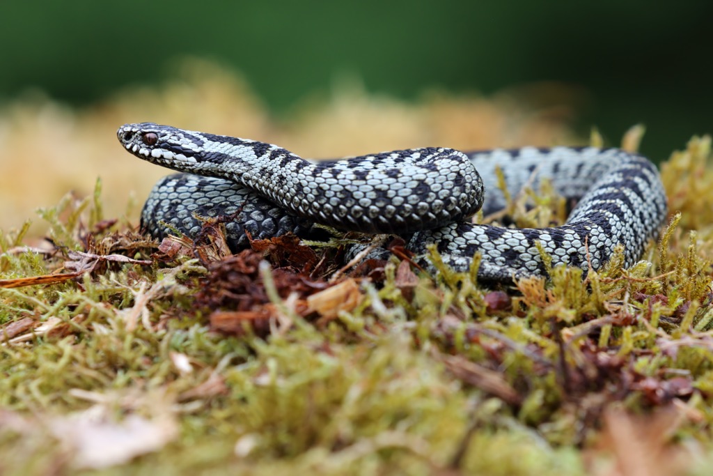
All nine of Scotland's amphibian and reptile species can be found in Dumfries and Galloway, including the UK's only venomous snake, the adder, as well as great crested newts, natterjack toads, and slow worms.
Approximately 32 butterfly species inhabit Dumfries and Galloway, including red admirals, painted ladies, and pearl-bordered fritillaries.
Non-native species reign supreme in Galloway and Dumfries' forests. For example, Sitka spruces are by far the most common trees in Galloway Forest Park, accounting for 72% of the park's forests. By contrast, Scots pine is the most common native species, accounting for just 2.5% of the total forested area.
Native oak woodlands, like the Wood of Cree, are dominated by sessile oaks interspersed with birches and rowans. Other common tree species in Dumfries and Galloway include lodgepole pines, Norway spruces, hybrid larches, and Douglas firs.
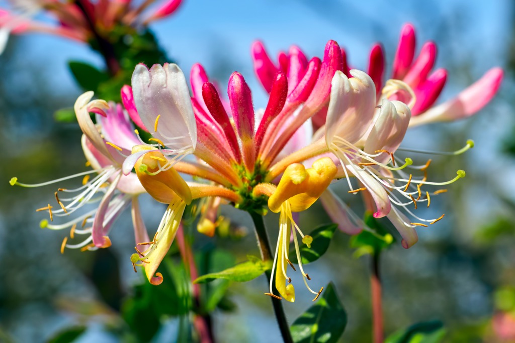
Around 2,500 flowering plant species blossom across Galloway and Dumfries' varied landscape. Vibrant species like bluebells, junipers, snowdrops, and primroses carpet the forest floors, while a unique blend of glasswort, thrift, red fescue, and sea rockets grows in coastal saltmarshes.
Plants that hikers may encounter in montane areas high in the Galloway and Moffat Hills include purple saxifrages, alpine mouse ears, downy willows, and alpine cinquefoil.
Located on the English border and Scotland's western coastline, Dumfries and Galloway has a long and storied history. Since the arrival of the Romans in the 1st century CE, the region has been inhabited by the Picts, Vikings, and Saxons.
Dumfries was established as a royal burgh by the Scottish king, William the Lion, in 1186, after which it quickly grew into one of the largest ports in the region. In the following century, Dumfries and Galloway were on the frontier of the First Scottish War of Independence.
Several famous events from the war happened in and around Dumfries, including William Wallace chasing the fleeing English forces through the Nith Valley in the late 12th century.
In 1306, Robert the Bruce murdered his rival, Red Comyn, at the old Greyfriars Kirk in Dumfries before being crowned King of Scots. Robert the Bruce's subsequent ex-communication and attack on Dumfries Castle helped reignite the campaign for independence, culminating in the Battle of Bannockburn in 1314, a heavy defeat for the English that confirmed Scottish independence.
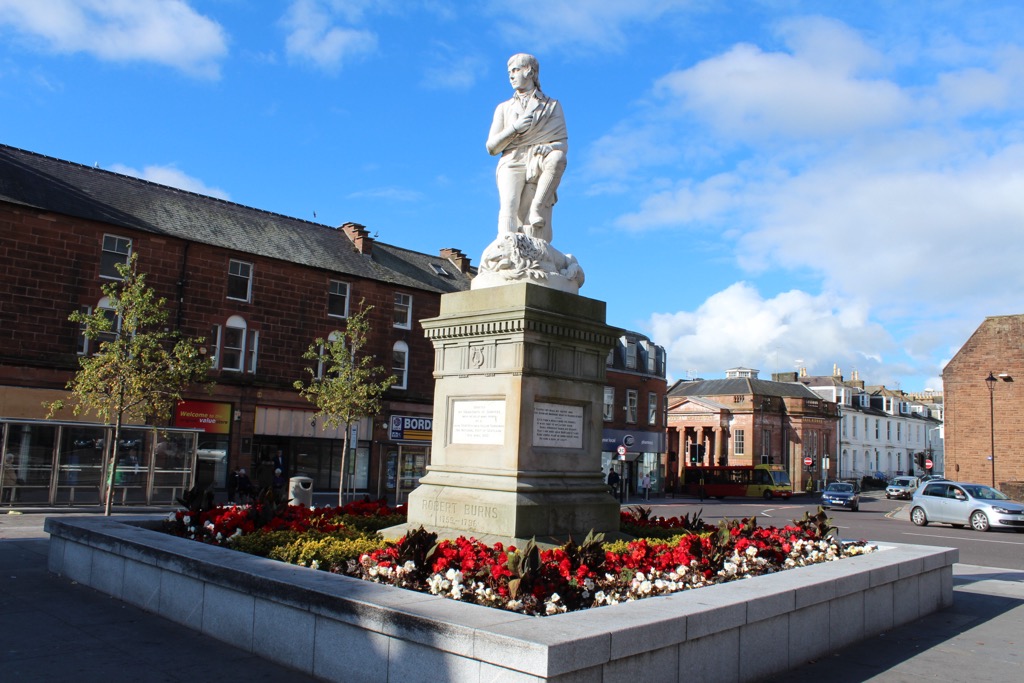
Bonnie Prince Charlie visited Dumfries during the Jacobite rising of 1745 for three days, staying in the now-demolished County Hotel on Dumfries' High Street. He fled after hearing rumors of the Duke of Cumberland's forces approaching from the south. Robert Burns, the national poet of Scotland, spent the final years of his life in Dumfries from 1791 until his passing in 1796. A statue of Robert Burns stands in front of Greyfriars Church on High Street.
The term Dumfries and Galloway has only been in use since the 19th century, with the historic counties of Dumfriesshire, Kirkcudbrightshire, and Wigtownshire becoming a sheriffdom in 1911 and official region in 1975.
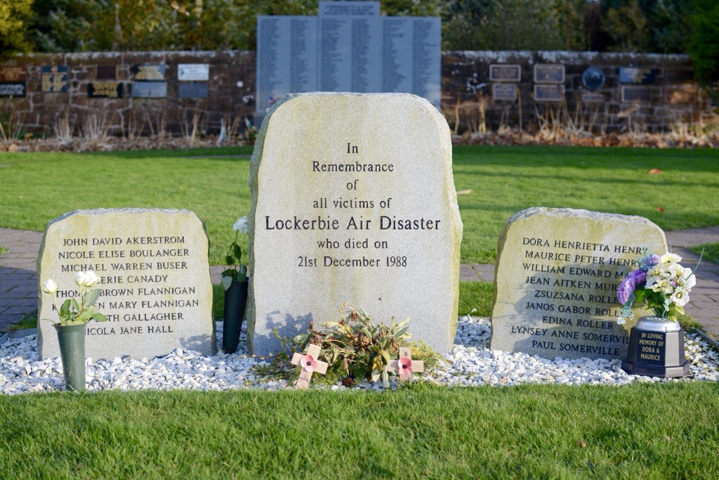
Dumfries and Galloway tragically became international news in December 1988 following the Lockerbie bombing, when a bomb went off on Pan Am Flight 103, crashing into residential streets in Lockerbie and killing everyone on board, as well as 11 Lockerbie residents. With 270 casualties, it is the deadliest terrorist attack in UK history.
Hiking and natural conservation became more popular in Dumfries and Galloway following the Second World War. The Galloway Forest Park was established in 1947, highlighting the region's outdoor recreation opportunities. The development of marked trails and visitor centers improved accessibility for casual hillwalkers. The Galloway Forest Park became the first Dark Sky Park in the UK in 2009.
Dumfries and Galloway is an isolated region of the Southern Uplands, with hikers sometimes underestimating its relatively low hill ranges.
When hiking in Dumfries and Galloway, bring waterproof clothing and footwear due to boggy paths and changeable weather conditions. Map out your route carefully and inform others of your itinerary.
The Merrick (843 m / 2,766 ft), or simply Merrick, is the highest mountain in Dumfries and Galloway and the Southern Uplands.
Part of the Range of the Awful Hand in the Galloway Hills, the Merrick is famous for having the longest line of sight in the British Isles. Its line of sight extends 141 mi (232 km) to Yr Wyddfa (Snowdon) (1,085 m / 3,560 ft) in Wales. However, Lamachan Hill (718 m / 2,356 ft) obscures most of the Merrick's views towards Yr Wyddfa, and sightings of Wales are rare.
The Merrick is popular with hillwalkers, thanks to its marked trails and views stretching to the Isle of Man and Northern Ireland. The shortest ascent of the Merrick is from the Bruce's Stone Car Park on the northern shores of Loch Trool. The trail is boggy and rocky, so waterproof footwear is a must.
From Bruce's Stone, erected to commemorate Robert the Bruce's first victory over the English in 1307, the trail begins by climbing steadily above the course of Buchan Burn before curving east past the Culsharg bothy (270 m / 889 ft) to the summit of Benyellary (719 m / 2,359 ft), which is marked with a cairn.
The Merrick becomes visible along the narrow Neive of the Spit ridge. A trig point marks the Merrick's summit. Descend the way you came. This Merrick hike is approximately an 8 mi (13 km) round-trip.
Criffel (570 m / 1,870 ft) may not be anywhere near the highest summit in Dumfries and Galloway, but it's easily one of its most visited. This standalone hill in Kirkcudbrightshire overlooks Solway Firth and is visible from the northern Lake District on a clear day. Criffel is one of Dumfries and Galloway's finest viewpoints, with views across Solway Firth to Skiddaw (931 m / 3,054 ft) and Blencathra (868 m / 2,848 ft) in the Lake District.
Despite its low elevation, Criffel is unrelentingly steep and isn't to be underestimated. That said, it's a manageable hike for regular hillwalkers. The best starting point for climbing Criffel is the Criffel Car Parking Area near Ardwall.
Start by following the path from the parking area's entrance through a gate into woodlands. The path ascends while following Craigrockall Burn to the forest's edge before turning south and snaking up Criffel's slopes.
A trig point and a large cairn called Douglas's Cairn mark Cirffel's summit. Descend the way you came, taking in views of Loch Kindar as you return to the parking area. This Criffel hike is a 3.6 mi (5.8 km) round-trip.
White Coomb (821 m / 2,694 ft) is the highest summit in the Moffat Hills on the northeastern edge of Dumfries and Galloway. White Coomb affords some of the best panoramas in Dumfriesshire, including the stunning Grey Mare's Tail Waterfall and Loch Skeen.
You can pick up the trail to White Coomb from the well-signposted Grey Mare's Tail car park, which the National Trust of Scotland operates. One of the most popular routes is a looped walk along the eastern edge of Loch Skeen to Lochcraig Head (801 m / 2,628 ft) before circling back on the loch's western side to White Coomb.
The trail is well-defined to start but disappears near Lochcraig Head and becomes muddy and thick with heather. Ensure you wear waterproof footwear when scaling White Coomb.
The trail starts by following the right side of Tail Burn before crossing a bridge and climbing above a gorge where Grey Mare's Tail, one of Scotland's highest and most beautiful waterfalls, is visible.
Passing the head of Loch Skeen, the clear path soon ends, and you'll need to follow the aforementioned boggy tracks to Lochcraig Head. You can use a drystone wall that cuts across the heather as a waymarker to reach Lochcraig Head's eastern crags. If you're looking to bag this peak, a short detour is needed to reach Lochcraig Head's true summit. From Firthy Brigg Head (766 m / 2,513 ft), follow the wall southwest over Donald's Cluech Head (777 m / 2,549 ft) and through Carrifran Wildwood to White Coomb.
White Coomb's summit offers sweeping views of the Scottish Borders and Solway Firth. Descend steeply on the northern side of Upper Tarnberry (549 m / 1,801 ft) and back to Tail Burn. It's possible to ford the burn in good weather using stepping stones and rejoin the good path back to your starting point. This White Coomb looped trail is approximately 7.5 mi (12 km) long.
Cairnsmore of Fleet (711 m / 2,333 ft) is the southernmost Graham in Scotland, located roughly 5.5 mi (9 km) east of Newton Stewart. With an elevation of 711 m (2,333 ft)—along with its subpeak, the Knee of Cairnsmore (660 m / 2,165 ft)—Cairnsmore of Fleet is also Scotland's southernmost 2,000 ft hill.
Cairnsmore of Fleet comprises vast moorlands, with its slopes providing views across the Galloway Hills, Solway Firth, and Cree Firth. The 7.4 sq mi (19.2 sq km) Cairnsmore of Fleet National Nature Reserve is on its eastern flanks, home to rare raptor species, including peregrine falcons, merlins, and buzzards.
The Tourist Route of Cairnsmore of Fleet starts from the Graddoch Bridge car park near Palnure. The trail leads towards Cairnsmore House, keeping to the right of its Walled Gardens. You'll pass through mixed woodlands, following signposts for "Cairnsmore Summit."
Soon, you'll emerge onto the Cairnsmore of Fleet's moorlands on an old partially-paved track that leads diagonally across the mountainside. On the Cairnsmore of Fleet's summit is a trig point and large cairn. Additionally, there's a memorial to the crew of the eight aircraft that crashed on the Cairnsmore of Fleet between 1940 and 1979.
Descend the way you came. The Cairnsmore of Fleet's Tourist Route is approximately a 7.8 mi (12.5 km) round-trip.
Nicknamed "The Scottish Riviera," no hiking tour of Dumfries and Galloway would be complete without visiting its impressive coastline.
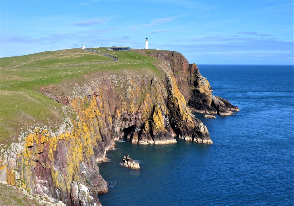
The Mull of Galloway Trail is one of the best long-distance hikes in Dumfries and Galloway, running over 25 mi (40 km) from Scotland's southernmost point, the Mull of Galloway, to the town of Stranraer. If you're looking for a multi-day adventure, you can extend this walk along the Loch Ryan Coastal Path for another 12.5 mi (20 km).
The Mull of Galloway Trail, including the Loch Ryan Coastal Path, is usually split into the following three sections:
From Newton Stewart to Gretna Green, Dumfries and Galloway boasts numerous historic and charming settlements from which to explore the region's landscape.
Glasgow International Airport is the nearest major airport to Dumfries and Galloway, located 80 mi (128 km) north of Dumfries.
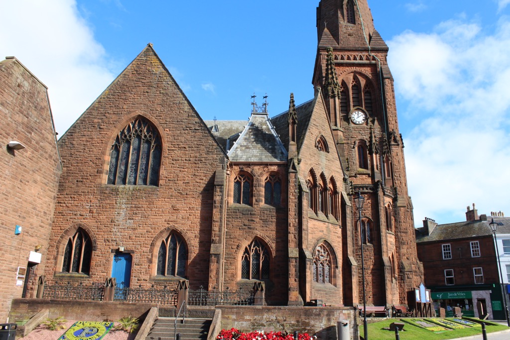
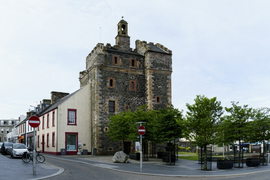
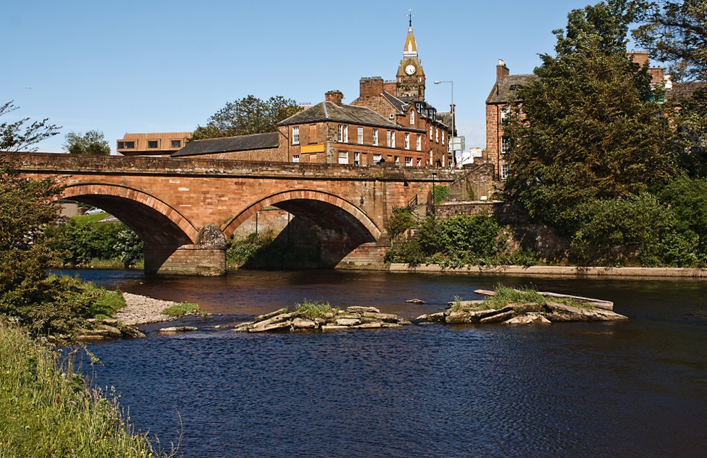
Dumfries is the largest settlement in Dumfries and Galloway, with a population of around 33,000. Perched near the mouth of the River Nith, Dumfries is a picturesque market town home to some of the best family-friendly attractions in the region, like the Robert Burns House and the 13th-century Caerlaverock Castle.
Dumfries is well-positioned for discovering some of the region's best hiking spots — Criffel is just 10 mi (16 km) to the south, and Galloway Forest Park is less than 30 mi (48 km) to the west.
Dumfries railway station connects Dumfries directly to Glasgow, Carlisle, Annan, and Locharbriggs.
Sat at the southern end of Loch Ryan is Dumfries and Galloway's second-largest town, Stranraer. It has a population of around 10,000.
Like Dumfries, Stranraer is a historically significant town — it was the site of the Battle of Loch Ryan in 1307 during the First Scottish War of Independence. Its main attraction is the 16th-century Castle of St John, which now serves as a museum.
Stranraer is the perfect place to book a room if you're hiking on the Mull of Galloway Trail. Plus, it's less than 30 mi (48 km) from Galloway Forest Park. Stranraer railway station provides services to Ayr, Kilmarnock, and Glasgow.
Annandale is a beautiful area of Dumfries and Galloway, with Annan the ideal base from which to explore the nearby Moffat Hills and the course of the Annan River. Annan has a population of roughly 8,700 people.
Annan lies 34 mi (54 km) south of the Moffat Hills, with the long-distance Annandale Way following the course of the Annan River from Annanhead (478 m / 1,568 ft) to the sea. Annan is also within 30 mi (48 km) of Criffel and the Solway Coast AONB.


