Scan the QR code and open PeakVisor on your phone
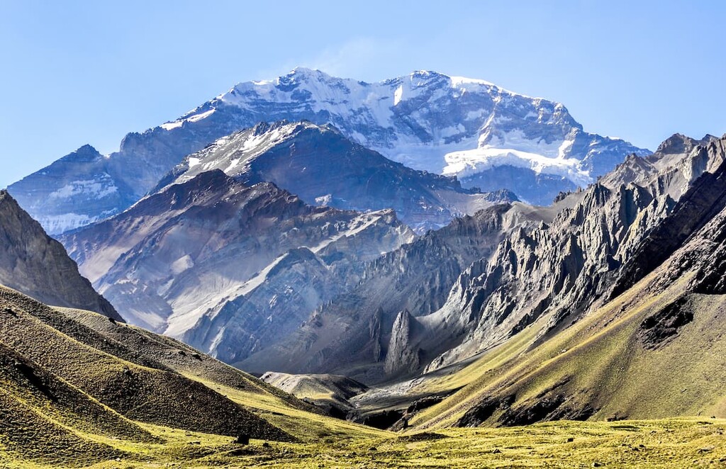
Distrito Las Cuevas is a 49 sq. km (12,108-acre) district in Argentina’s Mendoza Province, along Argentina’s Chilean border in the Andes Mountains. Las Cuevas and the eponymous town is part of the province’s Departamento de Las Heras. It is the westernmost district in the department, bordering Uspallata to the east, and is the highest-elevation district in Argentina. Las Cuevas is most noteworthy as the location of Cerro Aconcagua (6,961 m/22,838 ft), the tallest peak both in Argentina and the entire Americas. Aconcagua is the highest mountain in the world outside of Asia and the second most prominent (after Mount Everest) due to its isolated position as the highest peak on the American landmass. In addition to Aconcagua, there are 65 named mountains in Distrito Las Cuevas.
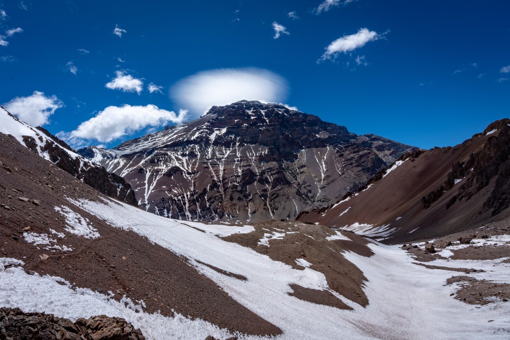
Rugged, arid alpine slopes and high-elevation mountains characterize Las Cuevas. As noted above, Aconcagua—the tallest mountain in the Americas and the tallest peak in both the Western and Southern Hemispheres—is located inside Distrito Las Cuevas.
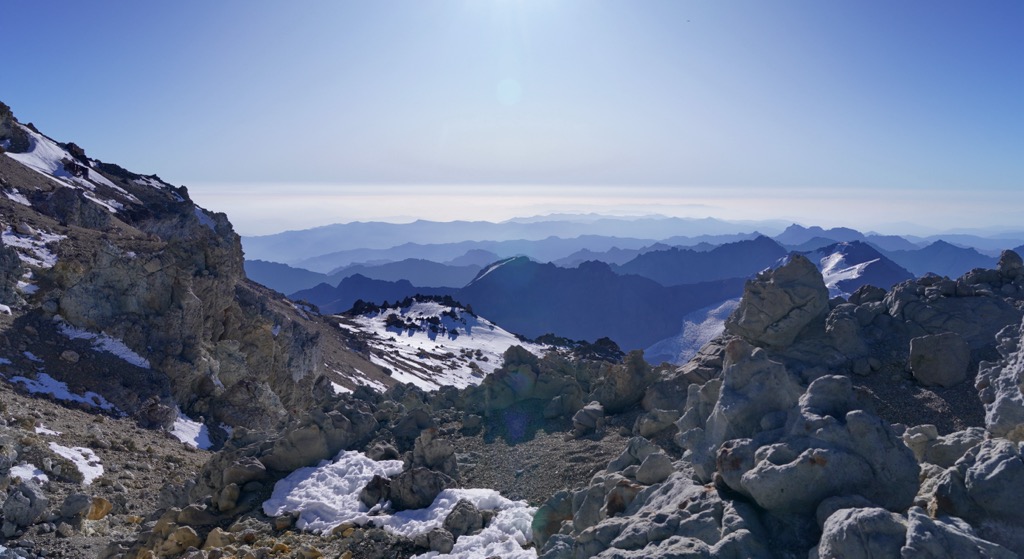
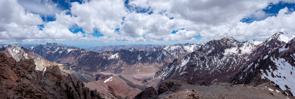
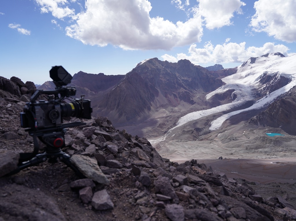
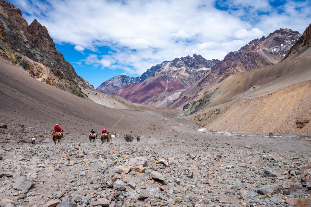
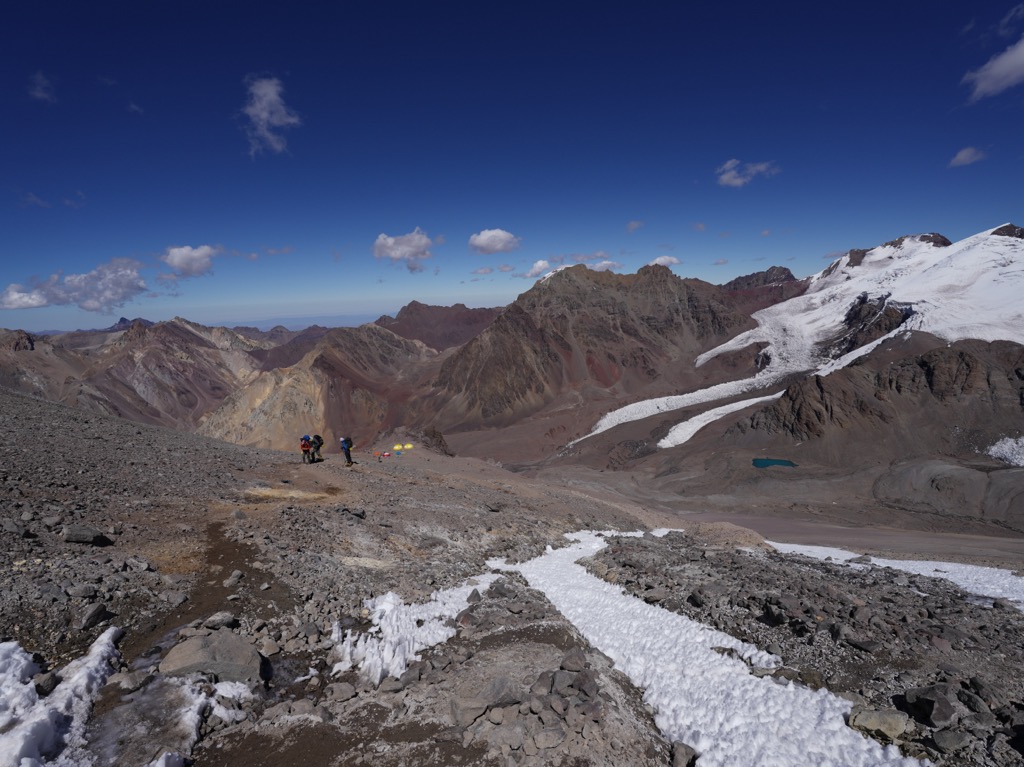
The mountain is located entirely inside the Aconcagua Provincial Park, and climbers must pay park fees to access it. In addition to its numerous peaks, the park’s primary geographic feature is the Horcones Valley, run through by an eponymous river descending from glaciers on Aconcagua’s slopes. It is north up this dusty, steadily rising valley, rimmed by increasingly loftier peaks, that climbers trek to summit Aconcagua via its Normal Route.
Overall, the park’s geography features several distinct zones. The base of Aconcagua begins in the arid, semi-desert around Las Cuevas, known as the “Pre-Cordillera.” This region is primarily dry, rocky terrain with sparse vegetation. Ascending above 4,000 meters (13,100 feet), climbers enter the Cordillera Principal, with steep, prominent slopes, rugged cliffs, and vast snowfields.
Along with the provincial park, almost the entire Las Cuevas district is above 3,200 meters (10,500 feet), so a cold, arid alpine climate characterizes the region. The range’s proximity to the Chilean Pacific coast makes for heavy snowfall and volatile storm patterns, particularly in the winter and shoulder seasons. Winds regularly reach over 200 kilometers per hour (125 mph) near the summit, and temperatures drop well below freezing even in the summer.
Aconcagua and the mountains in Las Cuevas (as well as the larger Andes range) were created by the subduction of the Nazca Plate underneath the South American Plate. The peak was formerly an active stratovolcano comprising several volcanic outlets bordering a shallow sea.
Around eight million years ago, however, the fault’s subduction angle began to decrease, causing an increase in horizontal pressure between the plates. This resulted in thrust faults lifting Aconcagua out of its volcanic bed, ending its time as a volcanic formation.
There are many vibrant ore deposits—greens, blues, and grays of limestones, carbonates, and turbidites—throughout the Horcones Valley, as well as minerals like copper and lithium in the surrounding mountains.
Much of the Distrito Las Cuevas is alpine or subalpine, characterized by an arid, barren ecosystem low in biodiversity. Regarding flora, there is little beyond small shrubs, tussocks, and grasses. Clumps of Azorella yareta and other cushion plants are common, growing together in dense clusters low to the ground. This centralized nature protects them from the wind and helps them retain heat. Columnar cacti thrive in drier areas of the foothills.
Tough, low-growing grasses like Peruvian feather grass grow throughout the lower slopes of the district, and Puya raimondii, the world’s largest species of bromeliad (better known as “Queen of the Andes”), is also found on the lower steppes. This plant is known for its enormous flower spike that can reach heights up to 8 meters (26 feet).
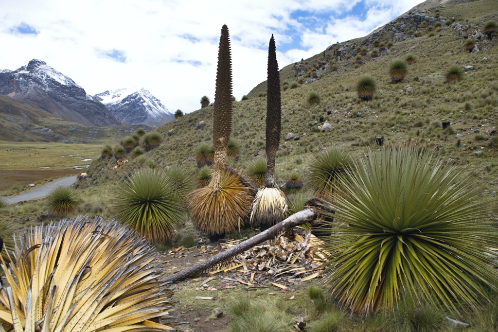
In general, what vegetation does exist in Distrito Las Cuevas is adapted to endure low temperatures, barren soil, and heavy snowfall. There is almost no vegetation whatsoever above 4,000 meters (13,100 feet).
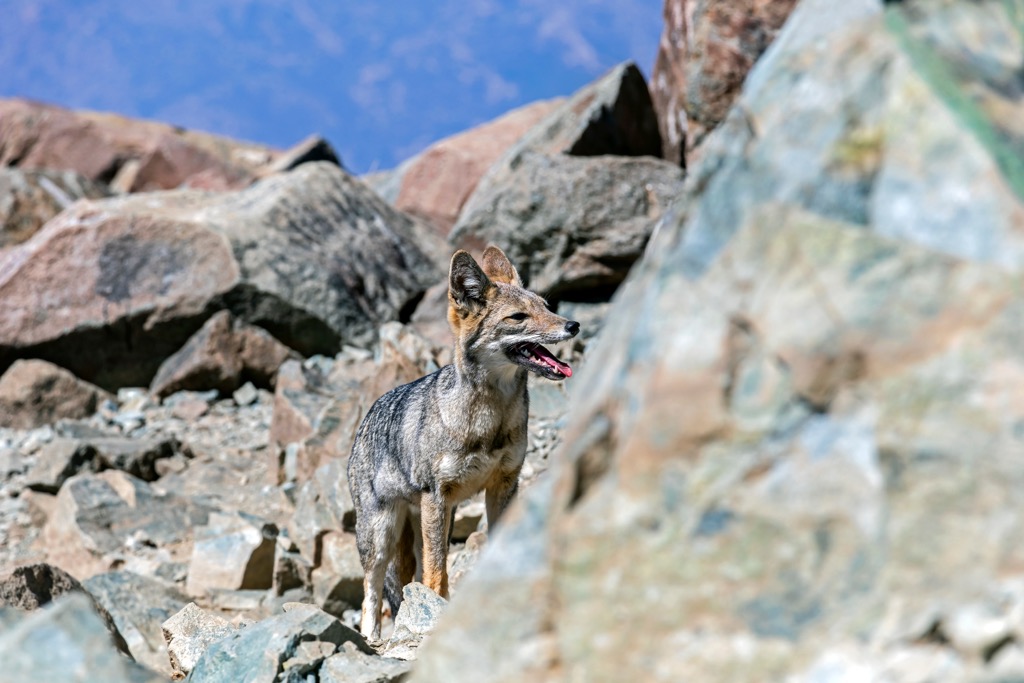
Fauna throughout the valley and surrounding heights include puma, red Andean foxes, vicuña, eagle, and the mighty Andean condor—boasting a wingspan of over 3.2 meters (10.5 feet)—as well as a select few species of frog and lizard. Birds like plovers and torrent ducks are common in lower valleys and streams. European hares subsist throughout the alpine heights and valleys.
The guanaco, a wild relative of the llama, is particularly conspicuous, and almost no Aconcagua climber will go without seeing a herd at some point or another, grazing on the sparse vegetation in the foothills. Another common sight is the vizcacha, a small rodent that nests inside the rocky alpine slopes and cliffs, often pillaging climbers’ tents and shelters.
The earliest known inhabitants of the Distrito Las Cuevas region were indigenous peoples like the Huarpes, Puelches, and Incas. Las Cuevas was likely never home to a permanent settlement due to its extremely high elevation and harsh climate. However, indigenous peoples have been entering the region for thousands of years, primarily for hunting and religious purposes, such as human sacrifices.
Famously, Aconcagua is the site of an Incan “capacocha” mummy—a seven-year-old boy dated to around the year 1500, sacrificed as part of a ritual to the gods. The mummy is one of the highest-altitude archaeological finds of its kind. It was found in a semicircular stone structure at 5,300 m (17,400 ft) in 1985.
With the arrival of the Spanish conquistadors in the 1500s, the region became part of the Viceroyalty of Peru. The Spanish began to exploit it for mineral wealth, particularly silver and gold. Europeans established many mining operations and colonial settlements in Mendoza, significantly changing the local communities and landscapes.
In the 1800s, the region played a crucial role in the Argentine War of Independence as a strategic route for military movements. General José de San Martín, one of the key leaders in the independence movement, crossed the Andes through the Distrito Las Cuevas with his army, eventually liberating Chile and Peru from the Spaniards.
Though indigenous peoples may have climbed many of the region’s peaks, the first known ascent of Aconcagua was in 1897 by Swiss guide and climber Matthias Zurbriggen, a member of a team led by British mountaineer Edward Fitzgerald. They summited via the northwest ridge of the peak, using what is today known as the “Normal Route.”
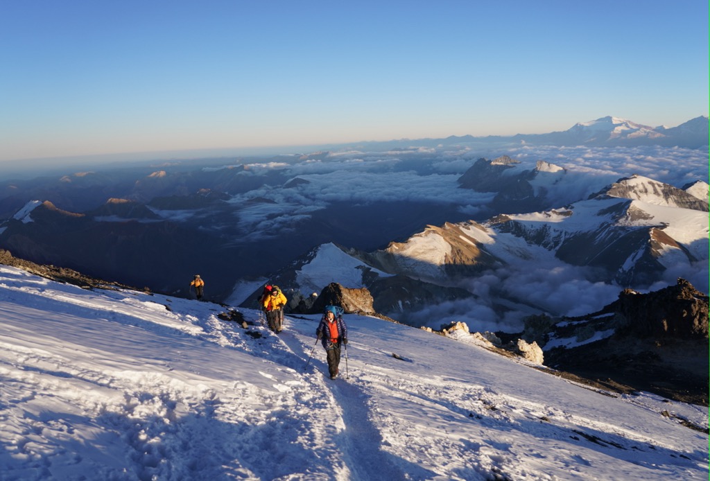
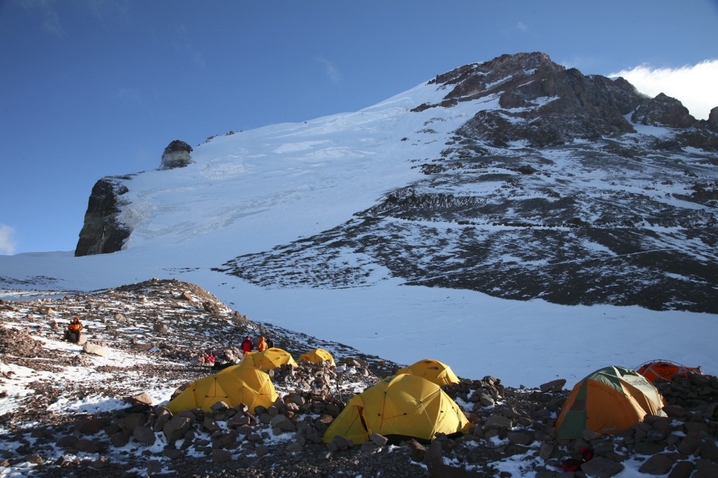
The Normal Route is Aconcagua’s safest and most popular route, beginning at the outflow of the Horcones River and ascending towards Plaza de Mulas Base Camp at 4,300 meters (14,100 feet).
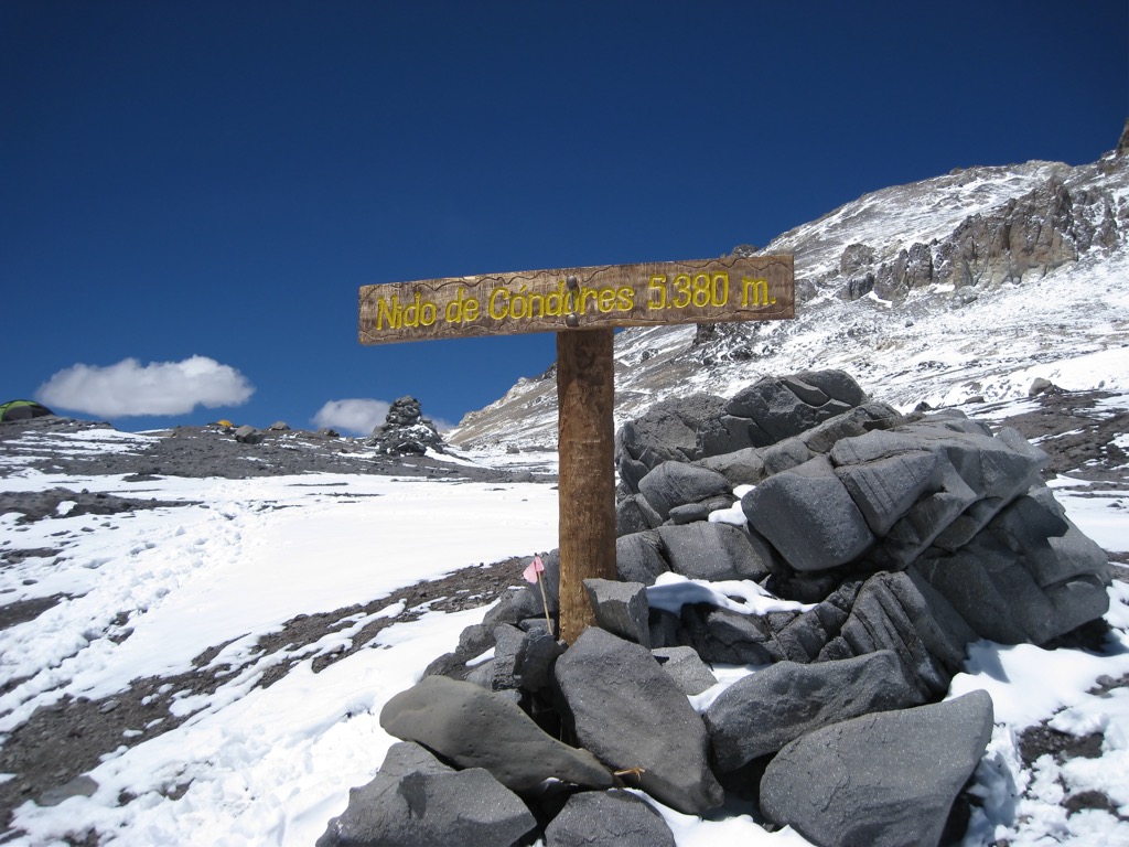
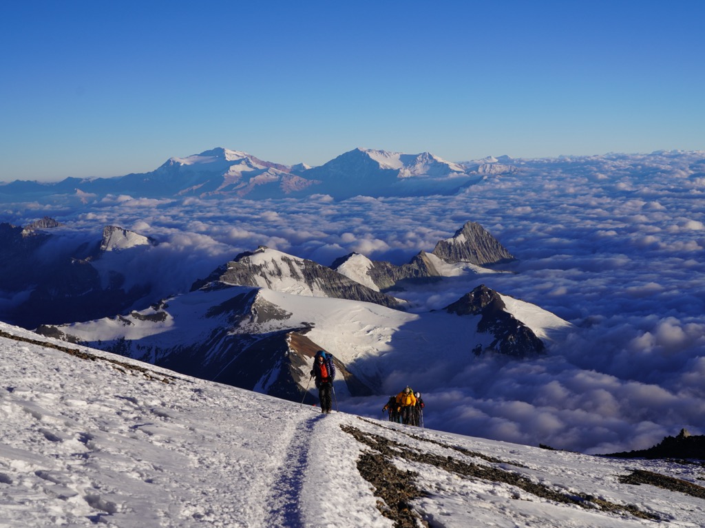
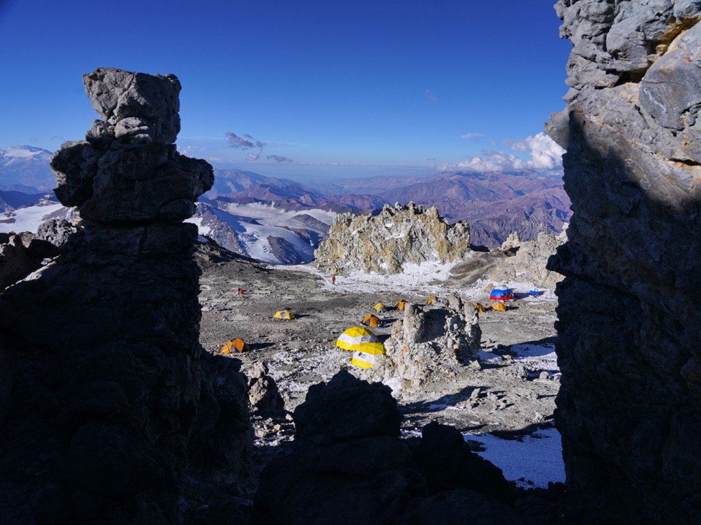
From Plaza de Mulas, climbers ascend steep scree slopes to Plaza Canada (usually Camp I) at 5,030 meters (16,500 ft). Canada is a large, flat plateau almost directly above Mulas, and the section from here to BC is one of the steepest on the ascent. From here, the route climbs to a high pass and over to Nido de Cóndores (Camp II) at 5,578 meters (18,300 ft) before turning back south to begin wrapping around the northwest ridge to Plaza Colera (Camp III) at 5,944 meters (19,500 ft).
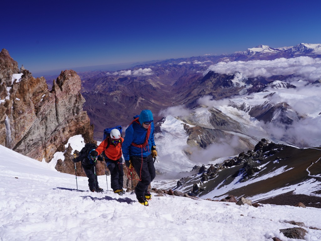
From here, most parties head up the northwest ridge to the summit and back in a single day. The most notable feature of the route is the “Canaleta,” a narrow gully guarding the summit ridge. Depending on conditions, the channel can either be a steep, icy snow slope or (when dry) a chute filled with loose rock. Either way, it’s generally the most dangerous section of the route, a frequent site for accidents.
The third and second most popular routes on Aconcagua are the Polish Glacier and the Polish Traverse (or “False Polish”), respectively. The former ascends from the mountain's opposite side, crossing steep snow and ice slopes up to 70 degrees, while the latter combines the Polish Glacier and Normal Route. It begins on the Polish before finishing on the Normal Route, thus offering more variety than the Normal Route but eschewing the most dangerous, technical sections on the Polish.
There are no longer any glaciers or permanent snowfields on any of Aconcagua’s usual routes, but crampons, axes, and ropes are still regularly used during periods of heavy snowpack.
The only sizable settlement inside Distrito Las Cuevas is the eponymous town. Las Cuevas is an excellent spot to acclimatize before entering the Aconcagua Provincial Park. Several small lodges and hostels cater to climbers. Portezuelo del Viento Mountain Lodge comes highly recommended by this author, who climbed Aconcagua in 2023.
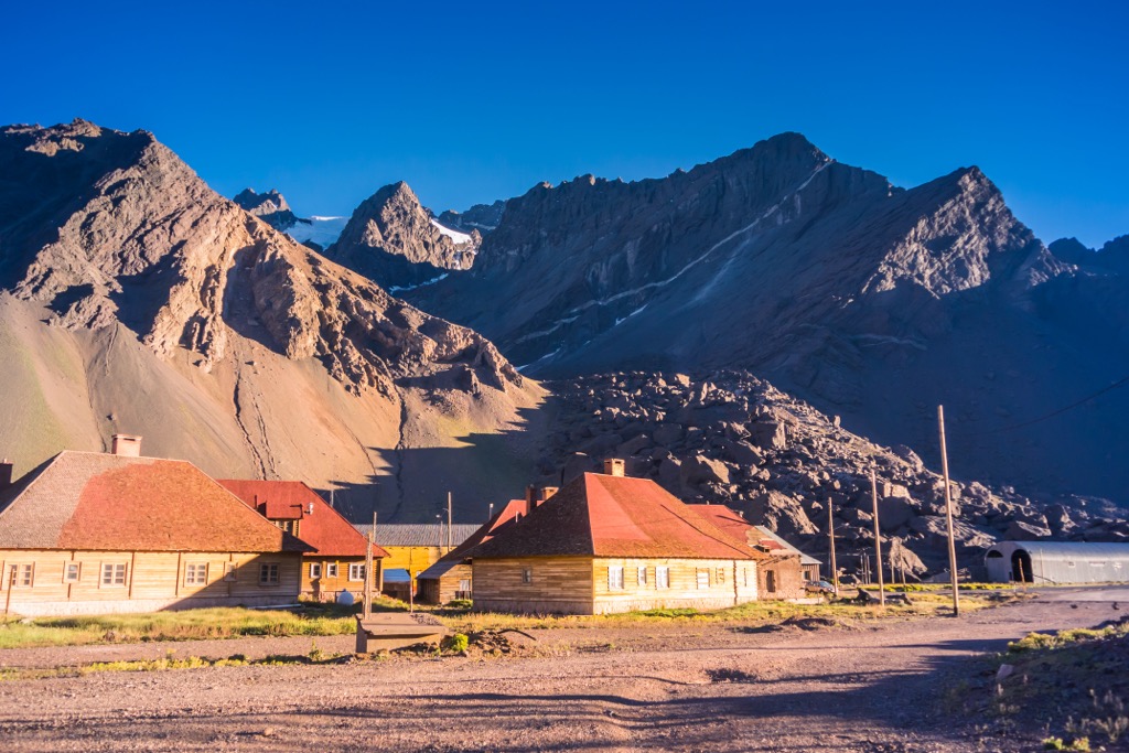
Las Cuevas is also noteworthy due to its position along Route 7, the final town before it enters Chile through Paso Internacional Los Libertadores. This highway is the main transport route from Santiago de Chile to Mendoza Province. In addition to the pristine hiking around Las Cuevas, be sure to check out the natural bridge “Puente del Inca” (also the name of a small town just down the road). Glacial melt carved this brightly-colored natural arch.
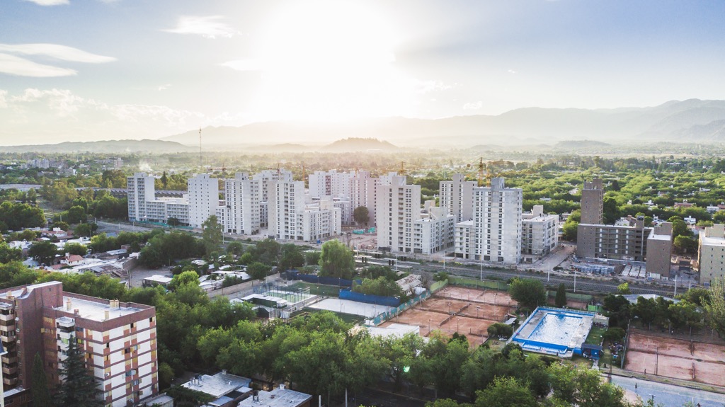
Mendoza is the largest town near Distrito Las Cuevas and Aconcagua (with over one million in its metro area) and the most common entry point for climbers and hikers. There are dozens of outfitters and guides in Mendoza for climbing and trekking, horseback riding, white-water rafting, and hot-air balloon flights.
Mendoza is also known for its laid-back atmosphere, tree-lined streets, fountains, statues, vibrant local cuisine, and bustling nightlife. The region is famous for its wine industry, particularly its Malbec wines, and winery tours here are world-class.