
Scan the QR code and open PeakVisor on your phone
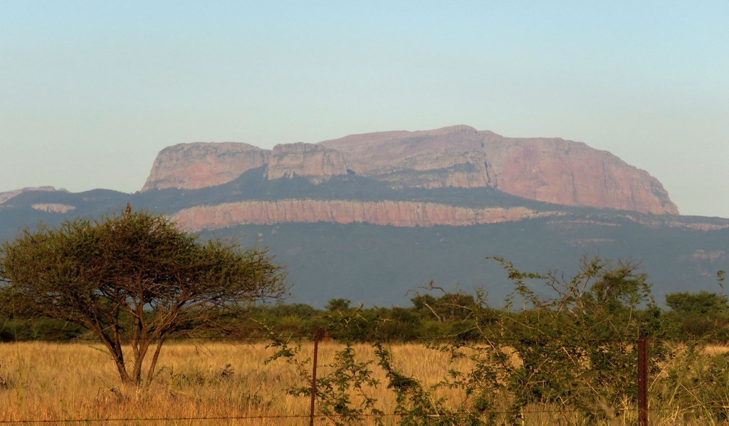
The Capricorn District Municipality is a prominent administrative district in the Limpopo province of South Africa. It has 243 named mountains, the highest and most prominent of which is Iron Crown Peak, measuring 2,126 meters (6,975 ft).
The Capricorn District Municipality is named after the Tropic of Capricorn, which passes through the region. The district covers an area of about 2,170,500 ha (5,363,422 ac). It’s bordered by Vhembe District Municipality to the north, Sekhukhune District Municipality to the south, Mopani District Municipality to the east, and Waterberg District Municipality to the west. Its central position makes it an important area for trade and transportation within Limpopo.
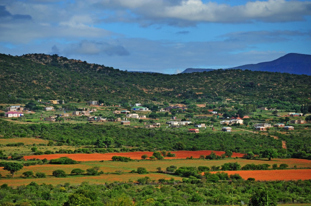
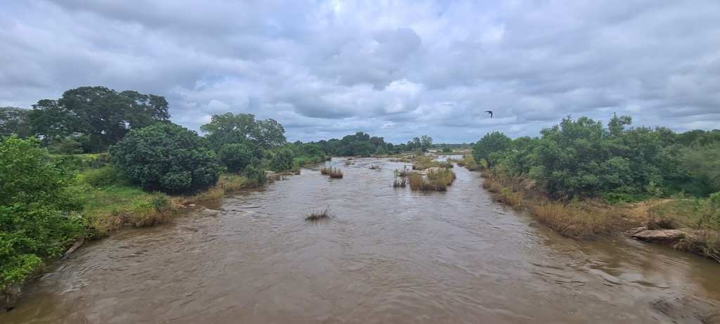
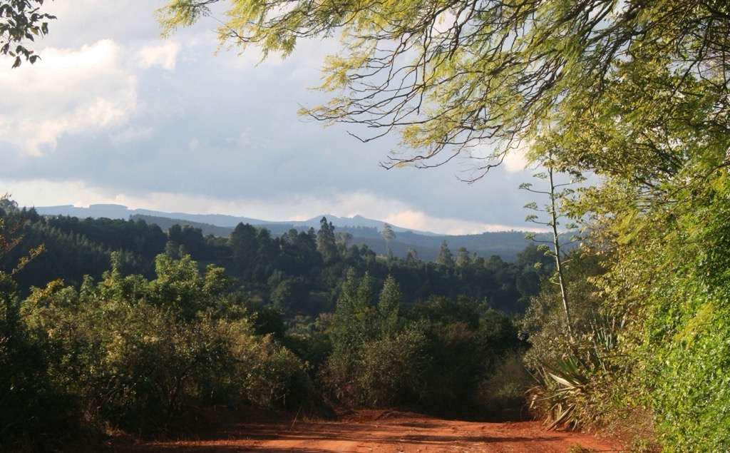
The topography is a mix of plains and hills, with ridges forming part of the northern Drakensberg escarpment. The landscape features bushveld vegetation, including grasslands and acacia trees. Rivers like the Sand River provide essential water resources for agriculture and local ecosystems.
The district has a semi-arid climate with hot summers and mild winters. Summer temperatures often exceed 30°C (86°F), accompanied by seasonal rainfall averaging 400 to 600 mm (16” to 24”) annually. Winters are dry and cooler, with temperatures ranging from 5°C to 20°C (41°F to 68°F).
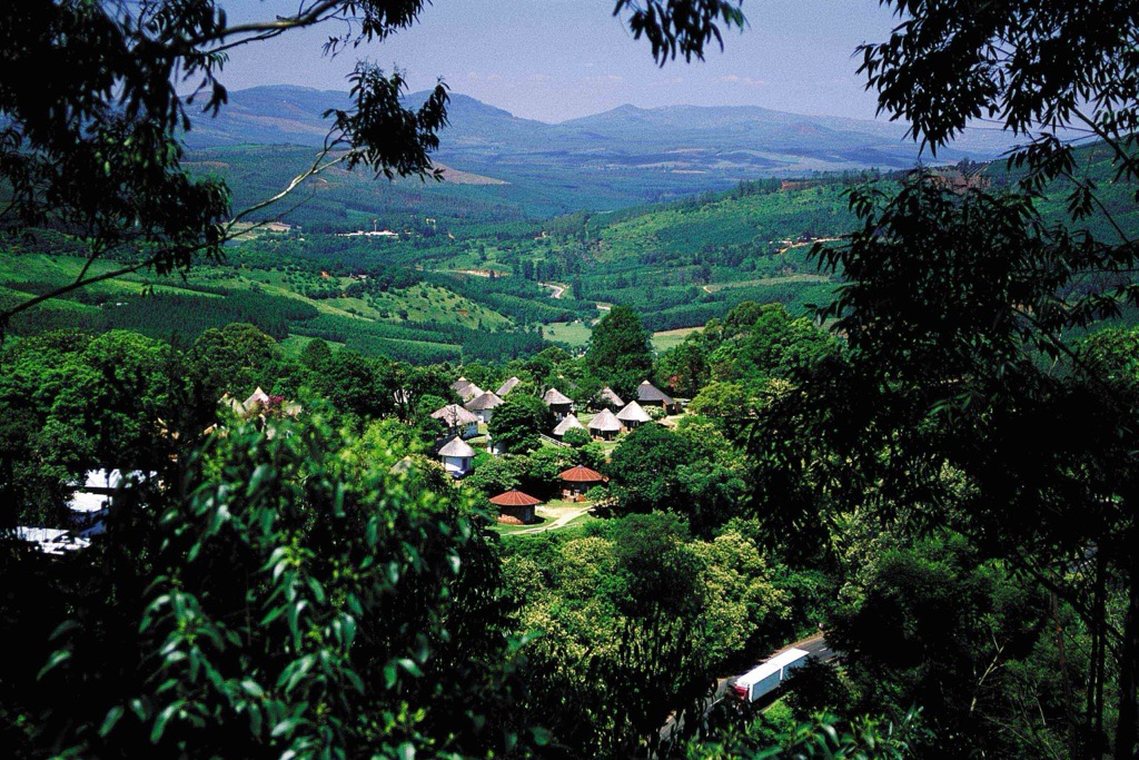
Capricorn includes urban centers like Polokwane, the district seat and provincial capital, as well as towns such as Molemole, Blouberg, Lepelle-Nkumpi, and Aganang. Polokwane is the largest city and serves as the district's economic and administrative hub.
The region is part of the bushveld biome, hosting diverse flora and fauna. Private game reserves and conservation areas attract ecotourism and contribute to wildlife preservation. The district also has significant mineral resources, including platinum and granite.
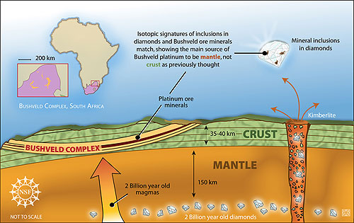
The Capricorn District Municipality lies within the ancient Kaapvaal Craton. This stable formation features Archean granitic and greenstone rocks, known for their mineral wealth, including gold and base metals. The district also hosts part of the Bushveld Igneous Complex, a globally significant source of platinum group metals, chromium, and vanadium.
Sedimentary formations from the Waterberg Group and remnants of the Karoo Supergroup provide valuable groundwater aquifers and record ancient climatic conditions. Extensive dolomitic formations, especially from the Malmani Subgroup, shape the region’s karst topography, featuring caves, sinkholes, and underground water systems.
The Capricorn District lies within the savanna biome, one of the largest biomes in South Africa. It's predominantly covered by mixed bushveld and savanna vegetation, characterized by grassy plains interspersed with scattered trees and shrubs. Key plant species include acacias, marula, and mopane.
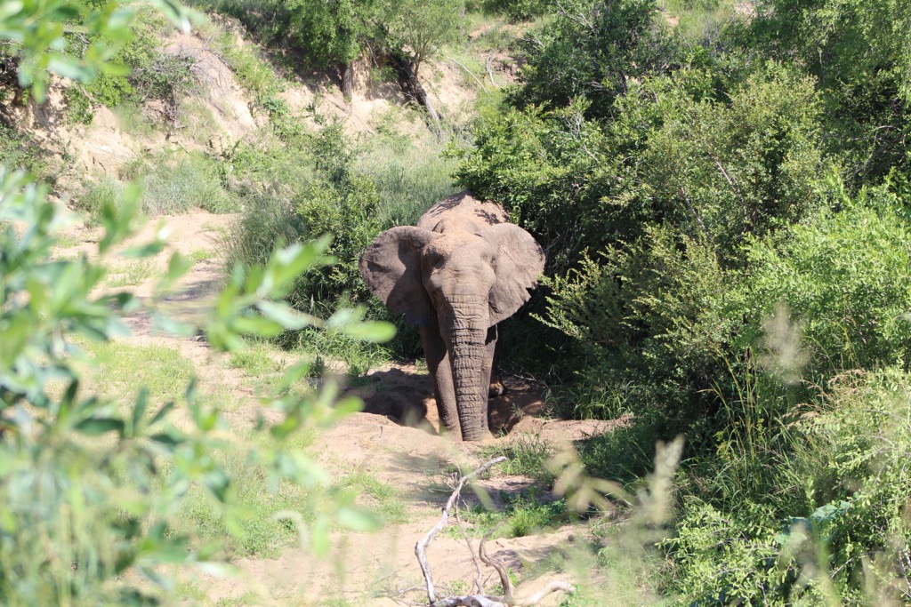
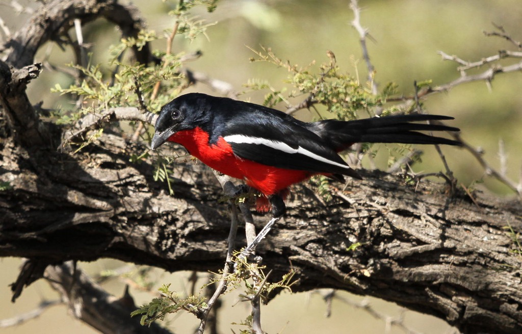
The Capricorn District is home to a diverse array of wildlife, including mammals, birds, reptiles, and insects. Common mammals include impala, kudu, and warthogs, which thrive in the savanna ecosystem. Bird species such as the lilac-breasted roller and African fish eagle are commonly sighted.
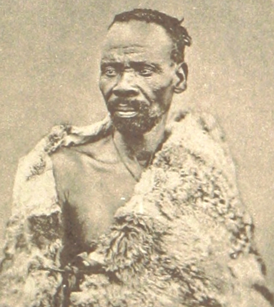
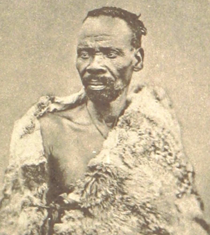
The Bapedi people were the earliest inhabitants of the Capricorn District Municipality. They are part of the larger Northern Sotho ethnic group. Under powerful leaders, most notably King Sekhukhune, the Bapedi were known for their resistance to foreign invasions.
In the 19th century, the Capricorn District Municipality became a focal point of colonial expansion, with the Dutch and later the British seeking control over the area. The Bapedi, under King Sekhukhune, resisted British control, culminating in the Sekhukhune War (1876–1879). Although the British eventually defeated Sekhukhune, his resistance left a significant legacy.
With the establishment of apartheid in 1948, the Capricorn District, like many other areas in South Africa, was severely affected by racial segregation policies. The Bapedi, along with other indigenous people, were subjected to forced removals, displacement from their ancestral lands, and confinement to racially designated areas. Despite this, local resistance movements emerged, contributing to the broader struggle against apartheid.
The fall of apartheid in 1994 marked a new chapter for the Capricorn District Municipality. With the establishment of a democratic South Africa, the region was restructured into local municipalities, and the Capricorn District Municipality was formally established as a political and administrative unit. Today, Capricorn is an important part of Limpopo province, with Polokwane as its regional hub.
The Polokwane Game Reserve offers diverse landscapes and wildlife through well-maintained hiking trails. The 4 km (2.5 mi) Acacia Walking Trail is an easy to moderate hike that allows hikers to enjoy the local flora, including various Acacia species.
For those seeking a more challenging adventure, the White Rhino Hiking Trail spans 12 km (7.5 mi). It is ideal for birding, hiking, and mountain biking, with the chance to spot wildlife such as zebras, giraffes, and occasionally white rhinos. The reserve is home to a variety of mammals, including blue wildebeests and several antelope species, and boasts over 300 bird species.
The Magoebaskloof Hiking Trail is a 62-km (38-mile) multi-day trail in the Limpopo highlands. As hikers traverse Indigenous forests, pine plantations, and grasslands, they often encounter the region's characteristic mist, which has earned it the nickname "the land of the silver mist."
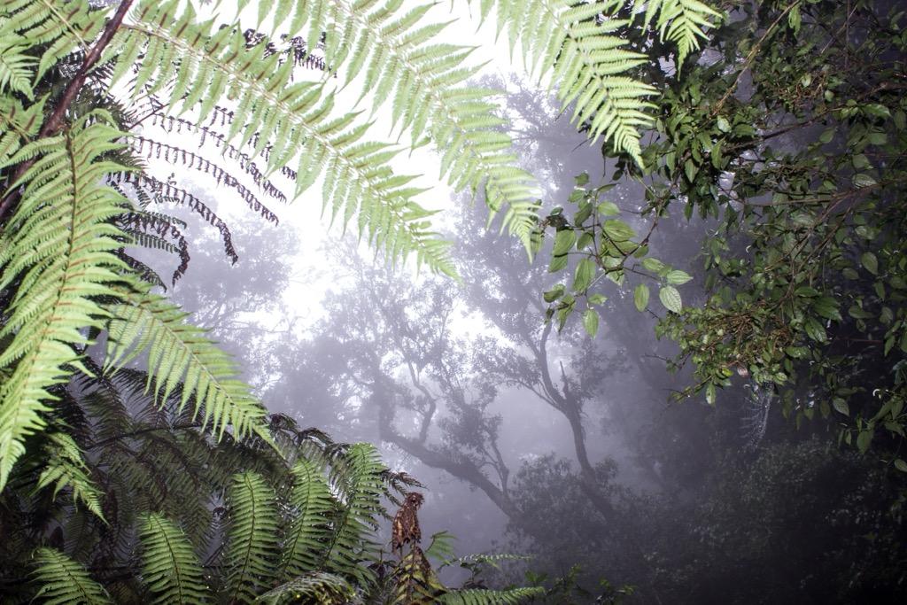
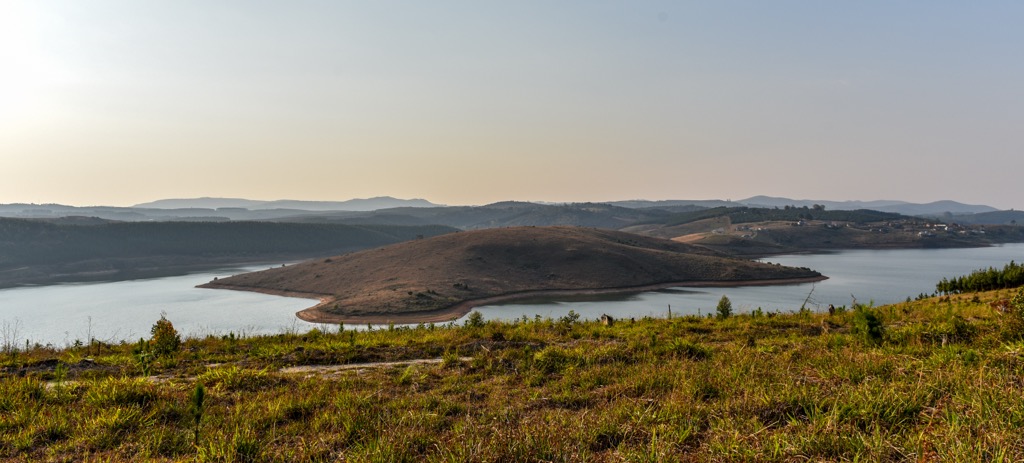
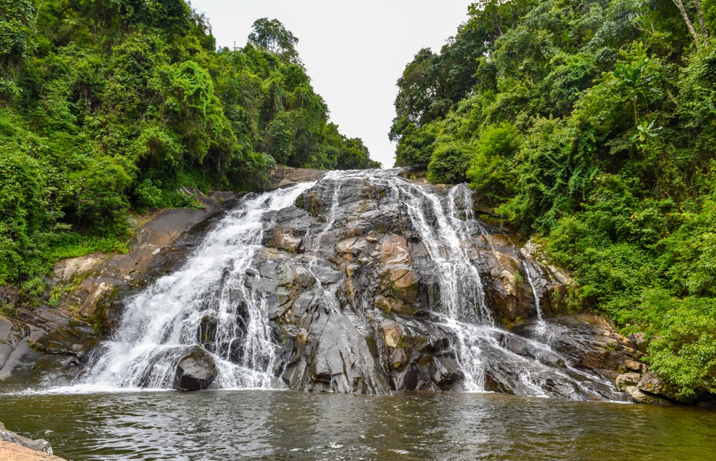
The trail is home to a diverse array of flora and fauna, including rare bird species like the Cape Parrot and Narina Trogon, as well as Samango monkeys. Notable spots along the trail include the Debengeni Falls and the Cathedral tree, a massive strangler fig. The trail also offers stunning views over the Ebenezer Dam and the Wolkberg Mountains.
Blouberg Nature Reserve covers 9,360 ha (23,100 ac) of diverse bushveld, woodland, and riverine ecosystems. It is home to the 2,045-meter (6,709-ft) Blouberg. The reserve features several hiking trails, including the challenging Blouberg Trail, which spans 15 km (9 mi) and offers dramatic mountain vistas, natural pools, and iconic Yellowwood Trees.
The reserve has over 225 bird species, including Verreaux’s eagle-owl, Brown snake-eagle, and Tawny eagle. In addition to birds, hikers will spot a variety of animals, such as Cape buffalo, giraffe, eland, waterbuck, gemsbok, zebra, and kudu, as well as smaller mammals like civet and African wildcat. Blouberg Nature Reserve boasts views of the dry bushveld savannah, giant baobabs, and mashatu trees.
The Louis Changuion Trail is a scenic 10 km (6 mi) loop trail known for its moderate difficulty. Starting from the village of Haenertsburg, it meanders through picturesque grasslands and Indigenous forests, offering views of the surrounding landscape, including the Ebenezer Dam.
This well-marked trail was originally laid out in 1993 by historian and local resident Professor Louis Changuion. It passes through the Haenertsburg Nature Reserve, home to the largest remaining portion of the critically endangered Woodbush Granite Grassland. This area is rich in biodiversity and features a variety of wildflowers.
Polokwane is the capital of Limpopo and a key transportation hub for the district’s major attractions, including national parks and cultural sites.
The Mokopane Biodiversity Conservation Centre focuses on preserving endangered species and offers educational tours. Visitors can observe wildlife of cheetahs and rhinos and learn about local conservation efforts.
Bakone Malapa Northern Sotho Open-Air Museum showcases the traditional lifestyle of the Northern Sotho people. Visitors can explore reconstructed homesteads, learn about traditional crafts, and experience cultural performances.
A short drive from Polokwane, the Makapan Valley, a UNESCO World Heritage Site, is an archaeological site part of the Cradle of Humankind. It offers insights into early human history and features caves with fossilized remains and ancient artifacts.
Blouberg is a town in the Limpopo province known for its high peak of Blouberg. The area is home to the Bahananwa people, who preserve traditional practices and languages.
Blouberg Mountain is one of the area's most prominent features. It offers breathtaking views, challenging hiking trails, and rock climbing routes. Its cliffs also host one of Southern Africa's largest populations of Cape vultures.
The Makgabeng Plateau is archaeologically significant and features ancient rock art sites dating back thousands of years. These artworks reflect the lives of early hunter-gatherers and later Bantu-speaking communities.


.jpg)
.jpg)
.jpg)
.jpg)