
Scan the QR code and open PeakVisor on your phone
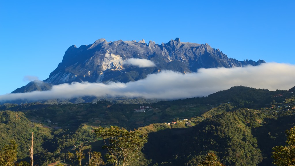
Brunei is a small coastal country on the island of Borneo in the Malay Archipelago. The landscape is one of dense jungle and rolling hills, which sweep up the side of the Crocker Mountains. There are 71 named mountains in Brunei. The highest and the most prominent is Bukit Pagon (1,850 m / 6,070 ft), which sits around 240 km (150 mi) south of the highest point on Borneo, Mt. Kinabalu (4,101 m / 13,455 ft). Bukit Pagon sits deep in a nearly impenetrable jungle, inaccessible from Brunei. The only way to the summit of the country’s tallest peak is through Malaysia, but it sees almost no visitors due to its extreme remoteness. Borneo is known for its natural beauty, with some of the most biodiverse areas on the planet. Most hiking here is about taking in the beauty of the world’s most pristine rainforests. Brunei has two national parks, including Ulu Temburong, the “Green Jewel of Brunei.” Brunei sees almost no tourists compared to Indonesia and Malaysia, its closest neighbors. But if you’re curious to see what the country offers, here’s where you should start.

Brunei isn’t a major tourist destination. In fact, its main source of tourism is from people trying to visit every country. The country is tiny compared to its neighbors on the island of Borneo, Malaysia and Indonesia. However, until a few centuries ago, Brunei controlled about a quarter of the island, roughly the area of Sarawak, Malaysia.
Today, Brunei comprises a small area on the northwest coast of Borneo. The country’s borders include two disconnected regions on either side of the Brunei River delta (Malaysia retained control of the middle).
Brunei’s western arm straddles the coast of the South China Sea and is mostly a deep, low-lying jungle. The eastern arm, Temburong, sweeps up into the Crocker Mountains. Most of this area is protected wilderness, including Labu Mangrove Reserve, Peradayan Forest Reserve, and Ulu Temburong National Park.
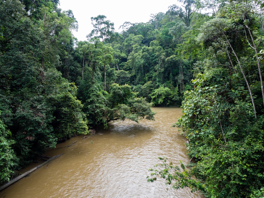
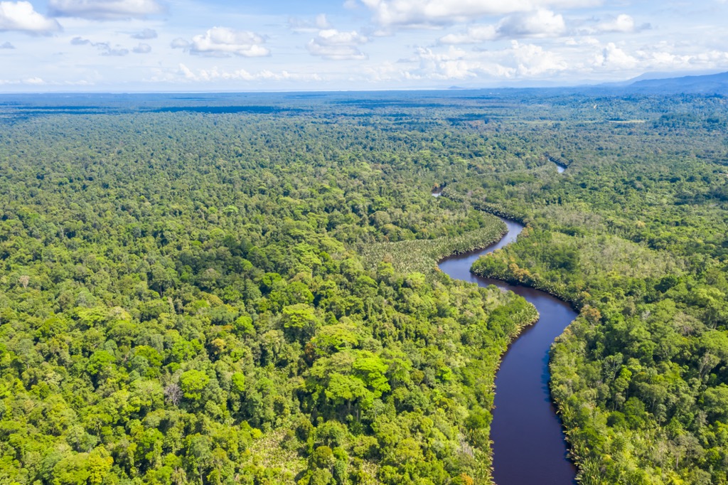
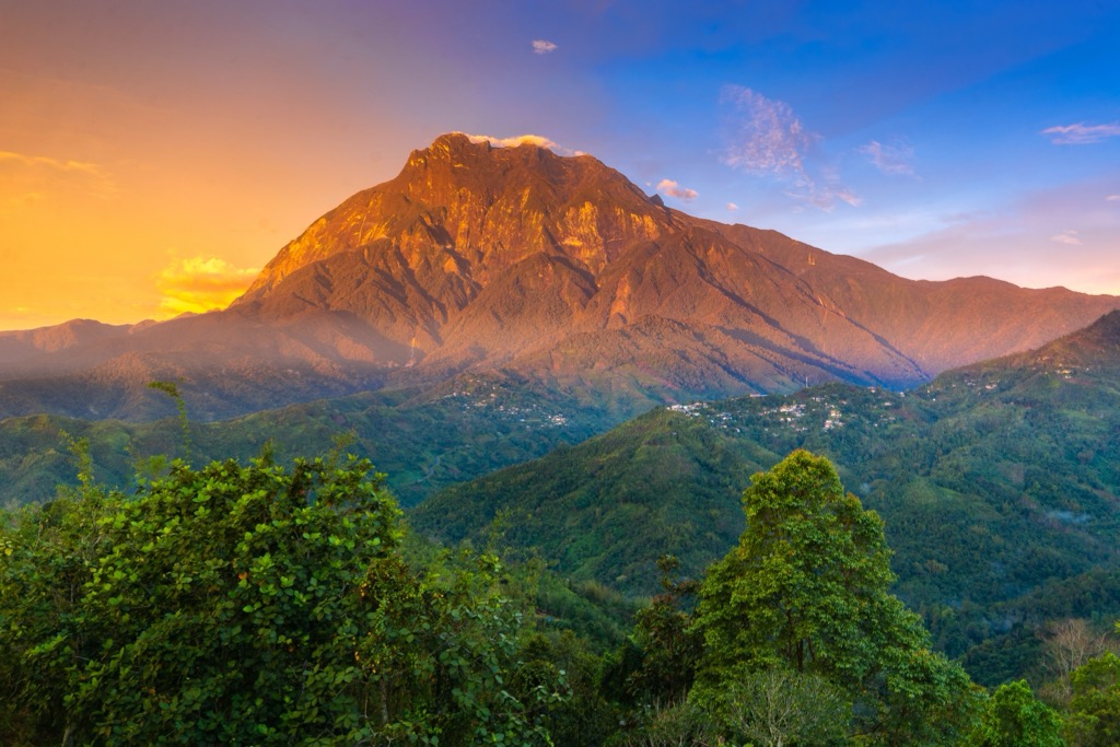
All of Brunei’s mountains sit in Ulu Temburong National Park, which makes up 40% of the Temburong District. The park has some of the best-preserved jungle in Borneo, which is why it’s called “The Green Jewel of Brunei.” It’s the country’s most worthy destination if you’re after unspoiled wilderness.
Zooming out, Brunei occupies a tiny area of Borneo, the world’s third-largest island. Borneo is one of the most biodiverse places on earth, with vast swaths of tropical jungle and towering mountains. Its rainforests, which have persisted for around 140 million years, are some of the oldest on the planet.
Borneo has a few major mountain ranges. These ranges are known by different names in different regions and are often divided by political rather than geological boundaries. The main ranges in Borneo are the Crocker Mountains and Meratus Mountains. The Crocker Range covers most of the north and central part of the island, including its highest peaks, Mt. Kinabalu and Mt. Trusmadi (2,642m / 8,668 ft). The Meratus Range sits on Borneo’s southern coast in the Indonesian province of South Kalimantan.
Before the last ice age, Borneo, Java, and Sumatra were connected to Asia by a land bridge. At the time, the South China Sea and the Gulf of Thailand were low coastal plains. Eventually, the icebergs melted, the sea rose, and the peninsula became an island chain.
Borneo has a significant elevation gradient, mostly due to volcanic activity. From the coast, Mt. Kinabalu rises over 4,000 m (13,435 ft) in just 37 km (23 mi). The Crocker range formed when magma intruded under the Earth’s crust, creating a bulge and slowly crystallizing into rock.
As the softer deposits on top eroded, the volcanic stone underneath showed through. This process occurred over about 10 million years, a short amount of time in geological terms. Their relative young age gives the Crocker Range, especially Mt. Kinabalu, a craggy, sheer look. Since forming, they’ve barely had time to erode.
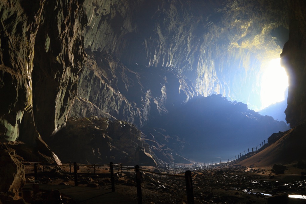
Borneo is also full of limestone, which features many caves, including some of the most spectacular caverns on earth, like Deer Cave. The cave’s central passage is one of the largest on Earth in terms of volume, with a ceiling 146 m (479 ft) high, running over 4.1 km (2.5 mi). The cave system has been home to a colony of millions of bats for so long that their guano has turned into a 100 m-tall (330 ft) hill, which supports its own ecosystem.
Borneo’s ecology is a central reason to visit, and Brunei is one of the best places to see the raw beauty of a tropical rainforest.
Borneo is a hotspot for biodiversity. Its tropical climate and elevation changes create many unique ecosystems. The island’s rainforests are some of the oldest in the world, dating back 140 million years. The island has around 15,000 plant species and around 1,000 species of mammals, birds, and fish.
That’s not quite as diverse as the Amazon rainforest. But Borneo has a very high number of endemic species, meaning they don’t exist anywhere else. As you might guess, many of these endemic species are also threatened or endangered, including the Bornean orangutan, one of three orangutan species. It also includes elephants, rhinoceroses, clouded leopards, and freshwater sharks.
Naturally, Borneo’s rainforests are a conservation priority. The island is much less disturbed than mainland Southeast Asia, meaning there are still vast tracts of untouched old-growth rainforest here. But, as you’d expect, Borneo’s rainforests are threatened by logging and human development.
Borneo has lost about 26 million acres (10.7 million hectares) of rainforest in the last twenty years. At the same time, we are learning more about the importance of these ecosystems. In the last fifteen years, 123 new species have been discovered in the central region of Borneo, which is now a protected area.
The World Wildlife Fund for Nature classifies seven major ecosystems in Borneo, all some type of tropical forest, including peat swamp forests, lowland rainforests, and montane rainforests.
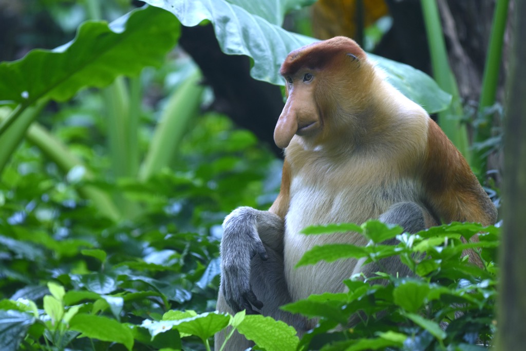
We normally think of peat bogs as cold places in northern Europe or Canada, and it’s unusual to see them in the tropics. However, peat and lowland rainforests cover most of Borneo. They have the richest biodiversity and support thousands of plants, including around 2,000 species of orchids and 3,000 trees. They’re home to many mammals, especially primates, like the slow loris and proboscis monkey.
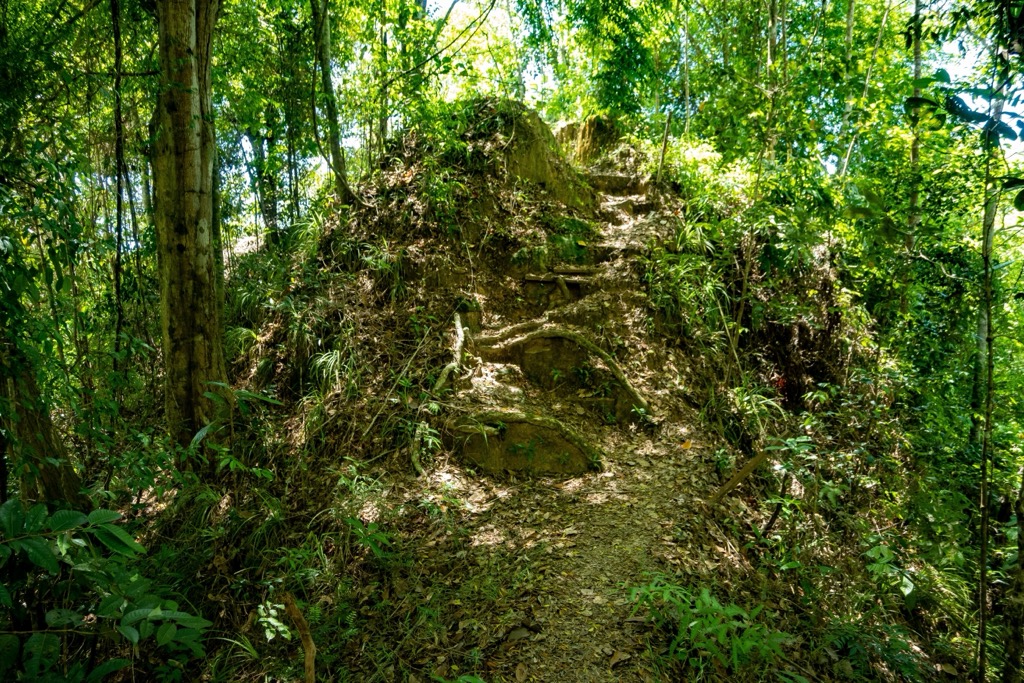
Ulu Temburong National Park is one of the best-preserved pieces of the Borneo montane rainforest. These areas are more upland and also cover a considerable area. If you want to see the beauty of a pristine jungle, visiting the park is a must.
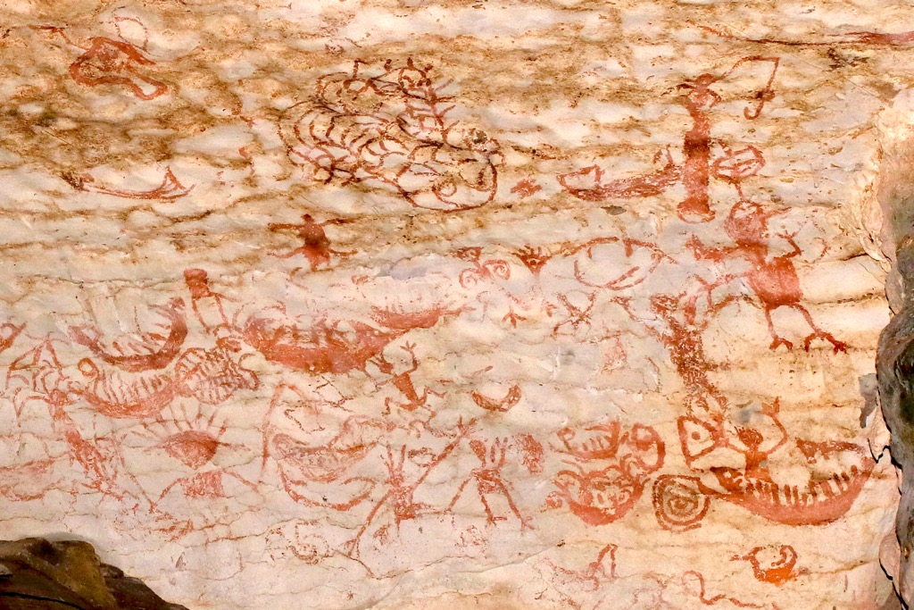
Humans first set up shop in Borneo around 40,000 years ago. Niah Cave in Sarawak, Malaysia, shows evidence of habitation by multiple human cultures over 30,000 years. At the time, Brunei was still connected to the mainland of Southeast Asia.
As sea levels rose and Borneo became an island, the Austronesians living there developed agriculture and technology. They also participated in a substantial sea-based trade route that transported jade, camphor, and spices.
Around the 14th century, Chinese settlers moved in and began harvesting bird nests, shark fins, and pearls. Harvesting nests from cave-dwelling birds to make bird nest soup is still very much alive in Borneo, as is shark hunting for shark fin soup. Both are controversial for ecological reasons.
In the late 1400s, the King of Brunei converted to Islam and declared independence from the Majapahit, a Hindu-Buddhist empire that controlled most of the Malay Archipelago. The country is still a Sunni Muslim monarchy governed by a sultan.
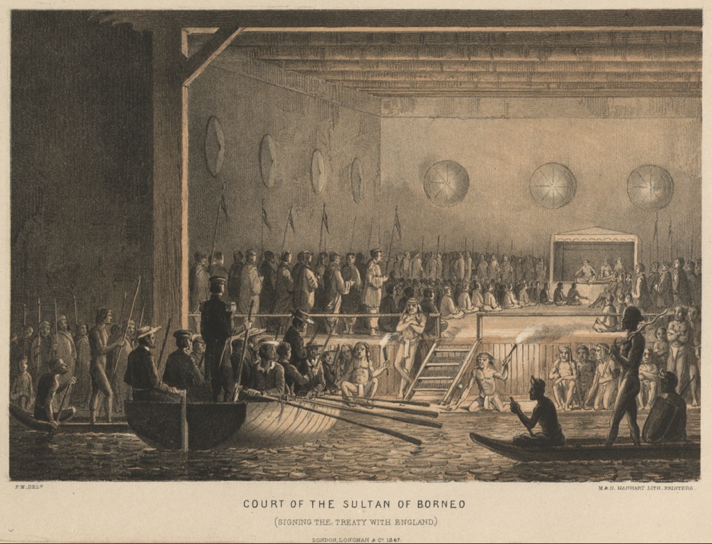
In the early 1500s, Magellan became the first outsider to visit Borneo. From that point forward, Brunei had a long period of conflict with European powers. They warred with the Spanish and were occupied and controlled by the British. During World War II, the Japanese occupied Brunei. After the war, Great Britain took over again. The Bruneians struggled for independence until 1984 when they finally became their own nation.
Since then, Brunei’s oil and gas resources have significantly raised the standard of living. Today, the country is industrialized and has Southeast Asia's second-highest standard of living (HDI) after Singapore.
Typically, people only visit Brunei if they are on a quest to see every country. It doesn’t stand out much compared to Malaysia and Indonesia. But that doesn’t mean it’s a waste of time. Some of the best-preserved natural landscapes in Borneo are in Brunei’s mountain rainforests. Meanwhile, there are plenty of good short walks in the coastal jungle around the capital city.
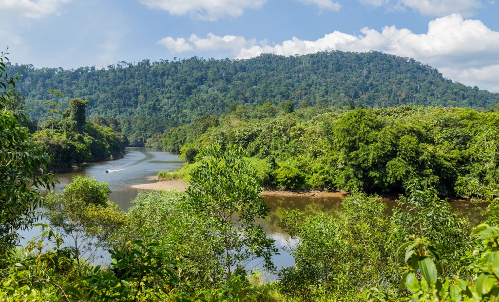
Ulu Temburong is the best destination in Brunei. The park makes up about half of the Temburong District, Brunei’s eastern arm. But, because Brunei’s tourism industry is pretty small, you have limited options for actually seeing it.
Until 2020, Ulu Ulu Resort, on the edge of the park, was the main jumping-off point for Ulu Temburong. It was a great way to access the park’s interior. But it’s shut down now, so logistics are a little trickier.

You can visit the park without a guide, but getting there involves traveling along the river deep into the jungle. If you want to see the park independently, it will take some daring (and probably some local help). Otherwise, the best move is to take a guided tour.
Just getting to the park takes some adventure. First, you’ll hop on a speedboat from Bandar Seri Begawan, the capital, up the Temburong River to Bangar. From here, you can take a taxi or bus to Batang Duri.
The next step is a longboat journey up the Temburong and Belalong Rivers into the park's wilderness. Ulu Temburong is a deep wilderness with no roads and just a few trails. Traveling by river is the most feasible way to see the country's interior.
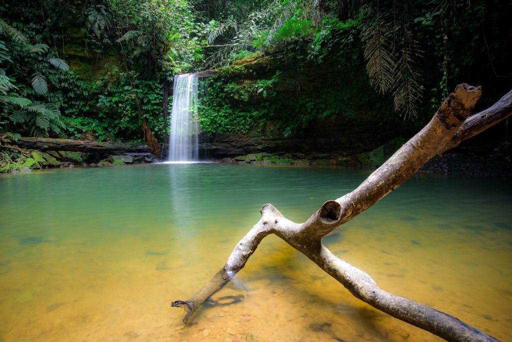
One of the only accessible trails in the park starts at the old Ulu Ulu Resort. From here, you can trek into the jungle about 8 km (5 mi) over a mostly flat trail to a waterfall overlook above the Temburong River. This is a good plan if you’re not going with a guide. You won’t need to take the river; just get a taxi to take you up the road to the trailhead.
Most visitors stick around Bandar Seri Begawan, Brunei’s capital. The city is surrounded by lush jungle with lots of short trails. Just north of the city center, you can find Tasek Lama, a sweeping hilly park with a waterfall. Take a taxi to the parking area and head uphill. A few branching trails into the park cover 15 km (9 mi) or so.
As I mentioned, Brunei is full of caves. And two of them are close to Bandar Seri Begawan. One is Gua Haimau – Tiger Cave. The trailhead is about 15 minutes southwest of the city center in Taman Rekreasi Bukit Dedap Park. The other is Gua Radat, about 30 minutes northeast, in Bukit Tempayan Pisang Park, right next to Serasa Beach.
Because of how close it is, it’s worth talking about Mount Kinabalu. It’s one of the best hikes in Southeast Asia and the only summit of its kind anywhere near Brunei. You simply don’t find steep, exposed peaks like this in the rolling jungle hills in the Malay Archipelago.
For starters, you’ve got to get there. Kota Kinabalu International Airport is about 40 minutes by plane from Bandar Seri Begawan. You can also drive, taking the bridge to Temburong and crossing into Malaysia at Mengkalap. Border crossings between Brunei and Malaysia are pretty straightforward, and both countries typically honor a 90-day stay without an extra visa for tourists. From there, head north to Kota Kinabalu.
Next, you’ll need a guide and a permit. Solo climbing is illegal despite the trail being well-marked and requiring no technical skills. You won’t regret spending the money– the weather is notoriously fickle, and having a local along helps a lot with finding the right weather window. The permit is 400 RM (Malaysian Ringgit), or about 86€.
The climb (hike) is a serious effort. The distance is manageable, but the elevation gain is intense. From the trailhead, the route gains 2,438 m (8,000 ft) in 11.1 km (6.9 mi). That kind of elevation in a single push puts you at risk of developing altitude sickness, especially if you’re coming from sea level.
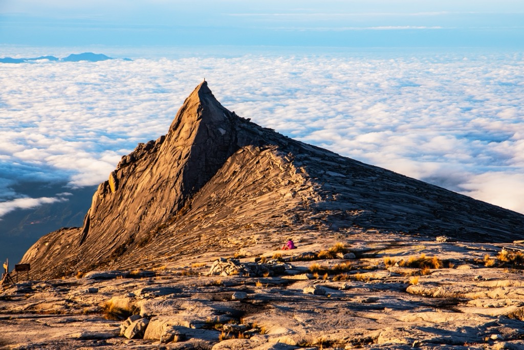
Therefore, hikers typically split the vertical into two pushes over a day and a half to three days. The first six kilometers, mostly intense stairs, end at Panalaban Refuge. From there, you will rest and acclimatize. The summit push is physically challenging but non-technical. The guides maintain fixed hand lines to help with steep spots. The elevation is grueling but well worth the effort.
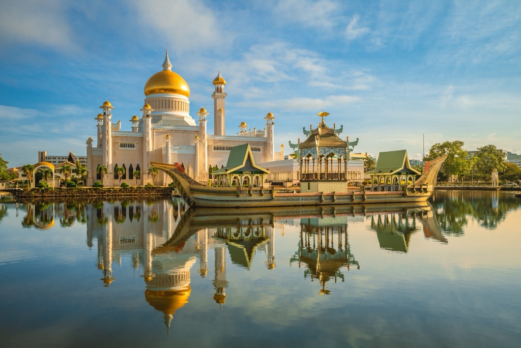
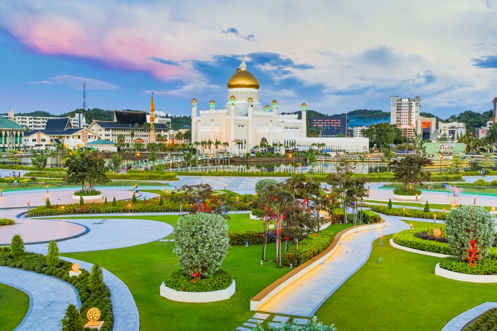
Bandar Seri Begawan (BSB) is Brunei's capital and largest city. It’s not exactly a megacity, with a population of just 100,000. But you can experience just about all the culture that Brunei has to offer here.
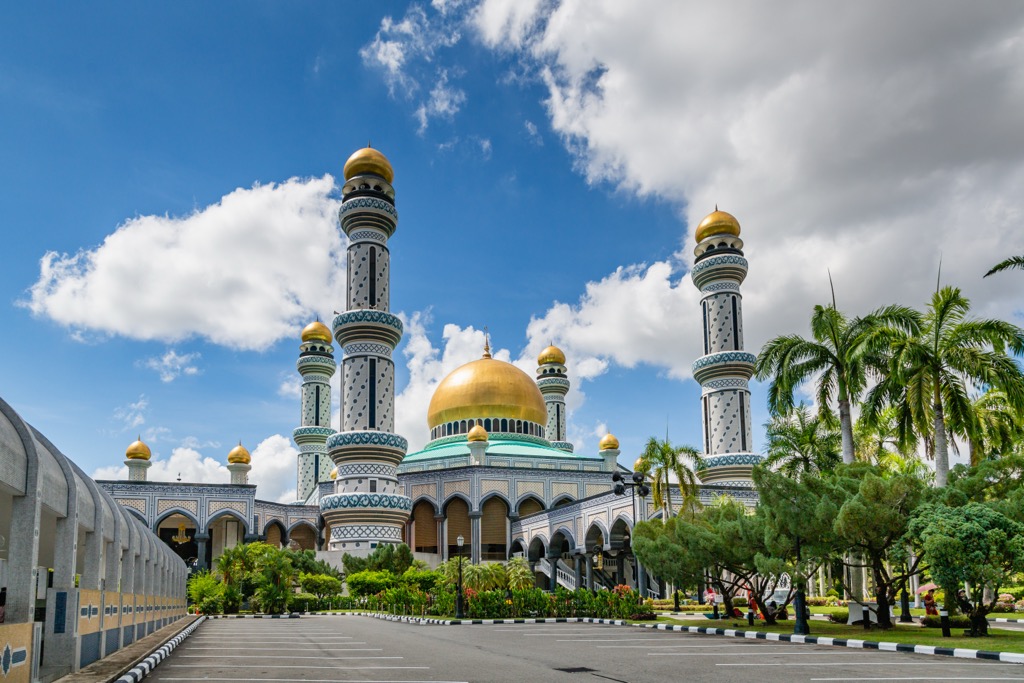
The main stop for most tourists is Jame’ Asr Hassanil Bolkiah Mosque, Brunei’s “postcard” attraction. It’s a magnificent mosque, decorated with gold and mosaic tiling. The Omar Ali Saifuddien Mosque is also a centerpiece of the city.
The other must-see Bruneian cultural oddity is ambuyat, the national dish. It’s a starchy powder made from the interior of a palm tree. Mixed with water, it becomes a gluey consistency. It’s not much to write home about on its own, but it makes a great vehicle for spicy sauce.


