Santanoni is also the name of the Santanoni Preserve, the 13,000-acre (53 km2) once-private preserve that contained Santanoni Peak.
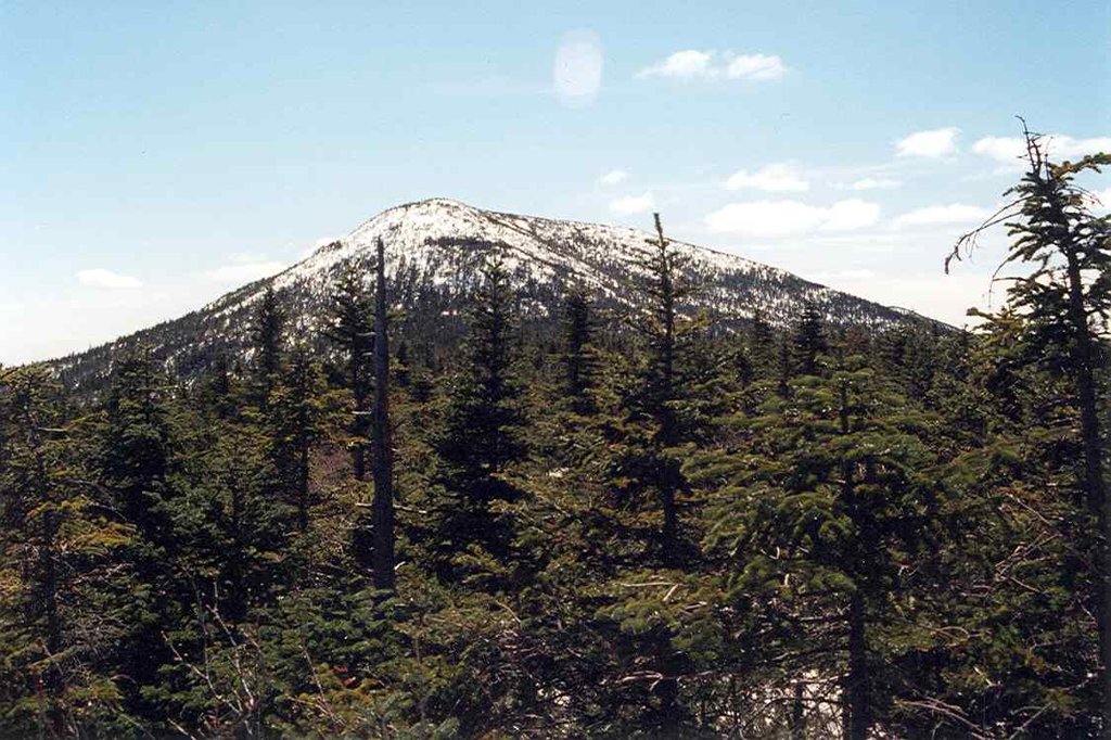
Santanoni Peak is a mountain located in Essex County, New York. The mountain is part of the Santanoni Mountains of the Adirondacks. The mountain's name is believed to be an Abenaki derivative of "Saint Anthony"; the first French fur traders and missionaries having named the area for Saint Anthony of Padua. Santanoni Peak is flanked to the north by Panther Peak, and to the southwest by Little Santanoni Mountain.
The east slopes of Santanoni Peak drain into the eastern Santanoni Brook, thence into Henderson Lake, the source of the Hudson River, and into New York Bay. The south end of Santanoni Peak drains into the southern Santanoni Brook, thence into Newcomb Lake, the Newcomb River, and the Hudson River. The southwest side of Santanoni drains into Ermine Brook, thence into Moose Creek, the Cold River, the Raquette River, the Saint Lawrence River in Canada, and into the Gulf of Saint Lawrence. The west slopes of Santanoni drain into Calahan Brook, thence into Moose Creek.
Santanoni Peak is within the High Peaks Wilderness Area of New York's Adirondack Park.
There's a hiking trail (T2) called Santanoni Trail leading to the summit. Santanoni Peak is one of the 1 peaks along the Santanoni Trail.
By elevation Santanoni Peak is
# 21 out of 1601 in Adirondack Park # 21 out of 3825 in New York # 19 out of 126 in High Peaks Wilderness # 21 out of 591 in Essex County # 1 out of 5 in the Santanoni Mountains # 21 out of 1678 in the Adirondack Mountains
By prominence Santanoni Peak is
# 5 out of 1601 in Adirondack Park # 6 out of 3825 in New York # 3 out of 126 in High Peaks Wilderness # 5 out of 591 in Essex County # 1 out of 5 in the Santanoni Mountains # 5 out of 1678 in the Adirondack Mountains
We use GPS information embedded into the photo when it is available.
3D mountains overlay
Adjust mountain panorama to perfectly match your photos because recorded by camera photo position might be imprecise.
Move tool
Rotate tool
Zoom
More customization
Choose which peak labels should make into the final photo and what photo title should be.
Next
Photo Location
Satellitte
Flat map
Relief map
Latitude
Longitude
Altitude
OR
Latitude
°'''
Longitude
°'''
Apply
Register Peak
Peak Name
Latitude
Longitude
Altitude
Register
Teleport
PeakVisor
This 3D model of Sagarmatha National Park in Nepal was made using the PeakVisor app topographic data. The mobile app features higher precision models worldwide, more topographic details, and works offline. Download PeakVisor maps today.
Download OBJ model
PeakVisor
The download should start shortly. If you find it useful please consider supporting the PeakVisor app.
PeakVisor for iOS and Android
Be a superhero of outdoor navigation with state-of-the-art 3D maps and mountain identification in the palm of your hand!