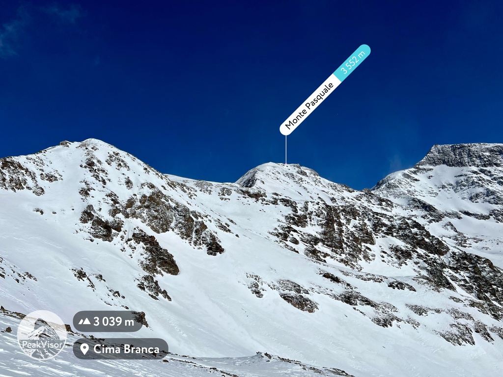
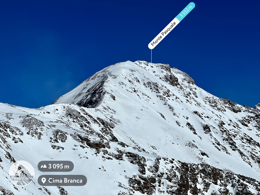
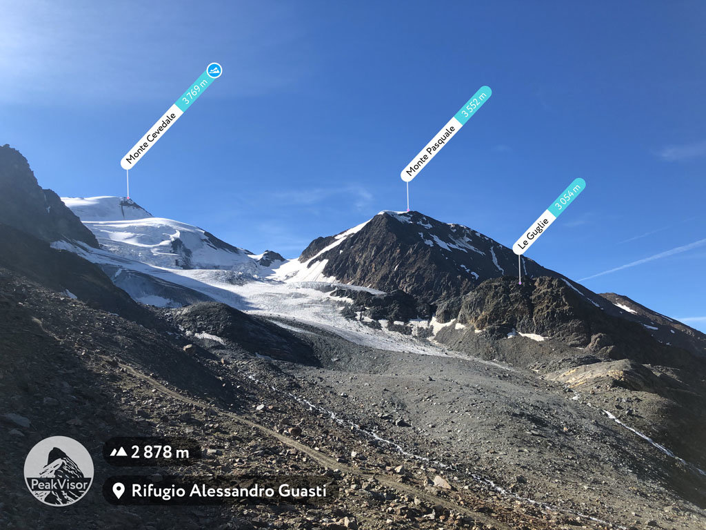
At an elevation of 3,552 m (11,654 ft.), and with a prominence of 136 m (446 ft.), Monte Pasquale forms part of the Southern Rhaetian Alps. It is located close to the town of Sondrio, in the province of Sondrio, in Lombardy, Italy.
Monte Pasquale is entirely surrounded by glaciers. To the north, hikers will be able to see the Vedretta di Cedèc and to the south, Vedretta del Rosole. To the west, the terrain slopes down to the Valle di Cedèc. The nearest town is the winter resort of Santa Caterina Valfurva.
Hikers interested in climbing Monte Pasquale can start their journey from Albergo dei Forni. (Travelers who choose to start from Santa Caterina Valfurva will have to drive along a toll road.) The most straightforward approach used to be from the north wall; however, the gradual melting of glaciers has created a hiking trail. Hikers still need to carry crampons in case of ice on the higher reaches.
Today, the regular route is over the east ridge. Rifugio Branca and Rifugio Gianni Casati give some respite on the way up. Toll costs average between €3.00 for 24 hours and €5.00 for 48 hours. The road is narrow but paved, and at the end, there is ample parking space.
Upon leaving the car park, visitors can reach Rifugio Branca by crossing the high or low glaciological path or the service road. The low glaciological track offers the most panoramic views over the Tibetan-style bridges.
The nearest mountain hut is Bivacco Colombo located 1 911m/6 271ft SE of the summit.
By elevation Monte Pasquale is
# 20 out of 425 in the Ortler Alps # 21 out of 1160 in the Southern Rhaetian Alps # 20 out of 370 in Parco Nazionale dello Stelvio - Nationalpark Stilfser Joch # 37 out of 3401 in Lombardy # 37 out of 973 in Sondrio
By prominence Monte Pasquale is
# 83 out of 425 in the Ortler Alps # 77 out of 370 in Parco Nazionale dello Stelvio - Nationalpark Stilfser Joch
We use GPS information embedded into the photo when it is available.
3D mountains overlay
Adjust mountain panorama to perfectly match your photos because recorded by camera photo position might be imprecise.
Move tool
Rotate tool
Zoom
More customization
Choose which peak labels should make into the final photo and what photo title should be.
Next
Photo Location
Satellitte
Flat map
Relief map
Latitude
Longitude
Altitude
OR
Latitude
°'''
Longitude
°'''
Apply
Register Peak
Peak Name
Latitude
Longitude
Altitude
Register
Teleport
PeakVisor
This 3D model of Sagarmatha National Park in Nepal was made using the PeakVisor app topographic data. The mobile app features higher precision models worldwide, more topographic details, and works offline. Download PeakVisor maps today.
Download OBJ model
PeakVisor
The download should start shortly. If you find it useful please consider supporting the PeakVisor app.
PeakVisor for iOS and Android
Be a superhero of outdoor navigation with state-of-the-art 3D maps and mountain identification in the palm of your hand!