
Fresh snow · last 24 h
30cm
Veny Valley · upper slopes
November 19 Snow Report
Good evening! Here is the outlook for tomorrow, Friday 20 November: tonight and tomorrow keep the snow tap open in the western Alps, with the strongest totals gathering from Aosta Valley to Lower Valais and the Northern French Alps.
Mountain intelligence by PeakVisor
The big picture
Archived data · Nov 19, 08:00 PM GMT+1
30cm
Veny Valley · upper slopes
35cm
Emosson · upper slopes
9%open
14 with lifts running · 5 without live lift data · Status for Nov 20
100km/h
Türnitzer Alpen · Nov 20, 04:00 AM GMT+1
Snow, across the mountains
Loading regional snow map…
Nov 12, 07:00 PM GMT+1 – Nov 19, 07:00 PM GMT+1
Regional upper-slope model values. Select an area for its outlook. Values vary with elevation.
Snowfall is modeled, not a station measurement. Compare elevation, wind and the current official bulletin before choosing your mountain day.
Methods & sourcesReport for November 19
Forecast valid for Friday, November 20
Published Nov 19, 08:16 PM GMT+1
Good evening! Here is the outlook for tomorrow, Friday 20 November: tonight and tomorrow keep the snow tap open in the western Alps, with the strongest totals gathering from Aosta Valley to Lower Valais and the Northern French Alps.
The freshest 24 hours were led by Veny Valley in Aosta Valley with 30 cm, closely followed by La Thuile Valley and Mont-Blanc at about 30 cm. Over the last 3 days, Veny Valley reached 75 cm, La Thuile Valley 72 cm, while Mont-Blanc reached 67 cm and Génépi 64 cm. It stayed dry in Ligurian Alps in the western Alps and Lower Austria in the eastern Alps, with only light totals for many areas away from the main snow stream.
Tonight into tomorrow, the pulse keeps rolling: Veny Valley is on for 38 cm, Emosson 35 cm, and Mont-Blanc 34 cm in the next 24 hours. Across the next 2 days, Aosta Valley, Lower Valais, Bernese Oberland and Vorarlberg all top out around 35 cm. Snow falls down to around 1,600 m in Emosson, around 1,800 m in Mont-Blanc, and around 2,300 m in Veny Valley. Lombardy, Moesano, Friuli, Ligurian Alps, Slovenia, Trentino and Veneto stay dry.
A small but tasty early-season menu: 28 resorts are in season, with 14 reporting lifts running. Zermatt has 7 lifts running, 24 cm from the last 3 days and about 90 cm of snow on its slopes; Cervinia also has 7 lifts, 25 cm fresh over 3 days and about 85 cm on its slopes. Les Diablerets is snowy too, but note high, level 4 of 5 avalanche danger and 67 km/h ridge wind. Opening soon: Val Thorens, Tignes and Val d'Anniviers on Saturday 21 November.
For tomorrow, Friday 20 November, the official danger reaches high, level 4 of 5, in 9 rated regions: mainly Lower Valais, plus Bex-Villars in Vaud and Fribourg Alps and Wildhorn in Bernese Oberland. Considerable, level 3 of 5, is widespread across 81 regions; moderate, level 2, and low, level 1, also appear. No rating yet from Italy, Austria, Germany or Slovenia. Strong ridge winds blow in Lower Austria, Bavaria, Aosta Valley and Vorarlberg. Fresh snow and drifting snow can make off-piste and touring terrain more dangerous, so read the local avalanche bulletin before leaving groomed runs.
Sleep well, wax lightly, and choose terrain with care tomorrow.
Snow depth is modeled on ski slopes. Check the resort’s own snow report for measurements. Report text, maps and lift information carry their own publication and update times.
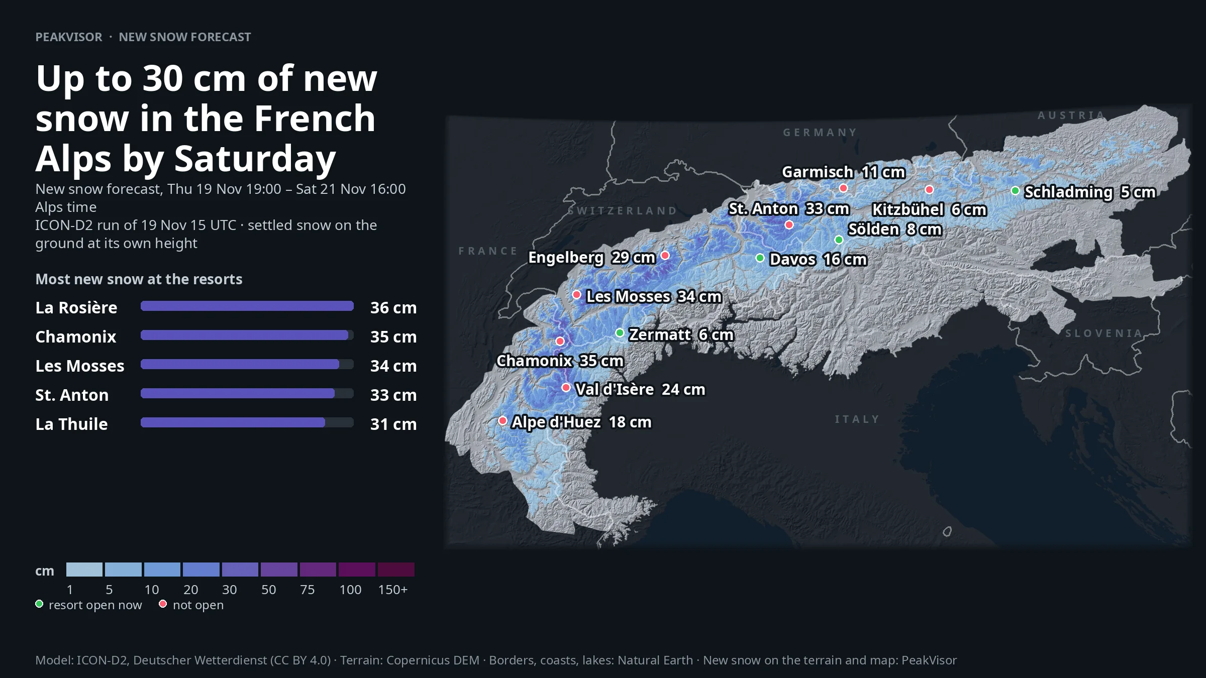
The forecast, mapped
New snow forecast, Thu 19 Nov 19:00 – Sat 21 Nov 16:00 Alps time · ICON-D2 run of 19 Nov 15 UTC · settled snow on the ground at its own height
Find your corner of winter
Follow the fresh snow or look at what’s coming next.
8 of 422 regions
From snowfall to ski day
Season dates are a starting point. Check the resort’s latest opening and lift information.
| Resort | Last 3 days | Next 48 h | Snow depth (model) | Lifts reported | Season / status |
|---|---|---|---|---|---|
| Les DiableretsBex-Villars | 33 cm | 31 cm | 47 cm | 2 / 45Nov 19, 07:55 PM GMT+1 | Lifts runningResort’s latest report |
| VerbierMartigny-Verbier | 27 cm | 14 cm | 56 cm | 1 / 27Nov 19, 07:38 PM GMT+1 | Lifts runningResort’s latest report |
| CerviniaCervinia and Upper Valpelline Valley | 25 cm | 6 cm | 85 cm | 7 / 15Nov 19, 07:03 PM GMT+1 | Lifts runningResort’s latest report |
| ZermattZermatt | 24 cm | 6 cm | 89 cm | 7 / 38Nov 19, 07:07 PM GMT+1 | Lifts runningResort’s latest report |
| GstaadGstaad | 12 cm | 24 cm | 24 cm | Not reported | Lift status unknownResort’s latest report |
| Andermattnördliches Tujetsch | 12 cm | 14 cm | 26 cm | Not reported | Lift status unknownResort’s latest report |
| KaunertalKauner Ridge | 9 cm | 9 cm | 54 cm | 4 / 13Nov 19, 07:20 PM GMT+1 | Lifts runningResort’s latest report |
| SoldaOrtler Range | 8 cm | 0 cm | 66 cm | 4 / 10Nov 19, 07:23 PM GMT+1 | Lifts runningResort’s latest report |
| DavosDavos | 8 cm | 16 cm | 17 cm | 5 / 67Nov 19, 07:38 PM GMT+1 | Lifts runningResort’s latest report |
| PitztalKauner Ridge | 7 cm | 7 cm | 80 cm | 3 / 21Nov 19, 06:58 PM GMT+1 | Lifts runningResort’s latest report |
10 of 19 resorts · Status for Nov 20. Open resorts are in season and not known to be closed. Snow depth is modeled on ski slopes. Lift reports have their own update times.
See the snow. Know the mountain.
Take a closer look with PeakVisor. Explore terrain in 3D, find ski routes and keep your mountain maps with you offline.
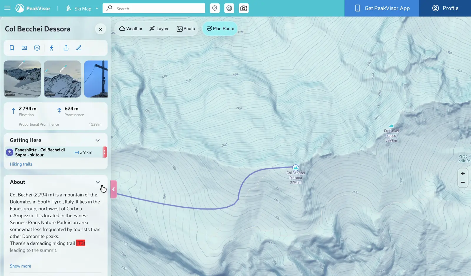 More perspective for your next adventure.
A clearer picture
New snowfall comes from weather models. Snow depth combines the model snowpack with weather station measurements. Regional snowfall summaries represent the 90th percentile over open ground; resort summaries use the 90th percentile over their slopes. Regional depth ranges cover the 10th–95th percentiles of snow-covered ground; the depth map shows the maximum. These are not village or base-station readings.
PeakVisor’s snow maps also combine Sentinel-2 satellite imagery, webcams and weather stations. Snow cover tells us where snow lies. It is a different measurement from snowfall or snow depth.
Danger ratings come from the responsible forecasting services and carry their own validity date. No rating means no published rating for that place and date. Read the full bulletin before leaving groomed runs.
Original snow data for the report dated November 19. Set 202611191858. Data times are shown in your local time zone.
Snow maps: PeakVisor (snowsense) New snow and snow depth: ICON-D2, Deutscher Wetterdienst (open data, CC BY 4.0), modified; before 9 Nov 2026 ECMWF IFS open data (CC BY 4.0), modified; scaled to the weather stations Snow cover: contains modified Copernicus Sentinel-2 data 2026; webcams of Panomax GmbH, feratel media technologies AG (www.feratel.com) and foto-webcam.eu and the cameras official resort and tourist-office pages embed; weather and avalanche service stations Avalanche danger: the EAWS member services, via avalanche.report 0 °C level and wind: ICON-D2, Deutscher Wetterdienst (open data, CC BY 4.0) Micro-regions: EAWS (regions.avalanches.org)
Snowfall totals come from weather models scaled to weather station data. Regional summaries use the 90th percentile over open ground; resort summaries use the 90th percentile over their slopes. They describe upper-slope conditions, not a station reading at your exact location.
The report shows the source data’s update time. While the page is visible, the interactive view checks for new data every 30 minutes. Source availability varies; if a refresh fails, the last available data stays visible with its original timestamp.
Yes. Dated reports keep the source snapshot and forecast window from their edition. They describe the outlook at publication, not today’s conditions. Open the latest report for current data.