
Fresh snow · last 24 h
22cm
Trollheimen · upper slopes
November 21 Snow Report
Good evening! Here is the outlook for tomorrow, Sunday 22 November: Northern Norway is the clear focus for new snow, while most other areas see only small additions or little at all.
Mountain intelligence by PeakVisor
Archived data · Nov 21, 07:54 PM GMT+1
22cm
Trollheimen · upper slopes
Near sea level
Finnmarkskysten · Lowest estimate across regions with data
26cm
Trollheimen · upper slopes
Loading regional snow map…
Nov 14, 07:00 AM GMT+1 – Nov 21, 07:00 AM GMT+1
Regional upper-slope model values. Select an area for its outlook. Values vary with elevation.
Natural Earth · Terrain Tiles, © Kartverket, Copernicus EU-DEM
Recent snowfall and depth come from the seNorge analysis, with MEPS filling gaps. The daily analysis ends at 06:00 UTC. Snowfall forecasts use MEPS.
Methods & sourcesForecast valid for Sunday, November 22
Published Nov 21, 08:28 PM GMT+1
Good evening! Here is the outlook for tomorrow, Sunday 22 November: Northern Norway is the clear focus for new snow, while most other areas see only small additions or little at all.
In the observed snow from Friday morning to Saturday morning, Trollheimen had the biggest fresh fall with up to 22 cm, ahead of Tromsø with 18 cm and Romsdal with 17 cm. Over the last 3 days, Trollheimen also led with 26 cm; Eastern Norway and Swedish Lapland stayed dry. The deepest modelled snow on resort slopes is at Røldal with 48 cm, Tromsø Alpinpark with 40 cm and Riksgränsen with 36 cm.
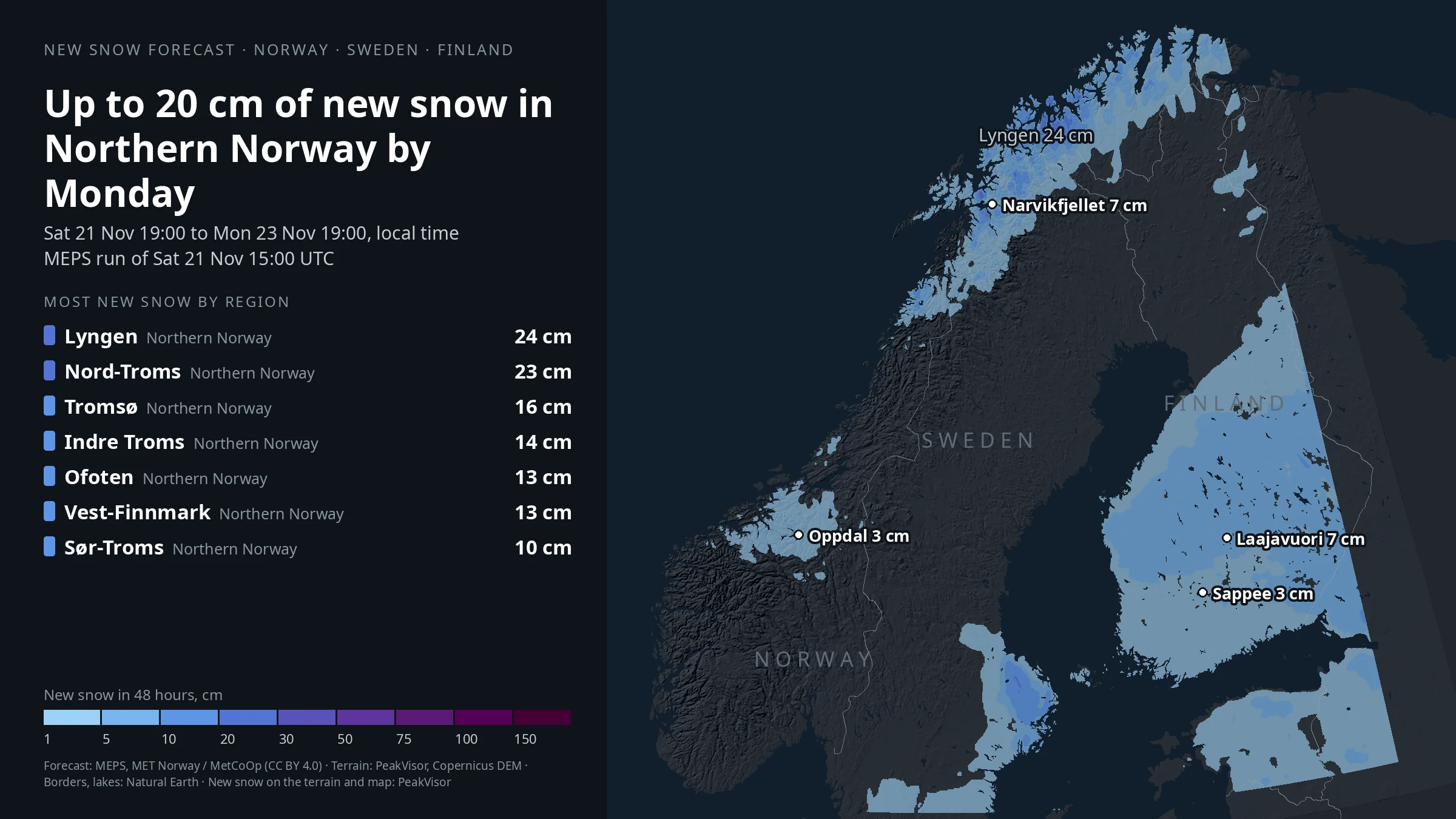
From Saturday evening to Sunday evening, the strongest forecast totals are in Northern Norway, with up to 18 cm on the higher slopes in both Lyngen and Nord-Troms. By Monday evening, Lyngen is still on top with up to 24 cm, just ahead of Nord-Troms on 23 cm; Tromsø follows with about 16 cm, then Indre Troms with 14 cm and Ofoten and Vest-Finnmark around 13 cm. Elsewhere it is much lighter: up to 8 cm in Southern Finland, 7 cm in Swedish Lapland, 5 cm in Central Norway, 4 cm in Western Norway and Northern Finland. Little or none falls in Eastern Norway and Central Sweden.
For tomorrow, Sunday 22 November, no service has published an official avalanche danger level yet. Before heading out, read the local avalanche bulletin from Varsom in Norway, Lavinprognoser in Sweden or FMI in Finland.
Enjoy the snow, and choose your plans with care.
Snow depth is modeled on ski slopes. Check the resort’s own snow report for measurements. Report text, maps and lift information carry their own publication and update times.
–
Loading regional snow map…
From Saturday evening to Sunday evening, the strongest forecast totals are in Northern Norway, with up to 18 cm on the higher slopes in both Lyngen and Nord-Troms. By Monday evening, Lyngen is still on top with up to 24 cm, just ahead of Nord-Troms on 23 cm; Tromsø follows with about 16 cm, then Indre Troms with 14 cm and Ofoten and Vest-Finnmark around 13 cm. Elsewhere it is much lighter: up to 8 cm in Southern Finland, 7 cm in Swedish Lapland, 5 cm in Central Norway, 4 cm in Western Norway and Northern Finland. Little or none falls in Eastern Norway and Central Sweden.
8 of 70 regions
| Resort | Last 3 days | Snow depth (model) |
|---|---|---|
| Ørskogfjell SkisenterRomsdal | 16 cm | 26 cm |
| Tromsø AlpinparkTromsø | 15 cm | 40 cm |
| FjellheisenTromsø | 15 cm | 37 cm |
| OppdalTrollheimen | 10 cm | 13 cm |
| Hassela Ski Resort ABHassela Ski Resort AB | 9 cm | 17 cm |
| YllasYlläs-Levi | 8 cm | 11 cm |
| Pyhä Ski ResortLuosto-Pyhä | 8 cm | 24 cm |
| Harpefossen SkisenterIndre Fjordane | 8 cm | 41 cm |
| LaajavuoriLaajavuori | 8 cm | 3 cm |
| LeviYlläs-Levi | 8 cm | 11 cm |
10 of 77 resorts · Modeled snow along the lifts
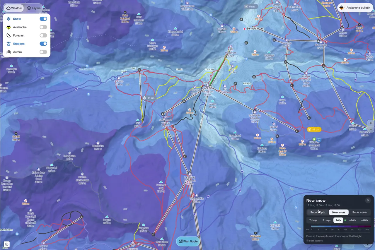
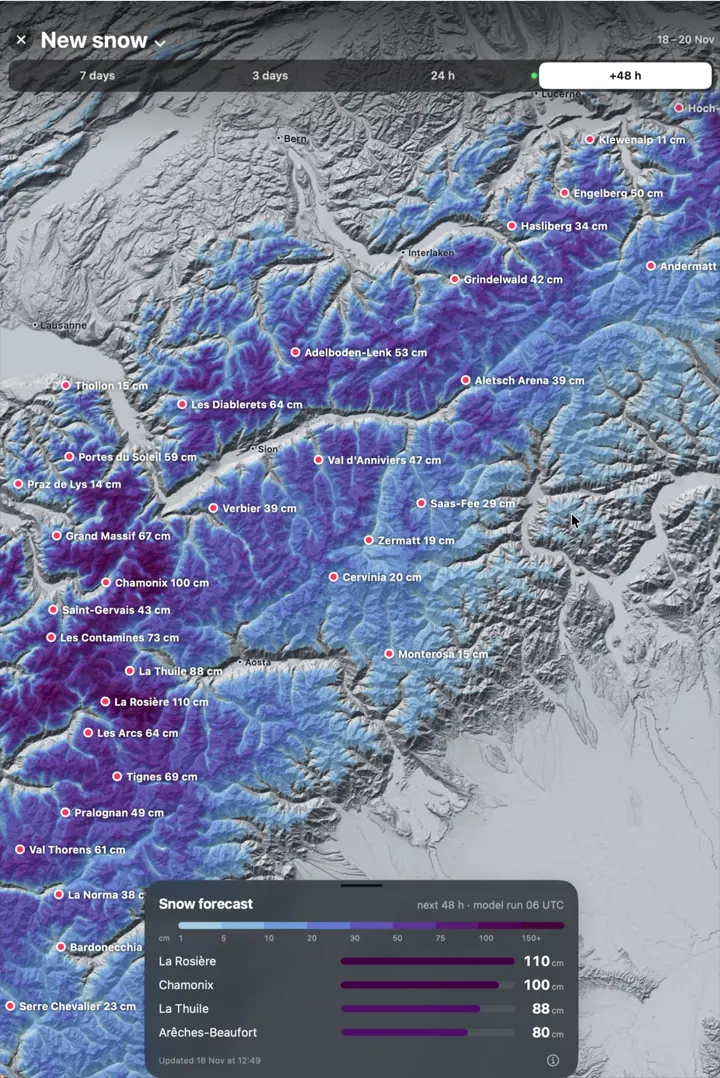
Take a closer look with PeakVisor. Explore terrain in 3D, find ski routes and keep your mountain maps with you offline.
Import a ski touring GPX into your PeakVisor profile to see the route in 3D. Public routes can also be shared as interactive 3D widgets.
Original snow data for the report dated November 21. Set 202611211854. Data times are shown in your local time zone.
Snow maps: PeakVisor (snowsense) Snow model: seNorge, NVE / MET Norway (NLOD / CC BY 4.0); MEPS, MET Norway / MetCoOp (NLOD / CC BY 4.0) Snow cover: Copernicus Sentinel-2 data (ESA), processed by PeakVisor; webcams credited per camera Avalanche danger: Varsom (NVE), Lavinprognoser (Naturvardsverket), FMI, via avalanche.report
Recent snowfall, snow forecasts, modeled snow depth and official avalanche bulletin links for Norway, Sweden and Finland.
The snow report shows where snow lies and how much fell. Avalanches depend on how the snowpack has formed and changed. Use the full official avalanche bulletin for the danger rating and the avalanche problems, including affected slope directions and elevations where reported. Check its validity for the area and day of your tour.
Snowfall totals are weather-model estimates adjusted to station data. Regional snowfall uses the 90th percentile over open ground, and resort snowfall uses the 90th percentile over its slopes. “Snow cover from” is the modeled altitude where snow depth reaches 5 cm; local coverage varies. Labels and colors in the snow cover view show this altitude. In the snow depth view, labels show regional ranges from the 10th to 95th percentiles of snow-covered ground, and colors represent their upper end (95th percentile). Local maxima appear only in the region details. The resort’s official report is the source for a local base measurement when available.
PeakVisor publishes a daily briefing. The visible live page checks for newer snow data every two minutes and when you return to the tab. Conditions update independently of the written report and recording, which describe the data used at publication. Earlier reports keep their original data. If a refresh fails, the last available data remains visible with its original timestamp.
Yes. Each dated edition preserves its original source data and forecast window. Choose the latest report for current conditions.