Scan the QR code and open PeakVisor on your phone
The range runs by several names probably to scare away the faint-hearted and feeble-minded. Being located in Uzbekistan, the Zeravshan aka Zaravshan aka Zarafshon aka Zerafston Range has a traditional Uzbek name given by the River Zeravshan.
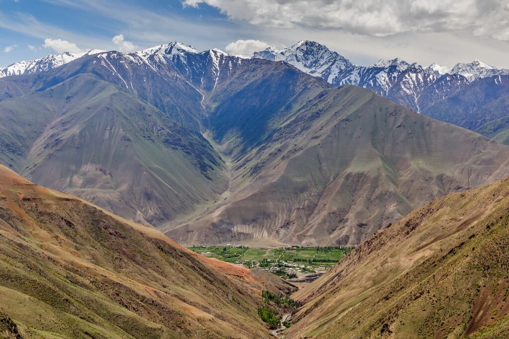
It stretches for 370 km in latitude direction along the south of Sogdiyskaya Region in Tajikistan where it reaches Mount Chimtarga (5,489m) in the central part. To the southwest of Penjikent, the range passes from Tajikistan to Uzbekistan, where it continues at declining altitudes along the inner border between Samarkand and Kashkadarian Regions where the range heights drop to 1500-2000 meters on average. The range finally subsides into a desert in the west of Samarkand city.
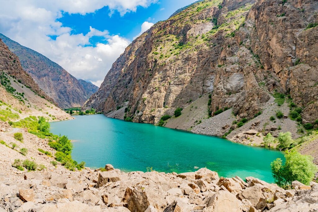
There are two other mountain ranges running from east to west parallel to the Zeravshan range. In the north, the Zeravshan valley stretches east for about 250 kilometers (160 miles) from Samarkand and separates the Zeravshan range from the Turkestan range. To the south, the Hisar Range runs parallel to the Zeravshan Range. To the west of Iskanderkul Lake, the Zeravshan Range and the Hissar Range are connected by the Fann Mountains which are assumed to be the highest part of both ranges, but it is a separate ridge.
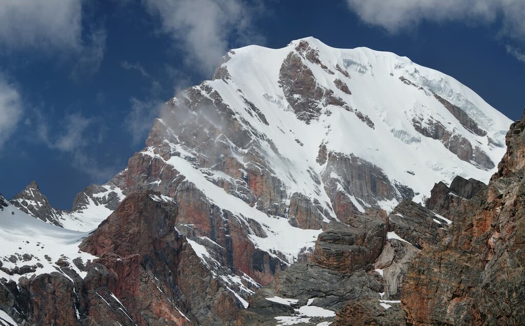
The average altitude is 4,110 m. Mount Chimtarga (5,489 m) is considered by many sources the highest point of the range, but it technically belongs to the Fann Mountains that connect the Zeravshan Range with the Hissor Range. Given that fact, it leaves MGU Peak (5,418m) the highest point of the Zeravshan Range per se.
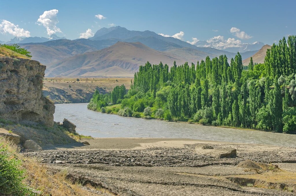
The northern slopes are traversed by numerous valleys formed by the left tributaries of the Zeravshan River, the southern slopes are poorly dissected with few spurs. In the east (up to the Fandarya River) there is a high-mountainous relief, in the west are the middle altitude mountains with karst forms of relief.
The snow line on the northern slope lies within 3400-4400 m a.s.l, on the southern slope it starts higher, at about 3600-4600 m. If the Fann Mountains are to be considered part of the bigger Zeravshan, we may safely say the Zeravshan enjoys well developed mountain hiking and climbing opportunities.
The Zeravshan Range slopes are covered with rare woodlands (mainly juniper), mountain steppes and alpine meadows. There are about 560 glaciers with a total area of 270 sq.km if you take the Fann Mountains into account. Yet, there are only 241 glaciers with a total area of 189.6 sq.km in the Zeravshan only.
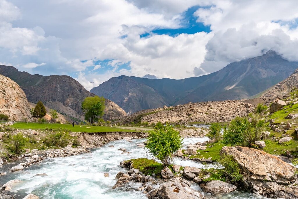
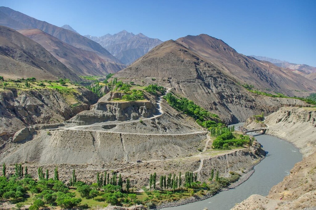
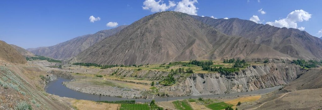
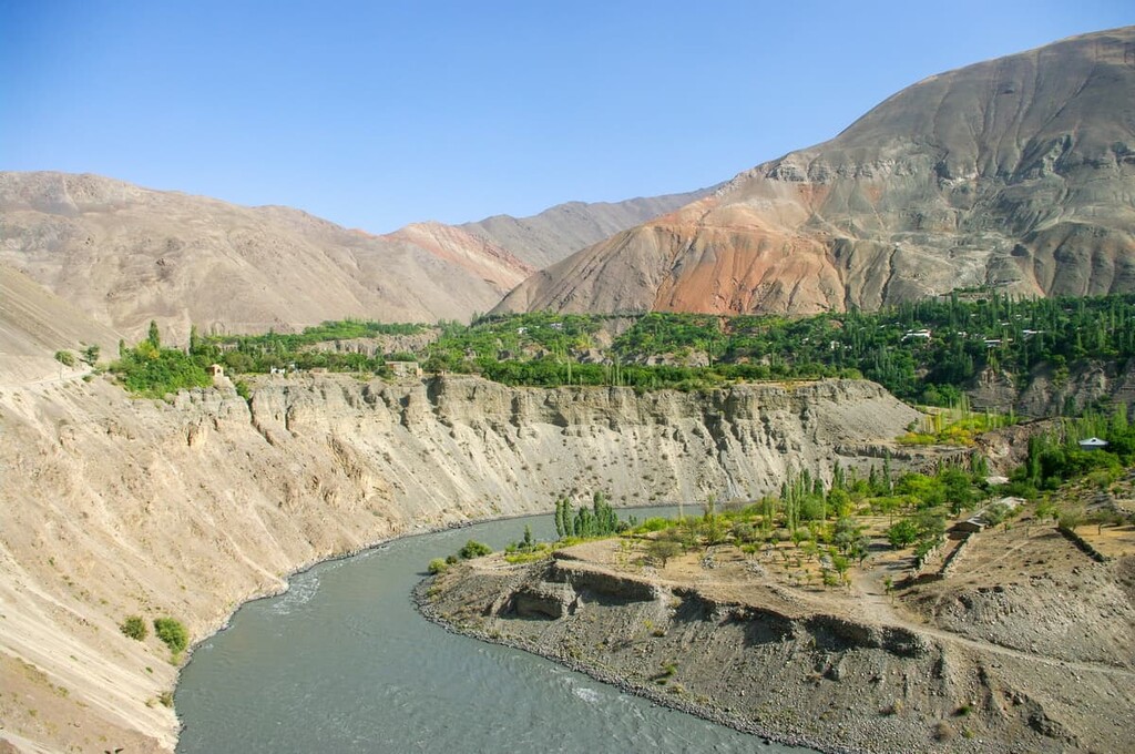
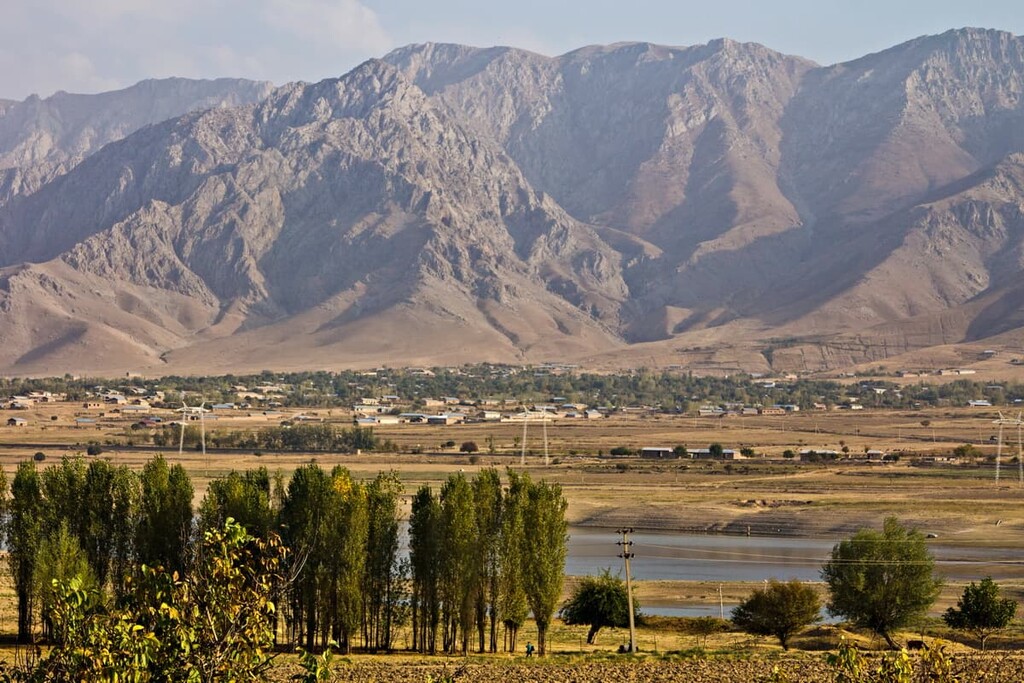
The center of the district is the valley of the Zeravshan River. The valley is densely populated and there is a road almost all the way up to the Zeravshan glacier. This road is the most convenient way to enter the area and access to the Turkestan and Zeravshan ridge. You can either travel from the south, from Dushanbe or from the north, from Khujand. Both of these options require passing through one pass Anzob and Shakhristan, respectively, are normally passable for the old Soviet four-wheelers called UAZ-loafers (Bukhanka) and take about 13-15 hours of driving. Both do not require border passes. In addition, the new road from the north through the Obburdon Pass also shortens the way, although it is a bit harder than the aforementioned. By the way, almost the entire length of the Zeravshan valley has cell phone service, electricity and stores.
The Zeravshan Range can also be accessed from the south from Dushanbe via Nawabad where the highway goes. However, the river valleys of the southern slope of the range are poorly explored.
There are about 130 passes; the most convenient automobile passes are Shakhristan and Anzob. Other passes include Akhba-Tavastfin, Akhba-Bevut, Akhba-Guzun, Akhba-Surkeltat, Darh Pass, Minora and Marda-Kishtige. Passes are rather high, e.g. the Kshtut Pass (3,550 m) or Mt. Chandara Pass (5,600 m), and Mt. Khazret Sultan Pass (4,600 m). The road connecting Dushanbe and Khujand runs along the ridge. The other road to Samarkand follows the Zarafshan River. Roads to secondary valleys, including the Yaghnob Valley, are mostly unpaved and in poor condition.
There are some short but difficult passes south to the Surkhob river valley from the headwaters of the Zeravshan glacier left tributaries. The most popular among tourists and well studied ones are through snow fields of the White / Bely, Nazar-Alyak II and Parak Glaciers. However, no less interesting in terms of sports mountain pass routes lie at the source of the glaciers Nazar-Ailyak I, Paran and Yarkhich, but they are not well studied yet.
The climate of the Zeravshan Range is rather peculiar, but typical for mountainous regions. The depressions and valleys are characterized by high temperatures which can rise up to 28°C (82F) in summer but never drop below 0 in winter. In January, it is relatively warm in the valleys, the minimum temperature is 1.5°C (35F). As the altitude increases it becomes cooler, at over 3,600 meters the weather remains cool - up to 13°C (55F) - even in July.
Precipitation falls most often on the windward side of the slopes. There may fall up to 2,000 mm per year. The mid-mountains receive almost no moisture, with less than 200 mm of precipitation per year, the climate is very arid there. The rainiest period is the end of spring spring - the beginning of summer. Nevertheless, precipitation is enough to feed the local rivers and lakes. Severe cold is noted in the highlands, where eternal glaciers and snow are located.
The mountaineering season is usually June to September, when the weather is stable, warm and dry.
The Zeravshan can be a good respite from the summer heat when the temperatures in midland Uzbekistan are over 40°C (104F) in the shade and never drop below 30°C (86F) at night. The locals call the hottest 40 days of the summer chillya.
The slopes of the mountains are usually covered by shrubs or tall grass, there grows archa, wormwood, and Pontic hawthorn. In contrast, river valleys enjoy rather dense forests, the largest wood areas are near the gorges. Many plants have successfully adapted to local conditions; the green cushions are formed in the highlands that can keep moisture and warm. In the lower reaches, where summer temperatures may be quite high, there usually grows needlewood. This helps to reduce the evaporation of liquid from the leaf's surface.
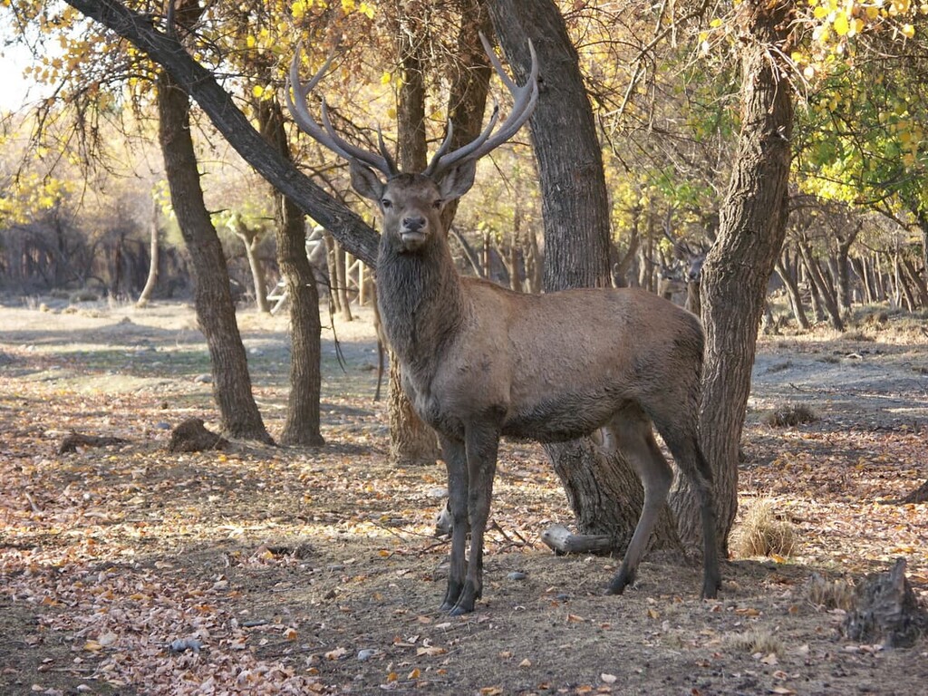
The animal world is impressive. Here lives the Siberian goat, ermine and brown bear. If you are lucky, you will spot an Asian leopard and Tibetan wolf, who’s become a rarity recently. Predators are hunting for gophers and hares and even mouflons (a species of wild sheep Ovis musimon) who are capable of climbing to great heights to escape from predators. If you are travelling in a valley or a gorge, beware of snakes, many of whom are poisonous. Among birds, the most common is mountain partridge.
The Zeravshan Range is crossed in a meridional direction by three rivers: the Fan Darya, the Kashtutu Darya, and the Magian Darya, which flow northward and are left tributaries of the Zeravshan river. The Fan Darya makes a gorge that crosses the ridge.
The Zeravshan River originates from the Zeravshan glacier and has a long history. The first settlements on its banks date back to 4-2 millennium BC. It is established that people lived here in the Neolithic period. The writer Quintus Curtius Rufus, famous in the Roman Empire, wrote about the river. Its gifts were used for irrigation, now the river is of great economic importance.
Water in the region is valuable and is used for irrigation - the developed irrigation system includes 85 main canals with a total length of 2,530 kilometers.
A part of the Zeravshan Range to the east of the Fan Darya River is known as the Matcha Range. It is about 5 km high, and to the east it is connected with the Alai and Turkestan Ranges. At this point (the Matcha Mountains) is the Zarafshan Glacier (24.75 km long), one of the longest glaciers in Central Asia. The northern slopes of the Matcha Ridge are relatively gentle and descend toward Zeravshan , while the southern slopes descend sharply into the valley of the Yaghnob River.
The vicinity of the flamboyant and bustling green Fann Mountains might be very misleading. The Zeravshan Range is quite the opposite. It appears harsh and cold, but most importantly, it is greatly underexplored. It is here that you can feel the true sense of adventure since the area has seen very few tourists and alpine groups in the last 20 years or so. The information about the area is skint and requires thorough fact-checking. There are many unconquered four-and-five-thousanders. Here you can stumble upon yet unpassed saddles and passes, information about which is lost or incomplete, which opens up opportunities for first discoverers.
Compact area allows to plan short, but technically diverse treks whose difficulty will vary from Category 2 to Category 6. In general, the area is characterized by rock walls quite suitable for various training camps. Surprisingly, you can see vertical firn snow here. This phenomenon is usually found in Patagonia.
The locals in the mountains are very friendly, but it is highly unlikely to get some professional help in an emergency situation since there is no communication, no medical facilities, no roads, there are only caravan trails and pack transport. Yet, they are ready to help at crossings when the bridges are absent.
The highest peak of the range is MGU Peak aka Moscow State University Peak (5,418m) located in the Tutelik hub next to Tutek Peak (5,259m). Next in height come Samarkand Peak (5,085m), Snezhnaya Mountain (4,990m), Takali-Ushba (4,925m), Valighond /Volgan (4,816m), Igla (4,805m), Takali (4,588m), Degrud (4,576m), and Kuhl Degrud (4,565m)
The ascent to Igla Peak (4,805m) through the junction of Eastern Darapioz (2B) and Ailanysh Passes (2B) is the main highlight of Matcha junction. Igla is the key summit of the Pamir-Alai as it stands at the point where the Turkestan, Zeravshan and Alai ranges converge. The views from the top of Igla are great. You can see the Zeravshan glacier and its surroundings from the summit.
The ascent from the Ailanysh Pass is very easy, you can go all the way up in bundles and hang only half a rope on the ridge on the peak itself. In a less snowy year it might be necessary to make 2-3 more ropes at the bottom of the ascent. In general, the ascent corresponds to the level of weak 2A but both the Eastern Darapioz and Ailanysh Pass are classified as 2B due to icefalls of the southern slope. Also, the altitudes of the passes in the classifier are overrated, the actual altitude of Darapioz is 4,335 meters, Ailanysh is 4,370 meters. Despite the fact that the peak is very popular, there are different estimates of its elevation in the reports, ranging from 4,770 to 4,805m. The latest most accurate measurements put it to 4,805m.
The ascent to Igla Peak can be recommended to groups hiking class 4 and higher.
Takali is a bigger name for the area at the junction of Hissar Range with the Zeravshan in the middle part of the Pamir-Alai between the Fann Mountains in the south-west and Matcha mountain junction in the north-east. To the north of the Takali knot passes a section of the Turkestan Range which curves to the south at Takali Peak (4,588m) and then in the area of the Hoki Pass Hoki the Turkestan Range takes a general western direction.
You can get to Takali either via the Zeravshan valley or through the Turkestan Range. Take a car from Ayni along the Zeravshan river valley. In the west, the road from Dushanbe to Ayni passes through the Anzob Pass. The fastest access is from the south; there are regular buses from Dushanbe to Ramit. The upper reaches of the Sardai-Meena and Sorbo rivers can be reached by car. If you opt for the Yakhsnu River, mind you that there may be snow bridges across the river. The path to the South Takali Pass on the right bank of the river is complicated by the large number of screes and the constant drop-off and climbing of the spurs. It is much more convenient to take the path along the left bank where there is a good trail used by the shepherds.
If you wish to get to Takali via the Turkestan Range, it can be accessed from the north through Khodjent along the gorges of the Laylak and Aksu rivers, where almost every year various mountaineering events take place.
The best time for hiking and climbing Takali is July, August, and early September. In July and August, the weather is usually good in the morning and at nighttime, there may be some rain in the evening. In September the weather is almost clear, but a little colder.
The Zeravshan Range conceals a lot of interesting things, it is perfect for both beginners and experienced tourists, so a trip to the local places will certainly be remembered for a long time. Among the biggies is the Kiev Abyss, whose popularity is conditioned by the depth of 990 meters, which is a record figure among other cave complexes in the post-Soviet space. The Kiev Abyss is very famous even though the nearby Hissor-Alai and especially the Turkestan and the Alai Ranges have more caves with great archeological or cultural value, e.g. the 18-hall 1-km long Kan-i-Gut Cave in the Turkestan Range has been actively explored since the 6th century AD. People mined for iron and lead here back in the 600s-1100s.
The Kiev Abyss is located on the Kyrktau Plateau (Forty Mountains Plateau). It is the karst plateau on the territory of Urgut district of Samarkand region of Uzbekistan, ten kilometers southwest of the town of Urgut, and is a spur of the Chakylkalyan ridge of the Zeravshan arc. The plateau stretches from northwest to southeast for 12 km and is bounded in the south by the valley of the Kashkadarya River, and from the north the Zaranzasaya gorge and precipices at the Zeravshan river valley. It abounds in all kinds of caves with vertical karst cavities, grottos, with underground labyrinths, karst springs and lakes. In total, about sixty karst cavities have been registered and studied.
The entrance to the cave is located at an altitude of 2,398 m in a coarse-grained rubble at the bottom of the karst sinkhole, in the southern part of basin Sarytkal, one kilometer to the west of Lake Katakul.
In 2003, in the Kashkadarya Region of Uzbekistan, at the southern foot of the Zeravshan Range in the Anghilak cave, located northwest of Teshik-Tash (a grotto in the nearby Baisuntau Mountains), were discovered Muster tools and the fifth instep bone of a human girl, whose size is in the range of variations from Neanderthal to anatomically modern man. The age of layer IV with paleo-anthropological findings, according to radiocarbon analysis, is 38-44 thousand years.
It may seem that there are not many interesting sights in this area, especially given the vicinity of the much-beloved Fann Mountains, but it is not so. The Zeravshan is perfect for both beginners and experienced tourists. You can visit the ancient villages or drop to Samarkand and Bukhara and enjoy the hustle-bustle of truly oriental life.
Sarazm is located on the left side of the Zeravshan River. Cult buildings have been preserved here in mint condition. The results of the excavations made it possible to get valuable jewelry inlaid with precious stones. So far, scientists have been arguing about the role of Sarazm in the history of Tajikistan and the whole area. It is believed that this settlement is more than 5 500 years old. Its inhabitants died or moved out due to significant changes in nature. It is assumed that there was a long drought which forced people to move to other places. Because of this, the settlement fell into disrepair. However, until the onset of drought, Sarazm had flourished, because it stood on the caravan trail used to transport lapis lazuli and tin. This trail later became the famous Great Silk Road, connecting China and India.
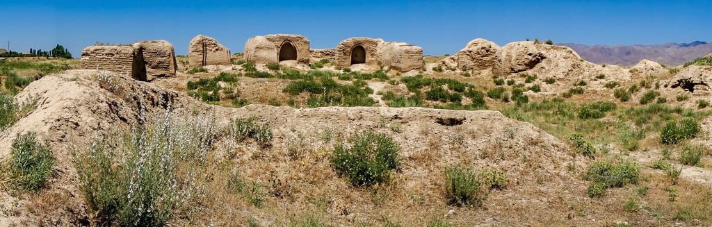
Sarazm is thought to be a part of the Margian civilization which appeared in the Neolithic Age or the Bronze Age, there is still some controversy about that. Anyway, a visit to this ancient settlement is worthwhile.
Karakul is located in Bukhara region, on the banks of the Zeravshan river. Karakul is associated with the oasis of the same name, which is considered one of the first inhabited on the entire Zeravshan Range. The first settlements here date back to the 5th century BC. Scientists have managed to find the remains of tools used by hunters and fishermen. Testimonies of the historians living in the 14-15th centuries say that during the reign of Tamerlane, the oasis flourished. There were many orchids here, and various buildings were built, including those of a cult nature. In the 18th century, Karakul was invaded by militant tribes, the ensuing battle for the territory left the oasis devastated. The local fortress, designed to protect against enemies, managed to contain the onslaught, which allowed it to exist until the 19th century. Now you can see its ruins.
Samarkand is a city of blue and green domes, bright facades and luxurious paintings, you can easily get lost in the bright kaleidoscope even more so because all inscriptions and bus announcements are in Uzbek language. This city is a real oriental fairy tale with a rave of colours. Fantastic cuisine, hospitality and original history awaits you in this one of the oldest continuously inhabited cities in Central Asia. Still, don’t think it is Disneyland incarnate. It is a city with a million people living in it, it is a city with traces of harsh history, the scars of which are traceable in its architecture.
The best way to get around is by cab, and if you go on foot don't complain that everything around is like in Brezhnev's times, and the road tarmac was also laid fifty years ago.
Getting around the city is an adventure in itself. Bus fare is around €0.10, but all the announcements are in Uzbek. However, there are ‘hookers-in’ who are announcing every stop and the route, which can help you understand whether you’ve taken the right bus. Taxis are €0.20-0.40 per person and the driver would usually take 3 more passengers. It is important to agree on the fare before you get into the taxi, you can be charged 10 times more just because you are a tourist.
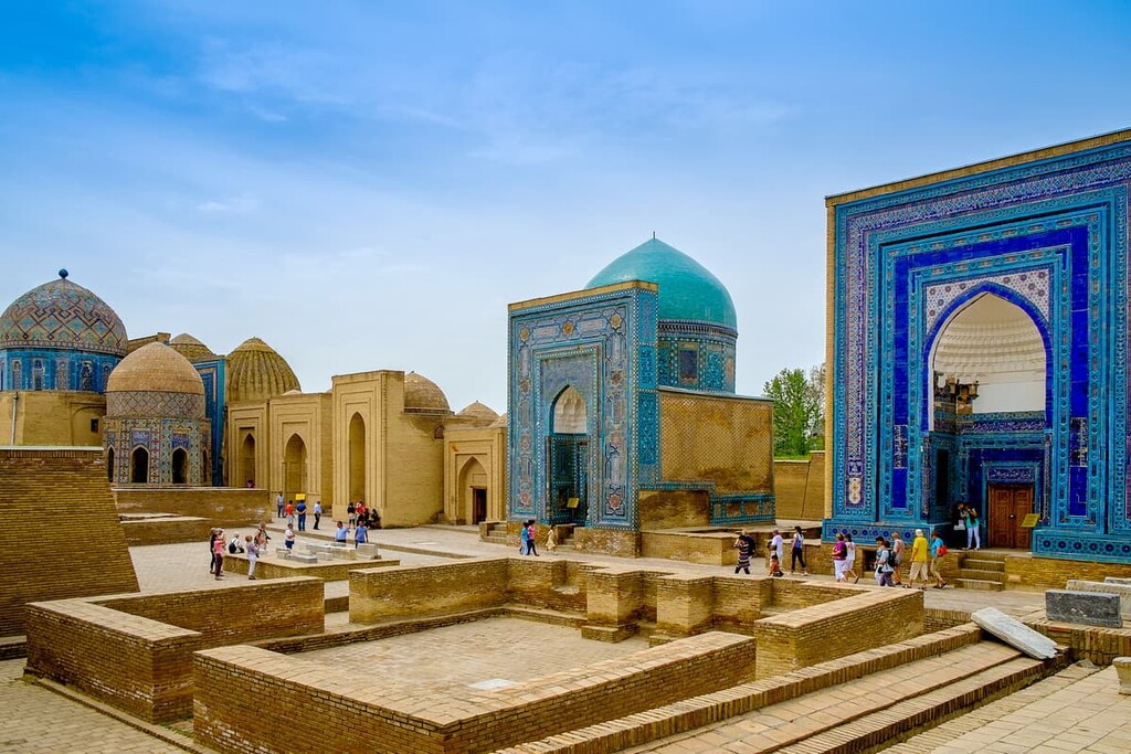
Everyone goes to Samarkand for ancient mosques and mausoleums, which will make you feel like a hero of oriental fairy tales. In 2001, UNESCO added the city to its World Heritage List as Samarkand – Crossroads of Cultures.
The main sights are concentrated in the center within walking distance from each other.
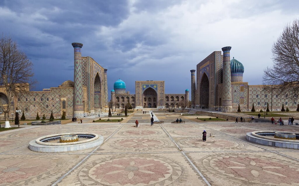
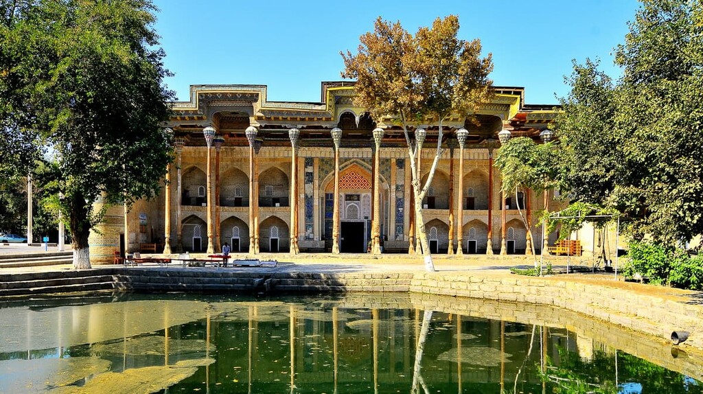
It is worth starting the city tour from Registan Square. It is the heart of the city and one of the most famous attractions of Central Asia. The ensemble of the square includes three madrassahs (spiritual schools) of the 15-17th centuries: Ulugbek Madrassah, Tilla-Kari Madrassah and Sherdor Madrassah. They are considered the oldest in the world and are examples of unprecedented skills of the builders of those times.
After Registan, go to Medina. Just follow the residential area. Medina is a place where locals live, it is vivacious and boisterous, people are really friendly and can easily invite you for pilaf or a cuppa.
The Siabian Bazaar, which is a 10-minute walk from Registan, is a must-visit. The market exposes the spirit of true Central Asia with its mind-blowing riot of colors, emotions, delicious smells, and loud sounds.
Another destination point is the Samarkand Regional Museum of Local Lore, located in an ancient mansion that used to belong to one of the richest merchants of Samarkand - Abram Kalantarov. The interior is made in European and Central Asian style. The museum itself consists of two departments: History and Nature. There are collected old ceramics, stuffed animals and artifacts from different historical periods of life. A large part of the exhibits are dedicated to European and Bukhara Jews. The museum is open on weekdays from 9.00 to 17.00.
If you are an art lover or like bringing back really culture-specific souvenirs, go to the Chorsu Gallery, located on the site of the oldest market in the city, right behind the Registan. You can find the paintings of the best Samarkand artists (and buy some if you like), national art crafts: clothes (including the famous skull-caps aka tubeteika, the brighter the colour, the better connection you have with cosmos and Allah!), sculptures, ceramics, souvenirs, carpets.
If you are interested in astronomy, visit the Ulugbek Observatory and Museum, located on the outskirts of Samarkand, on Kuhak hill. This is the place where our modern concept of the length of the year was established! Due to the exploration and description of 1018 stars and a catalog of the starry sky Zij-i Sultani made by Sultan Ulugbek in 1437, we now know that our year lasts for 365 days, 6 hours, 10 minutes, 8 seconds.
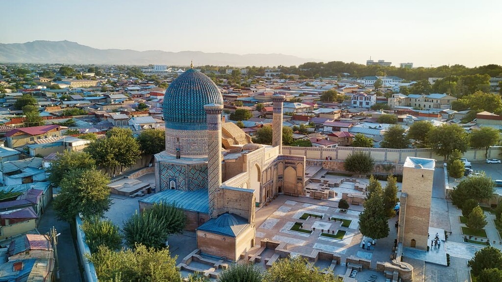
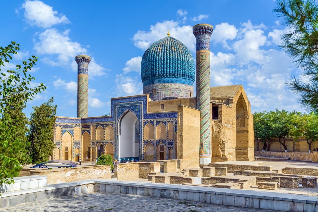
Timur (Tamerlane) was buried here 614 years ago. Gur-e Amir Mausoleum is the last refuge of the great leader. It is possible to visit the inside of Gur-e Amir only in the daytime and tourists can only access decorative tombstones - the real ones are hidden from the prying eyes in the basement crypt. However, the place looks most magnificent and enigmatic at night.
Make sure to visit Bibi-Khanym Mosque (Bibikhonim St.), the largest mosque in Central Asia. According to a legend, it was built by Temur's eldest wife - Sarai-Mulk-Khanum - together with masters from India, Iran, Khorezm and the Golden Horde. They say that if you make a wish and walk around Bibi Khanym crypt located in the mausoleum three times, it will definitely come true. The entrance fee is €2.30.
Khazret-Khyzr Mosque dates back to the 8th century. It stands on a hill, on the outskirts of the ancient settlement of Afrosiab (Shakhizinda and Tashkent streets) and is considered the most beautiful in Samarkand. Here in 2018 opened the mausoleum of the first president of Uzbekistan Islam Karimov. Climb the minaret and you will see stunning views of Bibi-Khanym and Shah-i-Zindu.
The Mausoleum of Hodga Donier (Prophet Daniel) is a pilgrimage site for believers of three religions: the tMuslims, the Christians and the Jews. This is because Tamerlan brought and buried here part of the ashes of the Old Testament Biblical prophet Daniyar.
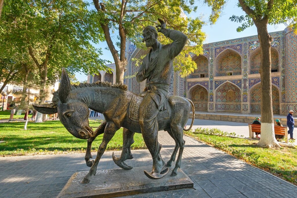
Bukhara is extravagantly decorative. It is a city of monuments: there are 217 madrassas, of which a hundred are under state protection. It is a religious center with its three hundred mosques and seven holy graves. Bukhara is the cultural capital of Uzbekistan, when the Persian Samanids reigned in the city, here worked Avicenna, Al-Biruni, Rudaki, Firdousi, and Omar Khayyam. The semi-mythical Khoja Nasreddin defended the poor here: his monument stands in the historic center on Lyabi-Haus Square. When making wishes, children and adults rub Nasreddin’s donkey's nose so that a wish will come true.
If you plan the tour geographically, you can start directly from the railway station, the so-called new history. To the left of the station is an airy-fairy baroque palace built for the arrival of Nicholas II. Yet, the emperor never made it here.
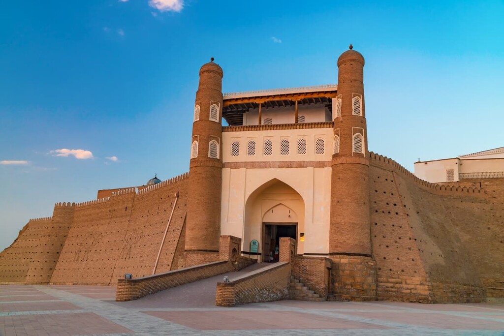
Bukhara was colonized by his grandfather, Alexander II, in 1868. The last three Russian tsars left the emirs to their own devices. Things changed dramatically after the October Revolution in 1917 when the Bolsheviks came to power. If you are into history, study the exploits of General Frunze and the Turkestan operation in the Ark fortress, which is outside the gates of the Old Town. The fortress stood strong during Genghis Khan’s siege, but General Frunze’s attack left only the walls. Now, the Fortress is restored, and there is a museum in it. The battles were bloody back in 1920, several beautiful palaces were burning for three days.
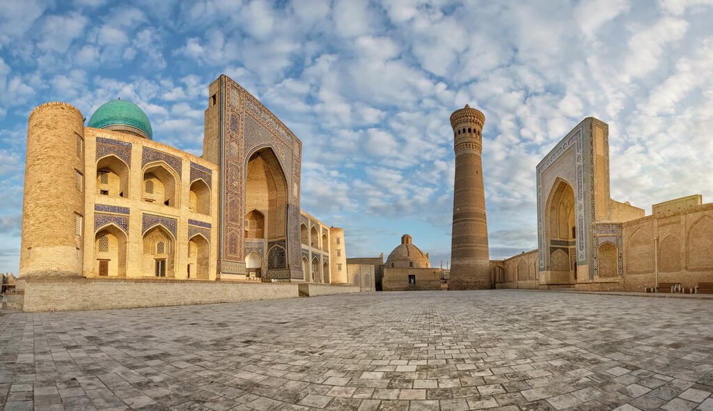
But first things first. Start the route from the Old City. When in Lyabi-Haus Square, turn your back to Nasreddin and take a coffee break by the pond or better have a cup of tea because good coffee is a rarity here. Before the revolution there were about a hundred such reservoirs in the city, but one Soviet doctor Isayev declared them a source of contagion, and they were covered up with sand. Cast a glance behind Nasreddin's back, there is a portico or pishtak as it is called in Islamic architecture of Nadir Diwan-Begi Madrasah: it features human faces, which wasforbidden by the Sunnis, but the Shiites, apparently, had nothing against it. Bukhara Madrassahs were built under the Shaibanids, Uzbek princes, descendants of modern Uzbeks: choose any, go inside and enjoy the paintings and marble carvings on the ceilings and walls. True, in each of the madrassahs, the trade is so lively that you can't go out without a pair of silk scarves or a CD of Uzbek music. Anyone who has read Leonid Solovyov's "The Calm Revenant" as a child needs to visit the Bukhara market which has not changed in centuries. However, don’t visit it in passing, it is better left for Sunday, there is too much to see and to do there.
Continue walking to the 47-meter-high Kalon Minaret, the tallest in central Asia. It was admired by Genghis Khan, but the artillery of General Frunze shot it at point-blank range. The minaret was later restored.
Across the road from the Minaret and the Ark Fortress is an amazingly beautiful mosque Bolo Haus, built in 1718, with twenty thin wooden columns carved out of wood.
Finally, the city's oldest monument is in Frunze Park. It is a small square mausoleum of Ismail Somani, built in 905. It appears to be carved, but ше is built of plain bricks with raw eggs added to them. You have to go around the mausoleum three times and make a wish: the building is so small that it's easy to do it just in case it comes true. And then you can eat mulberry right from the tree growing in the park: ripe berries fall on the ground, no one picks them, but only squash them with their feet.
In the evening, go to the hammam. The oldest, Bozori Kord hammam, is open until midnight. Mind you, the morning time is reserved for men only, but in the afternoon there may be women allowed as well.
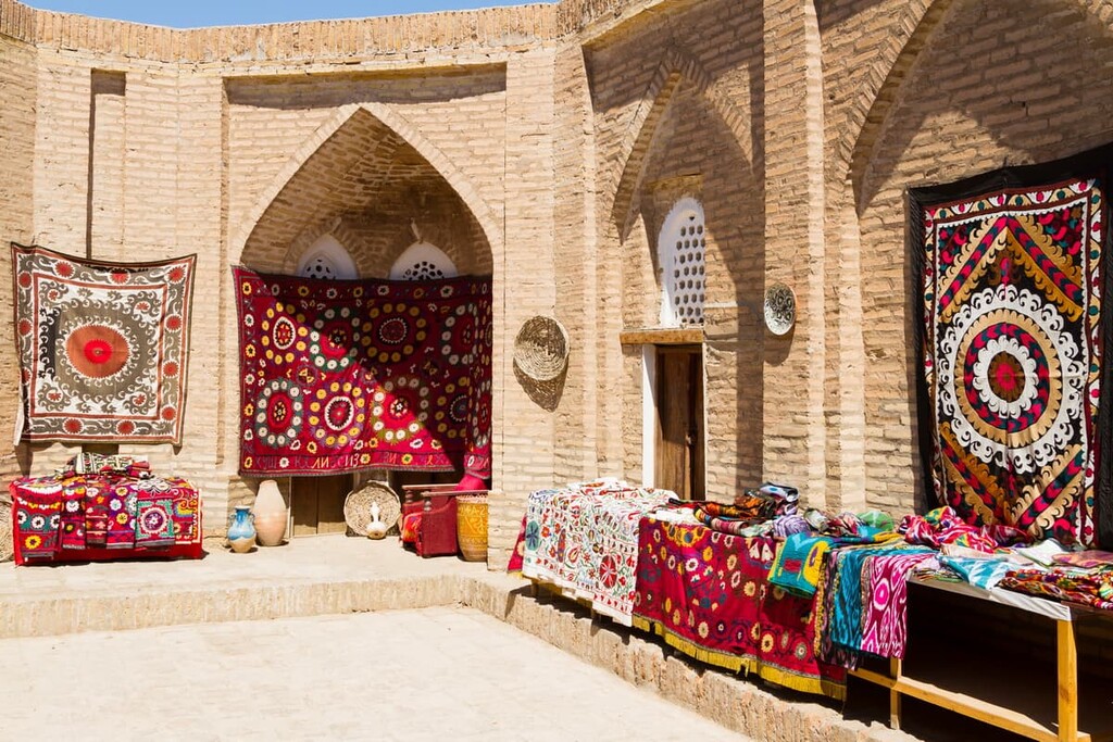
Leave the souvenir shopping for Sunday morning before the train leaves. Hunt for ceramic dishes, miniatures, boxes, blankets with embroidery called suzanne, or buy pchaks - the sharpest knives in the world which never have to be sharpened. And, of course, carpets - red, local, Bukhara carpets. The Uzbeks are skillful and hardworking people with well-developed aesthetic sense. Their handicrafts deserve a separate close study. Stop by the workshop where they make glove puppets for the traditional Uzbek theater Chodir Khael on Lyabi Haus; they will be happy to put on a little show just for you. But don't stay on the square in the evening - it's too loud here listening to the post-Soviet pop songs.
There is a direct flight from Moscow to Samarkand by Uzbekistan Airways. Don’t be prejudiced against the airline, the planes are in excellent condition. For an experienced traveler who can handle spending the night on the plane we recommend taking a night flight so that you will be in Samarkand four hours later. Given the time difference (GMT+5 hours), it will be morning there.
There are no Sunday evening flights, so it makes sense to fly back on Monday morning (08:55) to be in Moscow at 11:10.
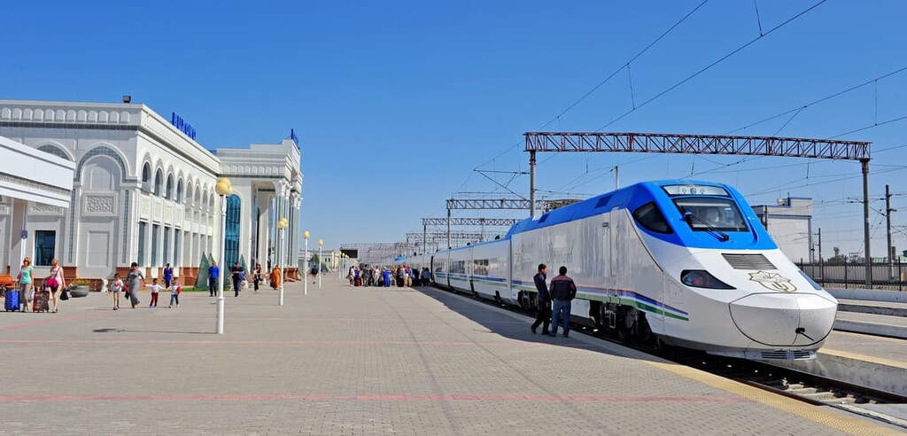
In 2009, Uzbek President Islam Karimov went to Spain and bought two high-speed trains there for €38 million. The train was named "Afrosiyob" and has nothing to do with Africa. Afrosiyob is the ruins of an ancient settlement that served as the basis for the present-day Samarkand. These ruins got their name in honour of King Turan Afrasiab, one of the legendary heroes.
Afrosiyob was launched on the route Tashkent-Samarkand-Bukhara, and since then the life of the tourist has become easier, to the rightful indignation of local cab drivers because it takes just 90 minutes or so from Samarkand to Bukhara, and you travel in very comfortable conditions. A ticket, depending on the class of carriage, will cost $20-35.
Mind you, if you want to see the schedule on the official website of Uzbek railroad, it will be half-Russian, half-English.
Another reminder, arrive at the station at least an hour in advance because sometimes the trains go off the schedule either departing earlier (just because they are tired of waiting for the scheduled time) or leaving later.
When going climbing or trekking in Uzbekistan or Tajikistan, you will be asked to pay a small environmental fee, which is usually handled by the travelling agency you go with. Another thing necessary for tourists from other countries who stay more than 10 days in the country is to register at the local police office, called OVIR (they are off at weekends). This can be done in person or by your travel agent. If you are from Russia, Ukraine or Belorus, you will not need any visa as well.
In any tour, in any area, it is worth preparing a few lists featuring completed info of the group. It is desirable to put a stamp on the lists as well, if you are trekking with some climbing school or club. When communicating with officials it saves time, there is no need to copy everything by hand.
Kyrgyz border passes are issued in Bishkek and must be additionally signed in Batken. However, there is no point in them because their presence does not affect the fees paid to the border guards in any way. Registration in Kyrgyzstan is not required. There is a frontier post in the upper reaches of the Zeravshan near the village of Tro, but the border guides are not interested in tourists at all.
For those who go by train it is important to remember that you should have your foreign passport on you at all times (In Russia and many post-Soviet states, there is a domestic passport and a foreign one), you will be fined (approximately 100USD) because the train goes through Uzbekistan where the foreign passport is required.
There might be some unpleasant remnants from war times between Tajikistan and Uzbekistan. Some mountain passes were land-mined. However, over the last 20 years many mines have been deactivated and as you are highly unlikely to venture to the mountains alone, you will be quite safe on the well-trodden routes.
Mobile connection is solid in the cities and towns in the Zeravshan Valley, yet when you venture to the mountains, it is better to have some satellite phone, e.g. Thuraya system usually provides a stable reception. You can arrange regular communication slots with the people at home or a coordination center of the climbing club you go with. You can also have LPD radios to provide communication on reconnaissance, during technical work, etc.
Tell us about your adventures and discoveries in the Zeravshan Range. We’d be happy to get any feedback at peakvisor@routes.tips. Or tag us on Instagram.