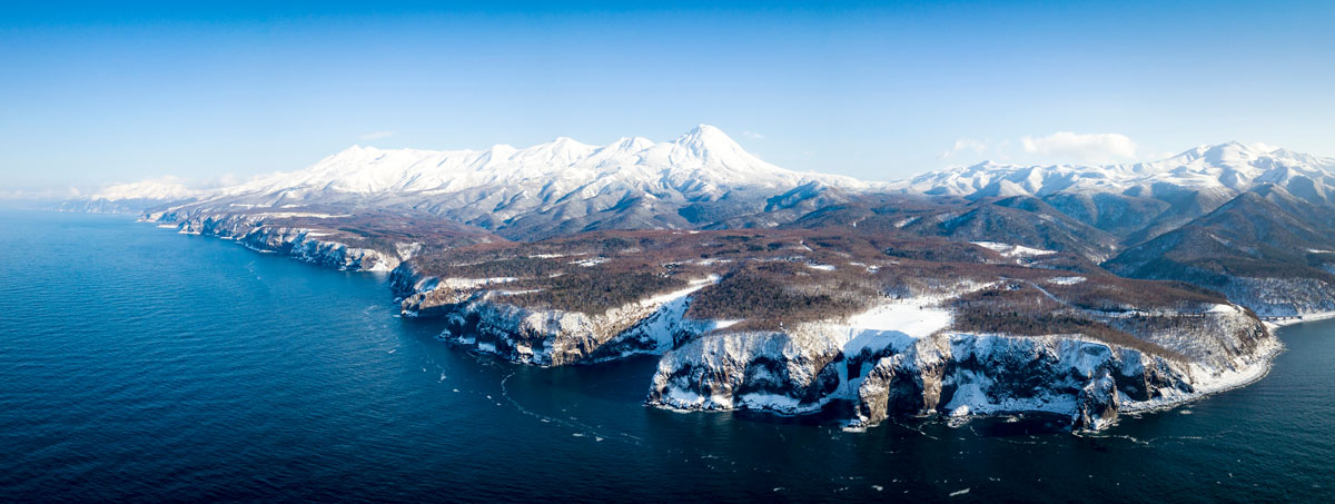
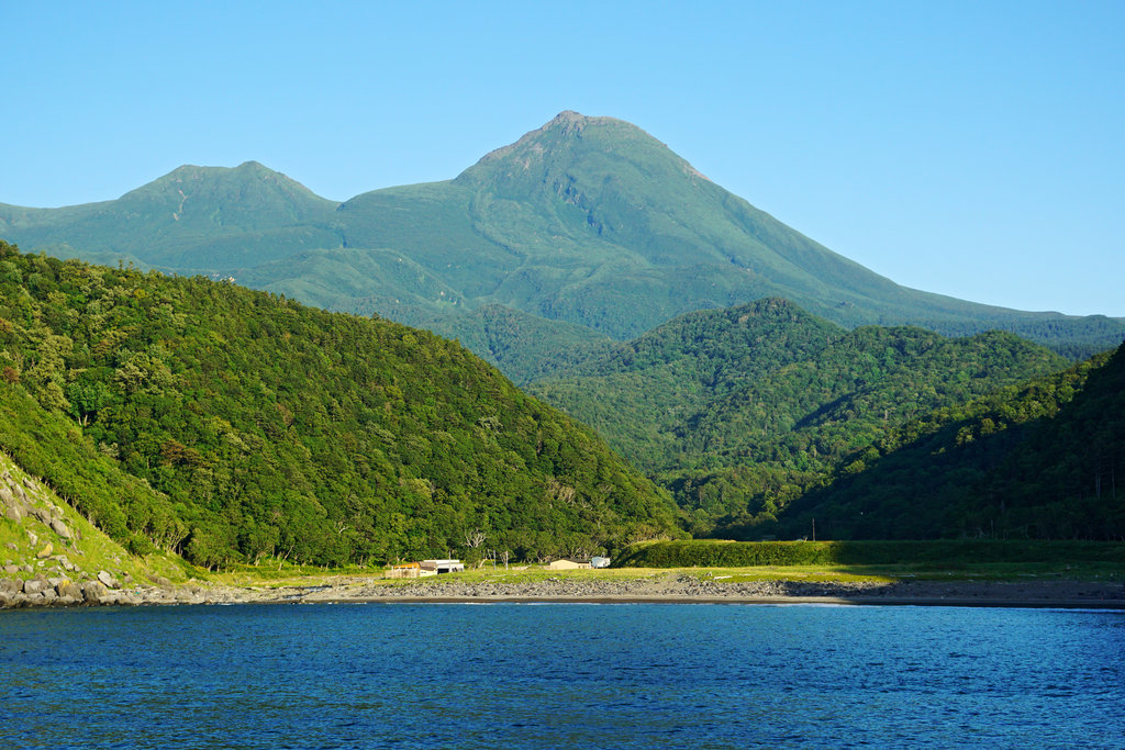
Shiretoko is a sort of Japanese Ultima Thule. In fact, in the ancient language of Ainu people who once inhabited this land, the world sir etok meant ‘the end of the world’, referring to the liminal position of the area. The peninsula is the easternmost point of Hokkaido, protruding into the sea of Okhotsk and separated from Russia only by the Nemuro Strait. Shiretoko has also been a UNESCO World Heritage Site since 2005 because it is the southernmost point where it is possible to see sea ice, usually visible further north in the Northern Hemisphere.
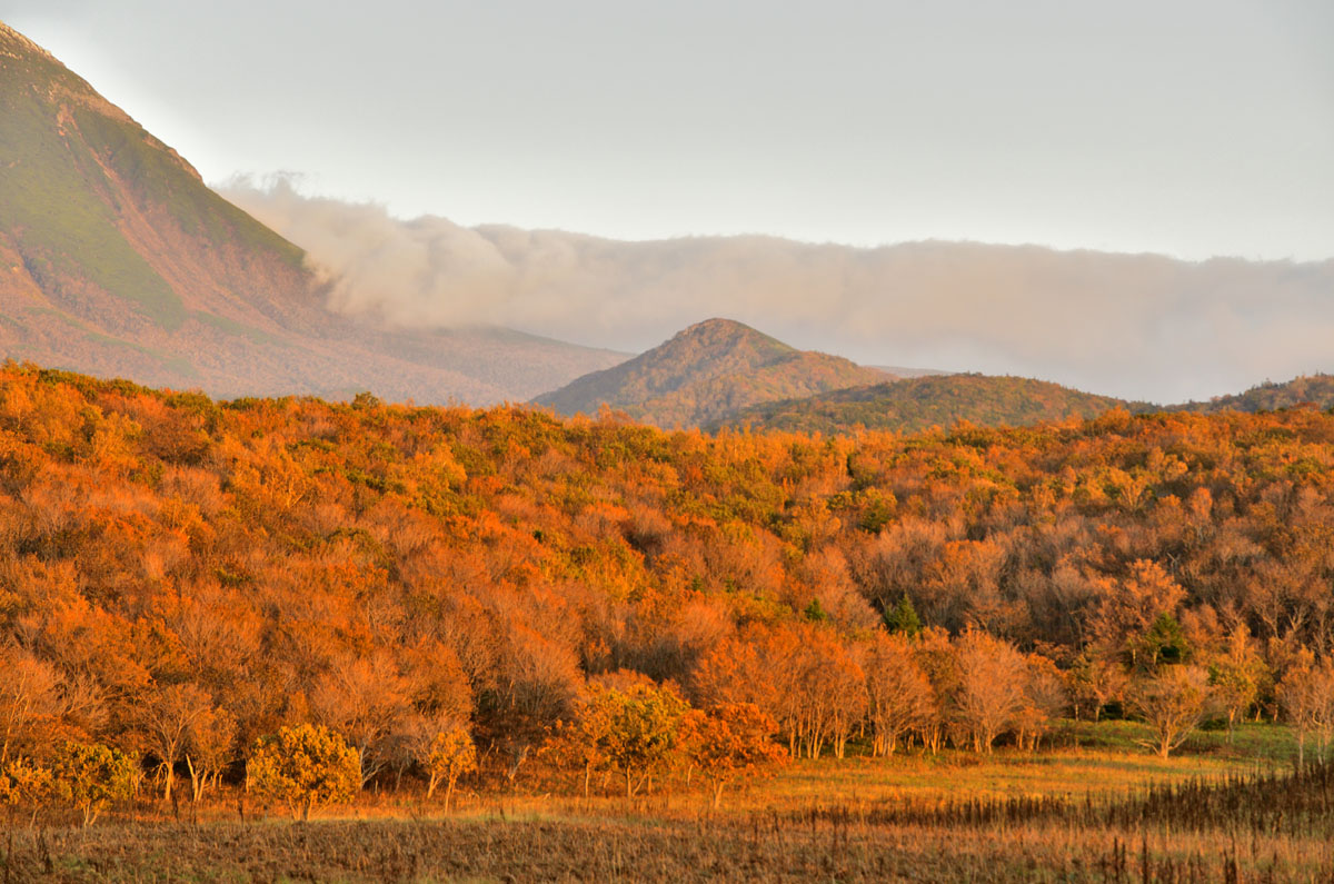
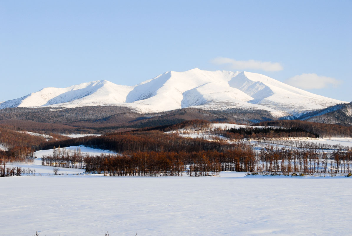
Its shape is rugged, constituted by a central spine of volcanoes that can be explored in about two days walking and characterized by the presence of big lakes and waterfalls.
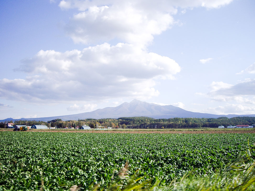
The territory of the Shiretoko Peninsula is occupied by The Shiretoko National Park, a natural treasure blessed with open landscapes and abundant wildlife. Besides foxes and brown bears, it is possible to spot the rear Blakiston's Fish Owl or the plant Viola Kitamiana.
It is said to be one of the most beautiful natural parks of the entire country, it is characterized by a unique combination of marine and terrestrial ecosystem.
Major Hiking Areas
Three-quarters of the area is covered with unexplored virgin forests, and on the majority of the peaks, trails are not even marked, like on Mt. Onnebetsu (1,330m). Even Paved roads are few, so the only way to enjoy hidden spots is to take one of numerous boats that offer guided tours. Due to the presence of wild animals and the absence of connection with the major city centres, it is not recommended to walk outside the marked-trails. Hikers must bring a bell against bears, which are commonly spotted even on most crowded trails. Trekking lovers who approach the area may want to receive detailed information at the Shiretoko Nature Center.
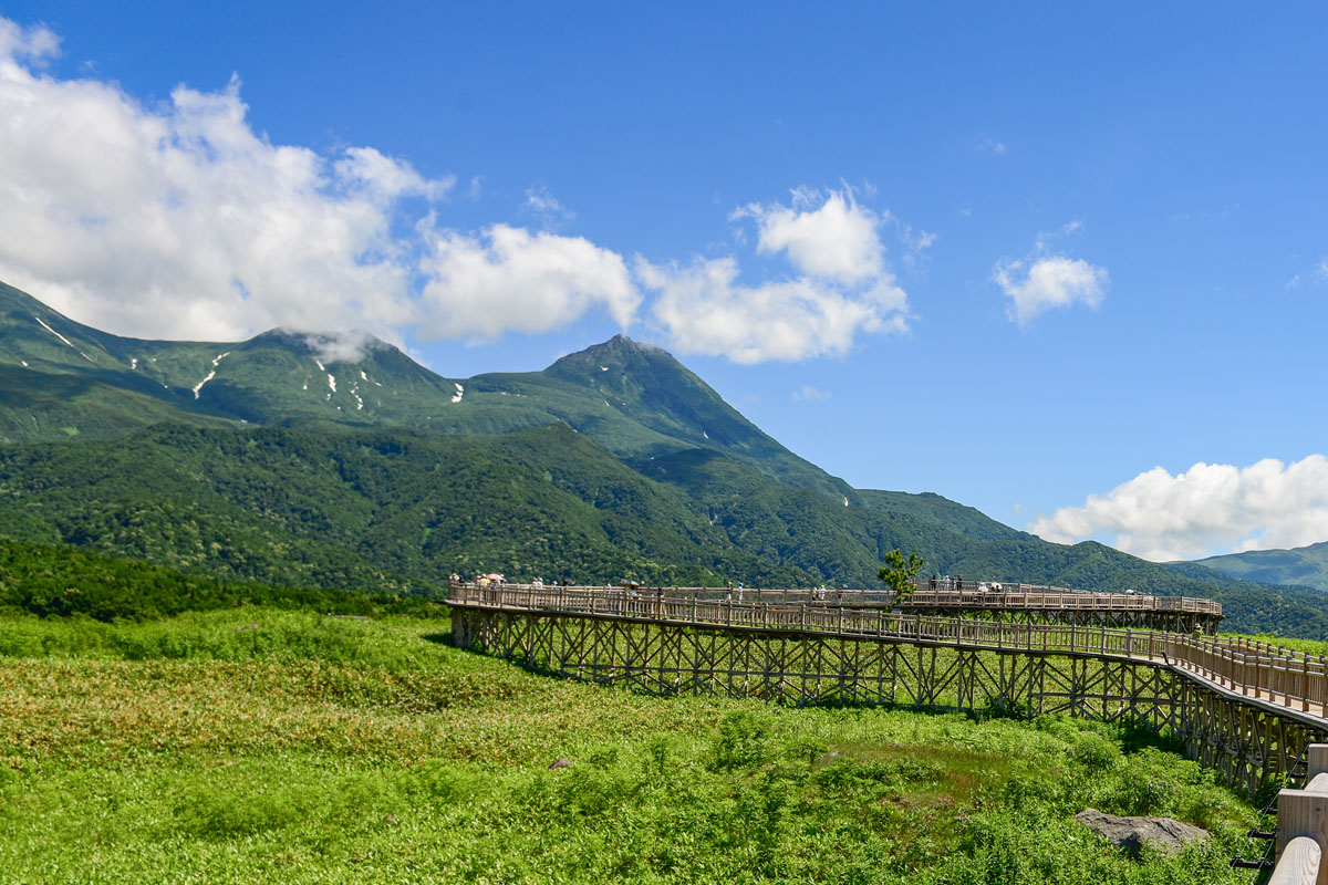
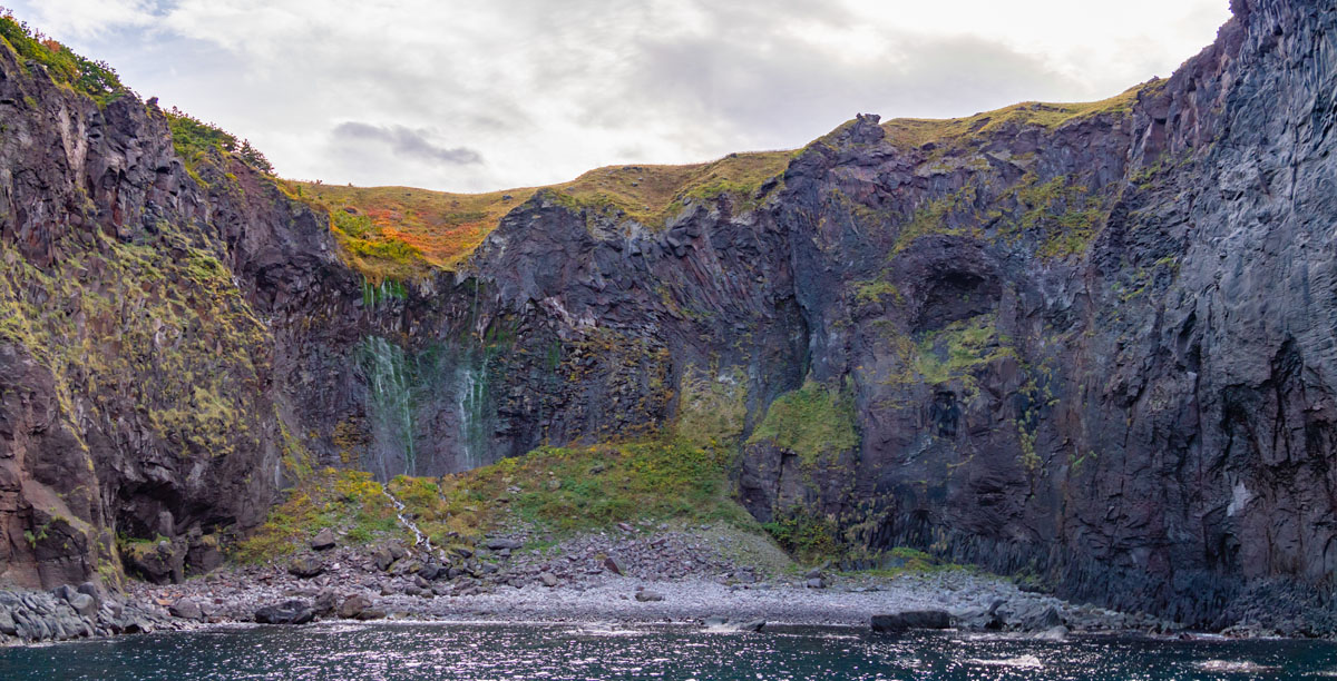
The Shiretoko National Park - The southern section of the park is designed to satisfy “common” tourists. Some well-marked trails are leading to the Furepe Waterfalls, which overlook a stunning cliff. The Shiretoko Five Lakes (知床五湖Shiretoko Goko) and Kamuiwakka Waterfalls are other places of interest inside the park. To reach them, it is necessary to get on a special bus. A wooden elevated road encircles the lake banks extending for about 1km and it is the most pleasant way to enjoy the wonders of this place. Instead, access to the northern part of the park is limited to professional climbers and alpinists. There is no GPS connection nor any human presence, but a large population of bears. To face this challenging path, hikers must be excellently equipped both physically and mentally. However, local authorities are not prone to allow people to access the area.
The Shiretoko Traverse leads hikers over 6 different mountains through a 20km trail feasible in 2 days. The first and tallest one is Mt. Rausu (1,661m), followed by Mt. Mitsumine(三峰 1,509m), Mt. Io (硫黄山 1,562m), Mt. Sashirui (サシルイ岳), Mt. Okkabake(オッカバケ岳), then Mt. Chienbetsu (知円別岳 1,544m). The end of the trail there is located beside the Kamuiwakka Waterfalls, inside the Shiretoko National Park. The first half of the trail up to Mt. Rausu goes along the broad spine of the ridge. You will reach Rausudaira (羅臼平) relatively quickly and find a campground and a 4-way junction. From here you can climb the slope up to Mt. Mitsumine crossing a small pass between the three peaks of the massif. The first big climb is Mt. Sashirui (サシルイ岳), from where the hike continues. The scenery will quickly change from the green of the pines to the yellowish white of volcanic soil. At this point, you can proceed to Mt. Okkabake (オッカバケ岳) and during the descent, you will see Mt. Io. Following the ridgeline, you will pass directly below the summit of Mt. Chienbetsu, finally reaching the top of the Mt. Io ridgeline.
Mt. Rausu (羅臼岳) 1,661m) is a volcano located inside the Shiretoko National Park. The main route leading to the summit is divided into two parts: the first one traverses a forest, while the second runs into rocky terrain and a marshland called Gokuraku-daira (極楽平). Most hikers reach Rausudaira in 4 to 5 hours after starting the hike. Halfway there is a junction that leads to Mt. Io if you turn left and to Kuma-no-yu hot springs if you go straight ahead. To reach the summit hikers must turn right. Since the hike is 12km long, staying at Kinoshita Hut is highly recommended.
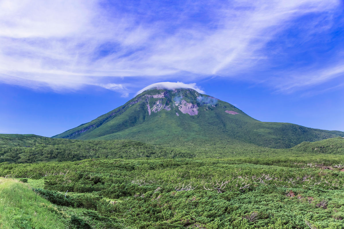
Mt. Shari (1,547m斜里岳) is a stratovolcano and one of Japan's 100 famous mountains that stands among the Akan Volcanic Complex and Shiretoko. Its former name was Onnenupuri. The name Shari in Ainu language means ‘marshes where reeds are growing’. It is also known by the names Okhotsk Fuji (オホーツク富士) or Shari Fuji (斜里富士), yes, anything magnificent or even worth mentioning should be called Fuji. Hikers who want to approach Mount Shari must be equipped with climbing shoes and gaiters. As one of the 100 Top Mountains in Japan, it is popular among climbers. However, compared to the famous mountains in Honshu, this one is wild and challenging. It takes about 9h to complete the hike. It is more convenient to choose the Old Trail during the ascent and the New Trail for the descent.
Mt. Chinishibetsu (1,317m知西別) - This peak’s shape and terrain are suitable for snowshoes walking and cross-country skiing in winter. The ascent to the summit takes 4h to complete, and the route is quite steep. Climbing shoes with metal pins are essential to reach the mountaintop, but the stunning view of the Shiretoko Mountains is worth the fatigue. The main trail starts in Mikaeri pass and traverses Lake Rausu before reaching this peak.
Mt. Unabetsu (1,419m海別岳) is an inactive volcano extending over three different districts: Shari, Rausu, and Shibetsu. Its name probably comes from an Ainu word meaning “ash river” or from the name of the river Unabetsu that springs on this peak. It takes 10h to complete the trail (about 6h to reach the mountaintop). Traces of snow are likely to be found in summer as well.
Major Cities and Facilities
Like the entire Hokkaido Island, Shiretoko Peninsula is characterized by the lack of transports and connections to major city centres. To reach many places outside Sapporo there’s only one bus a day and taxis are expensive. Renting a car is the cheapest and most convenient way to reach the peripheral area, where most of the tourist attractions and hiking trails are located. Alternative leisure activities are represented by kayaking, cruises, diving, and walking on drift ice.
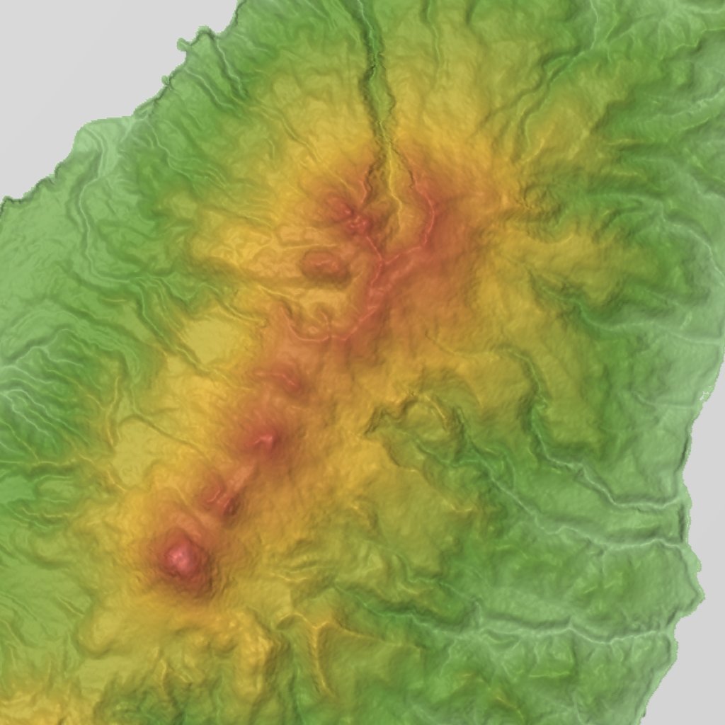
This 3D model of Sagarmatha National Park in Nepal was made using the PeakVisor app topographic data. The mobile app features higher precision models worldwide, more topographic details, and works offline. Download PeakVisor maps today.
Download OBJ model
PeakVisor
The download should start shortly. If you find it useful please consider supporting the PeakVisor app.
PeakVisor for iOS and Android
Be a superhero of outdoor navigation with state-of-the-art 3D maps and mountain identification in the palm of your hand!