
Scan the QR code and open PeakVisor on your phone
Once in a while, an avid hiker reaches a region that is above and beyond anything they have seen before. The Retezat National Park has all the prerequisites of a mountaineering Shambala, a place that leaves you in a state of wonderment. With 50 glacial lakes and stunning visuals, it enchants and enthralls both the mountaineering gurus and novices in mysterious ways. Mountain ways (and trails), of course! If you are on a journey to find yourself, or the ultimate beauty of the heights, find your way towards Retezat and don’t look back!
The Retezat mountains are part of the Southern Carpathians, specifically the Retezat-Godeanu range. They are found between two large basins, the Hațeg and Petrosani, and in between the Râul Mare and Jiul de Vest rivers. Consequently, numerous secondary basins and valleys with country roads make access quite easy.
The two main ridges, with a SW and NE orientation, are connected in their central part. The northern ridge peaks are as follows: Zlata (2,142m), Sesele (2,278m), Judele (2,334m), Bucura (2,433m), Peleaga (2,509m), Papusa (2,508m), Vârful Mare (2,463m), Lăncița (2,066m), Brădet (1,861m). The southern ridge has three main peaks, Iorgovanu (2,014m), Piule (2,080m), Drăcșanu (2,081m), also Custura (2,457m), Gruniu (2,294m), Lazăru (2,282m), Tulișa (1,792m). The most popular peak is the one named after the range: Retezat peak, standing at 2,485m.
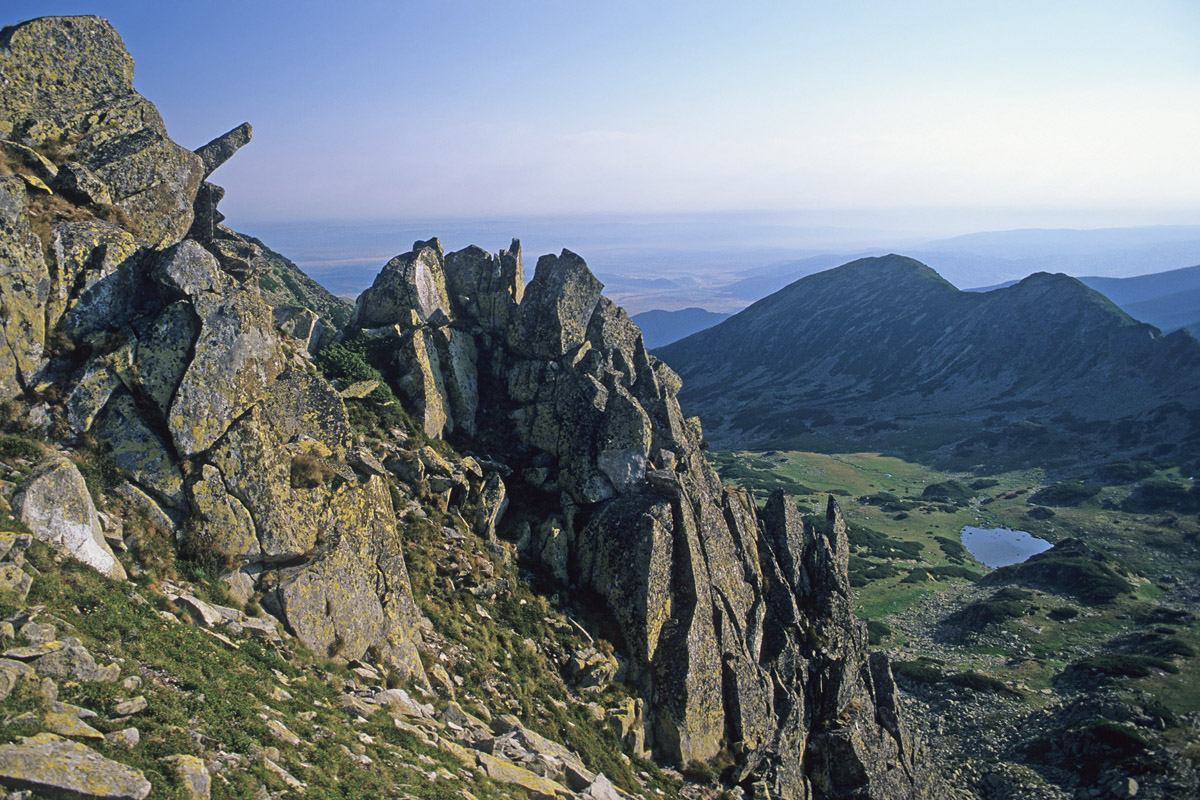
Although it is not the highest, Retezat has a peculiar shape and the plethora of stories and legends surrounding it managed to make it the most sought after in the entire range. Its weird shape, similar to a cut pyramid visible from north and south, attracts hikers and climbers alike. Actually, in Romanian language Retezat means ”cut off”, given the flat surface on top of the pyramid frustum. The peak stands at 2,845m and is located in the NW of the range. The views from here encompass great panoramas towards the ridges and Bucura Gate, Judele, Custura and Zănoaga peaks, and even farther, towards Godeanu and Țara Hațegului.

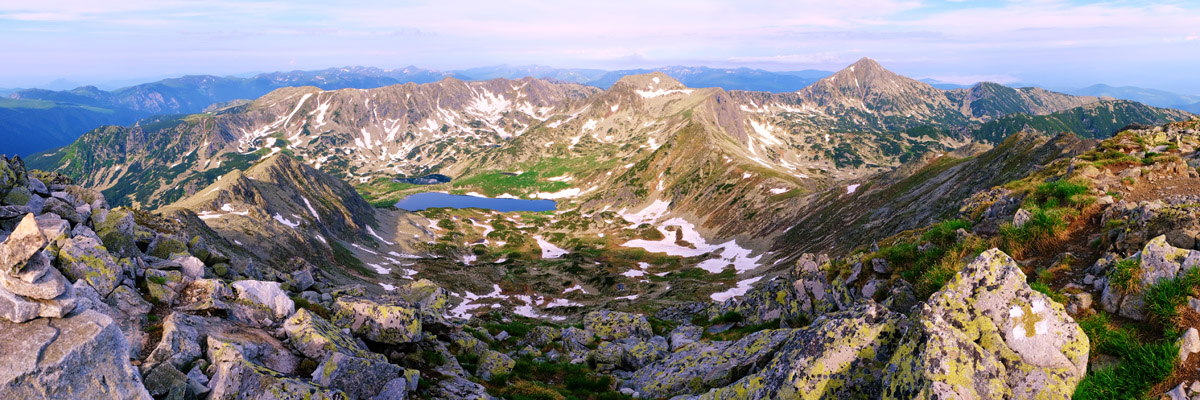
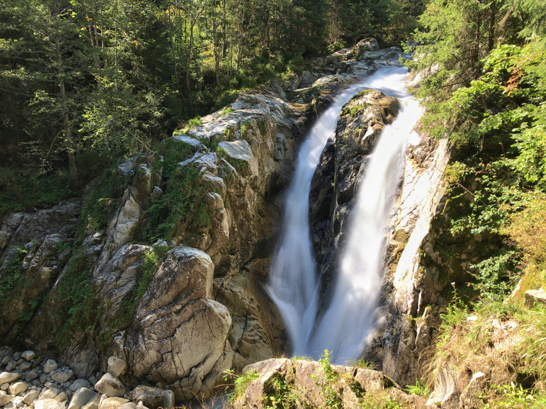
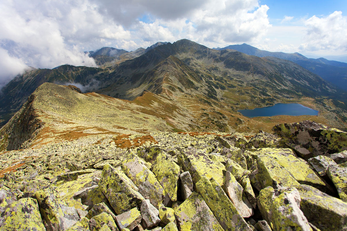
The scenery is spectacular and with a lot of variety, created by glacial and periglacial moulding - huge glacial cirques, valleys that attest the presence of once-mighty glaciers, numerous lakes, huge debris slopes, sharp or ruin-like rocks. Add the ever-present reindeer moss and you get an out-of-this-world landscape. You will find here the largest glacial lake in Romania - the Bucura (10 ha), and also the deepest - the Zănoaga (29m). The widespread presence of glacier lakes is one of the biggest tourist attractions of the park. There are 50 permanent glacier lakes, while the temporary ones appearing in spring and summer raise the numbers to 80. Also, you will find remarkable waterfalls such as the Lolaia, Ciumfu, Rovine.
From a geological point of view, the largest part of the massif, also called Retezatul Mare, is mainly formed of crystalline schists, while the southern part, more calcareous, is named Retezatul Mic. The tallest peak, Peleaga, stands at 2,509m. Towards the Hațeg basin, there is a huge steepness with triangular faces, as a result of erosion.
What is specific to the Retezat mountains is the multitude of slabs all over the place due to massive erosion. The forest covers steep declines of debris, while the lower vegetation covers the higher areas. Because of these specificities, the range has been deemed a National Park since here can be found rare species of flora. Over a third of the 3,500 plant species from Romania grow in this National Park. A certain area is also off-limits for tourists, the Gemenele Scientific Preserve. The highest ridges and knife-sharp edges are usually without any vegetation.
The massif has a harsh, wet climate as it is situated in the way of western and south-western air masses. Over 2000m, the average air temperature is -2/-4 °C. In the warmest month of July the average air temperature is around 6 °C on the highest peaks and 8-10 °C near the forest edge and lower. In the coldest month of January, the average temperature is around -10°C, growing towards the forest edge at around -8/-6°C. Beyond these averages, during summers temperatures might go beyond 20°C, while in winter they could drop below -30°C. The rainfall is quite massive, with an average of 1,400 mm at high altitudes and dropping to 1000-1200 mm near the mountain feet.
Depending on altitude, the snow lasts around 5-6 months per year, reaching a couple of meters in height. In sheltered areas, the accumulations may reach 3-4 m, while in areas exposed to winds, the snowpack has a relatively small thickness. Oftentimes, you can see the rock slabs or vegetation cutting through the snow. Also, you want to pay attention to ice as it is treacherous to step on. Make sure you use special equipment when traversing snow areas, as the number of yearly frost days in the range can reach 240.
The few of us, hardcore fans of the Young Indiana Jones, are always on the lookout for a hard candy adventure, no matter what. If you’re a master of the paper map and compass, enjoy remote villages, encounters with wicked sheepdogs, combatting unmarked trails and walking lron-Man-like marches with heavy backpacks, you have come to the right place. Godeanu can be either a meat grinder, or an atypical, beautiful mountain, depending on your attitude, outdoor experience, and toughness.
The Godeanu Mountains are found in the west of the Southern Carpathians, the third point of interest after Parâng and Retezat. There are 314 named mountains in Retezat-Godeanu Mountains. The highest and the most prominent mountain is Peleaga. This range is made of powerful metamorphosed crystalline schists with patches of sedimentary rocks and has an interesting asymmetry, super long approach distances and serious elevation stats, which makes it suitable for challenging hikes not recommended for newbies.
All of the high points of the range are amassed in the north and notable peaks of over 2000m are Godeanu Peak (2229m), Moraru (2284m), Gugu Peak (2291m), Scărişoara (1880m), Galbena (2402m), Borăscul Mare (2158m), Branului Peak (2026 m), and Gârdomanul (2058m). Of all these remote peaks, Godeanu and Gugu are the high altitude jewels of the range.
Gugu Peak is the highest mount of the range and the most mysterious at that with many juicy legends attached (read about spooky spots in Romania here). For starters, it is called “the vanishing mountain” because the mountain tip seems disappearing in the rays of light shooting out of the mountain. The peak is also notorious for being no-Instagram babe, many hikers tried to capture it on camera, but when the photographers developed their films, there were no images shown.
As to the legends per se, they say this is the sacred mountain of Zamolxe, the Dacian God and therefore, the mountain is a holy place. The inhabitants in the area are called gugulani and are famous for their longevity. Some say that here it is the very place where Decebalus had hidden part of his treasure, convinced that the spirit of the High Priest will guard it from the wrath of time.
Many tourists who have tried to spend the night on top of Gugu Peak accused unusual states similar to those of insomnia, shortness of breath, and confirms that they could not close an eye all night. Mysterious and paranormal phenomena wrapped in strange energies in the area, apprized the specialized scientific world in the field about these phenomena, once a plane crash in the area, plane that simply disappeared without a trace.

And the last but not the least strange fact is that Gugum, being quite a remote summit, is described in great detail by Jules Verne in his novel The Carpathian Castle published in 1892 even though the author never visited the area and the mountaneering reports of the time were scarce.
Godeanu Peak can be found to the west of the main ridge, between the Culmea Tucilei and Culmea Zanei ridges. South-west of the peak, the region has a lower, undulated terrain, the only remarkable feature being the river Şes. Around the peak, there are multiple glacial cirques. To the north, there is the Cîrnea glacial area, made out of three glacial cirques which combine and reach out through a common groove to the river Şes valley.
The shape of the range is almost triangular, with Scărişoara mountain in the middle. Except for the side towards the Cernei mountains, the triangle is limited by deep valleys and their rivers that flow peacefully at over 1000m of altitude. To the north-west, the range is limited by two opposite valleys, the Hidegului Valley and the Valley of the Şes river which separates the Godeanu from the Ţarcu Mountains. To the north-east, the Lăpuşnicul Mare river digs deep into a valley that is 900m below the peak of Mount Borăscu, thus separating Godeanu and Retezat ranges.

To the south-west, the borders of the Godeanu mountains are less obvious, as the altitude slowly decreases towards the Cernei Mountains. Still, the deep cut between Olanul mountain and Dobrii peak, where the Ogaşul Olanului and the Hidegului valleys start to take shape, makes it clear that this is the end of the Godeanu.
While the contour of the Godeanu is similar to a rectangle, the main ridge, with a south-western orientation, is basically the diagonal of the rectangle. Some of its heights go above 2000m, culminating with Gugu Peak, Piatra Scărişoara and Godeanu Peak, all situated towards the west. Also, in the western end of the range, Prislopului head connects Godeanu and Ţarcu Mountains. What is characteristic for the Godeanu is the flat surfaces which replace sharp ridges. Glacial cirques, generally not too large, are a common sight on both sides of the main ridge.
The trails of the Godeanu are fabulous and run in the wildest places of this part of the Southern Carpathians. The lack of scrambles, big walls or knife-edge ridges is countered by beautiful, high altitude alpine pastures where herds of horses, cattle and flocks of sheep still graze as they used to do during Jesus Christ times. Flat surfaces at high altitude and precipitously suspended plateaus find themselves in contrast with a few higher peaks and steep declines of the glacial cirques. One of the most interesting features of Godeanu, however, is an impressive bird’s view the ridge trail can give. Just one look around on a sunny day and you can spot the outline of the Parâng Mountains, the Apuseni, the Banat Mountains, the Danube plains, and even Cerna and Lăpuşnic regions.

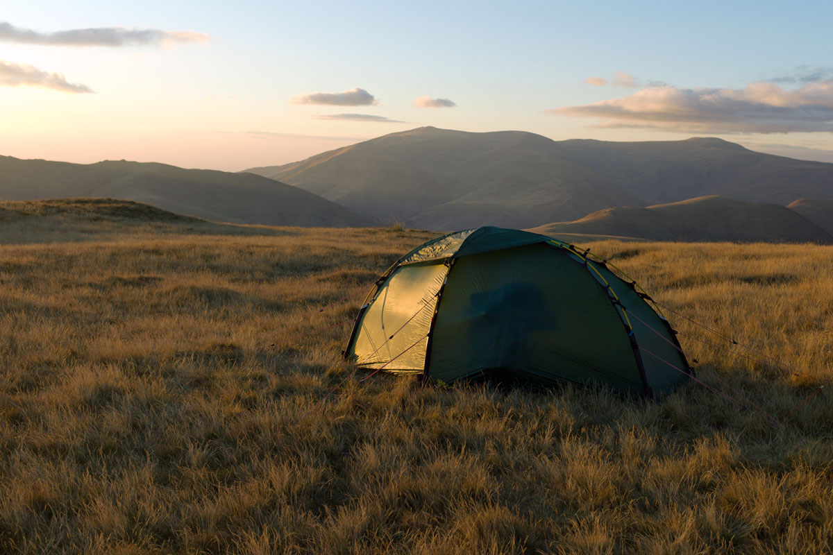
What really defines the Godeanu is the sheer length of the routes, large distances in every direction. You need to expect long routes of 15-20km along ridges or valley country roads with altitude gains of over 1,800m. The marks on the trails are very scarce, so you need to be well versed in using a compass and a map, however, ridge trails are very well defined. Be fully prepared with a tent or bivy sack, as there are no chalets in the Godeanu. You may encounter long-abandoned shepherd huts and squat there in case of emergency. There is one refuge, Gugu refuge, on the way to the peak.
Gugu refuge is situated at 1686m, under Branu peak and pass, halfway through from Gura Apei to Gugu peak, just where the forest ends.
Access the refuge from Simeria or Caransebeş. From Simeria to Haţeg you need to drive 30km. From Caransebeş to Haţeg, 70km. Just 9 km away from Haţeg, coming from Caransebeş (you do not reach Sarmisegetusa, but pass by Paclisa) take a left towards Rîuşor and Gura Zlata chalet. If you are coming from Caransebeş, take a right just 9km before Haţeg. As you take this road, you will pass a number of villages: Ostrov, Clopotiva (at the junction, keep to the main road bending slight left), Brazi.
You do not enter Brazi, just pass by. Keep to the right, along the valley of the Râul Mare. This is where the road towards Râuşor and Râu de Mori splits. Before this junction, there is a minimarket where you can shop (last one on the way). Also, ask for directions for the Gura Apei dam at Lake Gura Apeior.
From this point on, there are roughly 19km up to the dam. Take the Râul Mare valley, pass by Doruleţ chalet and Gura Zlata chalet. Once you reach the dam you may be asked for an ID (the dam is a place of national security concerns). Take a left to enter the dam, and keep in mind this area still has a mobile cellphone signal, while the rest of the trail may not.
Once you pass the dam, keep going for another 500m and reach Gura Apei chalet, where you can ask for another round of information. The country road keeps on going on the edge of the dam for another 4km, when you reach a bridge, pass it and take a right. Go another 2km around the lake, then another 4km on the Lăpuşnicul Mic valley, and reach a bridge where you need to drop your car and start walking.
Follow the trail on Lăpuşnicul Mic valley by going upstream for approx. 1.5km, then you start going up through the woods. When the trail enters the woods you should find a cairn. You may find cuts on the trees that show the way, you just need to pay attention in the first forest sector. Then, the trail gets really well defined. Exit the woods and see a large fallen pine. Take the right and in 5 minutes reach an information panel and a water source. Keep going in the same direction and reach the refuge in 3 minutes.
Pietrele chalet is situated in the Stânișoara valley at 1,480m in the forest; there are two main buildings, small wooden houses and also a camping place; reach the chalet following a 6km country road from Nucșoara, up to Cascada chalet (Cârnic), then follow the blue band trail (1½ from Cârnic).
Gențiana chalet is situated in the Pietrele valley, at 1,670m; they do not offer meals; 5 km away from Cârnic, where the Pietrele valley starts, take the blue triangle trail towards the chalet.
Cascada chalet is situated in the Cârnic area, at 980m; they will provide meals; parking lot is provided for a couple of days (while hiking); to get here follow the 6 km country road from Nucșoara.
Gura Zlata chalet is situated at 775m, they have a restaurant and also small wooden houses, a camping place; the chalet is built on a terrace above Râul Mare.
Buta chalet is situated at 1,580m, near the forest edge; take the road from Câmpu lui Neag to Butei Gorges, then to Văile Mării and reach Buta. Take the red cross trail from near Cheile Butei chalet and reach Buta chalet, it will take 4-5 hours.
Baleia chalet is situated in the Baleia clearing, at 1,410m; use the country road that goes from Hobița on Șerel hill (16 km, old blue triangle mark) or, from Hobița there is the blue triangle trail which connects it to the country road from Șerel pass (5 - 5½ hours on the road, 4 - 4½ on the trail).
Râușor resort is situated at 1,200m; there is a hotel, a restaurant, ski slopes, a surface lift; use the country road that goes from Râu de Mori along Râușor brook, passing near Colț citadel (12 km, 4 - 4½ hours walking).
Cheile Butei chalet is situated at 900mand has a restaurant and a pool.
The most beautiful route that reaches Godeanu Peak starts from the Cernei valley, through the Oslea Romana height. This is an honest route you cannot cheat since there is no country road parallel to the trail. You take off from Cerna-Sat, at 452m altitude.
From the trail panel, we enter an orchard. As you pass a shelter, you will notice the first red triangle mark of the route. After a couple of orchards and meadows, you reach a higher point and a first water source. After leaving the forest, you get to a sheepfold from where you can notice Oslea Română peak ( 1,781m).
After a long hike (two more water sources on the way), you reach Oslea Română peak. This is where you can spot another ridge connecting the Godeanu mountains to the Cernei mountains, as well as a fabulous view of the high altitude plateau. From here, get to the main north ridge, head for Godeanu peak and descend via another route or take the same way back.
This route connects the main ridge and the Gura Apei chalet, being the most important tourist road in the north of the massif since it passes by the highest peak of the Godeanu mountains: Gugu Peak (2290m). You can combine this route with the Mitului valley to obtain a spectacular loop route.
Start from Gura Apei on the blue cross trail and traverse the Branului valley on a wooden bridge. After 50m leave the marked trail and take a left on a sheep trail. After 15 minutes the slope becomes less inclined, you reach a clearing and continue to the west faces of the mountain. Reach another clearing and a water source, then pass by a sheepfold and enter the alpine pastures. From here, you will have a great panorama of the Ţarcu, Borăscu and Retezat mountains.
The trail follows the east face of the mountain, high above the Branului valley, connecting a sheepfold from Branul and sheepfolds from Scărişoara mountain. Before you reach the Branul sheepfold, leave the trail and take a right, to the top of the cirque that opens up above you. Pass by a spring and reach a pass between Branul and mount Gugu. From here, the climb gets steeper and you will reach the final goal, Gugu peak.
You can reach Bucura lake in several ways depending on your starting point. This is the largest glacial lake in Romania (10 ha) and the nearby panorama is impressive.
If you start from Pietrele chalet, take the blue band trail (Pietrele - Gențiana chalet - Bordul Tomii - Pietrele lake - Bucura saddle - Bucura lake - Peleaga clearing/Poiana Pelegii) and reach the lake in 4 - 4½ hours.
If you are hiking from Buta chalet, take the red cross trail (Buta - Plaiul Mic saddle - Peleaga clearing/Poiana Pelegii) and reach Peleaga clearing in 1 ¾ - 2 hours. Bucura lake lies a short walk from there.
Another way to get to Bucura lake is from the Gura Apelor dam. Take the blue cross trail, following the contour of the lake, then reach Zlata Mountain - Zlata peak - Great Zănoaga Lake - the Zănoaga Valley - Crucea Trăznitului - La Clince - Coada Slăveiului - Ana Lake - Bucura Lake. The marks on the trail are old, so use complementary means for orientation. Reach Bucura lake in 7 ½ - 8 hours.
Besides Bucura, all of the other 49 glacial lakes of the Retezat are worth exploring, but a few catch the tourists’ eyes more particularly: Zănoaga, Tăul dintre Brazi, Tăul Porții, Tăul Agățat, Galeșu lake. If you plan on camping near the lakes make sure you follow the park rules, which forbid bathing and polluting the water with chemicals.
The high ridge, between Great Peak (Vârful Mare) and Bucura I (Great Peak - Great Peak saddle - Peleaga peak - Bucura saddle - Bucura II peak - Vf. Bucura I - Retezat saddle) is marked with a red band.
You can reach Peleaga peak from Bucura lake by following a yellow cross that passes near the Mountain Rescue refuge and through Berbecilor glacial cirque (Căldarea Berbecilor) reaching the peak in merely 2½ hours.
If you plan to bag Bucura I and Bucura II peaks, or even Retezat if you have enough stamina, descend from Peleaga in Bucura saddle and follow the ridge from there.
Peleaga ridge area is also a good starting point for the western peaks of the range: Păpușa, Valea Rea, Vârful Mare, Custura, Gruniu peaks. Some ridge areas are technically challenging so make sure you have the training and equipment for tackling them. The ridge sectors that include Porțile Închise - Spălătura Păpușii - Păpușa Mare peak - Peleaga Saddle on one hand, and Păpușa Mare peak - Spintecatura Păpușii - Păpușa Mică peak - Custurii Saddle on the other, require extra care and technical knowledge.
From Bucura lake you can also follow the red point marks: Tăul Porții - Lacul Agățat - Vf. Judele Mic - Vf. Judele Mare - Bârlea Saddle - Bârlea Mountain - Șesele Mari Mountain - Great Zănoaga Lake, the route takes 5 ½ hours.
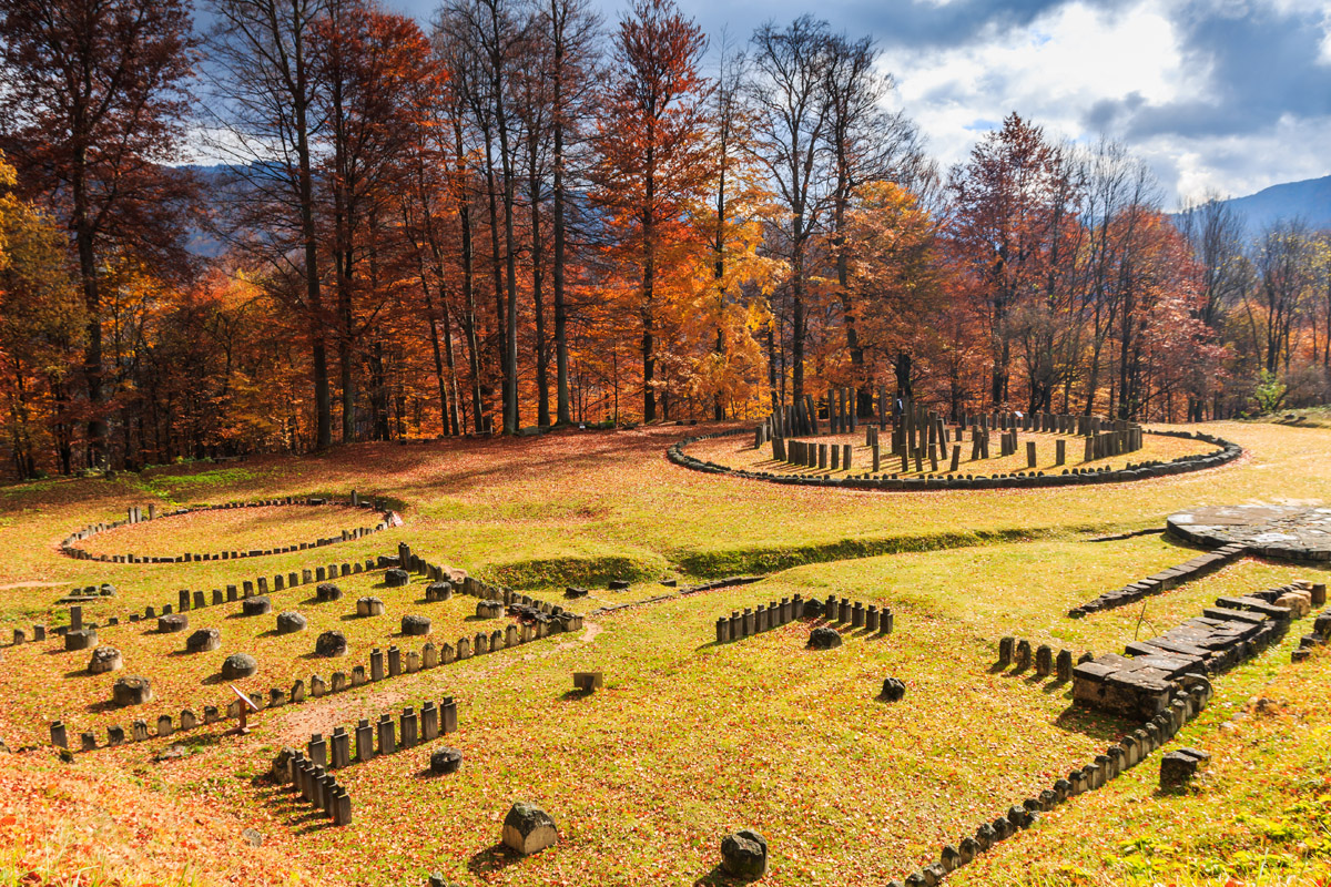
Haţeg is a small city with a massive historical legacy so you can take your time to visit the ruins of the most important ancient citadel in Romania (Sarmisegetuza), the buffalo preserve or other historical sites. It is the historic region of Transylvania with all its wonders attached and also has a piece of Trajan road built by the Romans as a part of Emperor Trajan’s extensive building programme and military campaigns in the region. The town also can boast of a dinosaur geopark, as according to the archeologists’ findings, Hateg used to be home for Struthiosaurus transylvanicus, a herbivorous reptile dating from Late Cretaceous, first discovered in the Haţeg area. From here, you can make your way towards Gura Zlata chalet or other touristic sites such as Râuşor, Lăpuşnicul Mare, Pietrele and many more. You can access both the Godeanu and Retezat ranges from this city.
You can access the Godeanu range from several Jiului valley villages (Cerna-Sat, Ineleţ, Scărişoara, Tatu), while others will take you to Oslea range (Small Retezat).
Clopotiva is a parish situated at 500m a.s.l. From here, you can enter the Râul Mare valley and reach Gura Zlata chalet, Tomeasa colony and Gura Apelor dam, then move farther towards the Pelegii clearing.
Râu de Mori is another parish situated at the same altitude. You can go from here up to the Râușor valley and reach Râușor resort (pass through Suseni and near the Colț citadel and church), 12 km.
Brazi is situated at the mountain feet. From here, go along the Râul Mare river (towards Gura Zlata), and after 3km reach a junction towards Râușor, în Râu de Mori parish.
Sântămăria Orlea is a parish situated near the national road Petroșani - Hațeg. From here, take a road towards Râu de Mori and farther towards Râușor where you will find a ski resort.
Sarmisegetuza is a parish located near the road Hațeg - Caransebeș, 4 km away from Clopotiva. Here you will find the ruins of the most famous Dacian ancient citadel, Ulpia Traiana Sarmisegetuza.
Ohaba de sub Piatră (400m a.s.l.) is located in the Streiului Valley at the confluence with the Sălașul brook. From here, you will find the road and trail marks for Cârnic, Pietrele and Gențiana chalets.
Nucșoara (600m a.s.l.) is a large parish in the Nucșoara valley, the main entrance gate towards the Retezat range.
Pui (415m a.s.l.) is a large parish located on Petrosani - Hațeg road. From here you can go up towards the Baleia chalet, passing through Râu Bărbat and Hobița villages.
Petroșani (650m a.s.l.) is a municipality that is the departure point for Lupeni, Uricani and Câmpul lui Neag villages where you will find marked/unmarked trails leading towards Great Retezat and Tulișa mountains ( the sedimentary part of the Retezat range).


