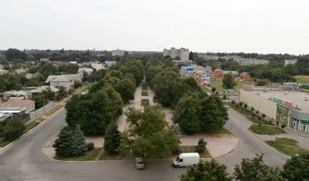
Zhovti Vody (Ukrainian: Жовті Води, IPA: [ˈʒɔu̯tʲi ˈwɔdɪ]; lit. 'yellow waters') is a city in Kamianske Raion, Dnipropetrovsk Oblast, central Ukraine. It is located on the Zhovta River approximately 70 km (43 mi) north of the metropolitan area's center, Kryvyi Rih. It hosts the administration of Zhovti Vody urban hromada, one of the hromadas of Ukraine. Population: 42,052 (2022 estimate). Since 1951 and hence forward during the soviet era, the city became a "secret city" (possibly a closed city) codenamed "Mailbox 28", and did not feature on maps, because of the establishment in the city in 1951 of a uranium mine and mill for the extraction and processing of uranium ore - although mining of uranium locally in the city has since officially ceased. Present day activities of the "Eastern Mining and Processing Enterprise" - VostGOK - headquartered in the city are reportedly concerned with extraction of iron ore and production of hydrochloric acid as well as the continued milling of uranium ore mined from more distant regions further to the east, and as such VostGOK is the largest European and the only Ukrainian extractor of uranium ore and only Ukrainian producer of uranium concentrate. Considerable parts of the city and its surrounding farmland are severely and dangerously polluted with uranium ore (and consequently radon gas in buildings built on uranium ore found naturally in the granite of the city, or due to the use of uranium containing granite in building foundations), with radioactivity levels in some instances in the city comparable to heavily contaminated areas surrounding Chernobyl, with residents suffering increased incidence of congenital conditions and cancers, many of which have been conclusively linked to radiation exposure. There appears to be evidence of disposal of uranium contaminated machinery at the edge of farmland surrounding the city, which contaminates nearby crops, and when excavated by scrap metal foragers, contaminate the individuals who handle the uranium contaminated scrap-metal, as well as those who come into contact with the individuals contaminated (family members, neighbours, etc).
Show more
Sun and Moon
Mon
Tue
Wed
Thu
Fri
Sat
Sun
May 2022
Date and time
00:00
06:00
12:00
18:00
Today
--
--
Sunrise
--
Sunset
--
Moonrise
--
Moonset
Phase
🌔 Waxing Gibbous
The perfect light time for beautiful photos:
--
Sunrise
--
Sunset
PeakVisor app
Get the app on your smartphone
New Panorama Tools
Trace location on the map
Measure distances
All the instruments are available in the context menu as well.
We use GPS information embedded into the photo when it is available.
3D mountains overlay
Adjust mountain panorama to perfectly match your photos because recorded by camera photo position might be imprecise.
Move tool
Rotate tool
Zoom
More customization
Choose which peak labels should make into the final photo and what photo title should be.
Next
Photo Location
Satellitte
Flat map
Relief map
Latitude
Longitude
Altitude
OR
Latitude
°'''
Longitude
°'''
Apply
Register Peak
Peak Name
Latitude
Longitude
Altitude
Register
Teleport
PeakVisor
This 3D model of Sagarmatha National Park in Nepal was made using the PeakVisor app topographic data. The mobile app features higher precision models worldwide, more topographic details, and works offline. Download PeakVisor maps today.
Download OBJ model
PeakVisor
The download should start shortly. If you find it useful please consider supporting the PeakVisor app.
PeakVisor for iOS and Android
Be a superhero of outdoor navigation with state-of-the-art 3D maps and mountain identification in the palm of your hand!