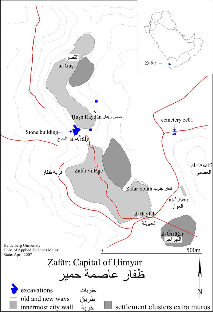
Ẓafār (Arabic: ظفار), also called Dhafar or Dhofar, is an ancient Himyarite site situated in Yemen, some 130 km south-south-east of today's capital, Sana'a, and c. 10 kilometres (6.2 mi) southeast of Yarim. Given mention in several ancient texts, there is little doubt about the pronunciation of the name. Despite the opinion of local patriots in Oman, this site in Yemen is far older than its namesake there. It lies in the Yemeni highlands at some 2800 m. Zafar was the capital of the Himyarites (110 BCE – 525 CE), which at its peak ruled most of the Arabian Peninsula. For 250 years the tribal confederacy and allies' combined territory extended past Riyadh to the north and the Euphrates to the north-east.
Show more
Sun and Moon
Mon
Tue
Wed
Thu
Fri
Sat
Sun
May 2022
Date and time
00:00
06:00
12:00
18:00
Today
--
--
Sunrise
--
Sunset
--
Moonrise
--
Moonset
Phase
🌔 Waxing Gibbous
The perfect light time for beautiful photos:
--
Sunrise
--
Sunset
PeakVisor app
Get the app on your smartphone
New Panorama Tools
Trace location on the map
Measure distances
All the instruments are available in the context menu as well.
We use GPS information embedded into the photo when it is available.
3D mountains overlay
Adjust mountain panorama to perfectly match your photos because recorded by camera photo position might be imprecise.
Move tool
Rotate tool
Zoom
More customization
Choose which peak labels should make into the final photo and what photo title should be.
Next
Photo Location
Satellitte
Flat map
Relief map
Latitude
Longitude
Altitude
OR
Latitude
°'''
Longitude
°'''
Apply
Register Peak
Peak Name
Latitude
Longitude
Altitude
Register
Teleport
PeakVisor
This 3D model of Sagarmatha National Park in Nepal was made using the PeakVisor app topographic data. The mobile app features higher precision models worldwide, more topographic details, and works offline. Download PeakVisor maps today.
Download OBJ model
PeakVisor
The download should start shortly. If you find it useful please consider supporting the PeakVisor app.
PeakVisor for iOS and Android
Be a superhero of outdoor navigation with state-of-the-art 3D maps and mountain identification in the palm of your hand!