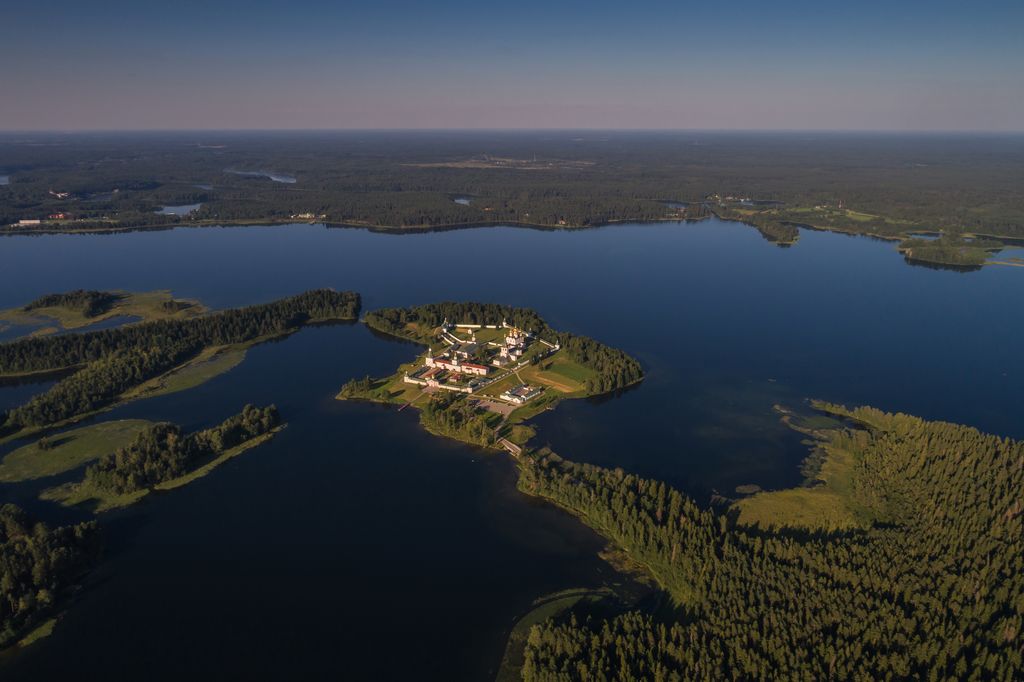
Lake Valdayskoye, or Lake Valdai (Russian: Валдайское озеро, озеро Валдай, romanized: ozero Valdai) is a freshwater lake located in the center of Valdaysky District of Novgorod Oblast in Russia in the middle of the Valdai Hills. One of the largest lakes in Novgorod Oblast, it has an area (without islands) of 19.7 km2 (7.6 sq mi), and the area of its basin is 97.2 km2 (37.5 sq mi). The average depth of Lake Valdayskoye is 12 m (39 ft) (the deepest point reaches 60 m (200 ft)). The lake freezes up in early December and stays icebound until early May. The lake is located in the center of Valdaysky National Park. The town of Valday stands on the southwestern shore of the lake along the M10 Moscow - St. Petersburg highway. One of the islands, Selvitsky Island (Russian: Остров Сельвицкий), is occupied by the Valday Iversky Monastery. Besides Valday, there are also several villages around the lake. An anabranch connects Lake Valdai to a smaller lake, Lake Uzhin (Russian: озеро Ужин). Lake Uzhin, the source of the Valdayka River, belongs to the river basin of the Msta River and thus to the Baltic Sea basin. The lake has almost a round shape with a large bay appended to it in the northwest. There are several islands on the lake, the biggest of which is the 119 ha (290-acre) Ryabinovy Island (Russian: Остров Рябиновый). It is connected to the lake coast in the south and to Iversky Monastery in the north. Lake Valdayskoye is located in the center of the Valdai Hills, and is surrounded by many other lakes. Many of these lakes drain into Lake Valdayskoye or into the Valdayka. The basin of the lake comprises all of the northeastern part of Valdaysky District. The lake has become a popular tourist-destination, with many recreation facilities on its shores. The first meeting of the Valdai Discussion Club took place on the lake in 2004. The lake is navigable, and the Zarya-211 (Russian: «Заря-211») cruiser ship sailed between the town of Valday and the Iversky Monastery until 2016. Since 2004, a road connects between Valday along the shore of Lake Valdai over a 140 m (460 ft) bridge to Ryabinovy Island and then over a 30 m (98 ft) bridge to the 11 ha (27-acre) Selvitsky Island to the monastery over which buses, taxis, and cars travel, or, during the winter when the lake is frozen, it is only a 3 km (1.9 mi) walk between Valday and the monastery over the frozen Lake Valdayskoye.
We use GPS information embedded into the photo when it is available.
3D mountains overlay
Adjust mountain panorama to perfectly match your photos because recorded by camera photo position might be imprecise.
Move tool
Rotate tool
Zoom
More customization
Choose which peak labels should make into the final photo and what photo title should be.
Next
Photo Location
Satellitte
Flat map
Relief map
Latitude
Longitude
Altitude
OR
Latitude
°'''
Longitude
°'''
Apply
Register Peak
Peak Name
Latitude
Longitude
Altitude
Register
Teleport
PeakVisor
This 3D model of Sagarmatha National Park in Nepal was made using the PeakVisor app topographic data. The mobile app features higher precision models worldwide, more topographic details, and works offline. Download PeakVisor maps today.
Download OBJ model
PeakVisor
The download should start shortly. If you find it useful please consider supporting the PeakVisor app.
PeakVisor for iOS and Android
Be a superhero of outdoor navigation with state-of-the-art 3D maps and mountain identification in the palm of your hand!