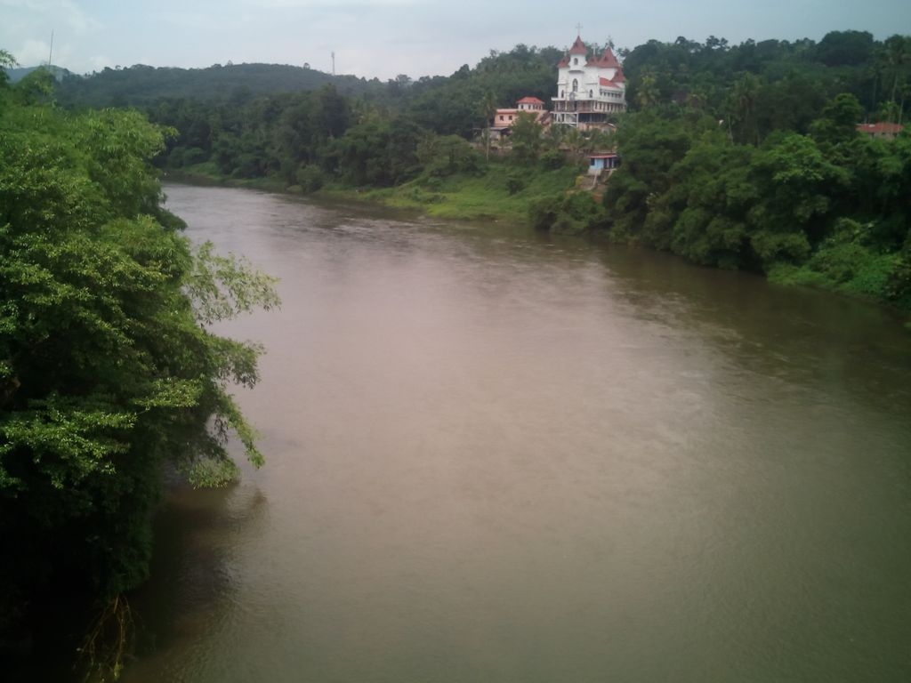
Vadaserikara is a village in Pathanamthitta district, in the state of Kerala, India. It is one among the 11 villages in Ranni taluk with geographical area of 6007 hectares. The nearest railway station is chengannur located at a distance of 30 km (19 mi) and sits at the confluence of the Pamba and Kallar River. The village is located on the main trunk road to Sabarimala–the Pathanamthitta-Pampa Highway and is a stopover for pilgrims on the way to Sabarimala, the abode of Lord Ayyappa, a pilgrim centre that attracts millions of Ayyappa devotees. It lies 3 kilometres (1.9 mi) from Kumplampoika and about 8 kilometres (5.0 mi) from Ranni. The Pathanamthitta-Seethathodu road also pass through Vadasserikkara. Marthoma Christians and Orthodox form the majority of the population. The village has seen much growth since the 1990s. One of the biggest bridges in the district is at Benglavkadavu.
We use GPS information embedded into the photo when it is available.
3D mountains overlay
Adjust mountain panorama to perfectly match your photos because recorded by camera photo position might be imprecise.
Move tool
Rotate tool
Zoom
More customization
Choose which peak labels should make into the final photo and what photo title should be.
Next
Photo Location
Satellitte
Flat map
Relief map
Latitude
Longitude
Altitude
OR
Latitude
°'''
Longitude
°'''
Apply
Register Peak
Peak Name
Latitude
Longitude
Altitude
Register
Teleport
PeakVisor
This 3D model of Sagarmatha National Park in Nepal was made using the PeakVisor app topographic data. The mobile app features higher precision models worldwide, more topographic details, and works offline. Download PeakVisor maps today.
Download OBJ model
PeakVisor
The download should start shortly. If you find it useful please consider supporting the PeakVisor app.
PeakVisor for iOS and Android
Be a superhero of outdoor navigation with state-of-the-art 3D maps and mountain identification in the palm of your hand!