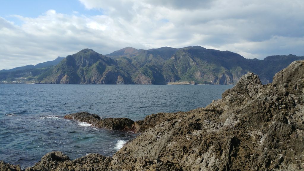
Ulleungdo (Korean: 울릉도; IPA: [uɭːɯŋdo]), also spelled Ulreungdo, is a South Korean island 120 kilometres (65 nmi; 75 mi) east of the Korean Peninsula in the Sea of Japan, formerly known as Dagelet Island or Argonaut Island in Europe. Volcanic in origin, the rocky steep-sided island is the top of a large stratovolcano which rises from the seafloor, reaching a maximum elevation of 984 metres (3,228 ft) at Seonginbong Peak. The island is 9.5 kilometres (6 mi) in length and ten kilometres (6 mi) in width; it has an area of 72.86 km2 (28.13 sq mi). It has a population of 10,426 inhabitants. The island makes up the main part of Ulleung County, North Gyeongsang Province, South Korea, and is a popular tourist destination. The main city of Ulleung-do is the port of Dodong (도동; 道洞), which serves as the main ferry port between Ulleung-do and the South Korean mainland. After tourism, the main economic activity is fishing, including its well-known harvest of squid, which can be seen drying in the sun in many places.
Show more
Sun and Moon
Mon
Tue
Wed
Thu
Fri
Sat
Sun
May 2022
Date and time
00:00
06:00
12:00
18:00
Today
--
--
Sunrise
--
Sunset
--
Moonrise
--
Moonset
Phase
🌔 Waxing Gibbous
The perfect light time for beautiful photos:
--
Sunrise
--
Sunset
PeakVisor app
Get the app on your smartphone
New Panorama Tools
Trace location on the map
Measure distances
All the instruments are available in the context menu as well.
We use GPS information embedded into the photo when it is available.
3D mountains overlay
Adjust mountain panorama to perfectly match your photos because recorded by camera photo position might be imprecise.
Move tool
Rotate tool
Zoom
More customization
Choose which peak labels should make into the final photo and what photo title should be.
Next
Photo Location
Satellitte
Flat map
Relief map
Latitude
Longitude
Altitude
OR
Latitude
°'''
Longitude
°'''
Apply
Register Peak
Peak Name
Latitude
Longitude
Altitude
Register
Teleport
PeakVisor
This 3D model of Sagarmatha National Park in Nepal was made using the PeakVisor app topographic data. The mobile app features higher precision models worldwide, more topographic details, and works offline. Download PeakVisor maps today.
Download OBJ model
PeakVisor
The download should start shortly. If you find it useful please consider supporting the PeakVisor app.
PeakVisor for iOS and Android
Be a superhero of outdoor navigation with state-of-the-art 3D maps and mountain identification in the palm of your hand!


.jpg)