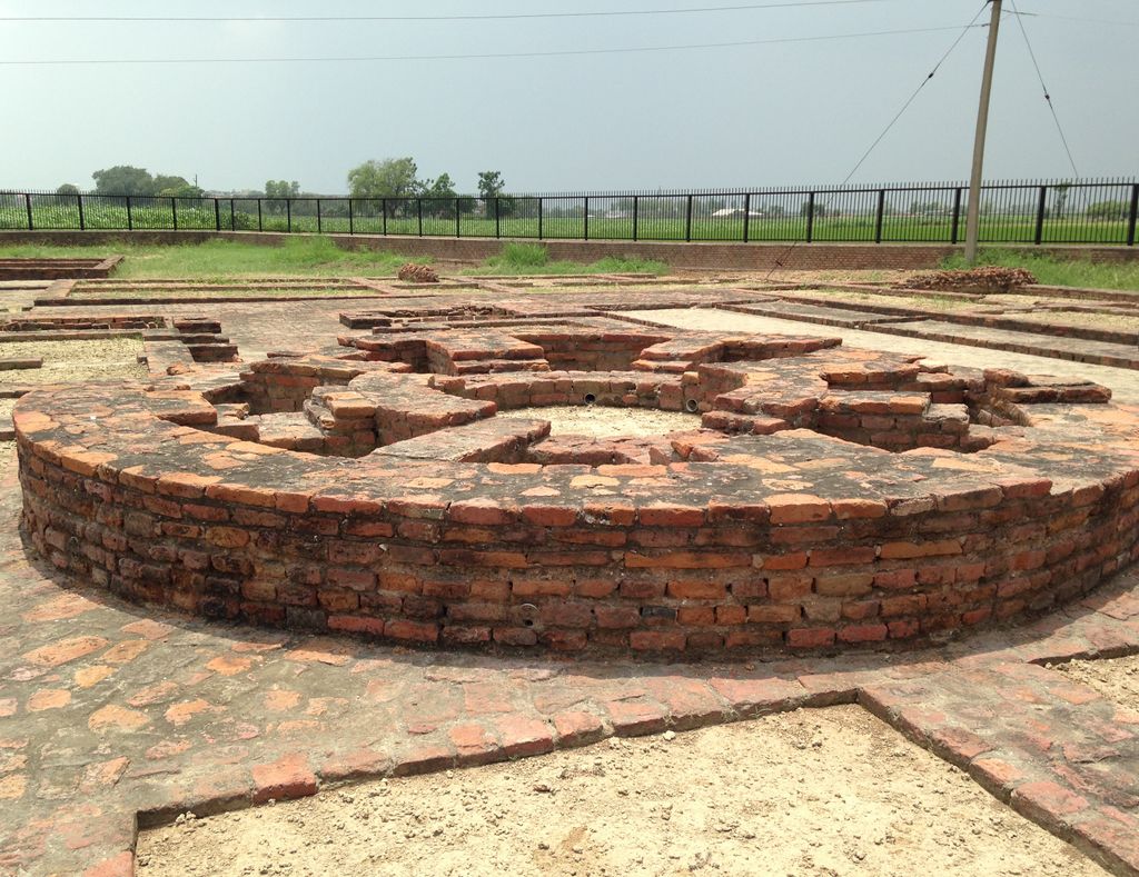
Sanghol is a historical village located in Fatehgarh Sahib District of Punjab, India dating to the Harrapan civilisation. It is also known as Uchha Pind Sanghol. It is about 40 km from Chandigarh on the way to Ludhiana and approximately 10 km from Dholewal. It is of archaeological significance. Excavations at the site have yielded coins and seals related to Toramana and Mihirakula belonging to central Asia. A Buddhist stupa was excavated in 1968, and in February 1985 117 carved stone slabs, including 69 pillars, 35 crossbars, figures and figurines, was excavated by the experts of the Directorate of Archaeology, Punjab. Scholars have said they are Kushan sculptures of the Mathura school of the 1st and 2nd centuries AD. They are in Sanghol Museum. Some of the art pieces from this museum sometimes go on display as special exhibits at various museums around the world. Situated on the top of a mound, Ucha Pind Sanghol is spread over an area of 200 km.
We use GPS information embedded into the photo when it is available.
3D mountains overlay
Adjust mountain panorama to perfectly match your photos because recorded by camera photo position might be imprecise.
Move tool
Rotate tool
Zoom
More customization
Choose which peak labels should make into the final photo and what photo title should be.
Next
Photo Location
Satellitte
Flat map
Relief map
Latitude
Longitude
Altitude
OR
Latitude
°'''
Longitude
°'''
Apply
Register Peak
Peak Name
Latitude
Longitude
Altitude
Register
Teleport
PeakVisor
This 3D model of Sagarmatha National Park in Nepal was made using the PeakVisor app topographic data. The mobile app features higher precision models worldwide, more topographic details, and works offline. Download PeakVisor maps today.
Download OBJ model
PeakVisor
The download should start shortly. If you find it useful please consider supporting the PeakVisor app.
PeakVisor for iOS and Android
Be a superhero of outdoor navigation with state-of-the-art 3D maps and mountain identification in the palm of your hand!