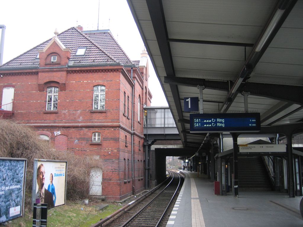
Berlin Heidelberger Platz is a railway station in the Wilmersdorf district of Berlin. It is served by S-Bahn lines S41, S42 and S46 and U-Bahn line U3. The station on the Berlin Ringbahn was opened with the name "Schmargendorf" on 15 December 1883. In 1980 the S-Bahn service was discontinued and the former entrance hall eventually became a nightclub. On 17 December 1993 the S-Bahn station was reopened, now directly connected to the adjacent U-Bahn station and therefore renamed Heidelberger Platz. The U-Bahn station opened on 12 October 1913 (architect Wilhelm Leitgebel). With its high groin vault it is one of the most brightly decorated of the Berlin network. The eponymous square was named after the city of Heidelberg.
Show more
Sun and Moon
Mon
Tue
Wed
Thu
Fri
Sat
Sun
May 2022
Date and time
00:00
06:00
12:00
18:00
Today
--
--
Sunrise
--
Sunset
--
Moonrise
--
Moonset
Phase
🌔 Waxing Gibbous
The perfect light time for beautiful photos:
--
Sunrise
--
Sunset
PeakVisor app
Get the app on your smartphone
New Panorama Tools
Trace location on the map
Measure distances
All the instruments are available in the context menu as well.
We use GPS information embedded into the photo when it is available.
3D mountains overlay
Adjust mountain panorama to perfectly match your photos because recorded by camera photo position might be imprecise.
Move tool
Rotate tool
Zoom
More customization
Choose which peak labels should make into the final photo and what photo title should be.
Next
Photo Location
Satellitte
Flat map
Relief map
Latitude
Longitude
Altitude
OR
Latitude
°'''
Longitude
°'''
Apply
Register Peak
Peak Name
Latitude
Longitude
Altitude
Register
Teleport
PeakVisor
This 3D model of Sagarmatha National Park in Nepal was made using the PeakVisor app topographic data. The mobile app features higher precision models worldwide, more topographic details, and works offline. Download PeakVisor maps today.
Download OBJ model
PeakVisor
The download should start shortly. If you find it useful please consider supporting the PeakVisor app.
PeakVisor for iOS and Android
Be a superhero of outdoor navigation with state-of-the-art 3D maps and mountain identification in the palm of your hand!