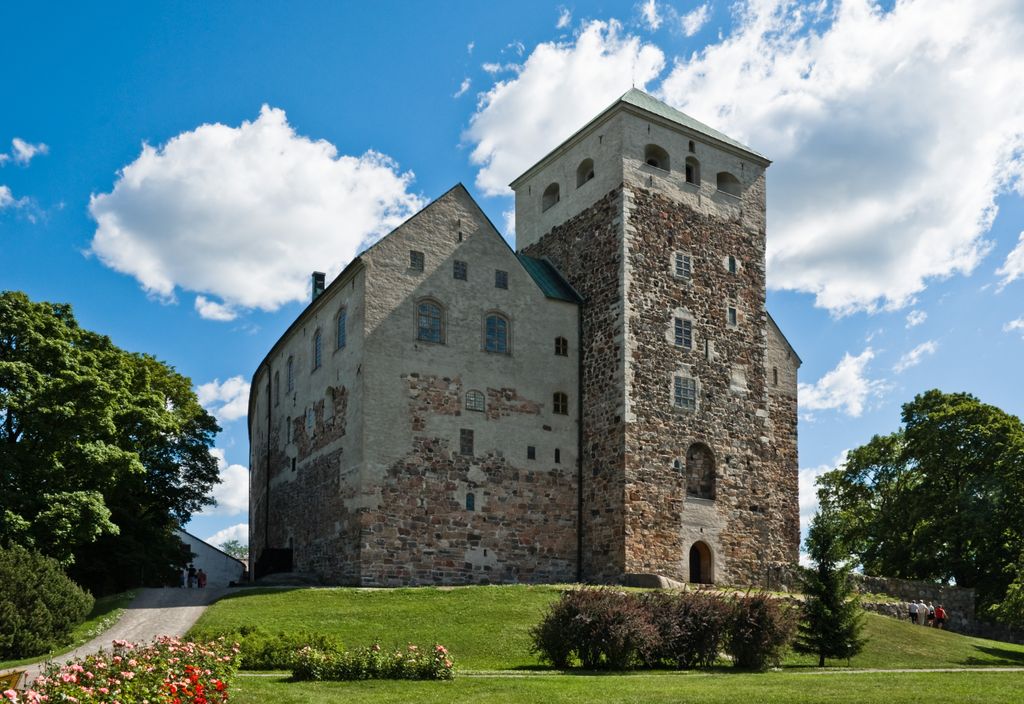
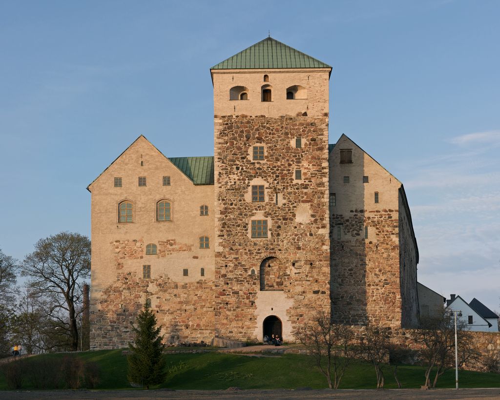
Turku Castle (Finnish: Turun linna, Swedish: Åbo slott) is a medieval building in the city of Turku in Finland. Together with Turku Cathedral, the castle is one of the oldest buildings still in use and the largest surviving medieval building in Finland. It was founded in the late 13th century and stands on the banks of the Aura River. The castle served as a bastion and administrative centre in Finland, which was a part of Sweden until the early 19th century. Only once did the castle figure in the defence of the realm, when Russian invaders from Novgorod destroyed Turku in 1318. It more frequently played a role in internal struggles for power within Sweden and the Kalmar Union. The castle's heyday was in the mid-16th century during the reign of Duke John of Finland and Catherine Jagellon. That was when the Renaissance Floor and King's and Queen's hall were built, along with other features. It lost its status as an administrative centre in the 17th century after Per Brahe's period as governor-general of Finland came to an end. Turku castle is today Finland's most visited museum, with attendance reaching 200,000 in some years. In addition, many of the larger rooms are used for municipal functions.
Show more
Sun and Moon
Mon
Tue
Wed
Thu
Fri
Sat
Sun
May 2022
Date and time
00:00
06:00
12:00
18:00
Today
--
--
Sunrise
--
Sunset
--
Moonrise
--
Moonset
Phase
🌔 Waxing Gibbous
The perfect light time for beautiful photos:
--
Sunrise
--
Sunset
PeakVisor app
Get the app on your smartphone
New Panorama Tools
Trace location on the map
Measure distances
All the instruments are available in the context menu as well.
We use GPS information embedded into the photo when it is available.
3D mountains overlay
Adjust mountain panorama to perfectly match your photos because recorded by camera photo position might be imprecise.
Move tool
Rotate tool
Zoom
More customization
Choose which peak labels should make into the final photo and what photo title should be.
Next
Photo Location
Satellitte
Flat map
Relief map
Latitude
Longitude
Altitude
OR
Latitude
°'''
Longitude
°'''
Apply
Register Peak
Peak Name
Latitude
Longitude
Altitude
Register
Teleport
PeakVisor
This 3D model of Sagarmatha National Park in Nepal was made using the PeakVisor app topographic data. The mobile app features higher precision models worldwide, more topographic details, and works offline. Download PeakVisor maps today.
Download OBJ model
PeakVisor
The download should start shortly. If you find it useful please consider supporting the PeakVisor app.
PeakVisor for iOS and Android
Be a superhero of outdoor navigation with state-of-the-art 3D maps and mountain identification in the palm of your hand!