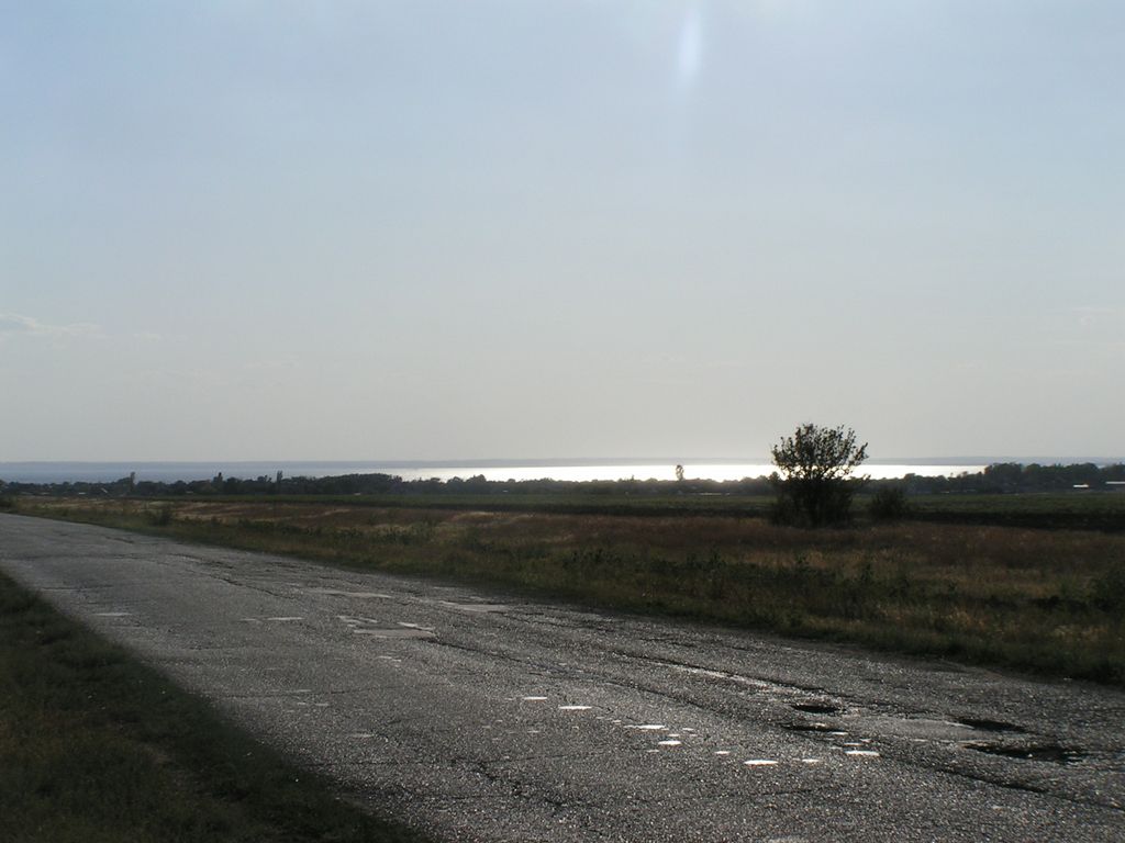
Tsimlyansk Reservoir or Tsimlyanskoye Reservoir (Цимля́нское водохрани́лище) is an artificial lake on the Don River in the territories of Rostov and Volgograd Oblasts at 47°50′N 42°50′E. Completed in 1952, the reservoir is one of the largest in Russia, providing power (Tsimlyansk Hydroelectric Station) and irrigation to the Rostov and Volgograd regions. Crops grown around the lake include wheat, rice, cotton, maize, alfalfa, fruit, grapes, and vegetables. The reservoir, together with the Volga–Don Canal and the lower course of the Don, provides an important waterway between the Volga River / Caspian Sea basin and the Sea of Azov. The Tsimlyansk Dam also provides flood control for the lower Don River basin. Completion of the lake resulted in strong local industrial growth. In particular, the city of Volgodonsk owes its existence to the Tsimlyansk Dam project. Under the waters lies the ancient Khazar fortress town of Sarkel.
We use GPS information embedded into the photo when it is available.
3D mountains overlay
Adjust mountain panorama to perfectly match your photos because recorded by camera photo position might be imprecise.
Move tool
Rotate tool
Zoom
More customization
Choose which peak labels should make into the final photo and what photo title should be.
Next
Photo Location
Satellitte
Flat map
Relief map
Latitude
Longitude
Altitude
OR
Latitude
°'''
Longitude
°'''
Apply
Register Peak
Peak Name
Latitude
Longitude
Altitude
Register
Teleport
PeakVisor
This 3D model of Sagarmatha National Park in Nepal was made using the PeakVisor app topographic data. The mobile app features higher precision models worldwide, more topographic details, and works offline. Download PeakVisor maps today.
Download OBJ model
PeakVisor
The download should start shortly. If you find it useful please consider supporting the PeakVisor app.
PeakVisor for iOS and Android
Be a superhero of outdoor navigation with state-of-the-art 3D maps and mountain identification in the palm of your hand!