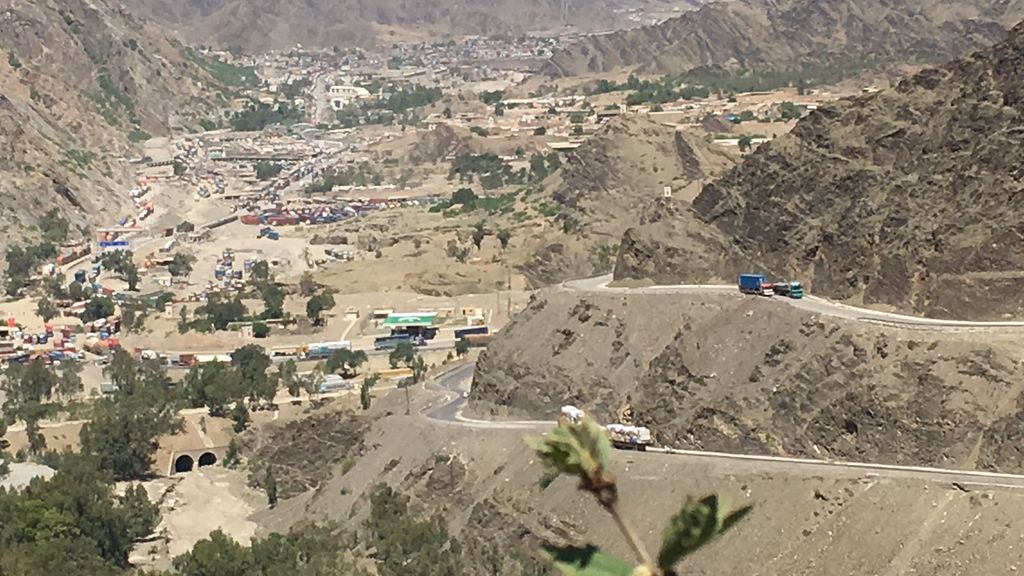
Torkham (Pashto: تورخم, romanized: torxam; Urdu: طورخم) is a Pakistani town in Khyber District (until 2018 the Khyber Agency of the now defunct FATA), that is the location of the Torkham Border Crossing with Afghanistan just to the west of the historic Khyber Pass. Torkham lies at the end of the N-5 National Highway. It is connected to city of Peshawar in the east. Transported goods arrive to Tokham from the port city of Karachi in Sindh province. Torkham is 5 kilometres (3.1 mi) west of the summit of the Khyber Pass. It lies on the most important supply route for US-led NATO forces in Afghanistan. Pakistan's government sometimes block supplies due to the American use of drone strikes in Pakistan, and for security reasons after firing from the Afghan side against Pakistani construction workers building a border fence. By the end of 2018, Pakistan had completed a 486 kilometer portion of the border fence around Torkham to seal the porous border in order to curb arms smuggling, illegal migration, and drug trafficking. Throughout history it has been an important trade route between the South Asia and Central Asia and a strategic military location. The adjacent town on the other side of border in Afghanistan is also known as Torkham. Torkham was the first point of entry into Pakistan for many of the 3.5 million Afghans who fled the Soviet invasion as refugees.
Show more
Sun and Moon
Mon
Tue
Wed
Thu
Fri
Sat
Sun
May 2022
Date and time
00:00
06:00
12:00
18:00
Today
--
--
Sunrise
--
Sunset
--
Moonrise
--
Moonset
Phase
🌔 Waxing Gibbous
The perfect light time for beautiful photos:
--
Sunrise
--
Sunset
PeakVisor app
Get the app on your smartphone
New Panorama Tools
Trace location on the map
Measure distances
All the instruments are available in the context menu as well.
We use GPS information embedded into the photo when it is available.
3D mountains overlay
Adjust mountain panorama to perfectly match your photos because recorded by camera photo position might be imprecise.
Move tool
Rotate tool
Zoom
More customization
Choose which peak labels should make into the final photo and what photo title should be.
Next
Photo Location
Satellitte
Flat map
Relief map
Latitude
Longitude
Altitude
OR
Latitude
°'''
Longitude
°'''
Apply
Register Peak
Peak Name
Latitude
Longitude
Altitude
Register
Teleport
PeakVisor
This 3D model of Sagarmatha National Park in Nepal was made using the PeakVisor app topographic data. The mobile app features higher precision models worldwide, more topographic details, and works offline. Download PeakVisor maps today.
Download OBJ model
PeakVisor
The download should start shortly. If you find it useful please consider supporting the PeakVisor app.
PeakVisor for iOS and Android
Be a superhero of outdoor navigation with state-of-the-art 3D maps and mountain identification in the palm of your hand!