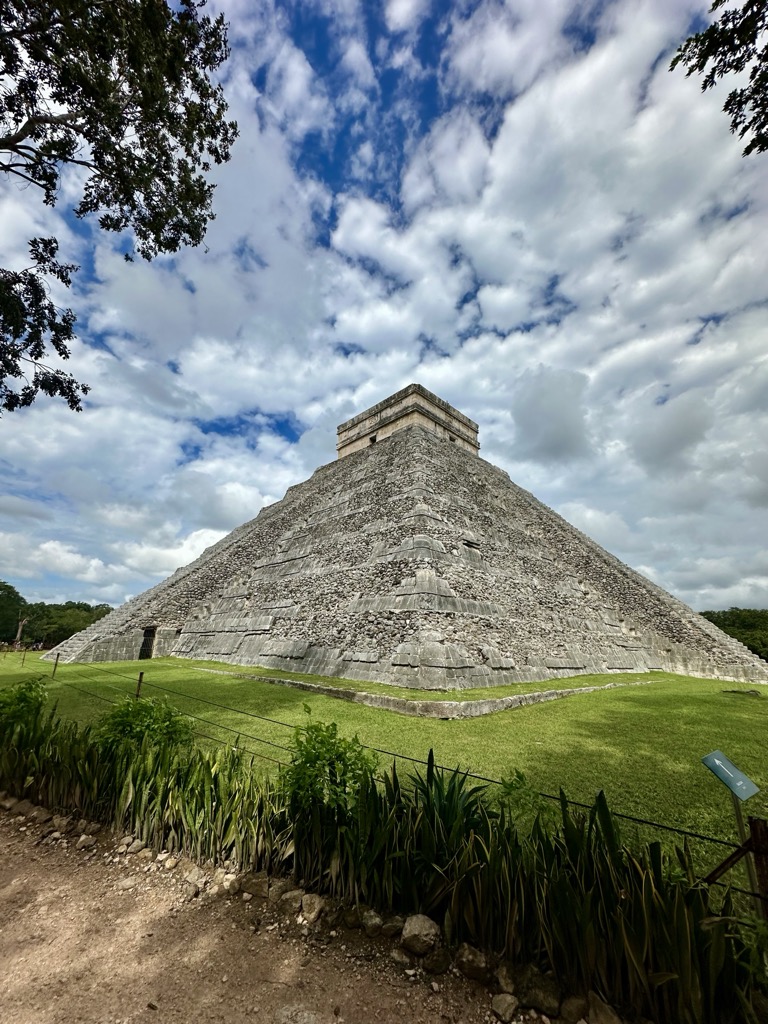
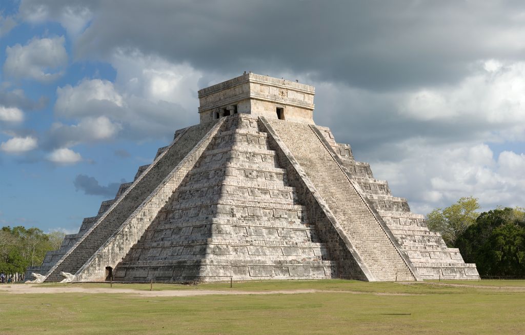
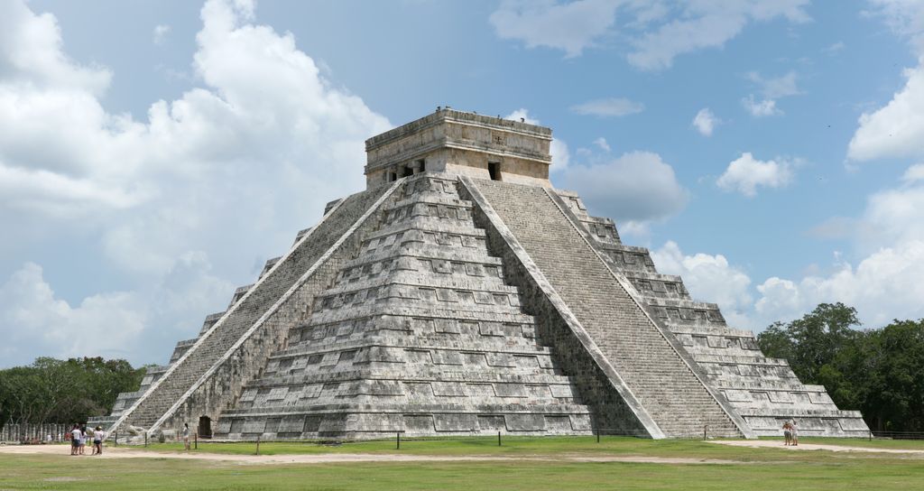
El Castillo (Spanish pronunciation: [el kas'tiʎo], Spanish for "the castle"), also known as the Temple of Kukulcan is a Mesoamerican step-pyramid that dominates the center of the Chichen Itza archaeological site in the Mexican state of Yucatán. The temple building is more formally designated by archaeologists as Chichen Itza Structure 5B18. Built by the pre-Columbian Maya civilization sometime between the 8th and 12th centuries AD, the building served as a temple to the deity Kukulcán, the Yucatec Maya Feathered Serpent deity closely related to Quetzalcoatl, a deity known to the Aztecs and other central Mexican cultures of the Postclassic period. It has a substructure that likely was constructed several centuries earlier for the same purpose. The temple consists of a series of square terraces with stairways up each of the four sides to the temple on top. Sculptures of plumed serpents run down the sides of the northern balustrade. Around the spring and autumn equinoxes, the late afternoon sun strikes off the northwest corner of the temple and casts a series of triangular shadows against the northwest balustrade, creating the illusion of the feathered serpent "crawling" down the temple. To contemporary visitors, the event has been very popular and is witnessed by thousands at the spring equinox, but it is not known whether the phenomenon is a result of a purposeful design since the light-and-shadow effect can be observed without major changes during several weeks near the equinoxes. Scientific research led since 1998 suggests that the temple mimics the chirping sound of the quetzal bird when humans clap their hands around it. The researchers argue that this phenomenon is not accidental, that the builders of this temple felt divinely rewarded by the echoing effect of this structure. Technically, the clapping noise rings out and scatters against the temple's high and narrow limestone steps, producing a chirp-like tone that declines in frequency. All four sides of the temple have approximately 91 steps which, when added together and including the temple platform on top as the final "step", may produce a total of 365 steps (the steps on the south side of the temple are eroded). That number is equal to the number of days of the Haab' year and likely is significantly related to rituals. The structure is 24 m (79 ft) high, plus an additional 6 m (20 ft) for the temple at the top. The square base measures 55.3 m (181 ft) across.
We use GPS information embedded into the photo when it is available.
3D mountains overlay
Adjust mountain panorama to perfectly match your photos because recorded by camera photo position might be imprecise.
Move tool
Rotate tool
Zoom
More customization
Choose which peak labels should make into the final photo and what photo title should be.
Next
Photo Location
Satellitte
Flat map
Relief map
Latitude
Longitude
Altitude
OR
Latitude
°'''
Longitude
°'''
Apply
Register Peak
Peak Name
Latitude
Longitude
Altitude
Register
Teleport
PeakVisor
This 3D model of Sagarmatha National Park in Nepal was made using the PeakVisor app topographic data. The mobile app features higher precision models worldwide, more topographic details, and works offline. Download PeakVisor maps today.
Download OBJ model
PeakVisor
The download should start shortly. If you find it useful please consider supporting the PeakVisor app.
PeakVisor for iOS and Android
Be a superhero of outdoor navigation with state-of-the-art 3D maps and mountain identification in the palm of your hand!


.jpg)


