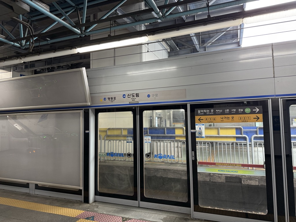
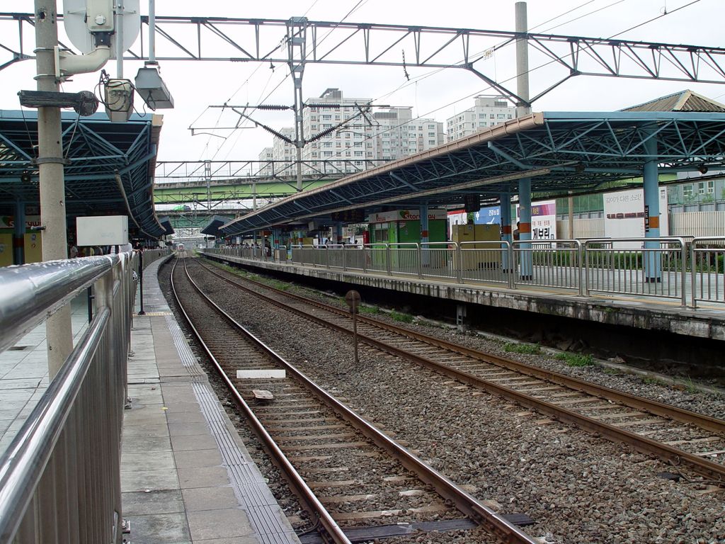
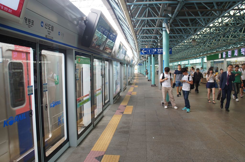
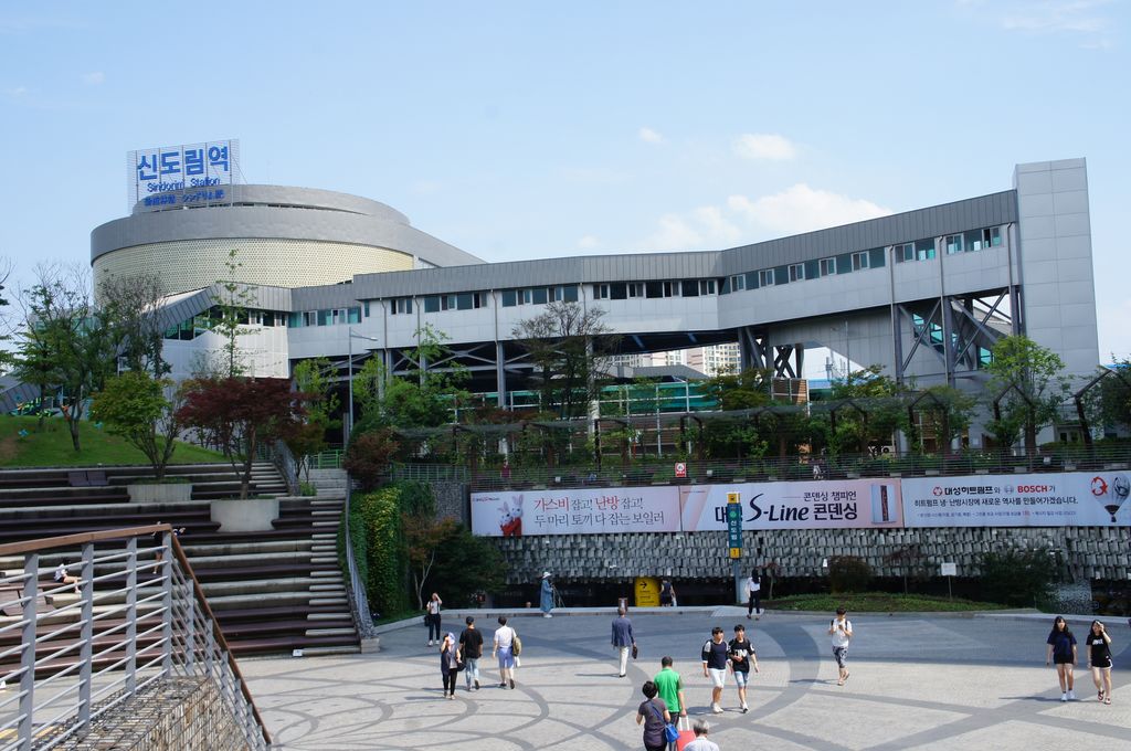
Sindorim station is a station on Seoul Subway Line 1 (overground platforms) and Line 2 (underground). It is also the southeastern terminus of Line 2's Sinjeong Branch to Kkachisan (underground platform 3). The station is located at the northern edge of Sindorim-dong, Guro-gu, Seoul, on the border with Yeongdeungpo-gu. Sindorim station is designed primarily to serve as a transfer station of the Subway Lines 1 and 2, having no direct exits from the Line 1 platform. It is known to be the most congested transfer station of Seoul Subway, especially during the rush hours. It is estimated that over 320,000 passengers per day use Sindorim Station to transfer between Lines 1 and 2. A plan to extend the Line 2 part of the station, including a new platform for the outer circle line, is now on design. Screen doors have been added to the subway platforms. D-Cube City, a large leisure complex consisting of a Hyundai department store, additional coffee shops & restaurants on the periphery, a Sheraton Hotel and a Lotte Cinema, is located next to the station. The complex was opened in 2011 and is directly connected to the station by an underground passageway which passes under the entire width of the station. All Line 2 trains that operate up to this station take the Sinjeong branch to be serviced at the Sinjeong train servicing depot, located next to Yangcheon-gu Office station. In 2013, improvements were made in terms of accessibility for Line 1. A new overhead concourse was constructed above the Line platforms to ease congestion in the underground concourse, where passengers transfer between Lines 1 and 2. The new overhead concourse includes childcare facilities and meeting rooms. South Korean music group Jaurim wrote in the song "The Departure," "Strip Show in Sindorim Station..."I wrote the lyrics, ".
Show more
Sun and Moon
Mon
Tue
Wed
Thu
Fri
Sat
Sun
May 2022
Date and time
00:00
06:00
12:00
18:00
Today
--
--
Sunrise
--
Sunset
--
Moonrise
--
Moonset
Phase
🌔 Waxing Gibbous
The perfect light time for beautiful photos:
--
Sunrise
--
Sunset
PeakVisor app
Get the app on your smartphone
New Panorama Tools
Trace location on the map
Measure distances
All the instruments are available in the context menu as well.
We use GPS information embedded into the photo when it is available.
3D mountains overlay
Adjust mountain panorama to perfectly match your photos because recorded by camera photo position might be imprecise.
Move tool
Rotate tool
Zoom
More customization
Choose which peak labels should make into the final photo and what photo title should be.
Next
Photo Location
Satellitte
Flat map
Relief map
Latitude
Longitude
Altitude
OR
Latitude
°'''
Longitude
°'''
Apply
Register Peak
Peak Name
Latitude
Longitude
Altitude
Register
Teleport
PeakVisor
This 3D model of Sagarmatha National Park in Nepal was made using the PeakVisor app topographic data. The mobile app features higher precision models worldwide, more topographic details, and works offline. Download PeakVisor maps today.
Download OBJ model
PeakVisor
The download should start shortly. If you find it useful please consider supporting the PeakVisor app.
PeakVisor for iOS and Android
Be a superhero of outdoor navigation with state-of-the-art 3D maps and mountain identification in the palm of your hand!


_20230430_005.jpg)


