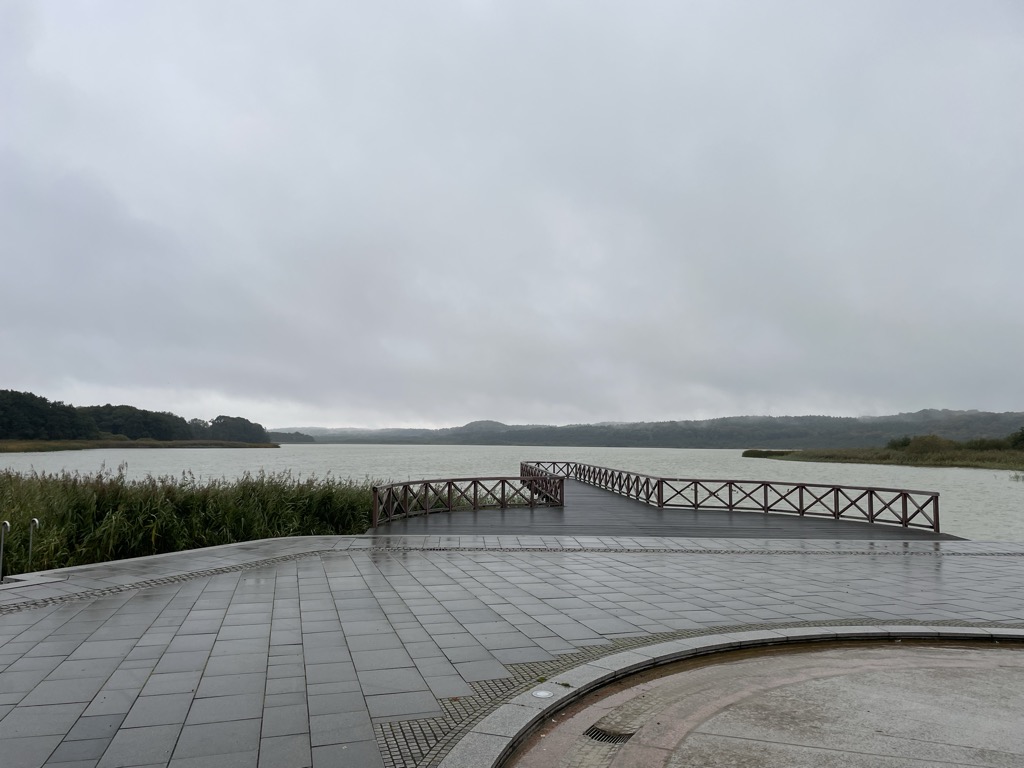
Schmachter See is a lake near Binz on the German Baltic Sea island of Rügen. It lies within the county of Vorpommern-Rügen in the state of Mecklenburg-Vorpommern. It has an elevation of 1.1 metres above sea level and its surface area is 1.18 km2. It is part of the Schmachter See and Fangerien Nature Reserve. The lake has its origins in the Ice Age. At the end of the glacial period there was an ice front here. Today the lake has an area of about 118 hectares. Before about 14,000 years ago the lake, which was then still part of the Baltic Sea, had a depth of up to 15 metres. About 5,000 years ago the waterbody was cut off from the Baltic by the bar of the Schmale Heide. Its only link to the Baltic is the drainage ditch of the Ahlbeck stream. As a result of natural silting-up processes it is today a shallow lake. In the centre it has a depth of only one to two metres. In addition the lake has lost a lot of its former area. Originally it purportedly reached as far south as Nistelitz. The name of the lake comes from the settlement of Schmacht to the southwest, but which no longer lies on the lake shore. The Ahlbeck, which drains the lake into the Baltic Sea, was canalised in the 1950s. The mouth of the pipe or ditch is located on the beach of Binzer Strand and is marked by an information sign. A variety of animal and plant species live on the lake and, including 40 species on the IUCN Red List of Threatened Species. For example, the bittern reed warbler greylag goose, goosander, smew white-tailed eagle and osprey occur here. The shores of the lake are mainly covered in beech woods. At the foot of the slopes are seepage springs. Close to the lake are alder carrs and marshes. The shore itself is mainly fringed by reeds and quaking bog vegetation. At the northern end the lake is the village of Binz. Here, there is a promenade and the "Park of Senses" (Park der Sinne).
Show more
Sun and Moon
Mon
Tue
Wed
Thu
Fri
Sat
Sun
May 2022
Date and time
00:00
06:00
12:00
18:00
Today
--
--
Sunrise
--
Sunset
--
Moonrise
--
Moonset
Phase
🌔 Waxing Gibbous
The perfect light time for beautiful photos:
--
Sunrise
--
Sunset
PeakVisor app
Get the app on your smartphone
New Panorama Tools
Trace location on the map
Measure distances
All the instruments are available in the context menu as well.
We use GPS information embedded into the photo when it is available.
3D mountains overlay
Adjust mountain panorama to perfectly match your photos because recorded by camera photo position might be imprecise.
Move tool
Rotate tool
Zoom
More customization
Choose which peak labels should make into the final photo and what photo title should be.
Next
Photo Location
Satellitte
Flat map
Relief map
Latitude
Longitude
Altitude
OR
Latitude
°'''
Longitude
°'''
Apply
Register Peak
Peak Name
Latitude
Longitude
Altitude
Register
Teleport
PeakVisor
This 3D model of Sagarmatha National Park in Nepal was made using the PeakVisor app topographic data. The mobile app features higher precision models worldwide, more topographic details, and works offline. Download PeakVisor maps today.
Download OBJ model
PeakVisor
The download should start shortly. If you find it useful please consider supporting the PeakVisor app.
PeakVisor for iOS and Android
Be a superhero of outdoor navigation with state-of-the-art 3D maps and mountain identification in the palm of your hand!