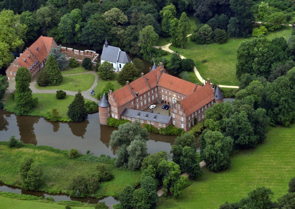
Herten Castle (German: Schloss Herten) is a moated castle situated in the town of Herten in the administrative district of Recklinghausen in the state of North Rhine Westphalia, Germany. It is located within an old English landscape garden and its first mentioning dates back to 1376. In 1962, the main castle building was declared a cultural heritage monument. While foundations of today's main castle building incorporate elements from the 14th-century building, the buildings visible today were built in the 16th and 17th century by Coesfeld architect Henric de Suer and his son Johann. They were built for the families Stecke and Nesselrode. After the First World War, the main castle building was no longer used as a residence and started to deteriorate. Subsidence caused by the widespread sub-surface mining in the surrounding industrial Ruhr area added to the structural damage, bringing the castle buildings close to collapse. Only radical restoration measures taken by the Regional Association of Westphalia-Lippe (German: Landschaftsverband Westfalen-Lippe) from 1974 to 1989 saved the late Gothic castle complex from total decline. Today it is used as a venue for concerts, cultural events and festivities. It also houses a café. The castle's park is popular for walking, picknicking, jogging and biking.
Show more
Sun and Moon
Mon
Tue
Wed
Thu
Fri
Sat
Sun
May 2022
Date and time
00:00
06:00
12:00
18:00
Today
--
--
Sunrise
--
Sunset
--
Moonrise
--
Moonset
Phase
🌔 Waxing Gibbous
The perfect light time for beautiful photos:
--
Sunrise
--
Sunset
PeakVisor app
Get the app on your smartphone
New Panorama Tools
Trace location on the map
Measure distances
All the instruments are available in the context menu as well.
We use GPS information embedded into the photo when it is available.
3D mountains overlay
Adjust mountain panorama to perfectly match your photos because recorded by camera photo position might be imprecise.
Move tool
Rotate tool
Zoom
More customization
Choose which peak labels should make into the final photo and what photo title should be.
Next
Photo Location
Satellitte
Flat map
Relief map
Latitude
Longitude
Altitude
OR
Latitude
°'''
Longitude
°'''
Apply
Register Peak
Peak Name
Latitude
Longitude
Altitude
Register
Teleport
PeakVisor
This 3D model of Sagarmatha National Park in Nepal was made using the PeakVisor app topographic data. The mobile app features higher precision models worldwide, more topographic details, and works offline. Download PeakVisor maps today.
Download OBJ model
PeakVisor
The download should start shortly. If you find it useful please consider supporting the PeakVisor app.
PeakVisor for iOS and Android
Be a superhero of outdoor navigation with state-of-the-art 3D maps and mountain identification in the palm of your hand!


.jpg)