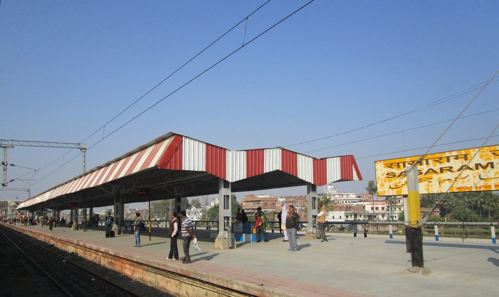
Sasaram Junction railway station is on the Gaya–Pandit Deen Dayal Upadhyaya Junction section of the Grand Chord line in India. It serves Sasaram and the surrounding areas in Rohtas district in the Indian state of Bihar. Sasaram is well connected to Delhi and Kolkata. It is also connected to Patna via Ara railway station. This place was also known for preparation of competitive exams at Sasaram Railway junction. According to earlier natives of this city, there was not proper electrification of city around 2007–2008 which hampered the studies of students seeking for competitive exams. Still Indian Railways had 24 hours power supply at Sasaram Junction. This led a small group of students to study there at night under electric lights. However, the authorities have now banned study groups citing safety concerns.
Show more
Sun and Moon
Mon
Tue
Wed
Thu
Fri
Sat
Sun
May 2022
Date and time
00:00
06:00
12:00
18:00
Today
--
--
Sunrise
--
Sunset
--
Moonrise
--
Moonset
Phase
🌔 Waxing Gibbous
The perfect light time for beautiful photos:
--
Sunrise
--
Sunset
PeakVisor app
Get the app on your smartphone
New Panorama Tools
Trace location on the map
Measure distances
All the instruments are available in the context menu as well.
We use GPS information embedded into the photo when it is available.
3D mountains overlay
Adjust mountain panorama to perfectly match your photos because recorded by camera photo position might be imprecise.
Move tool
Rotate tool
Zoom
More customization
Choose which peak labels should make into the final photo and what photo title should be.
Next
Photo Location
Satellitte
Flat map
Relief map
Latitude
Longitude
Altitude
OR
Latitude
°'''
Longitude
°'''
Apply
Register Peak
Peak Name
Latitude
Longitude
Altitude
Register
Teleport
PeakVisor
This 3D model of Sagarmatha National Park in Nepal was made using the PeakVisor app topographic data. The mobile app features higher precision models worldwide, more topographic details, and works offline. Download PeakVisor maps today.
Download OBJ model
PeakVisor
The download should start shortly. If you find it useful please consider supporting the PeakVisor app.
PeakVisor for iOS and Android
Be a superhero of outdoor navigation with state-of-the-art 3D maps and mountain identification in the palm of your hand!