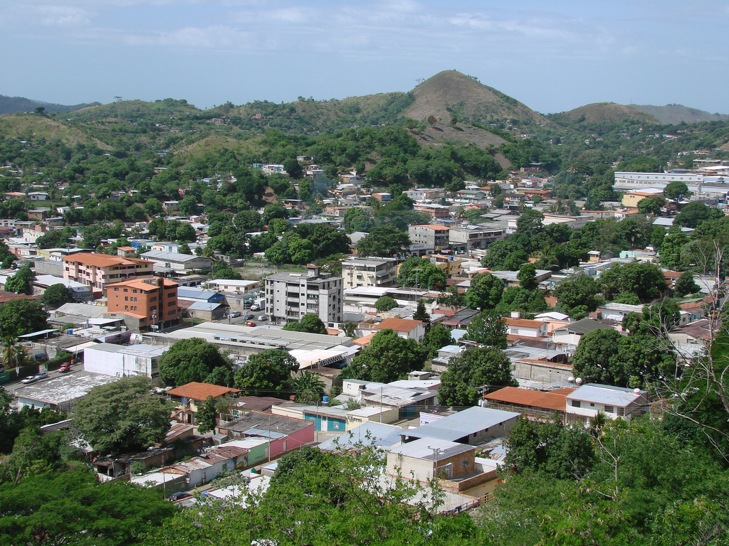
San Juan de los Morros (Spanish pronunciation: [saŋ ˈxwan de los ˈmoros]) is the capital city of Guárico State, located in Venezuela. The city is commonly referred to as the "Gateway to the Central Plains" (Puerta a Los Llanos Centrales). Having a geography in which majestic mountains prevail, the capital city's population is 120,111, (taken from the 2011 census), being the second most populated city in Guárico State, after Calabozo, and is the state's first in population density. It was one of the first cities founded in Guárico State, along with Calabozo, Valle de la Pascua, and Zaraza. Among the primary landmarks of the city are the Monument to the Flag, the mountain range Arístides Rojas (known as Morros de San Juan), the Monument to San Juan Bautista, El Platillón hill, the monument to the Beata Guariqueña, Madre Candelaria de San José, La Villa Olímpica, and the thermal waters (baños termales), which have great significance in the city due to the medicinal properties of its sulphuric waters (that is, because of the amount of sulphur that its waters possess): such is its effectiveness and fame, that from ancient times, once he became President of Venezuela, Antonio Guzmán Blanco, constructed the first highway to the city, which grants entry to this restoration supply that his own circle of relative physician had recommended. San Juan de los Morros has a weather of 24 to 32 °C and its remedy is ruled via way of means of mountains, which evaluation with the plains of the relaxation of the state. Guárico is the fourth largest state in the country in terms of area, but not in population, as it has a low population density. San Juan de los Morros used to be part of Aragua State, but it was changed during the 1930s to Guárico State, and the city was later named state capital, replacing the former capital, Ortiz. Among the major features of the city are the Statue of San Juan Bautista (John the Baptist) which is 19.8 meters (62,3 ft) high, the Bandera Monument, the Bolivar Square, 'Los Morros de San Juan' monument, the historic place and monument known as "La Puerta" (The Gate), and the hot springs. The medicinal sulfuric content of the springs makes them a significant tourist attraction. San Juan de Los Morros has a climate of 24 to 32 degrees Celsius and is dominated by surrounding mountains, which contrasts with the plains of the rest of the state. Typical dishes that originate from the Guarico area are: the cachapa, the pabellón criollo (Venezuela's typical dish), and arepas (a type of corn griddle cake). The city is connected to the south with Parapara and Ortiz by a national highway. It is served by the Guarico Municipal Airport.
We use GPS information embedded into the photo when it is available.
3D mountains overlay
Adjust mountain panorama to perfectly match your photos because recorded by camera photo position might be imprecise.
Move tool
Rotate tool
Zoom
More customization
Choose which peak labels should make into the final photo and what photo title should be.
Next
Photo Location
Satellitte
Flat map
Relief map
Latitude
Longitude
Altitude
OR
Latitude
°'''
Longitude
°'''
Apply
Register Peak
Peak Name
Latitude
Longitude
Altitude
Register
Teleport
PeakVisor
This 3D model of Sagarmatha National Park in Nepal was made using the PeakVisor app topographic data. The mobile app features higher precision models worldwide, more topographic details, and works offline. Download PeakVisor maps today.
Download OBJ model
PeakVisor
The download should start shortly. If you find it useful please consider supporting the PeakVisor app.
PeakVisor for iOS and Android
Be a superhero of outdoor navigation with state-of-the-art 3D maps and mountain identification in the palm of your hand!