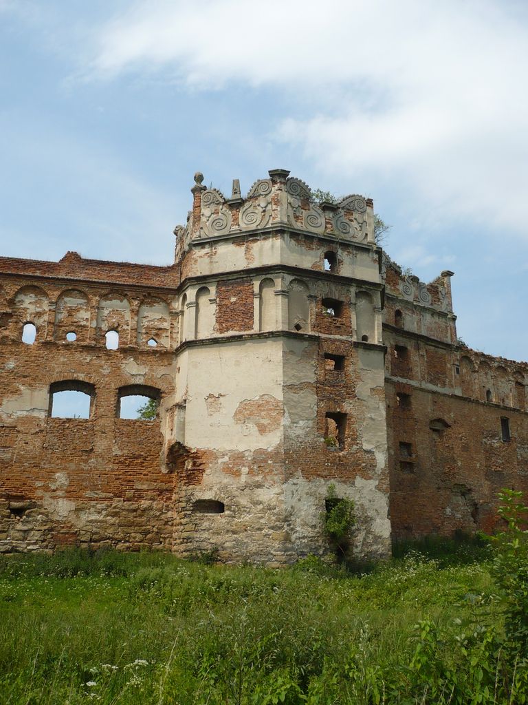
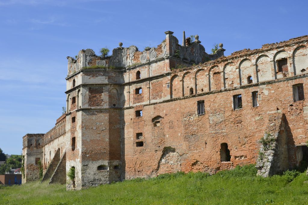
Stare Selo Castle is a castle in Stare Selo village, Lviv Raion, Lviv Oblast, Ukraine. This castle, or fortress, was built by the princely Ostrogski family. Its original timber fortifications, first mentioned in 1448, were destroyed by the invading Turks in the late 15th century. A more secure stone fort, intended to defend the Bârlad Road from Lviv to Romania, was built in Stare Selo in the 1580s. Those walls were breached and rendered useless by Khmelnytsky's Cossacks during the Siege of Lviv in 1648. The existing fortress, almost triangular in shape, with 15-metre high walls and a ceremonial gate on the south side, was commissioned by Prince Władysław Dominik Zasławski, one of the last members of the Ostrogski family. The citadel was erected in 1649-54 and formerly contained the palatial residence of Prince Zaslawski, one of the richest landowners of Eastern Europe and brother-in-law of King John III Sobieski. After Prince Zaslawski died in Stare Selo in 1656, the fortress gradually fell into disrepair, although it successfully withstood a siege by the Turks in 1674.
Show more
Sun and Moon
Mon
Tue
Wed
Thu
Fri
Sat
Sun
May 2022
Date and time
00:00
06:00
12:00
18:00
Today
--
--
Sunrise
--
Sunset
--
Moonrise
--
Moonset
Phase
🌔 Waxing Gibbous
The perfect light time for beautiful photos:
--
Sunrise
--
Sunset
PeakVisor app
Get the app on your smartphone
New Panorama Tools
Trace location on the map
Measure distances
All the instruments are available in the context menu as well.
We use GPS information embedded into the photo when it is available.
3D mountains overlay
Adjust mountain panorama to perfectly match your photos because recorded by camera photo position might be imprecise.
Move tool
Rotate tool
Zoom
More customization
Choose which peak labels should make into the final photo and what photo title should be.
Next
Photo Location
Satellitte
Flat map
Relief map
Latitude
Longitude
Altitude
OR
Latitude
°'''
Longitude
°'''
Apply
Register Peak
Peak Name
Latitude
Longitude
Altitude
Register
Teleport
PeakVisor
This 3D model of Sagarmatha National Park in Nepal was made using the PeakVisor app topographic data. The mobile app features higher precision models worldwide, more topographic details, and works offline. Download PeakVisor maps today.
Download OBJ model
PeakVisor
The download should start shortly. If you find it useful please consider supporting the PeakVisor app.
PeakVisor for iOS and Android
Be a superhero of outdoor navigation with state-of-the-art 3D maps and mountain identification in the palm of your hand!