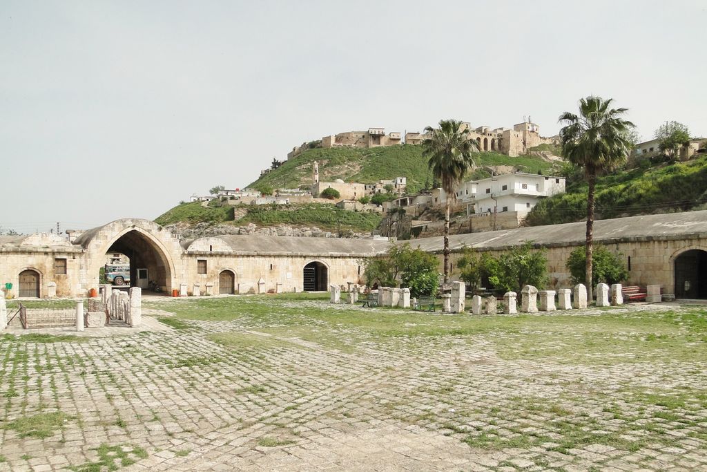
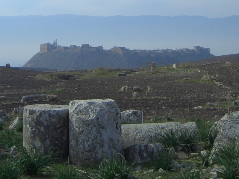
Qalaat al-Madiq (Arabic: قلعة المضيق also spelled Kal'at al-Mudik or Qal'at al-Mudiq; also known as Afamiyya or Famiyyah) is a town and medieval fortress in northwestern Syria, administratively part of the Hama Governorate, located northeast of Hama. It is situated in the al-Ghab plain, on the eastern bank of the Orontes River. Nearby localities include the district center al-Suqaylabiyah to the south, Bureij and Karnaz to the southeast, Kafr Nabudah to the east, al-Huwash to the north, Huwayjah al-Sallah and Shathah to the northwest and Al-Tuwayni and Ennab to the west. According to the Syria Central Bureau of Statistics (CBS), Qalaat al-Madiq had a population of 12,925 in the 2004 census. It is the administrative center and second largest locality in the Qalaat al-Madiq nahiyah ("subdistrict") which consisted of 40 localities with a collective population of 85,597 in 2004. The town's inhabitants are predominantly Sunni Muslims. Qalaat al-Madiq is the site of the ancient city of Apamea, the ruins of which are located just east of the town. The modern fortress, after which the town was named, was built during Muslim rule in the 12th century. It is still inhabited by townspeople. The Syrian Armed Forces retook this town from rebels during the May 2019 Hama offensive.
We use GPS information embedded into the photo when it is available.
3D mountains overlay
Adjust mountain panorama to perfectly match your photos because recorded by camera photo position might be imprecise.
Move tool
Rotate tool
Zoom
More customization
Choose which peak labels should make into the final photo and what photo title should be.
Next
Photo Location
Satellitte
Flat map
Relief map
Latitude
Longitude
Altitude
OR
Latitude
°'''
Longitude
°'''
Apply
Register Peak
Peak Name
Latitude
Longitude
Altitude
Register
Teleport
PeakVisor
This 3D model of Sagarmatha National Park in Nepal was made using the PeakVisor app topographic data. The mobile app features higher precision models worldwide, more topographic details, and works offline. Download PeakVisor maps today.
Download OBJ model
PeakVisor
The download should start shortly. If you find it useful please consider supporting the PeakVisor app.
PeakVisor for iOS and Android
Be a superhero of outdoor navigation with state-of-the-art 3D maps and mountain identification in the palm of your hand!