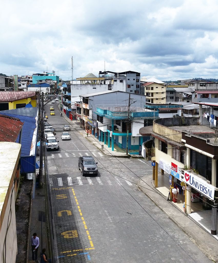
Puyo (Spanish pronunciation: [ˈpuʝo]), also known as El Puyo, is the capital of Pastaza, a province in Ecuador. Puyo is located at an altitude of approximately 950 metres above sea level by the Puyo River, a tributary of the Pastaza River, which eventually leads into the Amazon River. True to its name, derived from the Kichwa word for "cloudy", the local climate is a wet one and the weather is often overcast. Puyo was founded in 1899. Located between Baños, and the Amazonian cities of Tena and Macas, Puyo is the commercial, cultural and political capital of the region. In late 2006, the city had approximately 25,000 inhabitants. It was the fastest growing city in Ecuador in 2006. The seasonal changes in the climate are relatively small, and daytime temperature typically range between 18 and 24 °C, with sun and generally short, but heavy periods of rain daily.
We use GPS information embedded into the photo when it is available.
3D mountains overlay
Adjust mountain panorama to perfectly match your photos because recorded by camera photo position might be imprecise.
Move tool
Rotate tool
Zoom
More customization
Choose which peak labels should make into the final photo and what photo title should be.
Next
Photo Location
Satellitte
Flat map
Relief map
Latitude
Longitude
Altitude
OR
Latitude
°'''
Longitude
°'''
Apply
Register Peak
Peak Name
Latitude
Longitude
Altitude
Register
Teleport
PeakVisor
This 3D model of Sagarmatha National Park in Nepal was made using the PeakVisor app topographic data. The mobile app features higher precision models worldwide, more topographic details, and works offline. Download PeakVisor maps today.
Download OBJ model
PeakVisor
The download should start shortly. If you find it useful please consider supporting the PeakVisor app.
PeakVisor for iOS and Android
Be a superhero of outdoor navigation with state-of-the-art 3D maps and mountain identification in the palm of your hand!