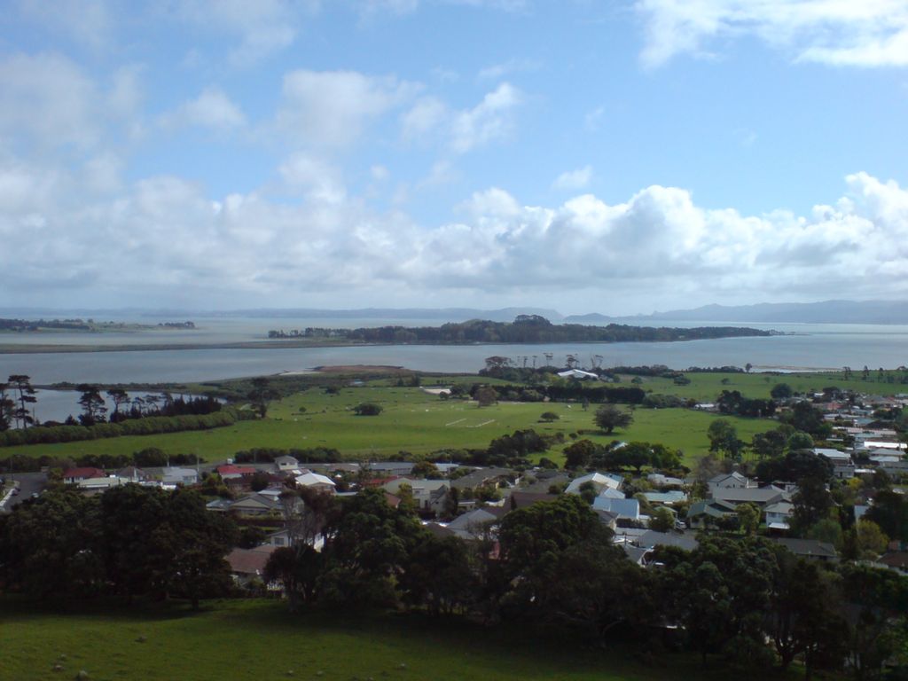
Puketutu Island, also known as Te Motu a Hiaroa, is a volcanic island in the Manukau Harbour, New Zealand, and is part of the Auckland volcanic field. European settlers called it Weekes' Island, but this was eventually abandoned in favour of the historical Māori name. The island is joined to the mainland via a causeway known as Te Ara Tāhuna. Te Motu a Hiaroa means "the island of Hiaroa" in reference to an ancestor who arrived on the island after journeying on the Tainui waka. Puketutu refers to one of the several maunga (mountains) and puke (hills) on the island. The New Zealand Ministry for Culture and Heritage gives a translation of "tutu shrub hill" for Puketutu.
We use GPS information embedded into the photo when it is available.
3D mountains overlay
Adjust mountain panorama to perfectly match your photos because recorded by camera photo position might be imprecise.
Move tool
Rotate tool
Zoom
More customization
Choose which peak labels should make into the final photo and what photo title should be.
Next
Photo Location
Satellitte
Flat map
Relief map
Latitude
Longitude
Altitude
OR
Latitude
°'''
Longitude
°'''
Apply
Register Peak
Peak Name
Latitude
Longitude
Altitude
Register
Teleport
PeakVisor
This 3D model of Sagarmatha National Park in Nepal was made using the PeakVisor app topographic data. The mobile app features higher precision models worldwide, more topographic details, and works offline. Download PeakVisor maps today.
Download OBJ model
PeakVisor
The download should start shortly. If you find it useful please consider supporting the PeakVisor app.
PeakVisor for iOS and Android
Be a superhero of outdoor navigation with state-of-the-art 3D maps and mountain identification in the palm of your hand!