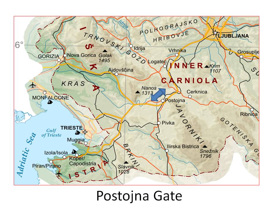
The Postojna Gate, less often the Postojna Gap (Slovene: Postojnska vrata), named after the local town of Postojna, is a major mountain pass of the Dinaric Alps. It lies in southwestern Slovenia, between the Hrušica Plateau to the north and the Javornik Hills to the south, at an elevation of 610 metres (2,000 ft). It formed due to tectonic subsidence and fluvial erosion by the Pivka River, which in the Pliocene flew superficially in this section. The terrain is significantly karstified. This relatively wide pass enables for the easiest passage from northearn Italy and northwestern Adriatic Sea to the Pannonian Plain, and had a very important strategic role in the past. Today, a rail line and the Slovenian A1 freeway traverse it.
We use GPS information embedded into the photo when it is available.
3D mountains overlay
Adjust mountain panorama to perfectly match your photos because recorded by camera photo position might be imprecise.
Move tool
Rotate tool
Zoom
More customization
Choose which peak labels should make into the final photo and what photo title should be.
Next
Photo Location
Satellitte
Flat map
Relief map
Latitude
Longitude
Altitude
OR
Latitude
°'''
Longitude
°'''
Apply
Register Peak
Peak Name
Latitude
Longitude
Altitude
Register
Teleport
PeakVisor
This 3D model of Sagarmatha National Park in Nepal was made using the PeakVisor app topographic data. The mobile app features higher precision models worldwide, more topographic details, and works offline. Download PeakVisor maps today.
Download OBJ model
PeakVisor
The download should start shortly. If you find it useful please consider supporting the PeakVisor app.
PeakVisor for iOS and Android
Be a superhero of outdoor navigation with state-of-the-art 3D maps and mountain identification in the palm of your hand!