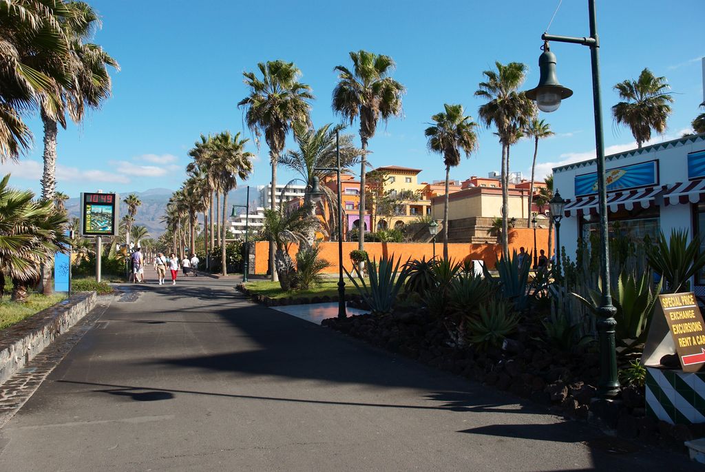
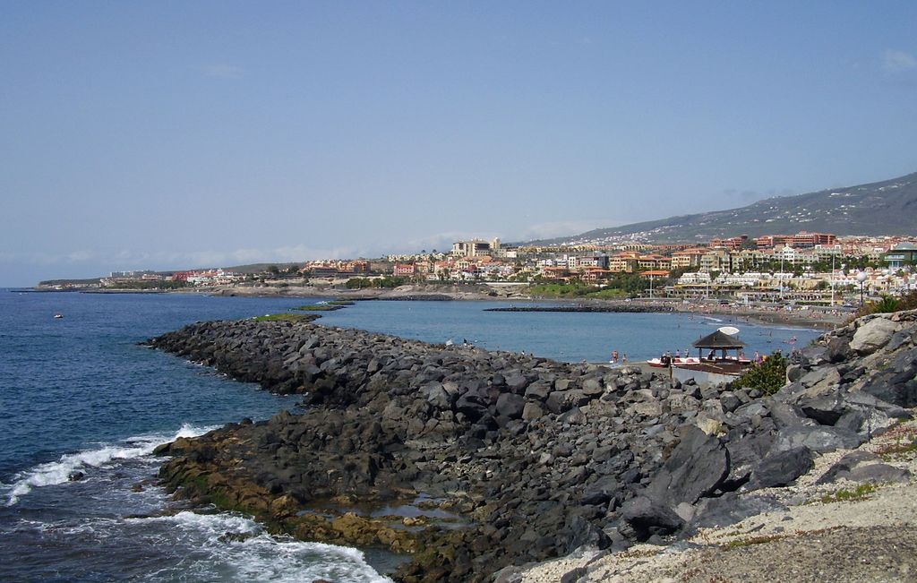
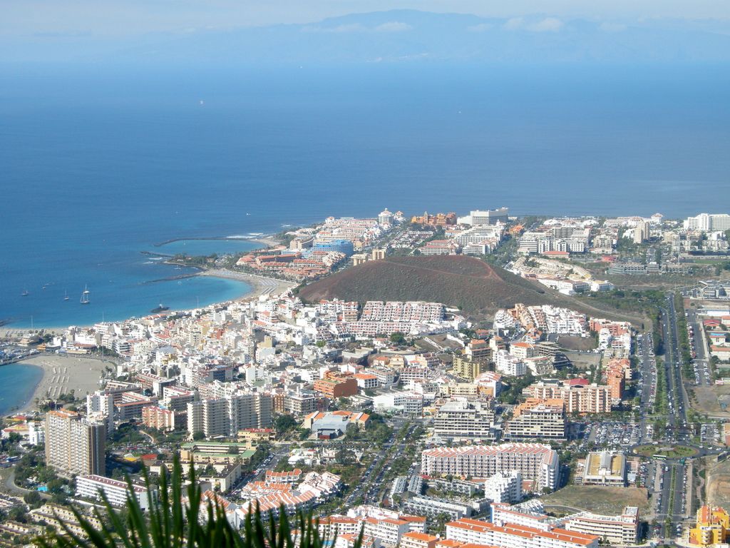
Playa de las Américas is a purpose-built holiday resort in Tenerife, one of the Canary Islands of Spain. It is located in the southern and southern-west part of the Municipality of Arona, close to the adjoining Municipality of Adeje in the west of Tenerife. It was built in the 1960s a few miles distant from the fishing village of Los Cristianos. Playa de las Americas now (2021) is part of the contiguous touristic construction zone lining Tenerife's entire southwestern coast. The resort area features bars, nightclubs, restaurants, attractions, and beaches, most of which are man-made with imported sand from Africa due to the darkness of the native volcanic sand. Playa de las Americas is a centre of nightlife in Tenerife. Nightlife is spread around the resort and includes the Veronicas Strip, Starco Commercial Centre and the Patch. There are five main beaches. This beach is found at the foot of H10 Gran Tinerfe hotel. This is the northernmost beach of Playa de las Américas. Protected by breakwaters, Playa de Troya beach allows for fun in the water without high waves. This beach is located near Ravine of Troy (Spanish: Barranco de Troya). Playa del Camisón is the southernmost beach of Playa de las Américas. A family friendly and accessible beach. With gold sand. The Central Park of Arona, or Parque Central de Arona, is a public park of 42,000 square metres. It has several squares, playgrounds and parking areas and a collection of tropical and Canarian plants. It is located in the centre of Playa de las Americas beside the football stadium. It is bordered by colleges, court, a hospital, and residential buildings. Arona.org General information site in English and Spanish Playa de las Américas -beaches World Travel Guide Specialised website in tourism in Tenerife Playa de las Americas Things to do Playa de las Americas Guide
Show more
Sun and Moon
Mon
Tue
Wed
Thu
Fri
Sat
Sun
May 2022
Date and time
00:00
06:00
12:00
18:00
Today
--
--
Sunrise
--
Sunset
--
Moonrise
--
Moonset
Phase
🌔 Waxing Gibbous
The perfect light time for beautiful photos:
--
Sunrise
--
Sunset
PeakVisor app
Get the app on your smartphone
New Panorama Tools
Trace location on the map
Measure distances
All the instruments are available in the context menu as well.
We use GPS information embedded into the photo when it is available.
3D mountains overlay
Adjust mountain panorama to perfectly match your photos because recorded by camera photo position might be imprecise.
Move tool
Rotate tool
Zoom
More customization
Choose which peak labels should make into the final photo and what photo title should be.
Next
Photo Location
Satellitte
Flat map
Relief map
Latitude
Longitude
Altitude
OR
Latitude
°'''
Longitude
°'''
Apply
Register Peak
Peak Name
Latitude
Longitude
Altitude
Register
Teleport
PeakVisor
This 3D model of Sagarmatha National Park in Nepal was made using the PeakVisor app topographic data. The mobile app features higher precision models worldwide, more topographic details, and works offline. Download PeakVisor maps today.
Download OBJ model
PeakVisor
The download should start shortly. If you find it useful please consider supporting the PeakVisor app.
PeakVisor for iOS and Android
Be a superhero of outdoor navigation with state-of-the-art 3D maps and mountain identification in the palm of your hand!