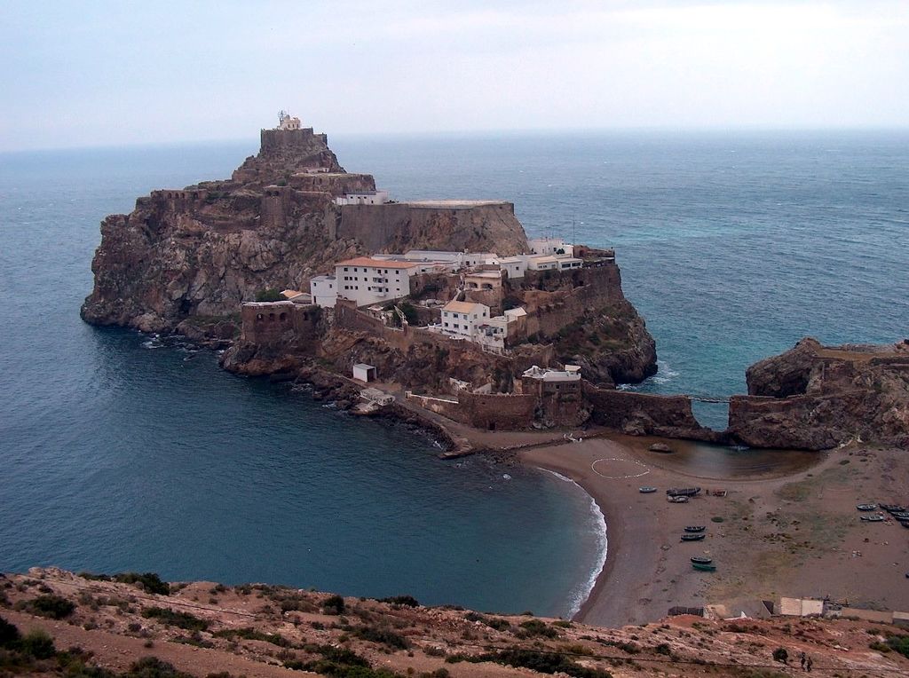
Peñón de Vélez de la Gomera (Spanish pronunciation: [peˈɲon de ˈβeleθ ðe la ɣoˈmeɾa]; Arabic: حجر بديس, romanized: Hajar Badis) is a Spanish exclave and rocky tidal island in the western Mediterranean Sea connected to the Moroccan shore by a sandy isthmus. It is also connected to a smaller islet to the east, La Isleta, by a rocky isthmus. The tidal island was named Hajar Badis (Rock of Badis) and was connected to the town of Badis. Vélez de la Gomera, along with La Isleta, is a premodern overseas possession known as a plaza de soberanía. It is administered by the Spanish central government and has a population consisting only of a small number of Spanish military personnel. Its border with Morocco is 80 m (260 ft) long, making it one of the shortest international borders in the world.
We use GPS information embedded into the photo when it is available.
3D mountains overlay
Adjust mountain panorama to perfectly match your photos because recorded by camera photo position might be imprecise.
Move tool
Rotate tool
Zoom
More customization
Choose which peak labels should make into the final photo and what photo title should be.
Next
Photo Location
Satellitte
Flat map
Relief map
Latitude
Longitude
Altitude
OR
Latitude
°'''
Longitude
°'''
Apply
Register Peak
Peak Name
Latitude
Longitude
Altitude
Register
Teleport
PeakVisor
This 3D model of Sagarmatha National Park in Nepal was made using the PeakVisor app topographic data. The mobile app features higher precision models worldwide, more topographic details, and works offline. Download PeakVisor maps today.
Download OBJ model
PeakVisor
The download should start shortly. If you find it useful please consider supporting the PeakVisor app.
PeakVisor for iOS and Android
Be a superhero of outdoor navigation with state-of-the-art 3D maps and mountain identification in the palm of your hand!