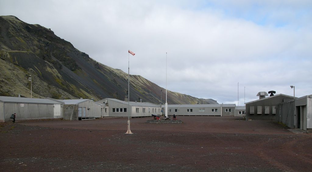
Olonkinbyen (literally The Olonkin Town) is the only settlement on the Norwegian island of Jan Mayen (aside from isolated cottage huts such as Puppebu). It was named after Russian-Norwegian explorer Gennady Olonkin. The only inhabitants on the island are the 18 personnel, 14 working for the Norwegian Armed Forces and 4 for the Norwegian Meteorological Institute, but can have up to 35 people inhabiting the island at any given time. Olonkinbyen houses the staff that operate the meteorological observation station, Loran-C station, Jan Mayensfield air field and other infrastructure. The meteorological observation service staff are responsible for the radiosonde releases and synoptic weather observations. The crew of the meteorological station is engaged for six months at a time. Supplies are delivered eight times a year by aircraft. Fuel and heavy goods are transported by boat during the summer. The settlement generates its own electrical power via three generators.
Show more
Sun and Moon
Mon
Tue
Wed
Thu
Fri
Sat
Sun
May 2022
Date and time
00:00
06:00
12:00
18:00
Today
--
--
Sunrise
--
Sunset
--
Moonrise
--
Moonset
Phase
🌔 Waxing Gibbous
The perfect light time for beautiful photos:
--
Sunrise
--
Sunset
PeakVisor app
Get the app on your smartphone
New Panorama Tools
Trace location on the map
Measure distances
All the instruments are available in the context menu as well.
We use GPS information embedded into the photo when it is available.
3D mountains overlay
Adjust mountain panorama to perfectly match your photos because recorded by camera photo position might be imprecise.
Move tool
Rotate tool
Zoom
More customization
Choose which peak labels should make into the final photo and what photo title should be.
Next
Photo Location
Satellitte
Flat map
Relief map
Latitude
Longitude
Altitude
OR
Latitude
°'''
Longitude
°'''
Apply
Register Peak
Peak Name
Latitude
Longitude
Altitude
Register
Teleport
PeakVisor
This 3D model of Sagarmatha National Park in Nepal was made using the PeakVisor app topographic data. The mobile app features higher precision models worldwide, more topographic details, and works offline. Download PeakVisor maps today.
Download OBJ model
PeakVisor
The download should start shortly. If you find it useful please consider supporting the PeakVisor app.
PeakVisor for iOS and Android
Be a superhero of outdoor navigation with state-of-the-art 3D maps and mountain identification in the palm of your hand!