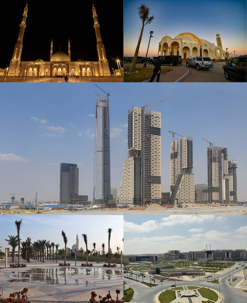
The New Administrative Capital (NAC) (Arabic: العاصمة الإدارية الجديدة, romanized: al-ʿĀṣima al-ʾIdārīya al-Jadīda), is a new urban community in Cairo Governorate, Egypt and a satellite of Cairo City. It is planned to be Egypt's new capital and has been under construction since 2015. It was announced by the then Egyptian housing minister Mostafa Madbouly at the Egypt Economic Development Conference on 13 March 2015. The capital city is considered one of the projects for economic development, and is part of a larger initiative called Egypt Vision 2030. The new capital of Egypt has yet to be given a name. A competition was launched on the new capital's website to choose a new name and logo for the city. A jury of specialists was formed to evaluate the proposals submitted to list and determine the best among all the proposals. No official results have yet been announced by the Egyptian Government. In October 2021, transportation minister Kamel al-Wazir indicated the city might be named "Masr," the Arabic equivalent of "Egypt." Other proposed names include "Kemet," "Al Mustaqbal," and "Al Salam." The new city is to be located 45 kilometres (28 miles) east of Cairo and just outside the Second Greater Cairo Ring Road, in a largely undeveloped area halfway to the seaport city of Suez. According to the plans, the city will become the new administrative and financial capital of Egypt, housing the main government departments and ministries and foreign embassies. On 700 square kilometres (270 sq mi) total area, it is expected to house a population of 6.5 million people, though it is estimated that the figure could rise to seven million. The government stated that the undertaking of the project is to relieve congestion in Cairo. Cairo has a metropolitan population of nearly 20 million.
Show more
Sun and Moon
Mon
Tue
Wed
Thu
Fri
Sat
Sun
May 2022
Date and time
00:00
06:00
12:00
18:00
Today
--
--
Sunrise
--
Sunset
--
Moonrise
--
Moonset
Phase
🌔 Waxing Gibbous
The perfect light time for beautiful photos:
--
Sunrise
--
Sunset
PeakVisor app
Get the app on your smartphone
New Panorama Tools
Trace location on the map
Measure distances
All the instruments are available in the context menu as well.
We use GPS information embedded into the photo when it is available.
3D mountains overlay
Adjust mountain panorama to perfectly match your photos because recorded by camera photo position might be imprecise.
Move tool
Rotate tool
Zoom
More customization
Choose which peak labels should make into the final photo and what photo title should be.
Next
Photo Location
Satellitte
Flat map
Relief map
Latitude
Longitude
Altitude
OR
Latitude
°'''
Longitude
°'''
Apply
Register Peak
Peak Name
Latitude
Longitude
Altitude
Register
Teleport
PeakVisor
This 3D model of Sagarmatha National Park in Nepal was made using the PeakVisor app topographic data. The mobile app features higher precision models worldwide, more topographic details, and works offline. Download PeakVisor maps today.
Download OBJ model
PeakVisor
The download should start shortly. If you find it useful please consider supporting the PeakVisor app.
PeakVisor for iOS and Android
Be a superhero of outdoor navigation with state-of-the-art 3D maps and mountain identification in the palm of your hand!


.jpg)
_07.jpg)


