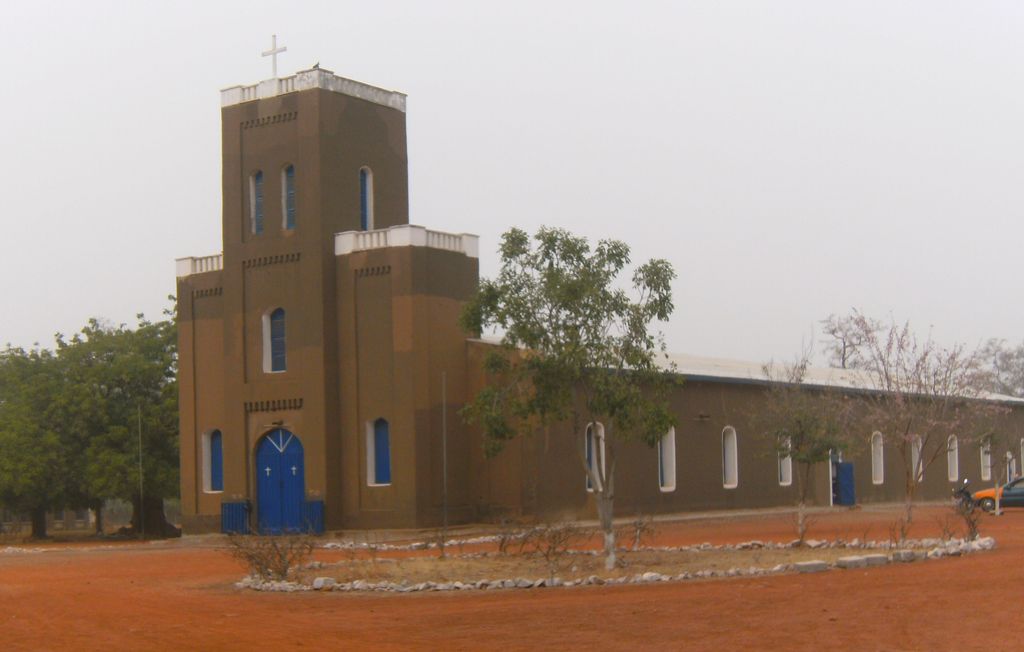
Navrongo is a town and the capital of Kassena-Nankana District in the Upper East Region of northern Ghana, adjacent to the border with Burkina Faso. Navrongo is the capital of Kassena-Nankana District – which is within the Upper East Region of northern Ghana. Navrongo has a 2012 settlement population of 27,306 people. Navrongo is an important market town, known for its cathedral and its grotto. It houses the Navrongo Solar Power Station, Ghana's first solar plant. Navrongo is located at 10°53′5″N 1°5′25″W. Navrongo's population in 2005 was estimated to be 25,470, and its population in 2012 was estimated to be 27,306. The terrain is flat and the ecology is typical of the Sahel – arid grassland with occasional shrubbery.
Show more
Sun and Moon
Mon
Tue
Wed
Thu
Fri
Sat
Sun
May 2022
Date and time
00:00
06:00
12:00
18:00
Today
--
--
Sunrise
--
Sunset
--
Moonrise
--
Moonset
Phase
🌔 Waxing Gibbous
The perfect light time for beautiful photos:
--
Sunrise
--
Sunset
PeakVisor app
Get the app on your smartphone
New Panorama Tools
Trace location on the map
Measure distances
All the instruments are available in the context menu as well.
We use GPS information embedded into the photo when it is available.
3D mountains overlay
Adjust mountain panorama to perfectly match your photos because recorded by camera photo position might be imprecise.
Move tool
Rotate tool
Zoom
More customization
Choose which peak labels should make into the final photo and what photo title should be.
Next
Photo Location
Satellitte
Flat map
Relief map
Latitude
Longitude
Altitude
OR
Latitude
°'''
Longitude
°'''
Apply
Register Peak
Peak Name
Latitude
Longitude
Altitude
Register
Teleport
PeakVisor
This 3D model of Sagarmatha National Park in Nepal was made using the PeakVisor app topographic data. The mobile app features higher precision models worldwide, more topographic details, and works offline. Download PeakVisor maps today.
Download OBJ model
PeakVisor
The download should start shortly. If you find it useful please consider supporting the PeakVisor app.
PeakVisor for iOS and Android
Be a superhero of outdoor navigation with state-of-the-art 3D maps and mountain identification in the palm of your hand!