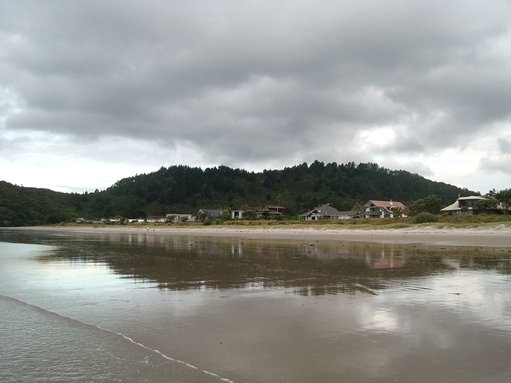
Matarangi is a beach settlement on the Coromandel Peninsula of New Zealand, with around 420 permanent residents in 2018 which increases to over 7000 holidaymakers during the summer period of late December to February. It was developed in the 1980s as a purpose-built resort town and occupies a white sand peninsula between the Whangapoua Harbour and historic Mercury Bay. It is half an hour from the towns of Coromandel to the west and Whitianga to the south east. Matarangi has a mix of older, smaller holiday houses (known in New Zealand as baches), while waterfront sections have luxury holiday homes and prestige lifestyles. The main attraction for families is the 4 km long white sand ocean beach which provides safe swimming all year round and surfing when the conditions are right. Beach access is from Kenwood Drive which leads to the Village Green with picnic facilities and a playground or from Ocean Close. The harbour also offers swimming, boating, kite surfing, fishing and bird watching, with an upgraded boat ramp, boat parking and picnic area. Occupying the scenic end of the sand spit ″the pines″ is "The Dunes", a Bob Charles-designed championship eighteen-hole golf course with a licensed club house, restaurant and pro shop. There is also a bowling green and there are several public tennis courts in the town. The small shopping centre has a Four Square store, liquor outlet, cafe, gift store and two real estate agencies. Accommodation consists of Matarangi Villas close to the golf course and holiday homes that can be rented privately or through holiday rental agents.
Show more
Sun and Moon
Mon
Tue
Wed
Thu
Fri
Sat
Sun
May 2022
Date and time
00:00
06:00
12:00
18:00
Today
--
--
Sunrise
--
Sunset
--
Moonrise
--
Moonset
Phase
🌔 Waxing Gibbous
The perfect light time for beautiful photos:
--
Sunrise
--
Sunset
PeakVisor app
Get the app on your smartphone
New Panorama Tools
Trace location on the map
Measure distances
All the instruments are available in the context menu as well.
We use GPS information embedded into the photo when it is available.
3D mountains overlay
Adjust mountain panorama to perfectly match your photos because recorded by camera photo position might be imprecise.
Move tool
Rotate tool
Zoom
More customization
Choose which peak labels should make into the final photo and what photo title should be.
Next
Photo Location
Satellitte
Flat map
Relief map
Latitude
Longitude
Altitude
OR
Latitude
°'''
Longitude
°'''
Apply
Register Peak
Peak Name
Latitude
Longitude
Altitude
Register
Teleport
PeakVisor
This 3D model of Sagarmatha National Park in Nepal was made using the PeakVisor app topographic data. The mobile app features higher precision models worldwide, more topographic details, and works offline. Download PeakVisor maps today.
Download OBJ model
PeakVisor
The download should start shortly. If you find it useful please consider supporting the PeakVisor app.
PeakVisor for iOS and Android
Be a superhero of outdoor navigation with state-of-the-art 3D maps and mountain identification in the palm of your hand!