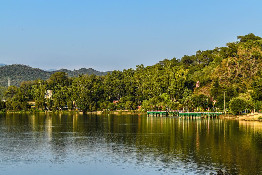
Mansar Lake is a lake located 62 km (39 mi) from the city of Jammu in Jammu and Kashmir, India. It is fringed by forest-covered hills, and is over a mile (1.6 km) in length and half-a-mile (0.80 km) in width. Surinsar-Mansar Lakes are designated as Ramsar Convention sites in November 2005. Mansar is primarily fed by surface run-off and partially by mineralised water through paddy fields. The lake supports CITES and IUCN redlisted Lissemys punctuata, Aspideretes gangeticus and Mansariella lacustris. The composite lake is high in micro nutrients for which it is an attractive habitat, breeding and nursery ground for migratory waterfolks like Fulica atra, Gallinula chloropus, Podiceps nigricollis, Aythya fuligula and various Anas species.
We use GPS information embedded into the photo when it is available.
3D mountains overlay
Adjust mountain panorama to perfectly match your photos because recorded by camera photo position might be imprecise.
Move tool
Rotate tool
Zoom
More customization
Choose which peak labels should make into the final photo and what photo title should be.
Next
Photo Location
Satellitte
Flat map
Relief map
Latitude
Longitude
Altitude
OR
Latitude
°'''
Longitude
°'''
Apply
Register Peak
Peak Name
Latitude
Longitude
Altitude
Register
Teleport
PeakVisor
This 3D model of Sagarmatha National Park in Nepal was made using the PeakVisor app topographic data. The mobile app features higher precision models worldwide, more topographic details, and works offline. Download PeakVisor maps today.
Download OBJ model
PeakVisor
The download should start shortly. If you find it useful please consider supporting the PeakVisor app.
PeakVisor for iOS and Android
Be a superhero of outdoor navigation with state-of-the-art 3D maps and mountain identification in the palm of your hand!