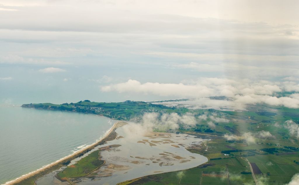
Maketu is a small town on the Western Bay of Plenty coast in New Zealand. Maketu has an estuary from which the Kaituna River used to flow, until 1956, when it was diverted to the Bay of Plenty, about 4 km (2.5 mi) upstream. It is also adjacent to Newdicks Beach located on the south eastern side of Okurei Point. Maketu is rich in ancestral Māori culture, specifically the Te Arawa tribe. Maketu was the landing site of the Arawa canoe. The chief who led the voyage of the Arawa waka from Hawaiki to New Zealand/Aotearoa was Tama-te-kapua. Many of the arrivals settled in Maketu, but some continued their journey inland, using the Kaituna River as far as Rotorua. Maketu is named after an ancient kūmara (sweet potato) pit in Hawaiki, the Māori ancestral homeland. Maketu has a predominantly Māori population, although in recent years there has been an influx of many cultures to Maketu. In 2011, Maketu was one of many areas along the Bay of Plenty coast affected by the grounding of the MV Rena and the subsequent oil spill. The Waihi Estuary Wildlife Management Reserve is near Maketu.
Show more
Sun and Moon
Mon
Tue
Wed
Thu
Fri
Sat
Sun
May 2022
Date and time
00:00
06:00
12:00
18:00
Today
--
--
Sunrise
--
Sunset
--
Moonrise
--
Moonset
Phase
🌔 Waxing Gibbous
The perfect light time for beautiful photos:
--
Sunrise
--
Sunset
PeakVisor app
Get the app on your smartphone
New Panorama Tools
Trace location on the map
Measure distances
All the instruments are available in the context menu as well.
We use GPS information embedded into the photo when it is available.
3D mountains overlay
Adjust mountain panorama to perfectly match your photos because recorded by camera photo position might be imprecise.
Move tool
Rotate tool
Zoom
More customization
Choose which peak labels should make into the final photo and what photo title should be.
Next
Photo Location
Satellitte
Flat map
Relief map
Latitude
Longitude
Altitude
OR
Latitude
°'''
Longitude
°'''
Apply
Register Peak
Peak Name
Latitude
Longitude
Altitude
Register
Teleport
PeakVisor
This 3D model of Sagarmatha National Park in Nepal was made using the PeakVisor app topographic data. The mobile app features higher precision models worldwide, more topographic details, and works offline. Download PeakVisor maps today.
Download OBJ model
PeakVisor
The download should start shortly. If you find it useful please consider supporting the PeakVisor app.
PeakVisor for iOS and Android
Be a superhero of outdoor navigation with state-of-the-art 3D maps and mountain identification in the palm of your hand!


.jpg)