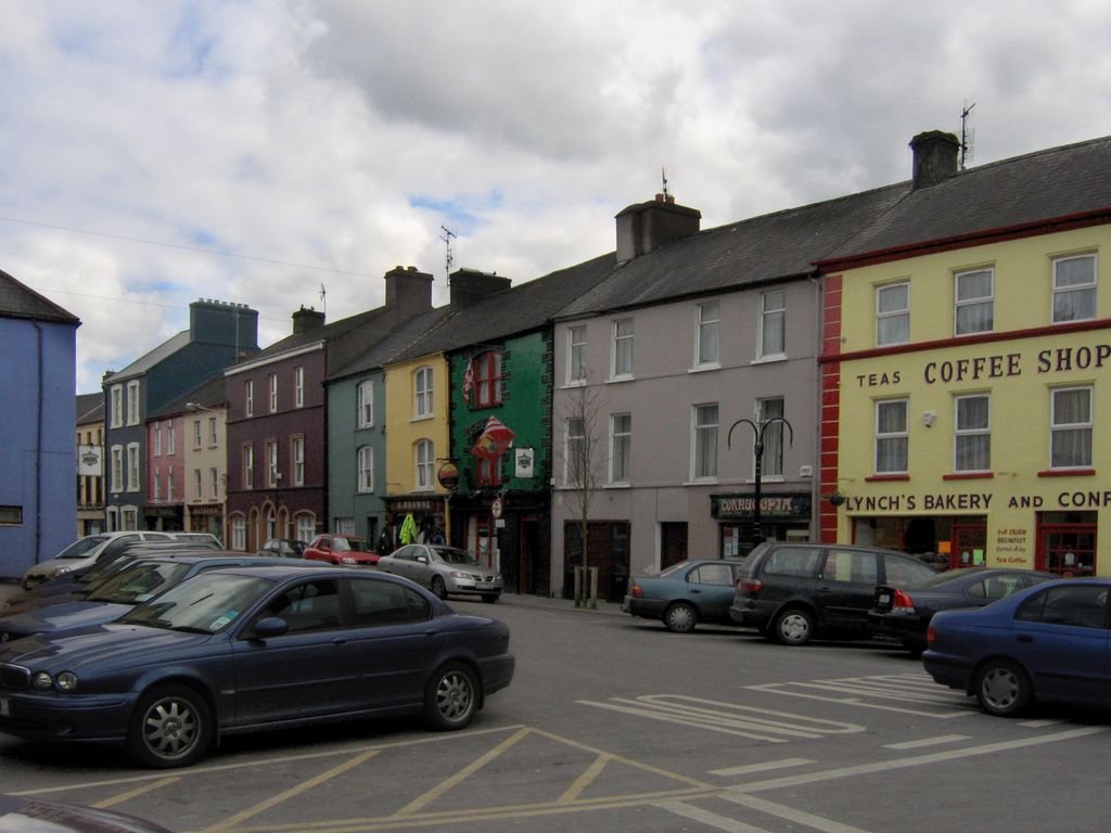
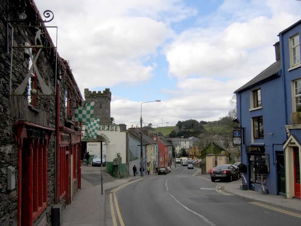
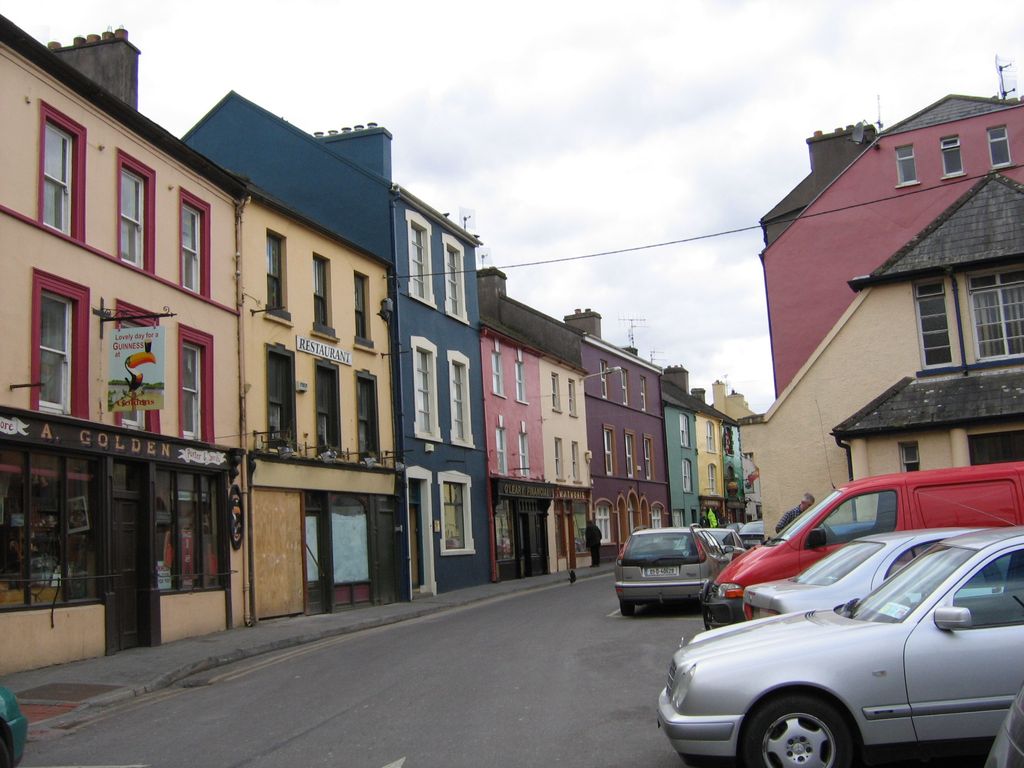
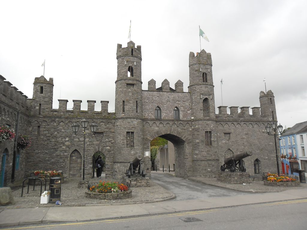
Macroom (; Irish: Maigh Chromtha) is a market town in County Cork, Ireland, located in the valley of the River Sullane, halfway between Cork city and Killarney. Its population has grown and receded over the centuries as it went through periods of war, famine and workhouses, forced emigration and intermittent prosperity. The 2011 census gave an urban population of 3,879 people, while the 2016 census recorded 3,765 people. Macroom began as a meeting place for the druids of Munster. It is first mentioned is in 6th-century records, and the immediate area hosted a major battle c. 987 involving the Irish king Brian Boru. During the Middle Ages, the town was invaded by a succession of warring clans, including the Murcheatach Uí Briain and Richard de Cogan families. In the early modern period the MacCarthys took control and later the area found prosperity via milling. The MacCarthys built a series of tower houses, some of which survive. The family lost influence during the Williamite wars of the 1690s, after which authority over the town castle waxed and waned between the MacCarthys and a number of Anglo-Irish families. The population fell in the 1840s during the Great Famine. Evidence can be found in the former workhouse, now the district hospital at the north side of New Street, and the mass graveyard to the west, near Clondrohid. During the late 18th and early 19th century, a number of Anglo-Irish families, and a branch of the Massey family, settled in the area. Many of their estate houses were burned in the period around the Irish War of Independence as the town was caught up in the turmoil of IRA activity. Today the town is an economic hub for the mid-Cork region, and the location of a Danone milk processing factory, which dries and cans infant formula from milk supplied by local dairy farmers. Until the 1950s, New Street was the town's economic hub, and contained many small retail outlets.
Show more
Sun and Moon
Mon
Tue
Wed
Thu
Fri
Sat
Sun
May 2022
Date and time
00:00
06:00
12:00
18:00
Today
--
--
Sunrise
--
Sunset
--
Moonrise
--
Moonset
Phase
🌔 Waxing Gibbous
The perfect light time for beautiful photos:
--
Sunrise
--
Sunset
PeakVisor app
Get the app on your smartphone
New Panorama Tools
Trace location on the map
Measure distances
All the instruments are available in the context menu as well.
We use GPS information embedded into the photo when it is available.
3D mountains overlay
Adjust mountain panorama to perfectly match your photos because recorded by camera photo position might be imprecise.
Move tool
Rotate tool
Zoom
More customization
Choose which peak labels should make into the final photo and what photo title should be.
Next
Photo Location
Satellitte
Flat map
Relief map
Latitude
Longitude
Altitude
OR
Latitude
°'''
Longitude
°'''
Apply
Register Peak
Peak Name
Latitude
Longitude
Altitude
Register
Teleport
PeakVisor
This 3D model of Sagarmatha National Park in Nepal was made using the PeakVisor app topographic data. The mobile app features higher precision models worldwide, more topographic details, and works offline. Download PeakVisor maps today.
Download OBJ model
PeakVisor
The download should start shortly. If you find it useful please consider supporting the PeakVisor app.
PeakVisor for iOS and Android
Be a superhero of outdoor navigation with state-of-the-art 3D maps and mountain identification in the palm of your hand!